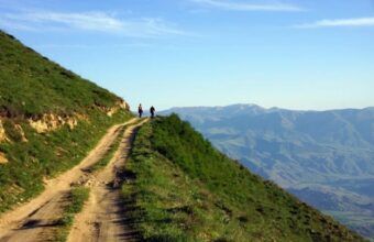
Georgia
Rolling hills and centuries-old villages
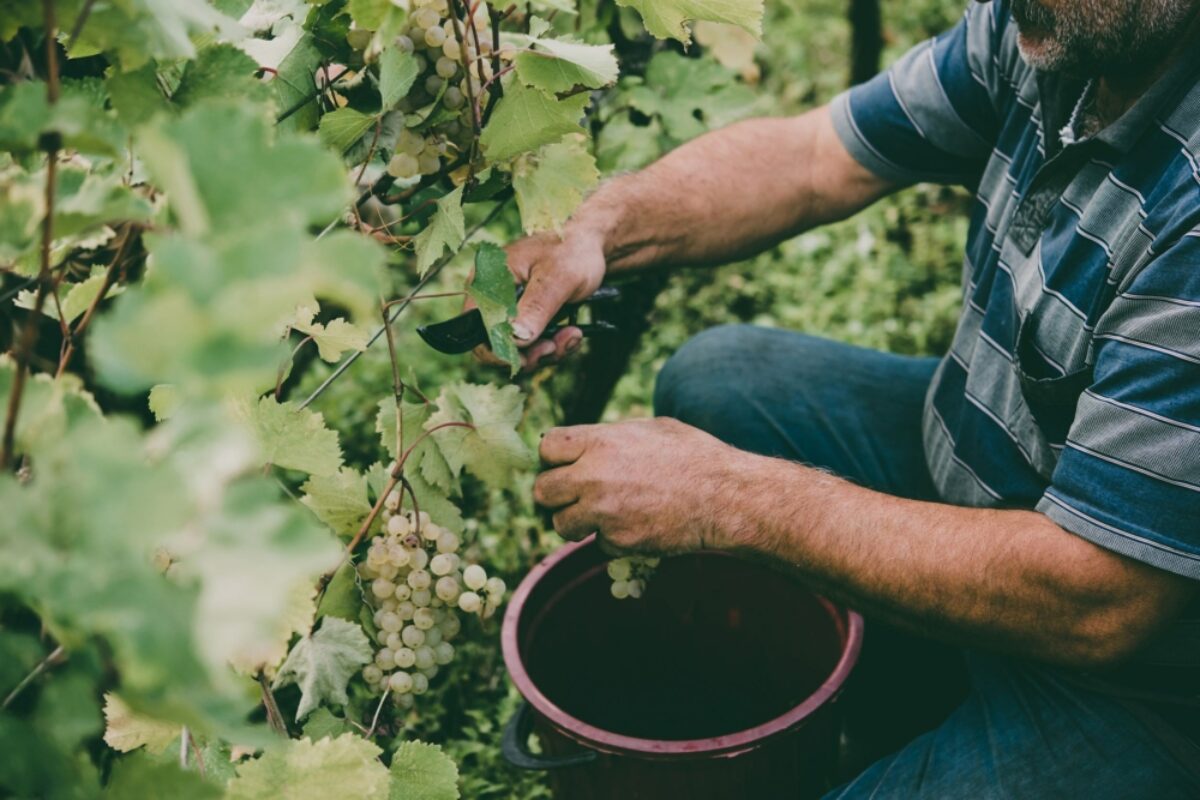
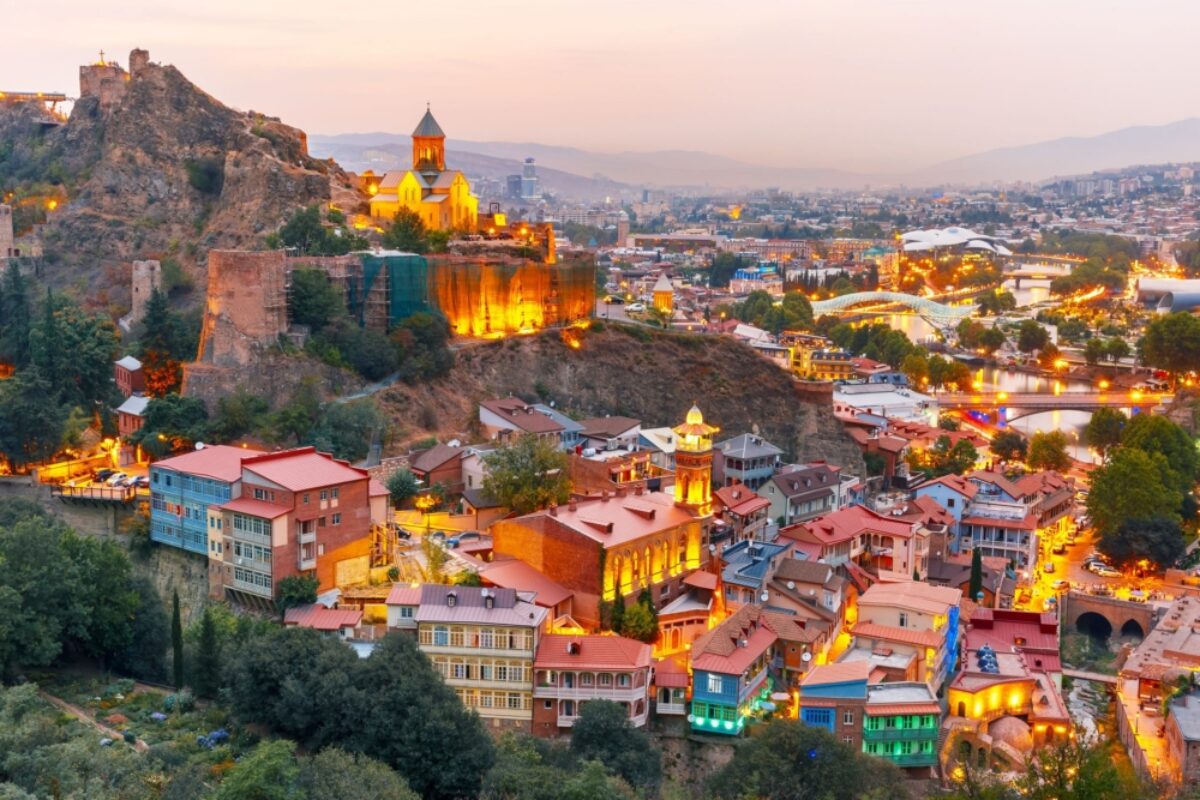
Georgia is no longer a backpacker’s secret. Where once only intrepid travellers traversed its green valleys and mountainous trails, today visitors come for Tbilisi’s nightclubs, world-class restaurants and an emerging natural wine scene.
However, the star of the show is still those old churches, watchtowers and monasteries that line Georgia’s countryside. Move beyond the cities and you’ll enter a world untouched by time, complete with Russian, Turkish and Persian influences.
Hidden gems in Georgia

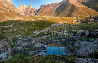
Racha
Imereti to Racha trek
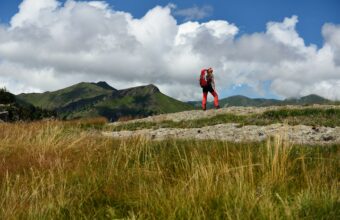
Difficulty: ModerateDuration: Two to three daysStart/end point: Drbo to OniAccommodation: Camping This almost unknown trail connects two regions—Imereti and Racha—through dense forests, peaceful valleys, and towering alpine cliffs. It offers picturesque views, wildflower meadows, and isolation from populated areas. The highlight of this hike is the panoramic views of Caucasus Mountain while walking on the ridge leading to the King Tamar cliffs, as well as extensive views over the Imerti plains. The path goes through old shepherd trails, found and improved by the Transcaucasian Trail team, creating a longer Imereti to Racha route. However, the trek is still unmarked and not well maintained. Therefore, you need to navigate with GPS trackers. Need to know The path is mostly straightforward and not technical, with some steep stretches, river crossings, and leftover snow on higher slopes. However, prepare to spend an almost full day walking. The trail rejoins a dirt road several times for a short while and has substantial climbs uphill. Many springs on the trail are seasonal, so it's essential to fill up with water at every opportunity. Also, be prepared to carry plenty between the undried springs. Be strategic where you camp, as there are limited flat areas to set up the tent. May to July and September to October are preferred times to hike. You will need a tent, proper camping equipment, and food for the entire hike. How to get to Drbo First, get to Sachkhere, a 20-minute drive from Drbo, with a marshrutka from Tbilisi's Didube Bus Station. The first van leaves at 9 am. There are vans from Kutaisi, too. From Sachkhere, hire a taxi, hitchhike, or walk 10km to the trailhead. How to leave Oni Several marshrutkas go to Kutaisi daily, but one goes directly to Tbilisi. I recommend asking around or your host for the exact timings.
Read more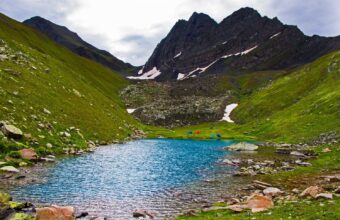
Racha
Udziro Lake trek
Difficulty: ModerateDuration: Two to three daysStart/end point: Shovi to GlolaAccommodation: Camping This little-known but gorgeous hike to the small alpine lake of Udziro at an elevation of 2,800m is an excellent alternative to busy hikes and popular destinations in Georgia. Clear skies, pleasant weather, and unusually shaped mountains make for a breathtaking panorama of the Caucasus range. The drawback is the logistics of getting to/from the start and end points with public transport. A short trek takes two or three days, starting in the village of Shovi and finishing in Glola. Despite the small distance, it’s a challenging trail with a lot of ascent and descent. I suggest doing it in three days to enjoy the surroundings without being rushed. Need to know Starting from Shovi is a popular choice and often advertised as such, but it has steep uphills over rocky terrain in some parts. However, you are treated with panoramic views of the Caucasus as you descend to the lake. Nevertheless, I prefer to hike the other way, as the ascent is not too steep. The trail is well-marked and easy to follow, but a few patches of overgrown plants make it slightly hard to navigate, so you should have an offline map app on your phone. The hike is doable only from late June, when the snow on Geske Pass melts, until late September. You can stay in Shovi or Glola before/after the hike but need full camping gear on the trek. How to get to Shovi First, get to Oni from the Didube Bus Station in Tbilisi. The marshrutka leaves at 8 am. From Oni, you can get a taxi or hitchhike. Alternatively, you can take a marshrutka to Amboraluri, the central city of Racha, and find transportation to Shovi. How to leave Glola Glola is the village next door to Shovi, so you'd need to ask around for transportation or try hitchhiking.
Read more
Svaneti
Svaneti to Racha trek
Difficulty: StrenuousDuration: Three to four daysStart/end point: Zeskho to GhebiAccommodation: Camping The trek from Zeskho, in Svaneti, to Ghebi, in Racha, is quite challenging but very beautiful. You should be comfortable hiking six to seven hours a day through some of the most isolated parts of the Caucasus, offering stunning views of the Rioni River valley, Edena Peak, and Sasvano lakes. Need to know Some sections of the trail require river crossings (big and small) and tackling hilly ascents and descents, with frequent elevation changes as it transits two steep mountain passes. You also walk on a narrow, slightly rocky mountain ridge with lofty slopes. Additionally, parts of the trek follow an old car road once connecting these two regions, but the road is almost lost with landslides, desertion, and overgrown flora. The dense Tskhenistskali Valley, with verdant plants and bushes, is the trickiest part. It almost covers the trail and makes it easy to miss. Therefore, hiking from Svaneti to Racha is recommended only for confident navigators. This area is remote, with no shelters or guesthouses, so a tent is necessary. You must have a passport or ID for a border checkpoint at the mountaineering centre. How to get to Zeskho, Svaneti You will need to book a taxi transfer from Mestia or Ushguli. You can hitchhike, but this road is rarely used by cars, and if you see one, it will be full. How to leave Ghebi, Racha The marshrutka from Ghebi to Oni departs only on Thursdays at 9 am and 6 pm. Otherwise, you'd need to hitchhike or take a taxi.
Read more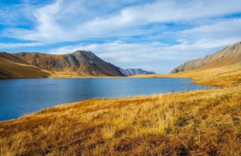
Kakheti region
Black Rock Lake trek
Difficulty: ModerateDuration: Two to three daysStart/end point: Lagodekhi/LagodekhiAccommodation: Huts/cabins This is a well-maintained and waymarked circular trek in Lagodekhi National Park. Agriculture and hunting are forbidden in the national park, making it ideal for observing the country's flora and fauna in their most natural and wild state. There’s a rare chance to spot wildlife, but it might happen. It's an unpopular trail with a few tourists. I loved the tranquillity of the trail and the info boards of local plants and animals residing here. The only drawback is that there are few water spots, so you need to carry plenty. Need to know Before the hike, you must register at the Visitor Center inside the national park and pay camping/cabin fees. Ask for updated information about the trails and springs (some run dry in summer). A tent is not necessary, but you'll need all the other trekking equipment including gas (for the second cabin in the alpine zone), plenty of water, and food. Bring a passport or ID for the border checkpoint. The path is difficult and involves quite a vertical gain, but nothing too challenging. How to get to Lagodekhi From Tbilisi, marshrutkas to Lagodekhi depart from Isani Bus Station hourly. The first one departs at 7:40 am. The journey is about three hours. Marshrutkas from Telavi and Rustavi are also available. How to leave Lagodekhi Marshrutkas to Tbilisi depart from Lagodekhi Bus Station at 45-minute intervals. The first van departs at 6:45 am and the last at 5:30 pm. Several marshrutkas depart to Rustavi and Telavi each day.
Read more
Samegrelo & Tobavarchkhili
Tobavarchkhili lakes
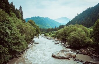
Difficulty: StrenuousDuration: four to five daysStart/end point: Mukhuri to KhaishiAccommodation: Camping Tobavarchkhili, meaning "Silver Lake" in Megrelian (a language spoken in Samegrelo), refers to the complex of lakes in the Samegrelo region, western Georgia. You pass rocky gorges, waterfalls, alpine meadows, and shepherd huts with the chance to glimpse Mt. Elbrus on a clear day. Starting from Mukhuri village, a jeep transfer to Natipuru at 2,000 metres can save you a long (20km), unscenic first day on a rough dirt road. Expect to pay 250-300 GEL for the transfer. However, landslides and unpredictable weather often block the road, so keep a buffer day in your schedule. Need to know This 45-km trek is one of the most challenging in Georgia. Depending on your route, pace, and weather, it takes four to five days. It includes high passes, steep elevation changes, river crossings, snow and ice-covered slopes even in summer, and some hard-to-follow paths. There is also no mobile coverage. Therefore, I recommend you hike with an experienced guide who has taken this trail several times before. Alternatively, you can hire a horse to carry the luggage to ease the hike. Rain and fog are frequent at Egrisi Mountains, so be prepared and have another buffer day to fully enjoy the lakes. For the best conditions, aim for late July to mid-September. The area lacks shelters, so you will need a tent, proper hiking gear, and enough food for the trip. The trek also has an alternative, shorter route from Skuri. It's even more challenging, and the logistics can be complicated. How to get to Mukhuri First, get to Zugdidi, the capital of Samegrelo. From the bus station by the bridge (not the one at the train station), the marshrutka (a minibus) departs for Mukhuri at 9 am, taking two hours. Hiring a taxi will get you there in an hour. Ask the driver to drop you off at Lugela Spring to reduce the less scenic walk by 7km. How to leave Khaishi Marshturkas that head to Mestia or Zugdidi daily pass by Khaishi but are usually full. Failing that, you might need a taxi or hitchhike.
Read more
Svaneti
Alternative Mestia to Ushguli trek route
The standard Mestia to Ushguli trek is one of the most popular multi-day hikes in Georgia – the only downside is it can feel busy during peak season! I much prefer this alternative route to Ushguli via Tsvirmi which avoids the worst of the crowds. Like the standard route it's moderate difficulty and can be done in three days, staying in guest houses overnight. The route From Mestia, you ascend onto the Zuruldi massif, then descend to the village of Tsvirmi, head to the Tetnuldi ski resort before merging with the classic trail to Ushguli via Adishi on day three and finish with Iprali to Ushguli on day four. I prefer this path because it offers much more pleasing scenery from the beginning and fewer hikers. The only downside is that the start of the first (if you can't take the cable car) and the second days are less scenic. From the cable car's top, the path goes to Zuruldi Ridge, where incredible panoramic vistas open up. The descent to Tsvimri goes through a steep forest with several vertical drops at some places. The beginning of the Tsvimri-Tetnuldi resort path follows the main road of Mestia-Ushguli - the least favourite part of the trek, but the views of Mt. Ushba make up for it. Need to know Guesthouses along the way offer a comfortable stay with meals. I love hiking this trail in September when the crowds are smaller, the weather is still warm, and the landscapes are gorgeous. June through October is generally a good time for this hike. You can take the new cable car from Mestia to the top of Zuruldi Ridge to skip the more challenging and least picturesque part. However, be prepared that the cable car might be closed, and you would still have to hike the unappealing first part of the trail. I suggest enquiring with the host in Mestia
Read more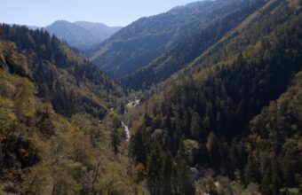
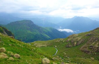
Borjomi-Kharagauli National Park
Hiking in Borjomi-Kharagauli National Park
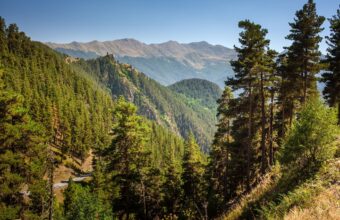
Borjomi-Kharagauli National Park, located in central Georgia, spans 107,083 ha of land and covers six districts, with plenty of hiking trails offering scenic panoramas. This park is the first of its kind in Georgia to comply with international standards for national parks, meaning every trail is well marked apart and their are designated areas for tents, fires and picnic areas. Trekking here involves staying either at the tourist shelters or putting up a tent. It is possible to go hiking in Borjomi-Kharagauli National Park in every season except summer, as it gets far too hot. The best way to get to the national park is to take a marshrutka from Tbilisi to Borjomi. The journey takes around two hours. From Borjomi, take another marshrutka towards Likani and ask your driver to drop you off at the park’s administrative centre. Twelve well-marked hiking trails provide single or multi-day hikes. Try some of the following:Nicholas Romanov's Trail The path goes through coniferous forests leading to Lomi Mountain and St George Church, with spectacular views of the Caucasus mountains. This moderately challenging trek takes three days with 43km long route.St Andrew’s Trail This difficult 4-day trek takes you to the highest peak of the National Park, called Sametskhvario (Shepherd’s Place). On your way, you pass through sub-tropical forests and alpine meadows, enjoying spectacular views of Mt Iron Cross.Panorama Trail The Panorama Trail is one of the most beautiful treks in Borjomi-Kharagauli National Park. It is a two-day, 34km long circular trail with stunning views and the chance to see wildlife including bears and wolves. You can visit the shepherd’s huts near the hiker huts to learn more about this challenging job.Footprint Trail This one-day moderately challenging trek is famous for the ancient yew trees you’ll pass, some of which are centuries-old. The winding path crossing mountain slopes through to Kvabiskhevi canyon.The Snow Shoes Trail This is one of the most popular trails, winding through evergreen forests covered in snow. The total length of the path is 15.5km and takes two days to finish. The route starts and finishes at the Likani guard station and follows the mountain ridge, with views of Mount Lomis Mta.
Read more
Georgia
Tusheti to Khevsureti trek
This spectacular five-day, 78km (48 mile) trek connects the regions of Tusheti and Khevsureti – starting from the village of Omalo and ending in Shatili. Tusheti is one of the most stunning mountainous areas of Georgia, located just behind the main ridge of the Caucasus. Both areas are still unspoiled from tourists and commercial buildings due to poor roads, which also gives another charm to the whole trip. This route is attractive not only for its nature but also for the traditional villages you’ll visit, which are dominated by stone towers that have stood since the Middle Ages. The trek follows a shepherd’s path connecting the regions. The first two days of hiking are spent on dirt roads connecting the villages of Tusheti, including Dartlo, one of the most well-preserved settlements in Tusheti, as well as abandoned towns with crumbling buildings. Afterwards, you'll continue walking towards Khevsureti through flat meadows, shepherds' shelters, the Atsunta Pass, with amazing views of Mount Tebulo. Eventually, you get to Khevsureti's ancient fortress of Mutso. From here, you continue your way towards Shatili Fortress. Make sure to stop by Anatori – House of the Dead – a place where inhabitants spent their last days during the plague of the 18th century. The route is quite popular among travellers and hikers; it is also suitable for those who want to try a camping trip, but don't want anything too wild and remote. In terms of difficulty, the trek is somewhere between moderate and hard. You gain elevation slowly, but the track is 75km long and crosses a 3,400m-high pass. Note that during this trip, you’ll pass several border checkpoints, where guards ask you to fill out registration forms for hiking in the border area. How to get to Omalo The only way to get to Omalo is by hiring a driver with 4WD. First, you need to get to Telavi or Kvemo Alvani village from Tbilisi either by a shared taxi or a marshrutka. Drivers are used to hikers and tourists heading to the region, so they can help you arrange the drive to Omalo. The drive to Omalo takes around 4-5 hours through the winding Abano Pass road. How to leave Shatili Marshrutkas from Shatili to Tbilisi leaves every Thursday and Sunday at noon. In high season they often get full, so buy tickets in advance.
Read more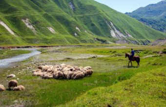
Georgia
Truso Valley to Kelitsadi Lake trek
This picturesque and remote trek starts from the scenic Truso Valley, near the border with South Ossetia. Here, you can explore abandoned villages, ancient towers and mineral lakes. The route traverses the Keli volcanic plateau – an arid, rocky land situated west of the Georgian Military Highway. Few hikers come here as it's very close to the separatist territory of South Ossetia and the track is quite challenging. However, the highlight of the hike – crossing two 3,400m high mountain passes and the glacial Kelitsadi lake itself – make the trek worthwhile for hiking in Georgia. The Truso Valley is around 20km from Stepantsminda. The trek starts from the sparsely-inhabited Kvemo Okrokana village and climbs up into the upper part of the valley. Look out for several mineral springs along the route, with some even forming pools of – icy – water you can swim in. Once in the valley, you see beautiful views of the opposing Mna gorge until you reach the rock-covered Keli plateau. The trek takes three days. There are no proper camping spots or home stays, so you’ll be wild camping. Bring a tent, food, and water. As the trek crosses a volcanic plateau, there are few water sources. Make sure to have around 4-5 litres of water when leaving Kvemo Okrokana. During the hike, you’ll pass the Higher and Lesser Khorisar volcanic peaks, until you reach the Khorisar Pass at 3,429m. The route is challenging so it’s worth taking a guide or GPS. From here, you should be able to see the White Aragvi River, which you’ll cross before descending to Kelitsadi Lake. The hike towards Ketrisi village from Kelitsadi offers spectacular views of the Kazbegi massif, but strays very close to the South Ossetian border, so make sure you’re on the right route. The path continues into the Esi river valley and enters a small canyon with steep slopes. The village lies ahead after crossing the Esri river via a wooden bridge. Look for the monasteries and nunneries of Ketrisi, or take a short walk to the ruins of Zakagori Fortress. How to get to Truso Valley The entrance to the valley lies at Kobi village. Either ask the marshrutka driver to drop you off there or take a taxi to the Kvemo Okrokana village. Since 2018, Mountain Freaks, a travel agency, organises a bus from Stepantsminda to Kvemo Okrokana twice a day. How to leave Ketrisi The easiest way is to call a driver and arrange a pickup. Otherwise, walk out of the valley and stop any marshrutka to Tbilisi on the Georgian Military Highway.
Read more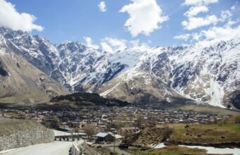
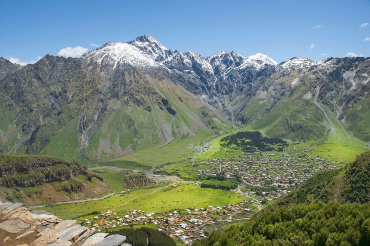
Kazbegi
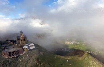
Stepantsminda to Gergeti Glacier day hike
Stepantsminda features highly in Georgia hiking itineraries. It's also a popular destination for day or weekend walking trips from Tbilisi due to the graceful Gergeti Trinity Church found at the foot of Mount Kazbegi. The church's picturesque location draws crowds of day trippers, making it feel crowded at times (something you won't see in the marketing photos). I prefer this extended hike – it takes you past the church but you then continue to the base of the Gergeti, leaving the crowds behind you. The hike is about 20km and moderately difficult (lots of relentless climbing). It will take you between seven and ten hours. Most people take five hours to climb the glacier and then come back to the village for another three. Even though this is a single day hike, be aware that you’ll gain more 1,500m in elevation. This is a tough walk, but the path is well marked and easy to follow. I'm sure you'll probably want to get your own version of the iconic church in front of Mt Kazbegi. In this case, be aware it will most likely be clouded over by mid-morning, so you'll need an early start to catch it in full glory. Alternatively, you can always take a taxi to Gergeti Trinity Church from Stepantsminda and start the hike from there. There are several routes from Stepantsminda, but the best trail to take to the church is through the Bashli Valley, offering some fine views of the surrounding mountains. This route is a bit longer, but the incline is less steep and is away from car traffic. The track passes a ruined tower and follows the Bashi creek up to the church. After getting to the church, the path continues towards the glacier through the birch forest to the Sabertse Pass. There are two options here, but the scenic route is the one that follows the ridge to the Sabertse crossing. Once there, you can explore a small shrine with a cross and enjoy a first look at the glacier. After crossing the metal bridge of the Chkheri river, the trail becomes steeper and climbs directly to the bottom of the glacier. The best time for this hike is from June till October. How to get to Stepantsminda There are several ways to get from Tbilisi's Didube Bus Station to Stepantsminda. The cheapest and least comfortable option is by marshrutka (shared van). It departs hourly from 8 am to 7 pm, except for mid-afternoon (at 2:30 pm and 3:30 pm). The journey takes around three to four hours. This is public transport designed for locals, so drivers do not stop at touristy spots along the Georgian Military Highway, except for one short break by a restaurant. Mercedes minivans to Kazbegi are more comfortable and will get you to Stepantsminda faster. Shared taxis are also available, but they wait for the car to fill up, or you pay for the empty seats.
Read more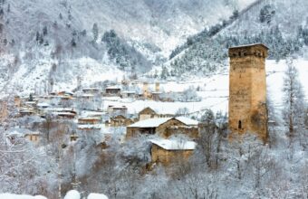
Georgia
Mestia to Ushguli trek (standard route)
The 60km hiking trail from Mestia to Ushguli is one of the most popular multi-day walking holidays in Georgia. Best hiked in the summer months of July and August, the Mestia-Ushguli hike takes three to four days to complete. The hike is moderately difficult, with lots of climbs & descents with high elevations (max. 2740 metres). The trek offers superb views and goes through several traditional villages in Georgia’s northwestern Svaneti region, with excellent home stays – so no tent required. Facilities on this trek are as good as it gets for a remote mountainous region. Most of the lodges even have free wi-fi. In Mestia, you can also find apartments to rent. Hosts at home stays serve breakfast, dinner, and can even prepare lunchboxes for the road. The only downside is that the treks popularity brings plenty of crowds, especially during peak season. For this reason I prefer this alternative route. The first and last days of the trek are straightforward, but there are significant climbs and high elevations in between. The hiking trail is well marked and starts from Mestia's main square passing through forests, meadows, fields of rhododendrons, and villages adorned with typical Svanetian houses and defence towers. On your way, you have fantastic views of Mount Ushba (one of the Caucasus’ most notable peaks at an elevation of 4,710m) and the Svaneti Valley, full of wild orchids and views of imposing Mount Tetnuldi and the Adishi Glacier. On the third day of the hike near Iprali village, you need to cross the Adishi river. In high season, locals offer horses to help travellers across the river. At other times, ask in the village about the water level and hire a horse if necessary. If you don't want to pay (or are scared of horses), walk around 50m upstream where the river branches out into several streams where you cross it on your own. The water is freezing, so wear hiking sandals and use sticks. The last day of the hike takes you to one of the highest settlements in Europe and a UNESCO World Heritage Site – the village of Ushguli, found right below Mount Shkhara. Most hikers in Georgia follow the main road to Ushguli, which can get dusty from car traffic and can be a disappointing end to a rural hike. However, there's an alternative route that goes through the villages forming the Ushguli community. Once in Ushguli, stay overnight and visit the 12th-century Lamaria Church, once a devoted to a pagan Svan god of fertility. If you’re still after some trekking, you can walk to the imposing Shkara glacier (five hours) enjoying breathtaking views of the snow-covered mountains. How to get to Mestia Direct marshrutkas from Tbilisi to Mestia depart from Samgori (Navtlughi) Bus Station at 7 am. However, because the journey is long and tiring, I prefer to break up the trip by taking a Tbilisi-Zugdidi train in the morning, spending a night in Zugdidi (to see the sights), and then taking a morning van to Mestia. If you take a train, you can also go directly to Mestia from the train station by van, departing at around 3 pm. The night Tbilisi-Zugdidi train has been suspended since the COVID-19 pandemic. Omnibus runs an overnight Tbilisi-Zugdidi bus, departing Ortachala Bus Station at midnight and arriving in Zugdidi at around 6 am. Alternatively, VanillaSky operates flights from Natakhtari Airport near Tbilisi, but flights fill up quickly and are often cancelled. Additionally, you can get to Mestia from Kutaisi. The direct marshrutkas leave from the Kutaisi bus station behind McDonald's.
Read more-

Imereti to Racha trek
View experience -

Udziro Lake trek
View experience -

Svaneti to Racha trek
View experience -

Black Rock Lake trek
View experience -

Tobavarchkhili lakes
View experience -

Alternative Mestia to Ushguli trek route
View experience -

Hiking in Borjomi-Kharagauli National Park
View experience -

-

Truso Valley to Kelitsadi Lake trek
View experience -

Stepantsminda to Gergeti Glacier day hike
View experience -

Mestia to Ushguli trek (standard route)
View experience

Georgia itineraries
Classic Caucasus
Explore the best of Azerbaijan, Georgia and Armenia
17 days From £2,939 pp
Highlights of the Caucasus
Wine, wilderness and welcoming cities
13 days From £1,697 pp
Overlanding through the Caucasus
Travel beyond the ordinary in Azerbaijan, Armenia and Georgia
21 days From £2,261 ppGeorgia travel companies