


Best Walking Holidays In Wales
Wales' best walking regions & long-distance hikes
Sandwiched between England to the east, the Republic of Ireland across the Irish Sea, and with Scotland looming to the north, Wales can appear somewhat diminutive on a large scale atlas.
But zoom in with a smaller-scale OS map and the packed contours and looping footpaths reveal a country that is vast, wild, and eminently explorable by foot.
You’d be hard-pressed to find a location in rural Wales that isn’t suited to a great walking holiday, but the following highlights are especially recommended.
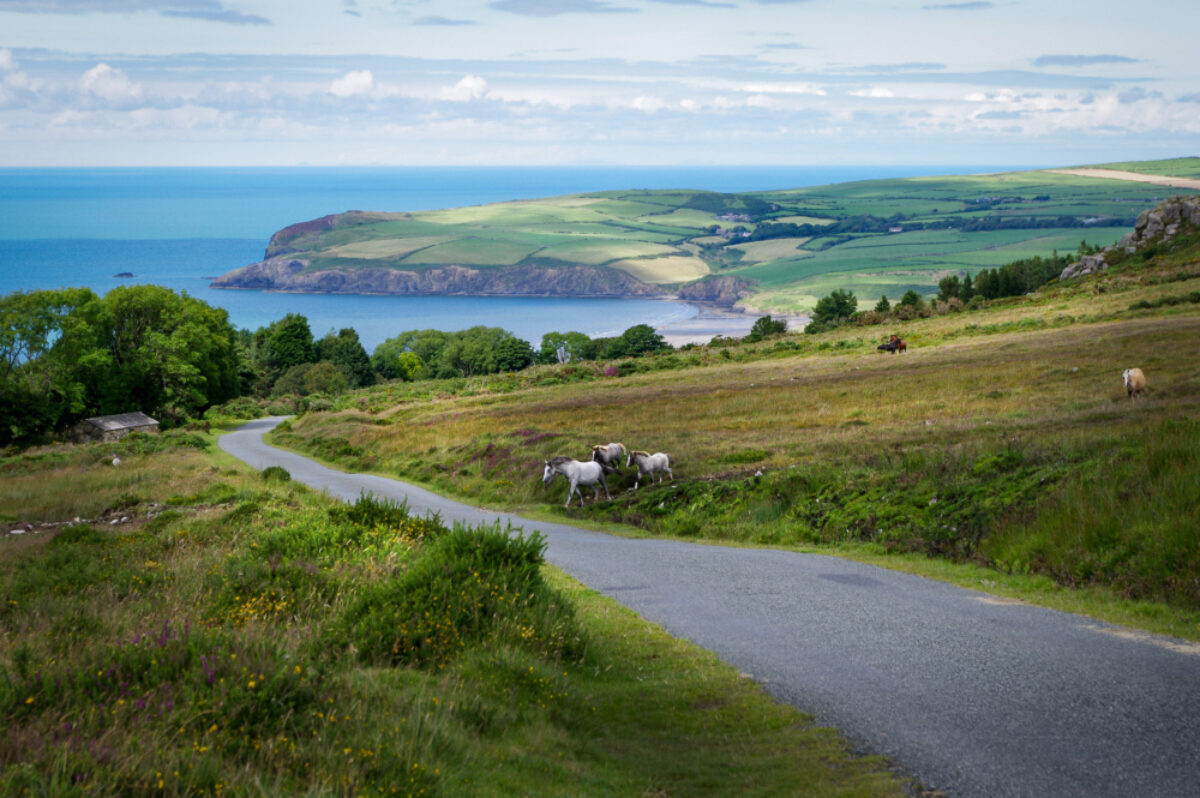
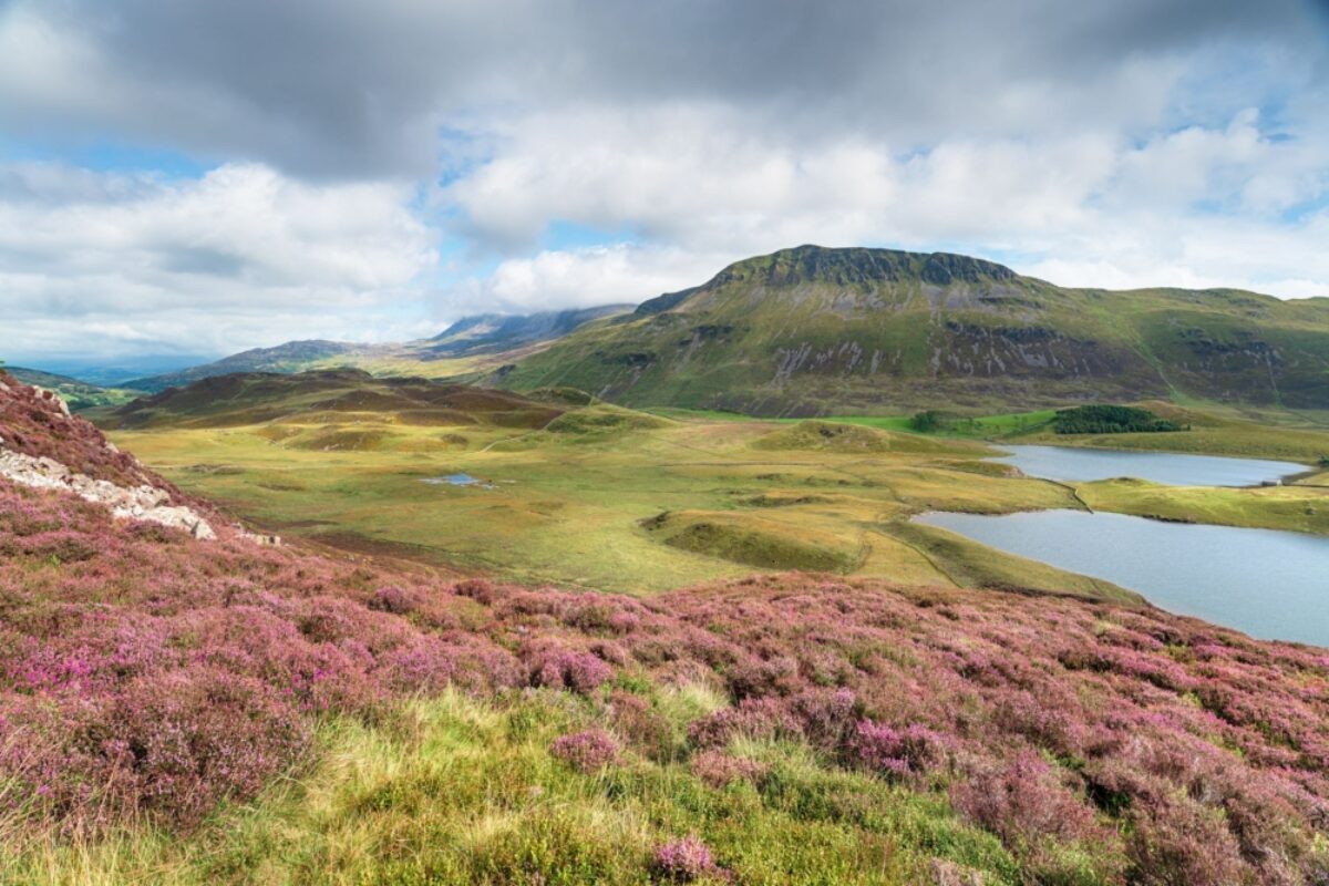
The Preselli hills in Pembrokeshire offer the ideal backdrop for a quiet walking holiday
Wales' best easy-going walking holidays
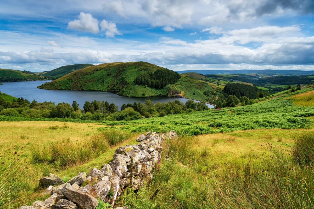
Llyn Clywedog reservoir near Llanidloes, Wales
Glyndwr Way (Llandidloes to Machynlleth)
Distance: 27 miles/43 km
Duration: Two days
Difficulty: Moderate
The full Glyndwr Way stretches some 135 miles (217km) through central Wales, but this 27 mile segment can be accomplished in two days for an easier-going weekend of walking. Read more: UK short walking breaks.
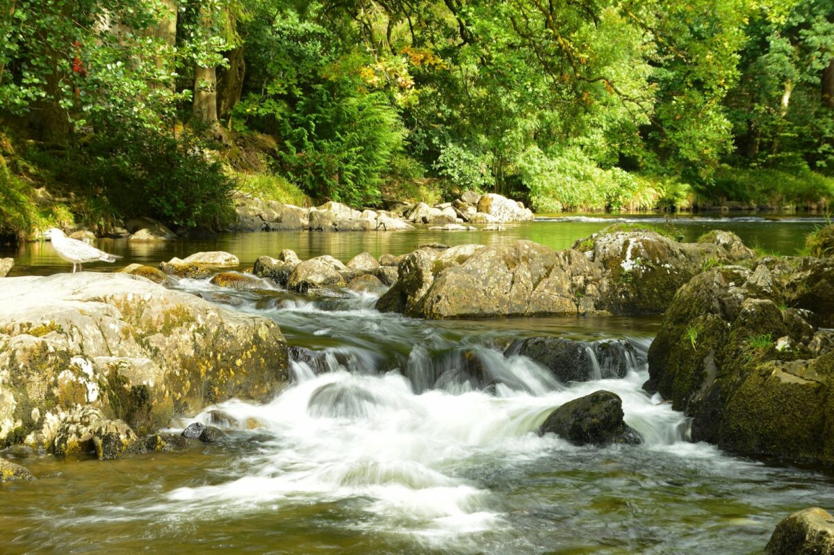
Riverside walks from Betwys y Coed, Snowdonia
Betws-y-Coed
Distance: Various day walks
Duration: Two to three days
Difficulty: Easy to moderate
For those less inclined to multi-day hikes, Betws-y-Coed is ideally situated in Snowdonia for easy to moderate day hikes. See more: Walks for beginners.
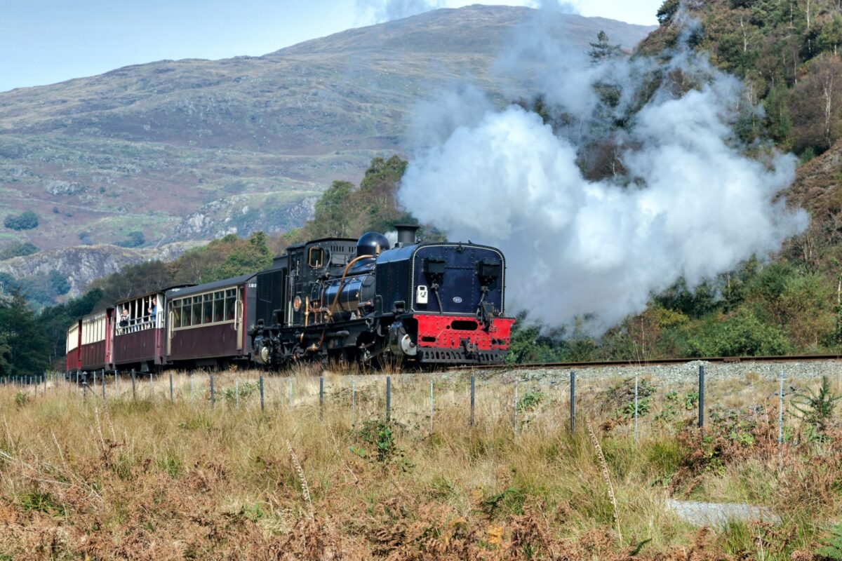
The Welsh Highland Railway promises family fun for all ages
Welsh Highland Railway
Distance: Various day walks, from three miles+
Duration: Two days+
Difficulty: Easy & buggy friendly
The 25-mile Welsh Highland Railway runs steam trains through Snowdonia between Porthmadog and Caernarfon. With easy-going walks from each station, the train line can be used as a fun and varied family walking holiday. See more: Family walking holidays.
Wales's top long-distance walking holidays
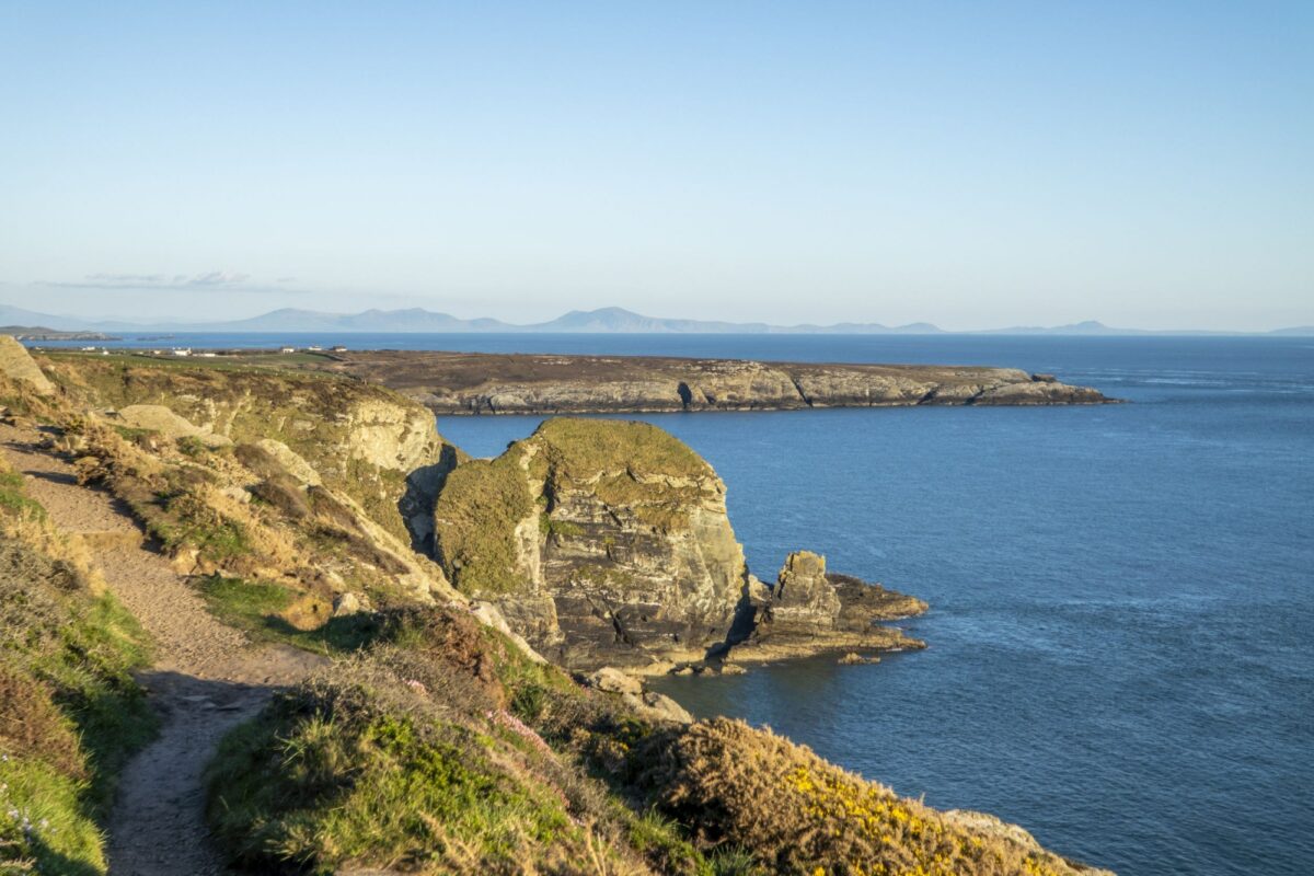
Crowd-free trails on the Anglesey Coastal Path
The Anglesey Coastal Path
Bearing the full brunt of the Irish Sea, the Isle of Anglesey in northwest Wales is wild and wave-lashed, with a coast reaching from vast dune-flanked beaches to knife-edge cliffs, isolated smugglers’ coves, hidden inlets and quaint fishing villages. This circular path takes the island’s entire coastline in its stride. There are numerous variations on the official route described below.
Distance: 130 miles
Duration: 12 days
Start/end point: St Cybi's Church, Holyhead
Difficulty: Moderate. Though coastal, the path should not be underestimated, with plenty of ups and downs, and stiff winds to battle on exposed cliff edges.
Suitable for: Hikers with a decent level of fitness who enjoy the coast and the satisfaction of completing a circular walk.
The Anglesey Coastal Path route
The path begins at medieval St Cybi’s Church in Holyhead. Leaving the Irish Sea port behind, the hike is initially relaxed, heading up and over stiles and kissing gates, past farms, old brickworks and around thrillingly remote National Trust headlands. Edging north, you’ll take in the Aber Alaw estuary and a string of lovely beaches, including Porth Tywyn Maw and cliff-backed Church Bay. The trail picks up pace with lots of ups and downs and fabulous scenery between Porth Trwyn and Amlwch, where ragged cliffs fall precipitously to inlets, smugglers’ coves and thrashing waters. There are sensational views of Middle Mouse, an uninhabited speck of an island that is Wales’ northernmost point (but you won’t find any crowds here!) en route to the charming coastal town of Cemaes.
Day four starts gently but steepens and becomes remoter after lighthouse-topped Point Lynas. Views now open to the east as you near the sweeping golden beaches at Dulas, Traeth yr Ora and Lligwy. After the pretty village of Moelfre, the easy-going route heads along sheltered limestone cliffs on day five. Red Wharf Bay is a highlight, with vast sands, rock pools, distinctive Castell Mawr rock (once an Iron Age hill fort) and a historic pub on the front. Day six is a long trudge along the shoreline, with rewarding views of Penmon Point and its lighthouse and the dark peaks of Snowdonia across the Menai Strait. Lovely Beaumaris and its near-perfect medieval castle conclude the day.
On day seven you’ll be mostly walking along roads along the narrowest section of the Menai Strait, passing under the suspension bridge and ending up at Llanfairpwllgwyngyllgogerychwyrndrobwllllantysiliogogogoch, unassuming apart from its impossible-to-pronounce, 58-character name (the world’s second longest). The following day is largely flat, with uplifting views of the Menai Strait and the mountains of Snowdonia and Caernarfon Castle across the water. The day ends inland to traverse the Afon Braint over stepping stones (covered at high tide). Day nine ramps up the beauty considerably, taking in the Newborough National Nature Reserve’s towering pine forest, formidable dune-backed beach and unforgettable Ynys Llanddwyn, a rocky spit of land with a ruined chapel and staggering views.
Gentle farmland gives way to huge coastal dunes on day 10, with the walk beginning in Aberffraw (famous for its scallop-shaped biscuits that are allegedly Britain’s oldest; dating to the 13th century). Low cliffs lead to the Neolithic burial chamber at Barclodiad y Gawres above rockpool-splashed Porth Trecastell. From here the dunes roll to Rhosneigr, where the path picks its way along the shore and through farmland to Four Mile Bridge and Holy Island. Here it becomes more rugged and rocky, passing some striking sea arches. The last day ends the hike on a high, with lofty cliffs, wild winds and waters. Good weather is a definite bonus as you make your way to the phenomenally scenic South Stack and its 19th century lighthouse, and beyond to Anglesey’s highest point: Holy Mountain (220m). The summit has extensive views reaching all the way to Ireland’s Wicklow Mountains on clear days.
The Anglesey Coastal Path sections
The path is well waymarked but OS maps and the guide (Walking the Isle of Anglesey Coastal Path by Carl Rogers) are useful. It’s best to hike the path from spring to early autumn because of weather conditions (some stretches are off limits in winter). Bring warm layers and waterproofs, and be sure to check local tide timetables.
Day 1: Holyhead-Porth Trwyn, Llanfaethlu (14.5 miles)
Day 2: Porth Trwyn-Cemaes (12.5 miles)
Day 3: Cemaes-Amlwch (8.3 miles)
Day 4: Amlwch-Moelfre (13.5 miles)
Day 5: Moelfre–Red Wharf Bay (6.3 miles)
Day 6: Red Wharf Bay-Beaumaris (14.1 miles)
Day 7: Beaumaris – Llanfairpwll (10.7 miles)
Day 8: Llanfairpwll Moel-y-don (8.5 miles)
Day 9: Newborough-Aberffraw (14.8 miles)
Day 10: Aberffraw – Rhosneigr (7.5 miles)
Day 11: Rhosneigr-Trearddur (15.3 miles)
Day 12: Trearddur-Holyhead (9.9 miles)
Sacred Anglesey
Anglesey has many saintly connections. Middle Mouse is called Ynys Badrig (Patrick’s Island) in Welsh, as legend has it St Patrick was shipwrecked here in 440 AD. St Cybi’s Church in Holyhead was originally constructed around 540 AD by St Cybi, cousin of St David, patron saint of Wales. And the chapel remains on Ynys Llanddwyn are associated with St Dwynwen, Wales' patron saint of lovers.
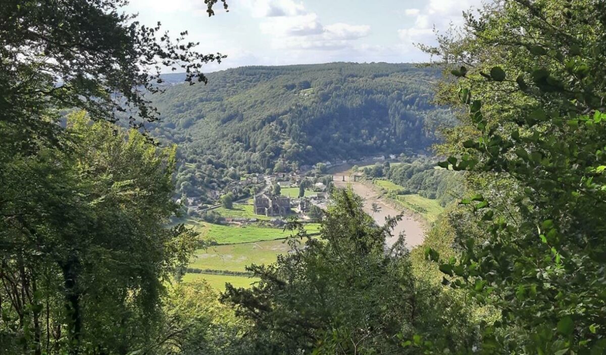
Tintern Abbey viewed from the Devil's Pulpit on the Offa's Dyke Path
Offa’s Dyke Path
This borderland ramble traverses wildly varying high ground between Wales and England, following the ancient fortification of Offa’s Dyke, purportedly built by Mercian ruler Offa to delineate the boundary between his kingdom and the Welsh. With a superb diversity of landscapes, it cuts coast-to-coast from Severn Estuary to Irish Sea along ravishing river valleys, over craggy summits and sparse moorland, through dense woods and via delightful forgotten towns and villages.
Offa's Dyke Path can be split up into moderately challenging daily sections which should be achievable for reasonably fit walkers. With careful planning (or the assistance of a walking holiday specialist) you'll be able to finish each day with accommodation and a comfortable bed—be sure to book in advance.
The path is most frequently walked south to north. If the full length seems daunting the path can be shortened at various convenient points: Kington, Chepstow, Monmouth, Hay-on-Wye, Kington, Knighton and Prestatyn have good public transport connections, with Chepstow, Kington, Knighton and Prestatyn connected by train.
Distance: 177 miles/285 km
Duration: 12-14 days
Start point: Sedbury Cliffs, Chepstow
End point: Prestatyn
Difficulty: Moderate
Suitable for: Reasonably fit hikers
Offa’s Dyke Path route
The southern trailhead, on cliffs overlooking the silty, tidal River Severn close to Sedbury, is in Gloucestershire, England. The hike soon crosses the River Wye to Wales and major hiking centre Chepstow, and at impressive Chepstow Castle you are also at the southern terminus of the Wye Valley Walk and Wales Coast Path long-distance trails. The path now traces the spectacularly sinuous River Wye through one of the trail’s finest sections north to Tintern. The approach through forest high above the Wye to the Devil’s Pulpit viewpoint, with winsome Tintern Abbey visible below, is especially astounding.
The route continues close to the Wye to historic Monmouth, then through flatter, less-spectacular countryside around the River Trothy, passing White Castle en route to Pandy on the eastern edge of Brecon Beacons National Park. A remote upland expanse is next: a challenging, exposed negotiation of the Black Mountains ridges, with lonely Capel-y-ffin and majestically ruined Llanthony Priory, far below the path, the only settlement until Hay-on-Wye. After Wales’ cultured second-hand bookshop capital, the trail rises into the rolling Radnorshire Hills, traversing dramatic Hergest Ridge to Kington, England. The subsequent leg to Knighton is perhaps the path’s loveliest, especially for the preserved sections of dyke and a ream of rewarding upland views without too much effort to obtain them.
Knighton is the last town en route before Prestatyn. The toughest part of the trail now hoists you up into the scenic Shropshire Hills AONB on continually hilly, sparsely-populated terrain to Brompton Crossroads. The going then gets flatter as the route bypasses pretty Montgomery and ascends to superb views of the Severn Valley. Buttington to Llanymynech, hugging the River Severn or Montgomery Canal, is pleasant but unspectacular walking, before the hills rear up again into former mining country from Llanymynech to spectacular Chirk Castle. Then comes another show-stopper, albeit with highlights often of a man made nature, as the path passes along the Llangollen Canal and dramatic Pontcysyllte Aqueduct to swerve north of lovely Llangollen. After here, the sheer crags of Creig iau Eglwyseg are thrillingly negotiated in another of the trail’s toughest stages, alongside crossings of boggy moors and extensive forestry to reach Llandegla. A fantastic although lengthy upland stretch is next, where views range from Snowdon to Cheshire as the route hits the lofty Clwydian Range of hills, passing the high point of Moel Fammau then descending to Bodfari. The hills now drop away, with impressive vistas of the sea and the route’s end spurring you on to reach Prestatyn.
Offa’s Dyke Path sections
Stage 1: Sedbury Cliffs-Monmouth (17½ miles/28 km)
Stage 2: Monmouth-Pandy (16¾ miles/27 km)
Stage 3: Pandy-Hay-on-Wye (17½ miles/28 km)
Stage 4: Hay-on-Wye-Kington (14¾ miles-23¼ km)
Stage 5: Kington-Knighton (13½ miles/27¾ km)
Stage 6: Knighton-Brompton Crossroads (15 miles/24 km)
Stage 7: Brompton Crossroads-Buttington Bridge (12¼ miles/20 km)
Stage 8: Buttington Bridge-Llanymynech (10½ miles/17 km)
Stage 9: Llanymynech-Chirk Mill (14 miles/22.5 km)
Stage 10: Chirk Mill-Llandegla (15 ½ miles/25¾ km)
Stage 11: Llandegla-Bodfari (17½ miles/28 km)
Stage 12: Bodfari-Prestatyn (12 miles/19 km)
A fractious history
The Wales-England borderlands are also known as the Marches. The name dates back to the medieval period when early Norman kings of England, striving to control the unrulier areas of their hard-won domain, appointed notoriously tough and often brutal ‘Marcher Lords’ to rule, often with powers normally reserved for kings such as raising armies, along the volatile boundary between the two lands.
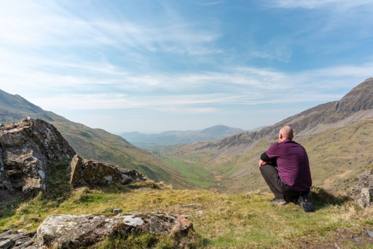
Admiring the view of Cwm Croesor from Cnicht, on the Snowdonia Way
The Snowdonia Way
Spreading across North Wales, the Snowdonia National Park (celebrating its 70th anniversary in 2021) is Wales at its wildest, highest and most dramatic. But 1,085m Mt Snowdon is just tip-of-the-iceberg stuff. This week-long, south-to-north trek takes in the full sweep of the national park; its moors, lakes, falls and rivers, brooding mountains, coastal towns and ancient sites.
Distance: 97 miles
Duration: Six to eight days
Start point: Machynlleth
End point: Conwy
Difficulty: Moderate if you stick to the low ground, but if you opt for the mountain route alternatives for peak-baggers it seriously ups the challenge.
Suitable for: Reasonably fit hikers. Though un-waymarked, the trail is easy to access and navigate. The mountain routes are for fit, experienced hill walkers only.
The Snowdonia Way route
Day one kicks off in the historic market town of Machynlleth, now notable as a centre of green energy. Crossing the River Dyfi, the trail dips into the oak tree-shaded Dyfi Forest before passing the slate-mining villages of Corris and Aberllefenni. Approaching the mountains of central Snowdonia, the hulking peak of 893m Cadair Idris slides into view. Skirt the mountain’s flank before descending through woods to the pretty dark-stone town of Dolgellau, with its heritage-listed houses, pubs and cafes.
Views of Cadair Idris’ formidable northern cliffs captivate as you leave Dolgellau on day two. Traversing the River Mawddach, the trail looks out across the river and woods. Easy-going woodland tracks precede another river crossing before you reach Coed y Brenin Forest, which give way to broad forest tracks leading to the moors above Trawsfynydd. Here views of the impressively rugged Moelwyn mountains await before a descent to the lakeside village of Trawsfynydd.
Day three begins gently with a walk around Trawsfynydd Lake, the rocky, heather-clad Rhinogydd mountains rearing above. From the lake’s northern tip, descend through woods into the broad Vale of Ffestiniog, marking the north-south Snowdonia divide. Views across the estuary and out to sea captivate as you make your way to Penrhyndeudraeth. From here, woodland paths meander into the foothills of the Moelwyns, with arresting views of the sea, the Llŷn Peninsula (west) and the pyramid-shaped peak of Cnicht (east). The final leg is a beautiful route along the River Glaslyn to Beddgelert at the foot of Snowdon.
From Beddgelert, the trail shadows the river to pass the rocky, legend-steeped hill of Dinas Emrys, with cracking views of Snowdon. Pass woodland-rimmed Llyn Dinas lake before continuing along the river to the glacial cirque of Llyn Glaslyn in the Nant Gwynant valley. Now things get wilder, with arresting views of the Moelwyns. The final stretch through the Lledr Valley is gentle and concludes at the medieval ruins of Dolwyddelan Castle and the tranquil village of Dolwyddelan.
Day five ups the drama, skirting the slopes of 872m Moel Siabod. There are superb views of the Glyderau and Carneddau mountains as you descend to the village of Capel Curig and start the long trudge through the breathtaking Ogwen Valley. Allow time to linger on the most spectacular section of the route, with rushing mountain streams, falls, lakes, and craggy peaks crowding the horizon, including 1064m Carnedd Llewelyn. The last section takes you back into slate-mining country, passing the Penrhyn quarry en route to Bethesda.
The final day involves a long 21-mile hike and 1,480m of ascent if you (consider breaking it up by staying overnight in Llanfairfechan). Beyond Bethesda, admire far-reaching views out to sea and the Isle of Anglesey. The trail meanders over hills to reach the misty plume of Aber Falls. Descend to seasidey Llanfairfechan, then continue up to the open moors at Tal y Fan and the modest summit of Cefn Coch and its stone circle. Make your way to the Sychnant Pass, skirting Conwy Mountain before dropping down to the impressively walled town of Conwy and its World Heritage-listed castle.
Snowdonia Way sections
Snowdonia’s weather is fickle, so check the Met Office mountain forecast before setting out. Waterproofs and warm layers are a must, as are OS maps or Cicerone’s comprehensive Walking the Snowdonia Way guide. There are good public transport connections, including train stations at the start/end points, and plentiful accommodation en route.
Stage 1: Machynlleth-Dolgellau (15.5 miles)
Stage 2: Dolgellau-Trawsfynydd (14 miles)
Stage 3: Trawsfynydd-Beddgelert (18.5 miles)
Stage 4: Beddgelert-Dolwyddelan (12.7 miles)
Stage 5: Dolwyddelan-Bethesda (15.5 miles)
Stage 6: Bethesda-Conwy (21 miles)
Myth and legend
Snowdonia is a land steeped in legend and ancient sites. The Iron Age hillfort of Dinas Emrys is where Merlin the wizard and the red dragon of Wales first appeared in British Myth.
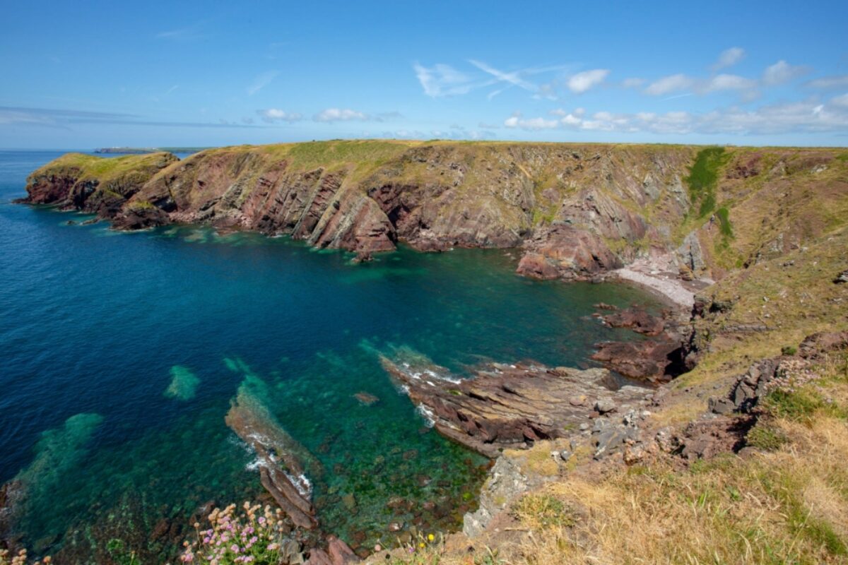
Summer views over the Pembrokeshire Coastal Path
Pembrokeshire Coast Path
Whisper it quietly; this might just be the best coastal path in Britain. Pembrokeshire has it all – dramatic clifftop vistas, seemingly endless beaches, secluded coves and tiny fishing villages, but best of all; almost no one knows about it, so you get pretty much all of it to yourself.
You’ll need two or three weeks to complete the trail in one go, and, as with most coastal paths in Britain, you’ll have to endure a lot of ups and down as you climb from clifftop down to cove and back up to clifftop, time and time again. But the rewards are plenty; as well as the sensational views, there’s wildlife to spot (seals, dolphins, all manner of seas birds), historic sites to explore (including no fewer than 11 castles), and exotic Welsh cuisine to fuel those tired legs (oggy and faggots, anyone?)
Distance: 186 miles (299km)
Duration: 16 days
Start point: Amroth
End point: St Dogmaels
Difficulty: Moderate: No problem to navigate, and not technically difficult, but don’t underestimate its length, nor the steepness of some of the cliff climbs
Suitable for: Any fit walker; great for families, though not necessarily in one sitting
Pembrokeshire Coast Path route
Starting in the seaside village of Amroth, day one takes you across the sandstone cliffs of south Pembrokeshire to pretty Tenby, with its pastel-coloured harbour buildings and boat rides out to the monastic island of Caldey. You’ll soon reach the beachside 12th-century castle at Manorbier Bay before passing a series of magnificent beaches – Freshwater West, Barafundle Bay, Broad Haven – each with its own unique character. Having negotiated a route around the MoD firing range at Castlemartin, and the more inviting Angle peninsula, you approach the least desirable part of the walk, around the heavily industrialised estuary of Milford Haven – fortunately, historic Pembroke and its magnificent Norman castle provide a welcome distraction.
The coastline becomes increasingly more attractive again as you approach Dale peninsular, then turns spectacular around Marloes peninsula where the three barren islands of Skomer, Skokholm and Grassholm attract thousands of seabirds, plus a boatload or two of curious day-trippers.
After the surfing hotspot of Newgale you reach St David’s, Britain’s smallest city and home to a beautiful cathedral plus a host of cute cafes, pubs and restaurants. The rugged coastline of St David’s peninsular provides fabulous hiking over the next few miles as you pass long sandy beaches, hidden coves and windswept bluffs before climbing the cliffs at Pwll Deri for outstanding ocean views.
The large harbour town of Goodwick and Fishguard offers a chance to stock up on supplies before you round the peninsular known as Dinas Island and negotiate the beautiful clifftop path to historic Newport, a precursor to the even more dramatic (and energy-sapping) clifftop walk on your final day.
Pembrokeshire Coast Path sections
Some of the more remote stretches have a dearth of accommodation so you may need to adjust your daily distances accordingly. In general, there’s a good range of places to stay, from campsites and hostels, to B&Bs and guesthouses. Don’t forget to factor in one or two rest days; walking for 16 days on the trot is a tough ask.
Day 1: Amroth – Tenby (7 miles)
Day 2: Tenby – Manorbier Bay (10.5 miles)
Day 3: Manorbier Bay – Broad Haven (10.5 miles)
Day 4: Broad Haven – Angle (20.5 miles)
Day 5: Angle – Pembroke (11.5 miles)
Day 6: Pembroke – Milford Haven (12.5 miles)
Day 7: Milford Haven – Dale (9.5 miles)
Day 8: Dale – Marloes (12 miles)
Day 9: Marloes – Newgale (15.5 miles)
Day 10: Newgale – St Davids (9.5 miles)
Day 11: St Davids – Whitesands Bay (8.5 miles)
Day 12: Whitesands Bay – Trefin (11 miles)
Day 13: Trefin – Pwll Deri (9.5 miles)
Day 14: Pwll Deri – Fishguard (10.5 miles)
Day 15: Fishguard – Newport (11 miles)
Day 16: Newport – St Dogmaels (16 miles)
Abergavenny and Blorenge viewed from Ysgyryd Fawr Skirrid Fawr
The Beacons Way
Involving stiff ascents and proper wilderness, this challenging eight-day linear hike thrusts you straight into the heart of the Brecon Beacons National Park, taking you well and truly off the beaten track to medieval castles, Iron Age hillforts and blustery lookouts where the only sound is the piercing whistle of red kites.
Distance: 99 miles
Duration: Eight days
Start point: Abergavenny
End point: Bethlehem
Difficulty: Challenging. The hike involves strenuous ascents and moorland traverses, and the weather and terrain (fog and bog) can make the going tough.
Suitable for: Fit hill walkers with experience, navigational skills and the right kit.
The Beacons Way route
Diving straight into the Black Mountains, day one is tough but spectacular. From Abergavenny, the trail heads up to the 486m Skirrid, with sensational views over to England on fine days, then hooks briefly onto the Offa’s Dyke Path to crest Hatterrall Hill. Next up is the wildly remote Vale of Ewyas and the romantic ruins of medieval Llanthony Priory, which Turner painted in 1794.
Things toughen up on day two, crossing four of the major ridges in the Black Mountains. A steep climb along Cwm Bwchel brings you to Bal Bach ridge (take care in poor weather when navigation is tricky). The path continues northwest over hills to Crug Mawr, then veers southwest to pass the Iron Age hill fort of Crug Hywel (Table Mountain) above the pretty town of Crickhowell.
Day three is easier, with a gentle ascent from Crickhowell to the bald summit of Pen Cerrig-calch. Descend to Cwmdu village and follow narrow country lanes before heading up to the Bronze Age burial cairns at Cefn Moel, where there are magnificent views of Ice Age Llangorse Lake.
Brace yourself for day four, with seven hours of strenuous walking and 1,110m of ascent ahead. It’s a challenging climb to boggy, exposed Craig y Fan Ddu, where the ridge leads to a plunging waterfall. Detour to Fan y Big for photo ops at the ‘diving board’ rock, then climb steeply to highest-of-the-high Pen Y Fan, descending via Corn Du for more far-reaching views. The trail descends sharply south to the car park on the A470 and footpath to the Storey Arms, an outdoor education centre and the trail’s halfway point.
Day five is less taxing, but you’ll be leaving the well-trodden paths from hereon and venturing into the remote western Brecon Beacons. The route negotiates streams, waterfalls, open hills and moors en route to Ogof Ffynnon Ddu National Nature Reserve, famous for its limestone pavements and cave systems. Descend pass quarries to reach a track taking you into Craig-y-nos Country Park.
Make your way steadily northwest and into proper wilderness on day six, taking in the vast sweep of Fan Brycheiniog (820m), with views of the mythical lake of Llyn y Fan Fach. Take particular care here in high winds and fog. The sheep tracks can be confusing, so consider using a compass to navigate your way to Llanddeusant.
Day seven is tough, with an ascent to cave-riddled Carreg yr Ogof and the summit of 635m Garreg Las, with its two Bronze Age burial cairns. Much of the route passes through open moor. Perched on a rocky outcrop, medieval Carreg Cennen Castle is your end-of-the-day reward. From here, it’s an easy final day on flatter ground north to the little town of Bethlehem. The highlight is Gaer Fawr, Wales’ second largest Iron Age hillfort, standing on an isolated ridge.
The Beacons Way sections
Go well equipped with proper hill-walking gear, a compass and 1:25.000 Ordnance Survey OL12 & OL13 maps. Advance planning is essential, especially in the western reaches of the national park where accommodation is scarcer. Consider also bringing an emergency shelter (bivvy bag). There is limited waymarking on the route’s upland sections. In late spring or early autumn, there are fewer hikers but still plenty of daylight.
Day 1: Abergavenny–Llanthony Priory (13.5 miles)
Day 2: Llanthony–Crickhowell (12 miles)
Day 3: Crickhowell–Llangynidr (12 miles)
Day 4: Llangynidr–Storey Arms (14.5 miles)
Day 5: Storey Arms–Craig-y-Nos (14.5 miles)
Day 6: Craig-y-Nos–Llanddeusant (10 miles)
Day 7: Llanddeusant–Carreg Cennen (12.5 miles)
Day 8 Carreg Cennen–Bethlehem (10 miles)
Wild Brecons
Topped out at 886m Pen-y-Fan and protected by their national park status, the fin-shaped Brecon Beacons are not the country’s highest peaks but that detracts nothing from their drama. As you hike along sheer-sided valleys, remote, heathery moors and over wind-buffeted heights, look up to sight peregrine falcons, buzzards and red kites.
Dramatic views of Corn Du from Pen-y-Fan
The Cambrian Way
Striking out from south to north over the mountainous spine of Wales, this is the nation’s toughest, wildest hike: not because of distance but because of the remoteness, with many sections lacking not just signage but any path whatsoever.
Distance: 298 miles
Duration: 21-24 days
Start point: Cardiff
End point: Conwy
Difficulty: Challenging
Suitable for: Seasoned hikers happy carrying full kit
The Cambrian Way route
From Cardiff the route rapidly rises into relentlessly hilly terrain, crossing the Brecon Beacons National Park and the still-wilder Cambrian Mountains before entering Snowdonia’s rugged ranges for the final eight days’ walking.
Especially in the last fortnight, you are traversing isolated terrain: sometimes going entire days without passing settlement or accommodation. You must therefore come with full kit, prepared to camp out. Full kit includes a tent, sleeping bag, survival bag, compass (ability to navigate is essential throughout) and cooking equipment (pubs and restaurants are few and far between).
The few towns on the trail include Pontypool (South Wales), Abergavenny and Llandovery (Brecon Beacons) and Barmouth (Snowdonia). Other places en route are tiny villages at most. There are some wilderness shelters in isolated sections. The grand finale—Conwy, with its castle and medieval town walls, sheltering below Snowdonia and beside the sea—gives the walk a beautifully theatrical conclusion.
The Cadair Idris mountiains in Snowdonia National Park
The Cambrian Way sections
Cambrian Way walkers are normally experienced, walking either the entire trail or at least a third in one go. Broken down, the three obvious sections are Cardiff-Llandovery, Llandovery-Barmouth and Barmouth-Conwy, all served by decent bus/rail connections.
Stage 1-2: Cardiff-Pontypool (26¾ miles/43 km)
From Cardiff the route is immediately surprisingly countrified, tracing the River Taf out of the city under the motorway to fairy-tale castle Castell Coch, then steeply up through forest to Machen, soon coming within sight of striking mountain scenery via Cwmbran to Pontypool.
Stage 3-8: Pontypool-Llandovery (93¼ miles/149½ km)
From Pontypool you emerge into the beautiful Brecon Beacons National Park, lush and barren by turns. The route skirts Blaenavon, descends to Abergavenny surrounded by its photogenic peaks, and flanks the eastern edge of the national park, the Black Mountains, before ascending to South Wales’ highest peak, Pen y Fan. The trail next runs west then north through seldom-trodden moorland to arrive at the northwestern nook of the national park, Llandovery.
Stage 9-13: Llandovery-Dinas Mawddwy (82¾ miles/134km)
The scenery on this section is some of the Cambrian Way’s remotest. After Llandovery the path enters mid-Wales, ascending into the Cambrian Mountains and passing only a handful of buildings, including the peaceful Strata Florida Abbey ruin, until Devil’s Bridge. Bothies provide shelter on the many wild upland stretches. The only other village with facilities en route is Ponterwyd, below mid-Wales’ highest summit Pen Pumlumon Fawr. After Dylfie is the drastic transformation between the rounded hills of Mid Wales and Snowdonia’s pointy peaks.
Stage 14-15: Dinas Mawddwy-Barmouth (22 miles/35½ km)
Among the most demanding sections, the steep climb out from Dinas Mawddwy and moorland continuation via Bwlch Llyn Bach, over southern Snowdonia’s highest mountain, Cadair Idris and down to the sea at Barmouth, is also the Cambrian Way’s prettiest. Decent public transport to/from the start/end also makes this a good section to do in isolation (doable without full kit in one long day).
Stage 16-18: Barmouth-Beddgelert (37¼ miles/61 km)
Another intensely gruelling and rewarding stretch begins straight out of Barmouth as the trail enters the Rhinog mountains. It is starkly beautiful, hard-going and little-trodden until Llyn Trawsfynydd (two days’ walking) then marginally easier (but still challenging) on the rocky, lake-bedaubed route to Beddgelert, below Snowdon.
Stage 19-21: Beddgelert-Conwy (35¼ miles/56½ km)
The last section navigates the highest mountain in England and Wales, Snowdon and traverses many more sheer rocky summits set off spectacularly by lakes like Llyn Ogwen, after which the longest sustained stretch of upland hiking on the whole route (some 30km) leads you to Conwy and the north coast of Wales.
What's in a name?
Wales was for many centuries known by the Latinised form (Cambria) of the Welsh word for Wales (Cymru). Thus the term ‘Cambrian Mountains’ originally referred to most major mountains of Wales; the Brecon Beacons and Snowdonia included.
About the author
Kerry Walker
Based in the mountains of Mid Wales, Kerry Walker is an award-winning British travel writer, author, photographer, translator and co-founder of Undiscovered Wales. She is also lover of mountains, cold places and true wilderness.
Find a Wales specialist
Tell us about your trip and we'll find your match
We'll connect you directly with the experts.

Connect with John Millen.
We'll connect you directly with the experts.
Connect with John Millen.
- Hand-picked local specialists
- Honest advice from real experts
- Free to use, no hidden fees