


The Pennine Way
A beginner's guide to walking the Pennine Way
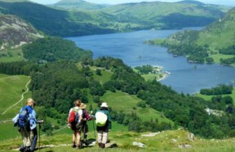
The Pennine Way, the oldest and one of the toughest of the waymarked UK walking trails, follows the rugged ridge of uplands that form the backbone of northern England.
This iconic hike meanders through some of northern England's best-known walking spots, from the Peak District to the Yorkshire Dales, into Northumberland National Park before finally just over the border with Scotland.
It's popular with day walkers, particularly around the Peak District and Yorkshire Dales, but don't be deceived: the full route is a tough, varied, but memorable undertaking.
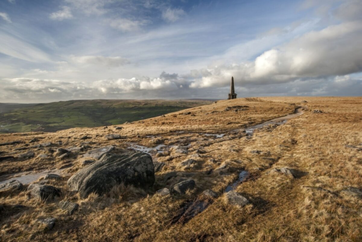
Stoodley Pike, above Hebden Bridge on the Pennine Way
Walking the Pennine Way
The Pennine Way
Distance: 268 miles (431km)
Duration: Three to four weeks, or shorter segments
Start point: Edale, Derbyshire
End point: Kirk Yetholm, Scottish Borders
Difficulty: Moderate to strenuous – hilly, often remote upland, long stretches between accommodation
Suitable for: Experienced walkers
Yes, it’s a challenging upland trail across spectacular scenery – but the Pennine Way stands for more than that.
The first British National Trail was established after campaigns to copy America’s great early walking trails. It’s now a national symbol celebrating the right to roam. It even crosses Kinder Scout, site of 1932’s mass trespass.
It treks along the backbone of England, offering a muddy-booted Grand Tour of the north’s natural wonders. Highlights include High Cup Nick ‘The English Grand Canyon’ and High Force, England’s biggest waterfall. You’ll see Malham Cove’s huge limestone pavement, the ‘Yorkshire peak’ of Pen-y-ghent and even follow stretches of Hadrian’s Wall too.
The Pennine Way sections
A few hardy souls undertake the full route in one go. Most people break it up into several segments, depending on how much time they have for each section. The full route looks like this:
Edale – Crowden, 16 miles
Crowden – Standedge, 11 miles
Standedge – Hebden Bridge, 15 miles
Hebden Bridge – Ponden, 11 miles
Ponden – Thornton in Craven, 12 miles
Thornton – Gargrave, 4.5 miles
Gargrave – Malham, 7 miles
Malham – Horton in Ribblesdale, 14 miles
Horton – Hawes, 14 miles
Hawes – Keld, 12 miles
Keld – Tan Hill Inn, 4 miles
Tan Hill Inn – Middleton in Teesedale, 16.5 miles
Middleton – Dufton, 19 miles
Dufton – Garrigill, 16 miles
Garrigill – Alston, 4 miles
Alston – Knarsdale, 6 miles
Knarsdale – Greenhead, 10 miles
Greenhead – Twice Brewed, 7 miles
Twice Brewed – Bellingham, 15 miles
Bellingham – Byrness, 15 miles
Byrness – Kirk Yetholm (Cheviot route) 27.5 miles
This can be broken up into three sections:
South section
90 miles/144km
Edale to Horton-in-Ribblesdale
Central section
102 miles/164km
Horton-in-Ribblesdale to Greenhead
Northern section
64 miles/103km
Greenhead to Kirk Yetholm
Alternatively you can break it up into shorter weekend (or long weekend) segments, you'll need to plan around transport and accommodation logistics. In some places, accommodation may be a distance away from the trail, and you'll either need to factor in the extra walking or arrange for a pickup with your B&B.
Hidden gems
The Pennine Way has some excellent detours for those with more time on their hands. A circular walk from Malham via Gordale Scar and Malham Cove would get you off the main trail for an afternoon.
Pennine Way need to know
Walking the Pennine Way makes you part of the story of walking in Britain – and all that entails. So expect to discover surprising wildernesses, old pubs and impressive landscapes, but also some of the logistical issues too. Don’t expect a sunny stroll through leafy glens, this is as hardcore as English walking gets.
Transport-wise, Edale thankfully has a station on the busy Sheffield to Manchester rail route. It’s just ten minutes’ walk up to the Old Nag’s Head where the route starts. Edale has no bus service though.
Kirk Yetholm is more remote. Nearest station is Berwick, more than 20 miles away. Best bet is bus from the Village Green to Kelso, then change bus for Berwick. There are only usually three a day from Kirk Yetholm, two a day from Kelso, so check latest timetables.
The route is generally well marked (with 458 signs to be exact) – but occasionally not. The path itself is often gravel or flagstones, but occasionally a boggy slog across windswept tundra.
There are hard, steep sections and famously the total route ascents surpass the height of Everest. The route includes more than 400 stiles and 20 miles on public roads too.
The Pennine Way is considered a classic for wild campers carrying their kit. For the less hardy, gaps between accommodation can be challenging. Booking ahead is vital. Don’t over-rate your ability to cover daily distances. Hilly sections are draining and severe weather can set in at any season.
The last mile
Despite the challenges, the Pennine Way offers one of the best ‘I’ve done it!’ feelings of all the UK's big walks. Descending into Kirk Yetholm is exhilarating after so many climbs. The end point is a pub too – the welcoming Border Hotel offers all finishers a certificate… and most importantly, a free half pint.
Read more
The Rambling Man website offers an excellent resource on the trail and logistics.
The National Trails website has detailed trip planning information.
About the author
Simon Heptinstall
Simon is a TV writer turned travel journalist and photographer who specialises in walking and hiking holidays in the United Kingdom, Europe and beyond. He writes on walking holidays in England for the Wall Street Journal, The Guardian, The Daily Mail, among others.
Find a The United Kingdom specialist
Tell us about your trip and we'll find your match
We'll connect you directly with the experts.

Connect with John Millen.
We'll connect you directly with the experts.
Connect with John Millen.
- Hand-picked local specialists
- Honest advice from real experts
- Free to use, no hidden fees