


Where To Walk In Wales
The best places for walking holidays in Wales
It may be the smallest nation on the mainland of Great Britain but don’t let its compact size deceive you: Wales is wild, remote and exceptionally well suited to walking holidays. Here’s a handful of Wales’ best walking areas.
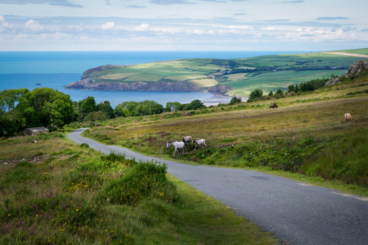
The Preselli hills in Pembrokeshire, Wales
Pembrokeshire
Pembrokeshire is the Wales of your imagination. With a cliff-wrapped coastline indented with smugglers’ coves and riven with false inlets, jagged rock formations, and gold-sand coves backed by ivy-draped woods, this region in Wales’ southwestern crook is an absolute joy to explore on foot.
Top billing goes to the Pembrokeshire Coast Path, an epic 186-mile national trail that begins in Amroth in the south and slowly and spectacularly edges its way up and over gorse-clad cliff and kissing gate north to St Dogmaels on the Ceredigion county border. If you don’t have time to see it all, the route (well marked and mapped) can easily be broken down into day- or week-long chunks, with buses joining the dots for the weary, and the nearest B&B or campsite, fishing village or seaside town never more than a few miles away.
Largely at cliff level, the path takes a dragnet through Pembrokeshire, revealing some of Britain’s most thrillingly remote and beautiful beaches, smashed by booming surf and regularly visited by seals, dolphins, porpoises, choughs, peregrines and puffins. Binoculars are a backpack must. Despite being a coast path, the trail should not be underestimated - the relentless up-and-down route tallies 35,000 feet of ascent and descent in total, the equivalent of climbing Everest.
Beyond the coast, the under-the-radar Preseli Hills and their mystery-laden moors, famous for the bluestone that built Stonehenge, beckon with prehistoric standing stones, Iron Age hill forts and Neolithic burial chambers. For the ultimate walk back in time, hike the seven-mile Golden Road.
Read more
See our full writeup on the Pembrokeshire Coastal Path here.
Corn Du, the summit of Pen y Fan in the Brecon Beacons
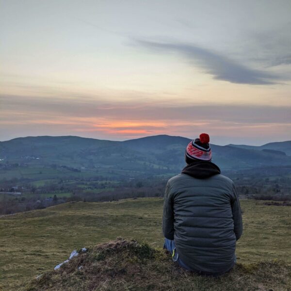
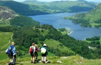
The Brecon Beacons
Though just a quick hop across the Severn Bridge, the Brecon Beacons feel a million miles away in spirit and landscape. If you’re coming from southern England, this range is probably your most accessible chunk of wilderness. Topping out at 886m Pen y Fan, the mountains here are by no means Wales’ highest (that honour goes to Snowdonia), but that detracts nothing from their majesty.
If you avoid the more heavily crowded trails heading up the big-hitter peaks, this region has hiking as remote and dramatic as you will find anywhere in the country. And trails so thoroughly off the beaten track that you will need to plan your route diligently and know how to read a map and a compass. Accommodation—especially in the quieter west of the region—can be sparse, supplies scant and public transport spotty. In short, come ready for a proper adventure!
Tortured into shape by the elements and bearing the scars of glacial erosion, the bald, fin-shaped Brecons rise above windy moors, lakes and forests. The wild terrain is not to be underestimated (fog and bog can put the mockers on the best of plans). Summer is best for weather but busier in the central Beacons, making spring and early autumn great choices.
Much of the region is a national park, traversed in its entirety east-west by the 99-mile Beacons Way national trail, a serious undertaking where you’ll often be alone with the red kites. Day hikes here are just as rewarding, however, with the bonus of being able to spend the evening by the fireside in a glorious old coaching inn or country pub.
Read more
See our full writeup on the Beacons Way here.
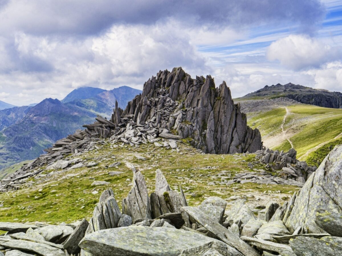
Castell y Gwynt atop Glyder Fach in Snowdonia
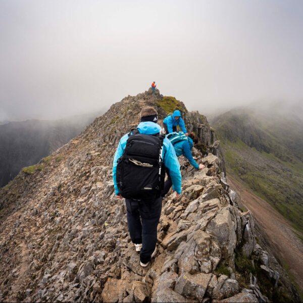
Snowdonia
Snowdonia is Wales at its most wild, rugged and enthrallingly mountainous. The highest peaks south of Scotland pucker up in this north-western stretch of the country, glowering above frigid lakes of quicksilver and dropping to lonely moors, meadows hemmed in by rambling dry-stone walls, forested river valleys and dune-backed beaches that roll for miles and gaze wistfully across the crashing waves of the Irish Sea.
Much of the region is protected under the banner of the Snowdonia National Park, celebrating its 70th anniversary in 2021, and nearly every inch has been diligently OS mapped—and in many cases, waymarked—making this hands-down some of Britain’s finest terrain for hiking.
Few can resist the siren call of the highest-of-the-high Snowdon (1085m), a craggy beast of a mountain that can be approached eight ways, from the tough scramble of Crib Goch to the long but gentle ascent on the Llanberis Path. But Snowdon really is only tip-of-the-iceberg stuff. Countless other hikes are just as rewarding: from a summit ascent of 893m-high Cadair Idris to walking in the high-drama, waterfall-laced Ogwen Valley and the primevally beautiful forests of Dyfi and Coed y Brenin. If you have the time and will, the 97-mile Snowdonia Way gives you a pinch of the lot.
Prime walking season is May through September for lighter, warmer days, but Snowdonia is fickle weather-wise, so always come prepared for harsh, boggy terrain and rain. A good drenching is to be expected and will make you appreciate that cosy slate-roofed B&B or wood-fire-warmed pub all the more.
Read more
See our full writeup on the Snowdonia Way here.
Featured Trips
14 Peaks Experience
Claim the ultimate bragging rights when you hike the highest and toughest peaks in Snowdonia national park…
Mindful Walking
Deep in the Berwyn hill range, tucked away in the Ceiriog valley, lies a tiny village and in the tiny village lies a traditional Welsh inn, with cosy log fires, local ale and delicious locally-sourced food…
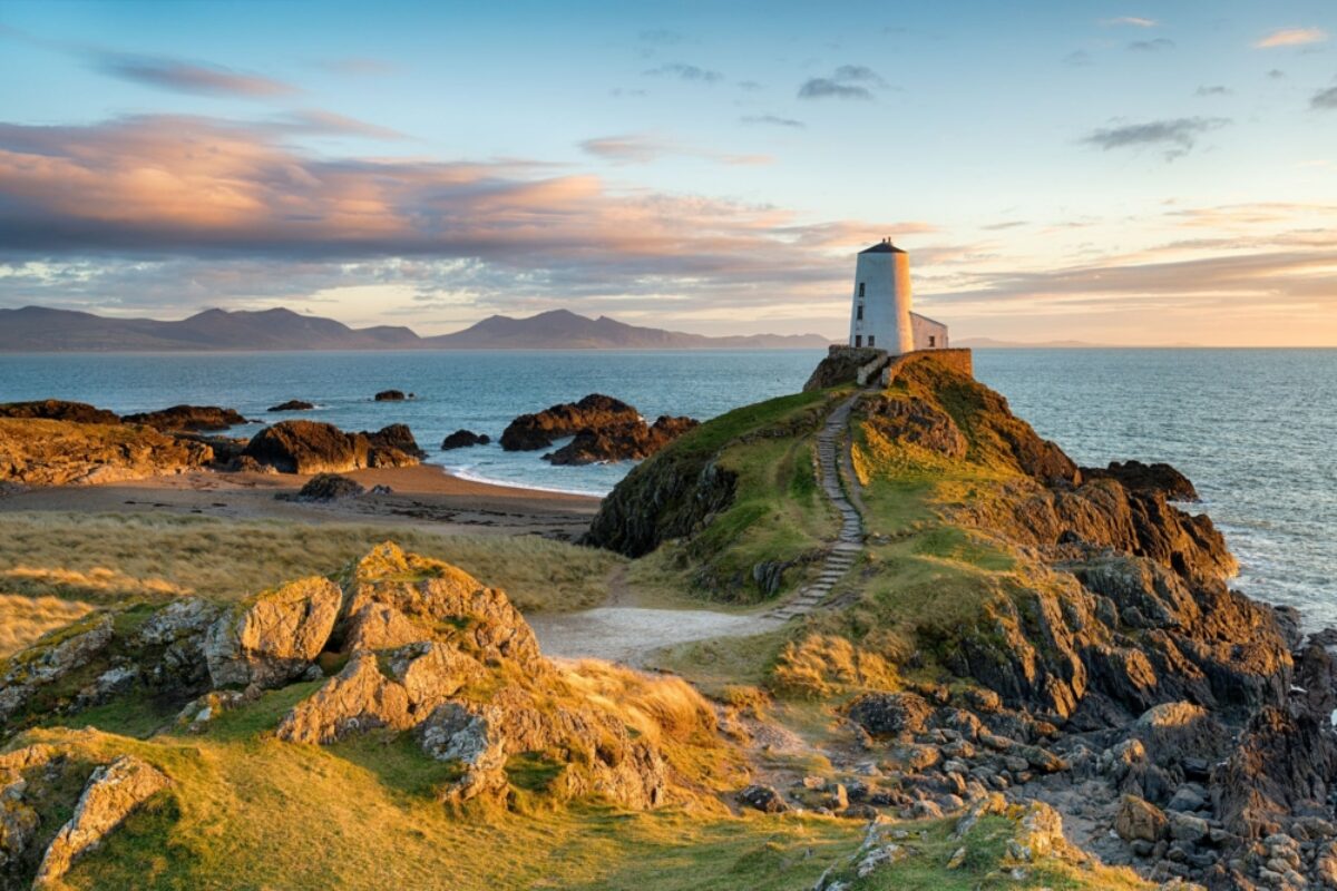
Sunset at Ynys Llanddwyn, on the west side of Anglesey
Anglesey
Dangling off Wales’ north-western-most tip and anchored to the mainland via the bridge over the Menai Strait, the Isle of Anglesey is defined by the tides, smacked by some ferocious storms and subject to the tempers of the Irish Sea. There is a magic to this island that is hard to put your finger on, but perhaps it’s the ever subtly changing light, the open horizons, the views of Snowdonia’s purple-bruised mountains to the east, or the glimmer of Ireland to the west.
Walkers are in their element here, whether you want to set off on day hikes or take the entire island in your stride on the 130-mile circular Anglesey Coastal Path, which is largely way-marked. The long-distance trail wriggles and writhes along the island’s coastline: from the broad dune-backed strands and pine forests of the southern Newborough Warren and Ynys Llanddwyn National Nature Reserve, to the wind-whipped, sheer, exposed cliffs around Wales’ northernmost point, which receives far viewer visitors than Land’s End or John O’Groats.
Windmills, lighthouse-topped stacks, prehistoric standing stones, pubs by the sea and restaurants dishing up local seafood punctuate walks here. And there are plenty of self-catering cottages and B&Bs where you can spend the night.
Spring through autumn is undeniably the safest bet for weather, with some stretches of the coast path off limits in winter. Check tide timetables before hitting the trail.
Read more
See our full writeup on the Anglesey Coastal Path here.
About the author
Kerry Walker
Based in the mountains of Mid Wales, Kerry Walker is an award-winning British travel writer, author, photographer, translator and co-founder of Undiscovered Wales. She is also lover of mountains, cold places and true wilderness.
Find a Wales specialist
Tell us about your trip and we'll find your match
We'll connect you directly with the experts.

Connect with John Millen.
We'll connect you directly with the experts.
Connect with John Millen.
- Hand-picked local specialists
- Honest advice from real experts
- Free to use, no hidden fees