Hiking & walking holidays in the Balkans
An expert guide to the best hikes & walks in the Balkans
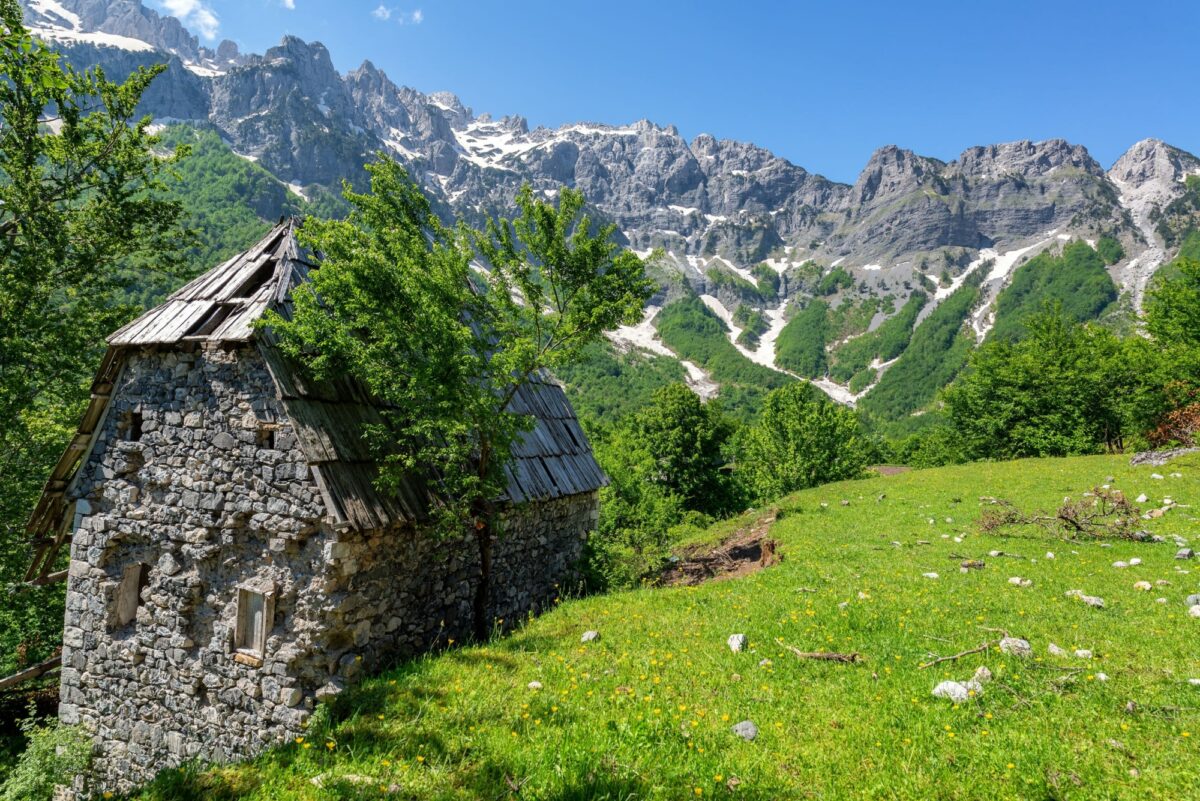
Walking holidays in the Balkans: Introduction
For me, the Balkans was love at first sight – the landscapes, the food, the history, the people, that off-the-map feeling which you find so rarely while walking in Europe.
I’ve been hiking in Balkans for over 25 years, and am still drawn back year after year, whether to walk new routes or seek out old favourites in Croatia or Macedonia, Montenegro or Albania, Kosovo and beyond.
There are some superb long distance hiking trails in the Balkans, several of which I’d include among my favourite walks anywhere in the world – yet for the most part, they are much less-known than routes in the Alps or the Pyrenees, and see far fewer visitors.
And there are a huge number and variety of day walks, from something like a stroll by Lake Skadar in Montenegro to long hikes on peaks such as 2,764m Korab on the border between Macedonia and Albania.
The more remote routes require a bit more confidence and experience than some of Europe’s better known mountain playgrounds – but this is at the same time one of their great draw-cards.
Ready to strap on your boots? Here's my guide to hiking and walking holidays in the Balkans.
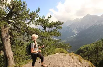
The best hikes and walks in the Balkans
Popular and lesser-known routes


Featured Hikes
 Balkans
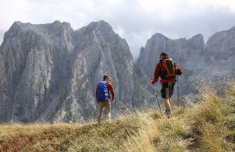
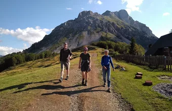
The Peaks Of The Balkans
Explore the spectacular landscapes of Montenegro and Albania's mountains
8 days €990 – €1,090 ppFeatured Hikes

The Peaks Of The Balkans
Explore the spectacular landscapes of Montenegro and Albania's mountains
8 daysFrom €990Where to go walking in the Balkans
Our experts' top picks
Montenegro
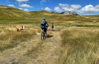
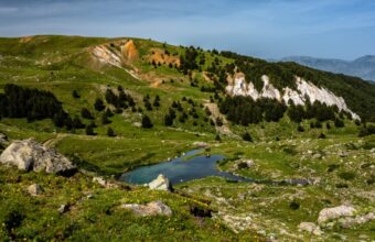
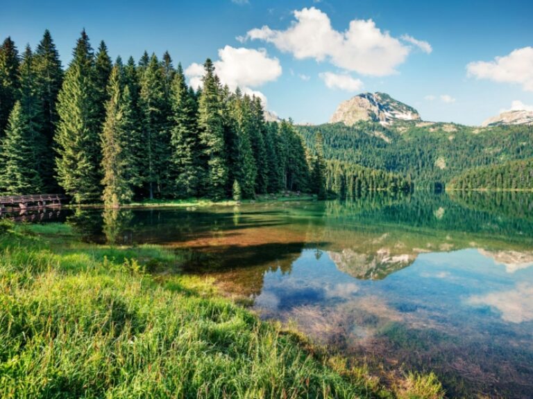
Durmitor National Park
Durmitor National Park is the most popular hiking area in Montenegro, and accordingly this was the first place I headed for on my initial trip to Montenegro back in the early noughties. Easily accessible, with plenty of well-marked trails, and plenty of jaw-dropping scenery, this is one of the best introductions to hiking in Montenegro.
Albania
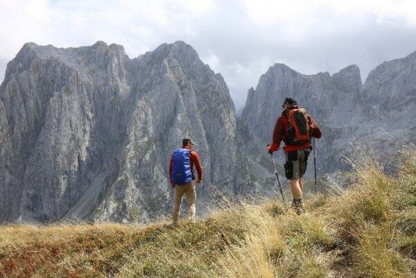
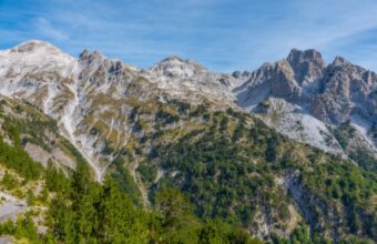
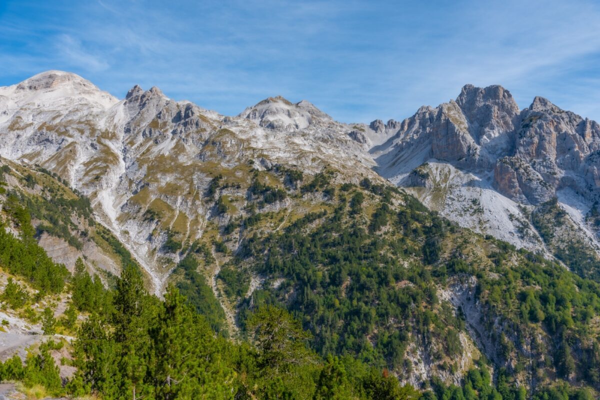
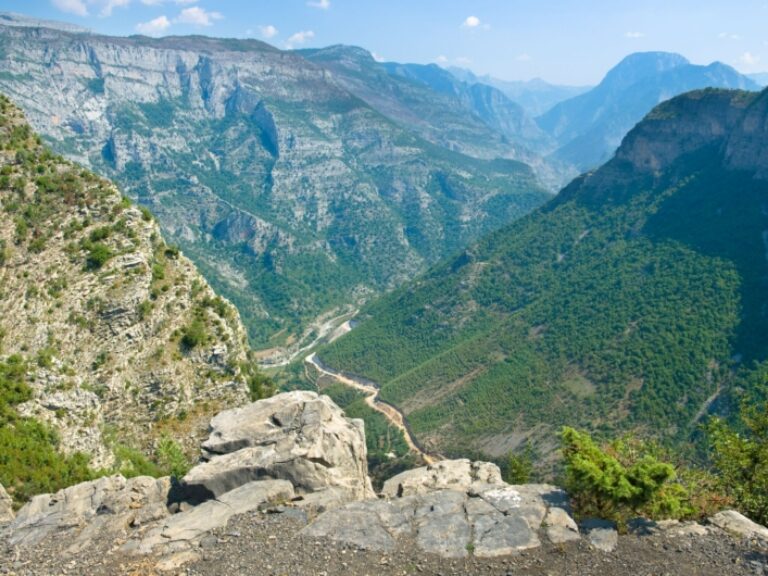
The Accursed Mountains
The Accursed (Prokletije) Mountains, which form the border between Montenegro, Kosovo and Albania are absolutely breathtaking – I remember being completely bowled over by the scenery on my first hiking trip to the Grbaja and Ropojana valleys (not to mention the fact that there were almost no other people on the trails there, although things have moved on a little since that time). The Prokletije mountains have been luring me back ever since.
Croatia
Velebit National Park
Croatia’s most extensive mountain area was also my introduction to hiking in southeast Europe – big and untamed, with stupendous karst scenery. For my money the north-south traverse of the Velebit mountains is still the best multi-day hiking route in Croatia.
Romania
Piatra Craiului National Park
Piatra Craiului boasts the most extensive series of trails of any of Romania’s national parks, and is a fantastic area for hiking. It’s an exceptionally good area for seeing wildlife – in fact my first visit to the national park was on a wolf- and bear-watching trip.
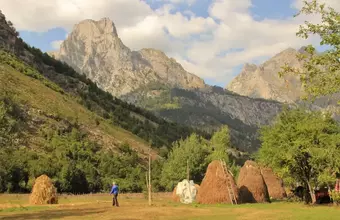
Planning a Balkans walking holiday
Everything you wish you'd known before you booked
Finding paths less trodden
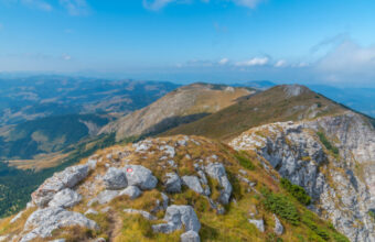
The Balkans draw a fraction of the visitors of Europe’s big hiking destinations in the Alps and Pyrenees. That said, this corner of Europe isn’t immune to the tourism industry’s preference to market what’s already popular rather than its lesser-known places. When you browse Balkan hiking trips you’ll generally find the Peaks of the Balkans stealing the limelight. It’s well earned publicity for an impressive project, but it’s far from the Balkans’ only long distance hiking trail.
If you’re looking for a multi-day, long-distance trail, consider the High Scardus Trail – along with the Peaks of the Balkans, it’s one of my absolute favourites: it’s unbelievably beautiful and almost entirely empty of other hikers. Alternatively consider hiking in Galichica National Park between lakes Ohrid and Prespa in North Macedonia, or the Zagoria Valley in southern Albania.
Hiking & walking holiday types
The Balkans have a few treks that follow ‘official’ long-distance trails, such as the Peaks of the Balkans, the High Scardus Trail and the Via Dinarica, with overnight stays in traditional village homestays. These are sold either as a self-guided (private) walking holiday, or an escorted (group) tour.
Escorted hiking tours are straightforward; you’ll be accompanied by a guide the entire time with a small group of other hikers following a fixed itinerary (and pace!) You’ll find group tours for the Via Dinarica and Peaks of the Balkans widely marketed online.
On self-guided walking holidays you’ll be hiking alone, the daily itinerary will be customised to suit your pace, each night’s accommodation will be pre-booked, and (usually) you’ll have baggage transfers to ferry your luggage from one homestay to the next.
Self-guided walking is fine in the Balkans (it’s been my choice for over 25 years) but you need to be a little more confident and self-reliant than a self-guided trip in some of Europe’s better-known hiking areas. A good local tour operator should provide a handheld GPS unit, a phone loaded with a local SIM card, and plenty of detailed info on each route, so you’ll be extremely well looked after.
Also common in the Balkans are “centre-based” walking holidays, where you’ll do either self-guided or guided hikes in one or more locations. There will be road transfers between each location and the itinerary may be interspersed with other non-walking activities and rest days.
The precise format of the tour is not always made clear on the operators’ websites: be sure to check what you’re signing up for before booking.
If you go with an organised tour, I’d recommend you pick one of the many excellent local operators who really know the area – this will give you a vastly more in-depth, rewarding and authentic experience, as well as putting money into the local economy. They know all the great village homestays and their guides know their local areas like the backs of their hands.
Valbona in the Albanian Alps
Balkans walking holidays FAQs
Your questions, our expert answers
Question
When is the best time to go hiking in the Balkans?
Answer
The main hiking season in the Balkans runs from June to October. July and August are hottest, with the potential for afternoon storms. September tends to be more settled. Wildflowers are at their most colourful in June.
Question
Can you trek in the low season?
Answer
Definitely. You can come slightly earlier or later than the main hiking season but expect lingering snow patches in the early season, and increased chances of rain later in the season. (I’ve hiked in Montenegro in what is generally the wettest month, November, and I can confirm that the potential for getting absolutely soaked is quite high!) Winters in the mountains of the Balkans are bitterly cold with plenty of snow, so you need to come suitably equipped.
Question
Can you personally recommend your favourite hike?
Answer
Trying to recommend my favourite hike in the Balkans is a bit like asking me to pick my favourite French cheese or bottle of wine – there are just so many hikes in the Balkans for which I have vivid, unforgettable memories. All of the hikes listed above are personal favourites, though it’s the trans-border trails which hold a particularly special place in my hiking hall of fame.
Question
Are hiking trails well marked in the Balkans?
Answer
Hiking trails in Albania, Bosnia, Bulgaria, Croatia, Kosovo, Macedonia, Montenegro and Romania – at least those in well-visited areas like national parks – are generally very well marked with trail blazes and signposts. In areas which are less visited, trail markings may well have faded.
Question
Do I need a permit to hike in the Balkans?
Answer
For cross-border trails like the Peaks of the Balkans and the High Scardus Trail, yes, you need to apply for cross-border permits before your hike. You can do this yourself, or (easier) there are several local tour operators who will do it for you for a very reasonable fee.
Question
Is wild camping allowed in the Balkans?
Answer
Wild camping is allowed in many mountain areas of the Balkans (there’s no problem camping on the Peaks of the Balkans trail for example), though not in some national parks (for example in Croatia). Just remember, if you’re camping – leave no trace. These special places should remain as beautifully untouched for the next hiker, and no one is going to come and clean up after you.
Question
Is it easy to find drinking water while hiking in the Balkans?
Answer
Many mountain areas in the Balkans are karst, meaning there’s often little or no surface water – this is true for Croatia and Montenegro, and much of the Peaks of the Balkans for example. There are springs, some of which are reliable throughout the hiking season, others less so. In any case I carry a metal flask, as well as one or more collapsible water ‘pouches’ for days when water is more scarce and I need to carry more with me, as well as a water filter. I always carry a small water filter on hikes in the Balkans (and most other places actually) – a Peak Series Collapsible Squeeze Filter from LifeStraw, to be precise. This weighs next to nothing, takes up hardly any space in my pack, and means I can collect water pretty much wherever I find it along the trail. In any case, avoid buying plastic bottled water – many of the plastic bottles will otherwise inevitably end up in landfill.
Question
Are wild animals a problem while walking in Europe?
Answer
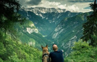
Though wolves and bears roam the wilder expanses of Europe’s highlands, you’re unlikely to encounter one. What you might come across, though, are shepherds’ dogs bred and trained to ferociously defend livestock against predators – and human interlopers – particularly in the Carpathians, Balkans and Caucasus. I’ve suffered unnerving canine encounters in Bulgaria and North Macedonia, where I was thankful to have experienced local guides – also my trusty walking poles. (While we’re talking animal hazards, tick-removal tools are must-packs, too.)