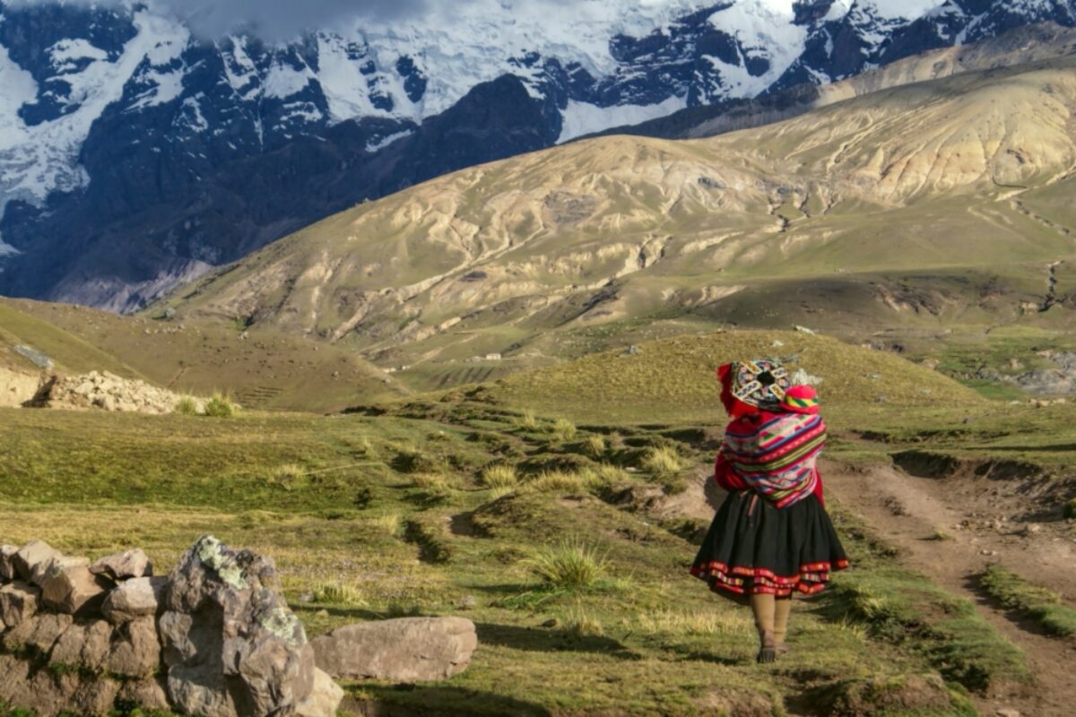
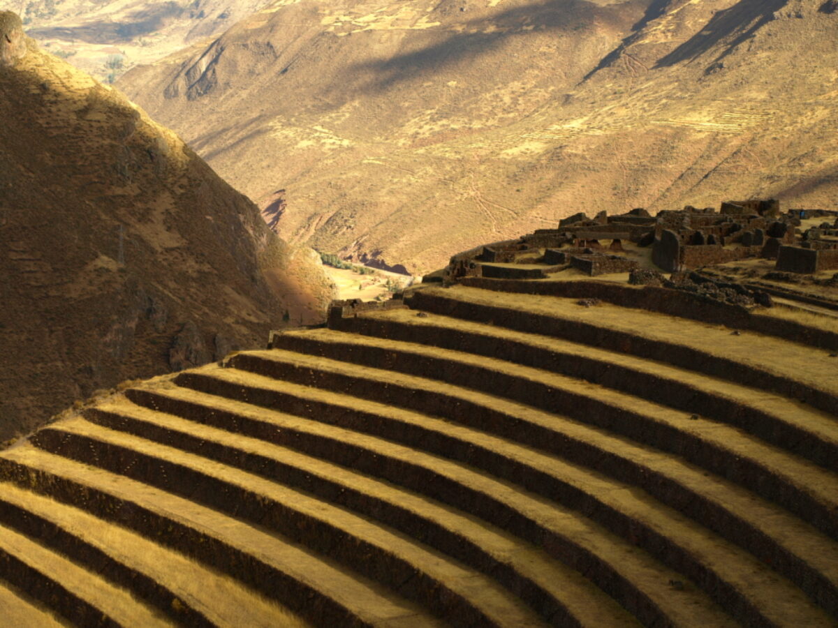
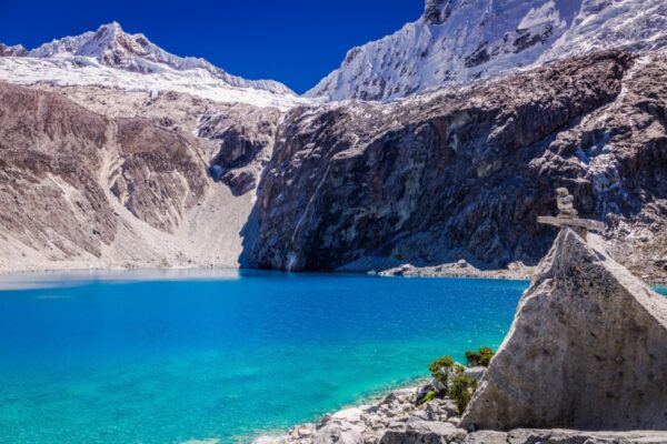
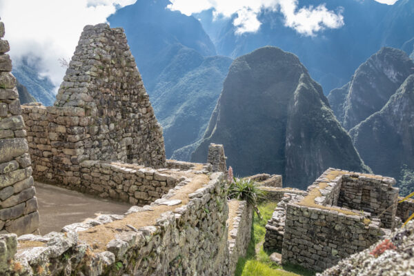
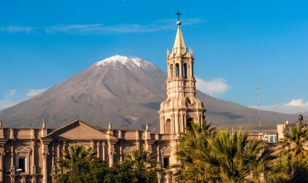
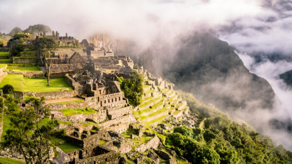
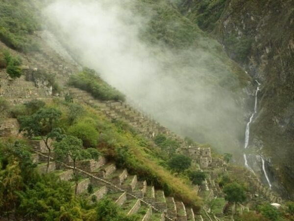
Mention Peru to most and their first response will almost certainly be: Machu Picchu!
For better or worse the famed citadel has become virtually synonymous with its host nation. But despite Machu Picchu's unarguable majesty, there is so much more to the rest of the country than these attention-stealing ruins. Pre-Columbian cultures left their indelible mark the length and breadth of Peru while the Incas were still in metaphorically short pants.
Beyond archaeology there's world-beating cuisine and a buzzing arts scene in Lima, inconceivably vast Andean landscapes, oh and we haven't even mentioned the Amazon rainforest, which occupies a good two-thirds of the country's territory. Sure, come for the ruins. But leave plenty of time for the rest — you won't regret it.
Which would you recommend between the Lares and Salkantay trek in March?
Answered by: Roxner Quispe
I would recommend the Lares trek (potentially combined with the Short Inca Trail) over the Salkantay trek in March. This is because the Salkantay trek is prone to landslides this time of year and they won't be clear until late April.
Before visiting Machu Picchu we'd like to arrive in Cusco and go straight to the Sacred Valley. Where would you recommend?
Answered by: Roxner Quispe
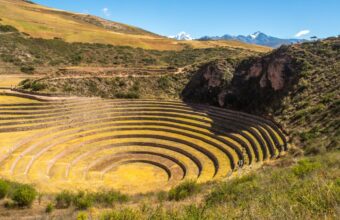
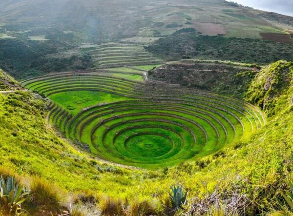
This is actually a smart way to start your trip, with a slightly lower altitude than in Cusco. I'd recommend Urubamba as it's got everything you need and has easy access to other sites like Pisac, Chinchero, Moray and Maras. It's about 1.5 hours drive from Cusco.
I'll be in the Huaraz region but looking for a trek similar to the Salkantay Trek - what do you recommend?
Answered by: Edita
For something similar to Salkantay in Huaraz I'd recommend the Santa Cruz Trek (4 days). It is the best option of the Cordillera Blanca for a first trekking experience: high mountain landscapes, glaciers and lagoons, without technical difficulty.
Are permits required for the Lares and Short Inca Trail trek?
Answered by: Sarah Confer
No permits are required for the Lares trek but you do need a permit for the KM104 trek. The good news is this permit system is totally separate to the full Inca Trail permit system, and availability is rarely a problem.
Before starting a trek are two days acclimatisation sufficient in Cusco?
Answered by: Roxner Quispe
You absolutely need to acclimatise before setting off on a trek but I'd recommend you acclimatise in the Sacred Valley – Ollantaytambo etc – rather than Cusco itself, as Cusco is very high and you might find it uncomfortable for your first few days there. I suggest saving your Cusco visit for after your trek.
It has usually started to rain by November, so hiking Ausangate from November onwards is not a good idea.
In fact it can be snowing in places by November. We had a group there recently and it was not fun for them due to the weather conditions. If it has to be November, the Inca Trail or Salkantay are good options.
On the classic camping trek, which loops around Mt. Ausangate, you’ll be camping for four nights in marked campsites that are more or less maintained by local communities.
The lodge route takes you from lodge-to-lodge, each one as beautiful as the last and all constructed from local materials. Part-owned and operated by members of the nearby Chillca community, the lodges are a great example of inclusive tourism. Although there is no electricity, the lodges are comfortable and cosy, especially in the evenings around the fire. The fresh meals prepared each day are delicious and you can even have a hot shower!
This is another trek that needs no permit and can, theoretically, be done solo. Yet it is highly advisable to book with a local trekking operator. With the higher altitude and more remote conditions, you will need a guide and support staff who are well-versed in the requirements of trekking in this area.
You can only really attempt this trek during the dry season, between May and August/September. Trekking during the rainy season (Dec-March) brings snow, flooded paths and the risk of landslides. Note that the dry season is winter in the southern hemisphere, which means night time temperatures will be cold – well below freezing.
The classic Ausangate trek is extremely challenging, in particular, because of the altitude, not to mention the cold nights. Even the very fit will find this a challenging route due to the altitude. You’ll need at least three days acclimatisation at altitude before setting off. An emergency horse will be available for exhausted trekkers but should not be relied upon for completing the trek. Make sure you’re fit, healthy, fully acclimatised and not suffering from any stomach troubles before you set off.
That said, although Ausangate is a beat of a trek, there is – as with Salkantay – a lodge version that brings some very welcome creature comforts to the overall experience, doesn’t negate the altitude, weather and gruelling ascents!
The dry season (April/May to September/October) is the best time for hiking in Peru and the Cusco region, but this is peak tourism season and the trails will be busier. Rainy season (November to March) brings less than ideal trekking conditions, but there are some advantages, not least warmer temperatures at night, quieter trails and (maybe) lower prices.
Unlike most treks in the area, the Lares trek is not prone to landslides or other issues during the rainy season, making it a great choice for the off-season. Just don’t forget to pack your rain gear!
No permits are necessary for hiking the Lares trail, but you will still want to book with a local operator. They will have the right connections with local horsemen and employ qualified guides who know the area well and speak Quechua. This is key for interacting with the communities along the route, as well as for ensuring your safety in the mountains. There is an extensive web of trails that go through valleys and over several mountain passes and trails are not well marked.
The trek is generally rated moderately challenging, although this will vary with side trips or changing the daily distances. Either way, the challenging aspect is principally due to the altitude.
There are several different routes for this hike, but the typical one will have you hiking about three days, covering around 25-30km. Most operators sell the trek with an extension to Machu Picchu, however note this is not, as it’s often described, a trek “to” Machu Picchu. You will go by train to a hotel Aguas Calientes for the night and then up to Machu Picchu with the other day trippers the next morning.
Good question! PLEASE remember to tip your guide, cook, and donkey handlers! Most guides lead over 28 separate Huayhuash trips per year. Considering that the Huayhuash Circuit is eight days long, that comes to over 224 days of hiking per year, not including extra days for gear preparation and unloading. You can divide it up by guide, porters and cooks (approx $10, $5 & $5 per person per day respectively) or just pool around 10% of the total trip cost and they'll divide among themselves. Your guide will give you an honest steer.
There’s plenty of budget hostels in the town and some decent trekking lodges in the surrounding hills.
For low budget hostels in Huaraz I can recommend Krusty Hostal; best for solo travellers, located in the city centre with a lively, social atmosphere. Big Mountain Hostel; a good budget option, located in the city centre, free breakfast included. Aldos Guest House; best for private rooms, clean spacious rooms.
The average price for a bed in a shared dormitory is $5 - 15 USD per night.
For trekking lodges, I’d suggest the Lazy Dog Inn; 30 minutes outside the city centre, very tranquil and near many trailheads. Churup Mountain Lodge; 45 minutes outside the city centre in the Cordillera Blanca, amazing views, also near many trailheads.
For a private room expect to pay $25 - 50 USD per night.
The Andean dry season, from May/June to September, is the best time to go trekking in the Huaraz region.
The shoulder seasons, March-April & October-November, see smaller crowds and lower prices, but the weather is less predictable and you may have trouble finding tours and departure dates.
Hiking during the rainy season, December-March, is discouraged and often simply not possible due to flooding, landslides, and dangerous or inaccessible hiking trails.
Since Huaraz is close to the equator, daylight hours remain roughly 11 to 12 hours per day year-round.
December is a wet month to trek in Peru, but all the main routes are open as normal. Here are a few suggestions for December:
1) On the Salkantay trail it's entirely possible to have a stretch of several dry days in December, but it will definitely be muddy in places. There is the option of lodge-to-lodge trekking on the Salkantay route so you don't have to camp in the rain.
2) Most of the trails through the Lares valley are rocky enough that they don't get muddy, but that's all camping with no lodges.
3) While Choquequirao has cabins along the route, I wouldn't hike that trail in the rain because of how steep most of it is.
4) The Inca Trail is usually pretty quiet in December, so you'll find it easy to get permits. However I can't in good conscience recommend the Inca Trail until they address the workers' rights (and even human rights) abuses of porters.
Two tips for making your hike more comfortable: First, have a good rain poncho, not the disposable ones that tear easily. Ponchos are better than rain jackets and rain pants because they let air flow around you and it’s likely to be warm since December is summer. Second, if you have the flexibility, tell your trekking agency that you would rather delay your trek a day or two in case a major rain storm is predicted for the original trek dates. They’re rare in December, but always a possibility.
I'd say the Two Day Inca Trail is a much better choice if you're concerned about altitude. The highest point on the full (four day) Inca Trail is 4,215 metres but on the two day trail it's only 3,680 metres. That's still high, but on the two day trail you are at high altitude for much less time and you can sleep at lower altitude the night before. The full four day trek has you at about 4,000 metres for a long time, and that 4,215 metre high point isn't the only high pass you have to cross.
Obviously the longer you can acclimatise the better, I'd strongly advise against arriving and heading straight off onto the trek.
Most people acclimatise in Cusco, but at 3,500 metres the altitude sickness can be rough here too! I'd recommend spending a couple days before your hike in the Sacred Valley such as in Ollantaytambo, which is a much more manageable 2,792 metres.
None of this constitutes medical advice and if you have any concerns you should talk to a doctor first.
It only takes about half an hour each way to hike Huchuy Picchu, so it's absolutely possible to do the hike, spend time at the top taking photos and get back down to Aguas Calientes. If you take the noon shuttle departing Machu Picchu, you should have time to buy take-out lunch in Aguas Calientes to eat on the 1:37 train.
It is not possible to buy an individual ticket only for any of the Machu Picchu day hikes (Huayna Picchu, Huchuy Picchu, etc). Tickets for those add-on hikes must be chosen when you are buying your Machu Picchu entrance ticket. If your tour agency bought your Machu Picchu ticket, you need to ask them if they can return it for a refund and buy you another. Machu Picchu tickets are sold by the government and are normally non-refundable and non-transferrable. However, an agency might be able to make that change for you.
If you bought the ticket yourself, you should buy another one that includes the day hike. Then, when you're in Cusco you can go to the Machu Picchu ticket office on Plazoleta Regocijo and try to get a refund for the original ticket. I can't guarantee that they'll give you a refund.
There are two train services from Cusco to Aguas Calientes (Machu Picchu), PeruRail and IncaRail. They each offer different classes of train services: PeruRail has three classes of train and IncaRail has five.
The lower class, called Expedition for PeruRail and Voyager for IncaRail, is still very nice and costs $55-$70 each way. If you want to splurge, check out the other classes of train but keep in mind that the ride is only about two hours each way from Ollantaytambo.
Prices for each service vary by time of year and time of day. (Like airlines, they have lower prices during times of day that fewer people want to travel.) During the off season, from October through March, prices tend to be about $10 USD cheaper each way.
You can see the exact prices for your travel dates on the PeruRail and IncaRail websites.
Research your trekking operator carefully before you book. Don’t go for the cheapest, as corners will be cut on the ground employees’ wellbeing and livelihoods. Don’t book anything on the street in Cusco. If you’re booking through an international brand, try to find out who is actually running the ground operations. Good quality trekking outfitters will talk openly about how they work responsibly with indigenous communities, or – ideally – will be fully or part-owned by local people. Stay in family-run hostels or hotels rather than big hotels owned by international brands. Buy souvenirs from non-profits like the Traditional Textile Center of Cusco, Mantay and Xapiri.
As Machu Picchu grows in its renown as a destination, a permit system has been enforced in order to keep the sheer volume of travellers in check. Permits to the following sites are required, and can be found here. (Note, however, that the site’s language options are limited and the online payment portal is notoriously spotty). You can also pay directly at the offices in Cusco or Aguas Calientes, or have permits arranged through a reputable tour operator.
Inca Trail permits
The classic four-day Inca Trail route is strictly regulated by a permit system. The limit is 500 people per day, including guides and porters, and permits sell out months in advance. Any variation of this route (even the one-day “Km 104 hike”, which overlaps with the last stretch of the Inca Trail), requires a permit. The Inca Trail is closed for conservation work every February.
Machu Picchu permits
Entrance to the citadel itself is capped at 2,500 per day. While this limit is rarely reached, it’s better to reserve in advance — especially during the peak season and festivals.
Huayna Picchu permits
For a short but steep hike to the top of the peak hovering behind Machu Picchu (called Huayna Picchu), reserve in advance. This permit is added to the entrance ticket. Entrances are managed in waves of 75 people at 7am, 8am, 9am and 10am for a total of 300 people per day. Less popular is the hike up Machu Picchu Mountain, which is also permit-regulated and can also be added to the entrance ticket.
In the Cusco region, Choquequirao is definitely the hardest trek that I’ve done, because the trail is very steep and you have to first descend 2,000 metres of elevation before hiking back up that same amount. The Inca Trail is hard because on the second day you hike over a pass that’s 4,215 metres above sea level.
The easiest is KM104 to Machu Picchu, which is really a day hike but you spend the night in Aguas Calientes and visit Machu Picchu the next morning. Lares can be relatively easy because it’s not a long trek, so you can take it slow.
I have been travelling solo around Peru since 2013 and have never had a problem as a female traveller. That said, I speak Spanish and take the time to research places before I go so I don't wander around looking lost. I have found hostels around Peru to be safe, but I avoid clubs and the party hostels. The Policía de Turismo is a police force dedicated to serving tourists but they rarely have anybody on staff who speaks English so if you need help you’ll probably have to find your own translator. Call the Centro de Emergencía de la Mujer at 100 for any crimes against women.
I wouldn’t call Machu Picchu a must-see, especially if you don’t like crowds. That said, of all the Inca ruins near Cusco, Machu Picchu is the biggest that’s easiest to get to and has the most qualified guides who can tell you all about the site. Comparatively, the Inca ruins at Pisac are more accessible, cheaper and have fewer crowds but aren’t as big. Choquequirao is just as big and impressive but requires a long and challenging hike.
Lunch and dinner almost always start with soup because it’s cold in the mountains and you need to hydrate. Meals are relatively light with small portions because digestive systems don’t work as well when you’re at altitude, i.e. when your body is functioning with less oxygen than it’s used to. However, trekking agencies cook plenty of food, so there’s always seconds and thirds if the portions are too small for you.
Yes. Choquequirao is the easiest to do without a guide because the trail is easy to follow and local families rent cabins and provide meals. Salkantay is getting easier every year, in terms of infrastructure.
Personally, I like Lares the most because you get a real taste of indigenous Andean culture while staying close to Machu Picchu. If you want to do a challenging trek and see Inca archeology, but not necessarily Machu Picchu, go to Choquequirao.
Yes, if you acclimate to the altitude first. Every day somebody gets to the point that they can’t walk any more and a porter actually carries that person piggy-back. I don’t think that should be allowed, but it happens and you don’t want that to be you.
Trail conditions are best during the dry season, from April/May through September/October. I’ve done plenty of trekking in November, December, March and April but avoid January and February because those are the rainiest months. I think April and May are the best because it doesn't rain much but the hills are still green and covered with flowers.
Note that the Inca Trail is closed for maintenance during the month of February.
Acute Mountain Sickness (AMS) is by far the most important factor to keep in mind while trekking in Peru. Most treks in Peru involve high altitude at some point. Machu Picchu is situated at 2,430m above sea level and Cusco at an incredible 3,400m. The town of Huaraz is at 3,052 metres but the hikes in the area are between 4,000 and 6,000 metres. Arequipa is only 2,335 but most treks there take you to close to 6,000 metres. Arriving here from Lima or elsewhere you’ll immediately notice the thin air, with reactions ranging from mild breathlessness to headaches and nausea. Severity varies by person and is usually more pronounced for younger and older travellers.
Plan two or three days at altitude before you start your trek. I recommend two days taking it easy in town, followed by an easy hike at high altitude before you start the trek. Near Cusco, consider hiking to Inkilltambo or Waqra Pukará. In Huaraz, Laguna Parón and Pastoruri Glacier both take you to high altitude without a lot of walking. Near Arequipa, check out the Ruta del Sillar. In Chachapoyas, visit Kuélap or Yalape. During that time, drink plenty of coca leaf tea (the traditional Andean remedy for altitude sickness), stay hydrated, avoid alcohol and heavy meals, and generally just go easy on yourself.
You'll receive a reply by email. Questions and replies may be anonymised and reproduced on Horizon Guides.
§ 04
The Peru atlas
30 picksPlaces & Experiences You Won't Find Elsewhere
Where
What
One of the most demanding hikes I’ve done in the Cusco region is the two day/one night hike to Quellcaya Glacier, the largest tropical glacier on the planet, in the Vilcanota Mountain Range, approximately five hours from Cusco.
Known locally as Quenamari, the glacier sits at 5,600 metres above sea level and serves as a critical water source for the Sibinacocha Lagoon and beyond. It feeds the Vilcamayo River, which becomes the Urubamba River that winds through the Sacred Valley towards Machu Picchu, and later the Ucayali River – itself a tributary of the mighty Amazon.
The glacier itself is striking, a vast, glaring expanse of ice stretching across the mountain. Standing there, the silence is profound, broken only by the occasional crack of shifting ice or the distant calls of Andean birds. It’s a scene I haven’t encountered anywhere else.
Beyond its geographical significance, the glacier holds deep cultural importance for the local Quechua communities, who continue to perform ancestral rituals in honour of Pachamama, or Mother Earth. Meeting the people who live in this extreme environment was fascinating. With the help of a guide to translate from Quechua, I was able to hear their stories—how they survive at this altitude, relying on alpaca herding, weaving, and a deep knowledge of their environment. The remoteness of their lives is difficult to comprehend; the nearest town is 40 kilometres away. Spending time with them was a real privilege
The surrounding landscape is every bit as remarkable as the glacier itself. The region is dotted with glacial lakes, peat bogs, and untouched high-altitude grasslands. I was particularly struck by the wildlife—there are vicuñas, llamas, and alpacas here, and, unexpectedly, frogs! In the Sibinacocha Lagoon, I saw more frogs than I’d imagined possible, their chorus filling the air as we set up camp in sub-zero temperatures. Some of these species are endangered, yet here they seemed abundant, thriving in the icy glacial waters.
Need to know
This trek is not for the casual hiker. It’s physically demanding, and the high altitude is a serious factor. Prior acclimatisation in Cusco (at least two days) is essential, and you need to be comfortable hiking for extended periods in sub-zero conditions. The final approach to the glacier involves a three-hour ascent at extreme elevation.
The only viable time to visit is during the dry season (April to October). Even then, weather in the Andes is unpredictable, and sudden rain or snow showers are always a possibility. Avalanches can be a risk in the wet season, making this trek unsafe from November to March. Essential gear includes warm, layered clothing, waterproof trekking trousers and boots, gloves, a hat, sunglasses, and high-SPF sun protection. Despite the cold, the high-altitude sun is intense. A headlamp is also necessary for early-morning trekking in low light.
Accommodation options include camping or a rustic lodge near the glacier. I camped on my visit, but after experiencing temperatures well below freezing, I’d strongly consider the lodge next time.
With the glacier retreating rapidly due to climate change, now is the time to witness this extraordinary natural phenomenon. This trek is challenging, but for those willing to step far beyond the usual tourist trails, it offers an experience that is both humbling and unforgettable.
Difficulty: MildDuration: Approx. two hours hiking (10 hours including travel to/from Cusco)Max elevation: 4,900m
You may have heard of Vinicunca, Peru's ‘rainbow mountain’ made famous as a popular – and often crowded – day trip from Cusco. What most people don’t know is that there are actually several rainbow mountains in the Vilcanota range, of which my favourite to visit is Palcoyo Rainbow Mountain.
Palcoyo is a quieter, less-showy alternative to Vinicunca, with multiple rainbow-striped peaks instead of Vinicunca’s single summit. The colours of Palcoyo are less vibrant than Vinicunca, and don’t make quite such an ‘Instagrammable’ shot – personally I think this is a good thing, as it has kept Palcoyo a much more peaceful place to visit. Having done both hikes, I find Palcoyo to be the more rewarding choice for seeing Peru’s colourful mountains without a demanding climb.
Starting early in Cusco, a scenic three-and-a-half-hour drive takes you through high-altitude Andean landscapes, passing herds of llamas and alpacas, with a stop at the colonial-style village of Checacupe along the way. The drive itself is part of the adventure, with stunning scenery to take in and with breakfast included, you’re fueled up for the trail ahead.
The hike itself is a gradual ascent, beginning with a 25-minute walk to the first viewpoint. The high altitude naturally slows the pace, but I found the route steady and manageable. A cobblestoned path leads to the second viewpoint, where three rainbow mountains come into view. Another 20 minutes leads to the Stone Forest at 4,900m, a rugged area of rock formations that offers a sweeping panorama of all three surrounding mountains.
The landscape holds more than just colourful mountains – a red river flows through the valley, and the distinct terrain of the red valley adds to the scenery. This is an active farming area, with alpacas grazing in the distance. Unlike the crowded trails of Vinicunca, Palcoyo remains largely untouched, and I found it to be a much more peaceful experience.
The weather in the Andes is unpredictable, so layers, sun protection, and a refillable water bottle are essential. Coca leaves can help with altitude, and I’d highly recommend spending a few days acclimatising in Cusco beforehand. Although the journey is long, Palcoyo is a quieter, less strenuous alternative to Vinicunca for those with a free day in Cusco.
Difficulty: ModerateDistance: Approx. 24kmDuration: Four days (three days hiking)Accommodation: HomestayStart/end point: Santa María/Aguas Calientes
In my opinion, Machu Picchu represents everything that needs to change in the tourism industry. The ruins are marketed as the "lost city" that you can "discover" like some sort of modern day Indiana Jones. But tell that to the people who've lived around these ruins for centuries. Why don't they feature in the Machu Picchu story – or benefit from the vast profits it brings to big tourism companies?
To answer some of these questions, alternative ways of getting to Machu Picchu have been developed by those of us in the responsible tourism movement. This 'coffee route' breaks down the barriers between mass tourism and local people. You'll get to know coffee farmers, stay in their family homes, and trek with them on the backroads to Machu Picchu that most visitors don't even know exist.
The final leg does involve taking the regular shuttle bus from Aguas Calientes to the entrance gates, but you'll be there safe in the knowledge that you did it the 'right' way.
Difficulty: StrenuousDistance: Approx. 42kmDuration: Four days hikingStart/end point: Soraypampa/HidroelectricaAccommodation: Camping
The Palcay Trail is a virtually unheard of Machu Picchu trek. The trail runs through community-managed land and access is allowed only with local consent, making this a truly unique trek for those who manage to get permission.
I find this route offers all the magical elements of the Inca Trail – cloud forest, Inca ruins, towering mountains – but almost entirely free of any other trekkers. The route starts in Soraypampa, approximately three hours’ drive from Cusco, and begins climbing almost straight away. The main climb is on the second day, with two high mountain passes, and by the fourth day you arrive at the hydroelectric station near Aguas Calientes. Typically you’d spend the night in a hotel there before doing a day tour of Machu Picchu the following morning.
One word of caution, though: this is a very challenging route, and one I’d only recommend for fit and experienced trekkers. The highest point is Inka Chiriaska at 4,937 m, and Palcay Pass isn’t far off at 4,708 m. The ascents are steep but the views, right across the valley all the way to Salkantay mountain, are incredible.
You can’t realistically do this hike on your own, you need a guide and to gain the necessary permissions to enter community-managed land.
Duration: Five to six hoursDifficulty: Mild
If you fancy a day of less strenuous walking, the Llanganuco Lakes hike may be a good option. I usually recommend it as an acclimatisation hike prior to a longer trek. The vehicle does the hard work, dropping you at Portachuelo Pass (4,780 m / 15,682 ft) where you have magnificent views of the high peaks of the Cordillera Blanca, such as Huandoy, Huascaran, Chopicalqui and Chacraraju. From here you descend the way you have come, into the Llanganuco Valley, past Lakes Orconcocha and Chinancocha, and onto Maria Josefa Trail.
This trail takes its name from a local legend: the María Josefa in question was a beautiful local girl who caught the eye of a rich landowner. She rejected his repeated advances, and finally decided to run away over the Cordillera Blanca, where he couldn’t find her. Unfortunately, as she was making her escape, the landowner caught up with her at Llanganuco Lakes. Once again she turned him down, and in a fit of rage, he stabbed her and left her to die. A heartwarming story of gender violence.
Duration: Six to eight hoursDifficulty: Moderate to strenuous
Located in Huascaran National Park, the Laguna 69 trailhead is a three hour bus ride from Huaraz and requires an entrance fee of S/30. While I almost always prefer hiking independently, for this hike a tour guide is by far the most practical and cost-effective option. Hiring a taxi would be expensive and difficult to arrange for the return trip to the city. Tours usually cost around S/60 per person, depart at 4 am and return to Huaraz around 6 pm.
Difficulty: Strenuous Distance: 11.9 kmDuration: Six to seven hoursMax elevation: 4,541 mStart/end point: Wilcahuain Village
Laguna Aguak is a challenging rocky ascent to yet another turquoise alpine lake. The trek has a well established footpath and is easy to follow throughout the entire duration.
The first two kilometres of the hike is quite easy with a very gentle incline over grass hills. However, with over 1,100 metres of elevation gain in under 12 kilometres, the trek quickly transitions to steep rocky switchbacks. This was one of the most unfrequented treks in Huaraz I completed, as I only saw two other hikers and two older women herding their sheep through the first portion of the trek. Unfortunately, I had to turn back within 11 kilometres of the glacier due to a thunderstorm. With wishful thinking, I continued to push for the laguna under thunder and rain, hoping to get a glimpse and quickly descend before the storm became too strong. But predictably, the lightning migrated directly overhead and the rain turned to hail and continuing would have been reckless.
Need to know
Located in the Huascaran National Park, Lagua Aguak has an entrance fee of 30/S and is about 30 minutes from the city centre by combi or taxi. Transportation details by combi are the same as mentioned in Laguna Llaca and Laguna Radian. At the very beginning of the trail, you will pass a few residences along a dirt road before the terrain becomes more expansive and the trail more solitary. However, it’s important to be cautious of the dogs here. Most locals allow their dogs to roam freely, and therefore they can be territorial of sections of public road near their residence. On these roads in particular, I encountered several very aggressive dogs and contemplated turning back before even reaching the trailhead. Luckily, I was able to find an alternative route to the trailhead to avoid passing near them. On the way back to the combi stop, nervous to walk through the same neighbourhood, I asked if I could walk along with a few locals I saw passing and felt much safer.
Difficulty: MildDistance: 10.8 kmDuration: Four hoursMax elevation: 3,939 mStart/end point: Wilcahuain Village
Laguna Radian is a pleasant day trek that transitions from a wide gravel path through open, rolling hills to a moderately steep and narrow footpath. Just under 11 kilometres long with 560 metres of elevation gain, Laguna Radian is a great option for an acclimation hike.
The trail begins with a gentle incline through tranquil forest and passes a few remote residences. After the first three kilometres, the trail becomes fairly steep and offers incredible views of Cordillera Negra behind you as you ascend. Once at the laguna, you’ll see a magnificent backdrop of snowy peaks and their reflection in the laguna, including Huascaran, the highest peak in Peru.
Need to know
Located in the Wilcahuain Village, the trailhead is 30 minutes by vehicle from Huaraz. A taxi will likely cost 40 to 50/S whereas public transport by combi will cost 2/S. To go by combi, go to the intersection of 13 De December & Jr Cajamara in the city centre and exit the combi at the Wilcahuain ruins. The trailhead is about a five minute walk from the combi stop along a dirt road and through a bit of forest. When you reach a sign for Laguna Radian, turn right and continue past several farms. From there, the trail has a clear footpath and is easy to follow. Be cautious of aggressive dogs on the trail. While I personally did not encounter any dogs on this hike, other trekkers I met in the city centre warned me of their unnerving confrontations.
Difficulty: ModerateDistance: 6.3 kmDuration: Three hoursMax elevation: 3,700 mStart/end point: San Pedro Village
Another stunning and easily accessible day hike, Wilcacocha Lake is located 30 minutes away from Huaraz in Cordillera Negra. Reaching 3,700 m, Wilcacocha lake is situated at lower altitude than the majority of other day hikes, making it ideal for acclimation.
Taking about three hours round trip, the trail has a fairly mild incline and overlooks beautiful green hills and provides spectacular views of the cordillera Blanca in the distance. While a pleasant hike, don’t expect the laguna to be a crystalline turquoise like so many other alpine lakes in the Huascaran National Park. Wilcacocha Lake is much smaller and can be a bit muddy as it isn’t fed by a glacier. Although, it is still beautiful nonetheless.
Need to know
While guided tours are available in Huaraz, I recommend doing this trek independently. Taking public transport is relatively simple, much less expensive, and will allow you to avoid the crowds of going with a bus of 20 other trekkers. To go by public transport, take a combi from the north side of Antonio Raymondi road. The departure site is conveniently marked on google maps, as “Colectivo to Laguna Wilcacocha”. Note that there is no entrance fee.
Difficulty: ModerateDistance: 18 kmDuration: 6.5 hoursMax elevation: 4,500 mStart/end point: Wilcahuain Village, near Lazy Dog Inn
Tranquil, eerie, and delightfully long, Laguna Llaca is a lesser-known day hike with a gradual ascent along rocky footpaths, gravel roads, and a short scramble to reach the alpine lake. Of the dozens of alpine lakes I explored in Huaraz, Laguna Llaca was one of my favourites. Apart from trekking on the gravel road at times, there is a special and solitary feeling here, which can be a rarity when hiking along with popular guided tours. Laguna Llaca requires a moderate level of fitness, although the actual trail is not technical or precarious.
The trail begins on a narrow footpath over an expansive plain and transitions into gentle hills with tall grass. As you continue along the gradual incline there's a moment when you can see the trail leading through a massive gorge between two rock faces in the distance. This sight was one of the most memorable and invigorating of the entire trek. A thrilling shiver struck me when seeing such a tiny path disappear though two enormous rock towers streaked with black, white, and vivid green limestone. Upon entering the gorge, a backdrop of massive snowy peaks emerges unexpectedly. From there, the trail transitions to a gravel road along the valley wall and above a wide river. A few diverging footpaths offer the option to get off the road temporarily and cut through lush portions of forest. Just before reaching the laguna, there is a short rock scramble that takes about 30 minutes. You may even see a small base camp of climbers just before the scramble, as the surrounding rock faces offer dozens of sport climbing and multi-pitch routes. When I went, I was the only person at the laguna. Intermittent gusts of powerful wind interrupted the absolute silence I was privileged to experience there.
Need to know
The trailhead is located in Wilcahuain Village, 30 minutes from the city centre. There are two transport options: taxi or combi (small public bus). A taxi is the fastest option and will likely cost 40 to 50/S, whereas a combi only costs 2/S but takes much longer.
Although the trail is relatively straightforward to follow, getting to the trailhead can be tricky if you are taking public transport: Take a combi from the intersection of 13 De December & Jr Cajamara in the city centre. Exit the combi at the stop for Wilcahuain Village. From there, walk for 30 minutes along the dirt road toward the Lazy Dog Inn, which will be on your right. After passing the inn, continue walking up the hill for about 10 minutes and you will see a small and rocky footpath on the left side of the road. This is the official start of the trail although it is extremely easy to miss. The trail is located in the Huascaran National Park and has an entrance fee of S/30 per day that needs to be paid in cash.
Although the neighbourhood where the trail starts is very remote, I felt safe the entire time as everyone I passed was willing to provide directions or guidance when they could. However, it is always best to ask the receptionist at your accommodation about safety before venturing solo in unknown neighbourhoods.
Difficulty: ModerateDistance: 2.2 kmDuration: Three to four hoursMax elevation: 5,150 mStart/end point: Conchucos Valley
Short, sweet, and easily accessible, Nevado Mateo is a mild and non-technical glacier hike to the 5,150 metre summit. Mateo is ideal for first-time climbers or as a warm-up excursion for altitude acclimatisation if you’re preparing for larger peaks. While the terrain is not technically challenging, do not underestimate scrambling over rocky terrain and through potentially deep snow above 4,000 metres. It is not for the faint of heart! Rest assured that the challenge is well worth the suffering, as panoramic views of Nevado Poroquingua, Chopicalqui and the Pucahirca, Chacraraju, and Contrahierbas massifs wait at the summit.
The first portion is a solid combination of steep, exposed, rocky incline, large rock scrambles, and one precarious, exposed rock ledge, usually covered in snow and ice. There are bolts here in case you’d like to clip in for belay as an extra safety precaution. While you continue to climb you’ll be treated to epic views of Chopicalqui and Huascarán even before reaching the glacier. The glacier somewhat resembles an icefield on a 50 degree incline. Therefore, there is usually a well trodden path and snow trench, although depending on the season there can be extremely deep sections of snow just before the summit.
Need to know
Mateo is located in Huascaran National park and requires an entry fee of 30/S. If you’re experienced enough to go without a guide, make sure you arrange return transportation before leaving Huaraz. While this single day excursion is absolutely stunning, I found it strange that Mateo is marketed so heavily in Huaraz, especially among the plethora of other more complex peaks in the region. From what I observed, the majority of backpackers flock to Huaraz for the famous Laguna 69, Pastoruri Glacier, and the Huayhuash and Santa Cruz circuits. Once there, Nevado Mateo is presented as an approachable option for a first alpine experience. However, if you’re ready for more demanding ascents, do not let the abundant advertising fool you into thinking that Mateo offers something especially unique compared to other peaks. Rather, it’s just more accessible (and more easily sold) to a larger range of abilities.
Nonetheless, you’ll still be surrounded by snow capped towers and other adventurous spirits who share a love for the mountains. There is never a downside to that.
Difficulty: MildDistance: 3.4 kmDuration: Two hoursMax elevation: 5,050 mStart/end point: Catac village, take the detour towards the glacier and start from the parking lot.
Located in the southern part of the Cordillera Blanca in Huascaran National Park, the bowl-shaped Pastori glacier sits at 5,250 metres and has lost one third of its size in the last 30 years. This short and beautiful day hike is one of the most popular in Huaraz for its easy accessibility and spectacular, close-up views of the glacier.
The path to the glacier only takes about 30 to 45 minutes, has a very mild incline, and is paved most of the way. The path travels atop beautiful barren rock with a view of other snowcaps in the background. If you're planning on doing some big treks, this one makes a great warm up and acclimatisation hike.
Need to know
Located three hours from Huaraz by vehicle, there is no public transport to the glacier and so the most practical and economical option is to book a guided tour. Taxis are much more expensive and difficult to arrange for the return trip. Be aware that for most guided tours for trails located a few hours from Huaraz, the trail can be quite crowded. While the landscape is incredibly beautiful and serene, you won’t find much solitude on this hike.
Difficulty: StrenuousDistance: 4.4 kmDuration: Four daysMax elevation: 6,354 mStart/end point: Llanganuco Accommodation: Camping
The fourth highest peak in the Cordillera Blanca, Nevado Chopicalqui boasts a dramatic snow shelf and summit ridge. Considered one of the best summit views in the entire range, you’ll be astonished by dozens of neighbouring, rugged white peaks and massifs, including Huascaran, Pisco, Yanapaccha, and Contrahierbas. The most common route is along the Southwest Ridge and is ideal for climbers with prior technical mountaineering experience, glacial navigation skills, excellent physical fitness, and familiarity ascending exposed, steep ice slopes with two ice axes.
Located at the end of Llanganuco Valley and starting below 4,000 metres, days one and two are a mild climb through dense Quenuales forest and along the ridge-line to the basecamp. The following day has a more strenuous uphill of 30 degrees over several moraines until reaching the glacier. It is common for climbers to ascend on the glacier to 5,350 metres to set up high camp. From high camp, the summit ascent transitions from a moderate incline along a wide ridge to a steep and narrow slope. While the final summit push does not require highly technical climbing, the exposure is exceptionally jarring and requires navigation around crevasses and seracs (ice blocks). If successful, the total summit ascent takes about seven to nine hours.
Need to know
The trailhead is located three hours from Huaraz in the Huascaran National Park and requires an entry fee of 65/S for a 30 day pass. Located just five kilometres apart, many mountain guides recommend summiting the less strenuous Nevado Pisco as a warm-up ascent to help with acclimation for Chopiclaqui. Be aware that avalanches are a hazard on the west ridge of the mountain.
Difficulty: StrenuousDistance: Four kmDuration: Four daysMax elevation: 6,120 mStart/end point: Collon VillageAccommodation: Camping
An iconic pyramid summit capped by a massive ice mushroom, Nevado Tocllaraju is one of the most famous peaks in the Cordillera Blanca. Located in the Ishinca valley, the Tocllaraju summit ascent via the Northwest Ridge is a classic mountaineering expedition that requires prior experience in moderately technical climbing, repelling, navigating around crevasses, and ascending exposed ice slopes of 50 to 70 degrees.
The summit offers spectacular panoramic views of other snow caps including, Aquilpo, Palcarajui, Vallunaraju, and Huamash to name a few.
Starting in Collon Village, the trek begins with a gentle incline through the Quebrada Ishinca valley to Ishinca Base Camp, situated at 4,390 metres. The following day, a short and strenuous trek hour trek along a steep moraine ridge takes you to high camp, situated at 5,000 metres. A rigorous day awaits as you begin the summit attempt. While the lower glacier has a mild incline, be cautious of crevasses as you will most likely need to cross a bergschrund (deep crevasse) to reach the ridge. The majority of the ridge is a humbling, steady slog of 55 degrees, requiring two technical, bergschrund crossings at the base of the ice mushroom, and a final push on a 70 degree incline to the summit pyramid. Triumphant and high on altitude, the descent consists of two the three rappels and exposed downclimbing to reach the lower glacier below the ridge. If you’re returning to base camp, the entire day takes about 10 to 12 hours.
Need to know
Note that in some years the bergschrunds have been un-passable, forcing many guided parties to turn around or find an alternate, elongated route. Be aware that fierce winds often follow the sunrise in the Cordillera Blanca, making the final summit push along steep and faceted snow even more precarious and difficult. As with any ascent in the high mountains, it is imperative that you are well acclimated and physically fit.
Difficulty: StrenuousDistance: 14.2 kmDuration: Three daysMax elevation: 5,752 mStart/end point: Cebollapampa Accommodation: Mountain huts
Nevado Pisco is ideal for novice mountaineers and climbers who are eager to attempt a first alpine ascent with a guide. With over 1,800 metres of elevation gain, the trek has a solid mix between strenuous rock scrambles and pleasant footpaths. The three-day ascent begins at 3,900 metres and reaches an altitude of 5,752 metres at the summit. For those who have their eyes set on more technical peaks, Nevado Pisco is recommended as a warm-up climb.
Starting from the village of Cebollapampa, a short three hour hike takes you to Pisco Base Camp at 4,700 metres, with the option to sleep in a mountain hut. Day two is your summit attempt. Departing from camp around 2 am to reach the summit for sunrise, the ascent takes four to five hours across mixed terrain. Beginning with a steep climb to the top of a moraine, the trail oscillates between gentle footpaths and strenuous scrambling until you reach the glacier. Once roped up and crampons fitted, you’ll have another three hours of moderate incline on the glacier to reach the summit. You’ll be rewarded with panoramic views of some of the highest peaks in the Cordillera Blanca such as, Alpamayo, Caraz, Huascaran, Chopicalqui, and Yanapaccha.
Need to know
Although I love the freedom and adventure of trekking independently, I decided to go with a guide as I am not yet qualified to navigate glacial trekking and mountaineering equipment myself. The summit push is not extremely steep or technical, however it is still physically demanding due to the altitude. If you are considering going without a guide, prior mountaineering experience and snow condition knowledge is imperative. There are crevasses, unexpected steep sections of built-up snow that change with the season, and of course the standard risks that accompany any exposed, glacial trekking.
Difficulty: Moderate-strenuousDistance: 11 kmDuration: Two daysMax elevation: 4,700 mStart/end point: Cebollapampa Accommodation: Mountain hut
Short and sweet with spectacular alpine scenery, Pisco Base Camp is a simple and moderate-to-strenuous (due to the altitude) trek with 800 metres of elevation gain. It’s a great option for those looking for an easier climb in higher altitude, as there are no technical rock scrambles or strenuous slogging over moraines and loose ground.
Starting in the village of Cebollapampa, the trailhead is located 2.5 hours from Huaraz. A short three hour hike of steady incline takes you to the base camp at 4,700 metres. The base camp has a comfortable yet modest mountain hut built by an Italian organisation, Mato Grosso. Surrounded by the snowy giants of the Cordillera Blanca, you’ll be treated to incredible scenery and feel fully immersed in the mountains.
Need to know
If you’re accustomed to trekking and navigating independently, have experience hiking in the high mountains, and have prior knowledge of AMS symptoms, you do not necessarily need a guide to reach Pisco Base Camp. However, if you’re new to high mountain and independent trekking, I'd strongly recommended you hire a guide.
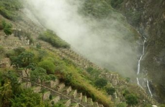
Difficulty: StrenuousDistance: 50 kmDuration: Four daysMax elevation: 4,959m/16,270ft.Accommodation: CampingStart/end point: Socma to Piscacucho
This is another lesser-known trek in the Sacred Valley and Machu Picchu area, and is one of the most difficult in the whole Cusco region.
On the final day of my preferred route you link up with the first day of the classic Inca Trail, but in the opposite direction. Despite this, very few other hikers do this trek, making it a great hidden gem in an otherwise busy region.
My preferred route starts at Socma and follows the same route as the Cachiqata trek (Quarry Trail). But where that trek veers north, this route goes west into the Chancachuco Valley and, on the second day, over some strenuous mountain passes to beautiful Ancascocha Lake, fed by glaciers from Huayanay mountain. The mountain scenery up here is out of this world.
The downhill stretch from Chancachuco to Chilca or Paukarcancha is particularly stunning, with beautiful wild orchids lining the trail.
On the third day you see the first day of the classic Inca Trail in reverse and get to visit the ruins of Paukarcancha and Llaqtapata before finishing the hike where the classic Inca Trail begins. From here, you can either take the train to Aguas Calientes and a bus to Machu Picchu or, my favourite, finish with the KM 104 (‘short Inca Trail’) and arrive at Machu Picchu on foot.
No permits are required unless you’re combining the hike with the classic inca trail.
Difficulty: MildDistance: 23 kmDuration: Two daysMax elevation: 4,335 metresAccommodation: CampingStart/end point: Patabamba to Lamay
This is one of my favourite shorter treks in the Sacred Valley region. The hike leads to the remains of Huchuy Qosqo, which means ‘small Cusco’ in the indigenous Quechua language.
The Huchuy Qosqo Trek is an excellent choice for inexperienced hikers as it is the easiest trek in the Cusco area. The hardest climb takes only three hours, followed by a downhill walk. I usually recommend this hike for groups with kids or older trekkers, although proper acclimatisation is still essential.
One of the most impressive features is the Leon Punku Canyon, which leads you through a stunning Inca road that runs along the bottom of the canyon. Another interesting feature of this hike is that it’s the only trek where you can camp within Inca ruins.
The route starts in Patabamba and leads through grassland puna as it climbs towards Sihuas pass, following some of the original Inca roadway, of which the more famous Inca Trail is just one section. Eventually on the end of the first day you reach the site of Huchuy Qosqo and make camp at the ruins. (With no light pollution for miles, the high altitude night sky here is one of the best places to stargaze.) The next morning you can explore the ruins before descending and finishing in Lamay town, which is an interesting place to explore for an hour or so.
Probably my favourite way to hike to Machu Picchu is by combining the Huchuy Qosqo trek with the KM 104 (‘short Inca Trail’) hike, and entering Machu Picchu on foot rather than by bus with all the day trippers.
If you prefer more of a challenge, the alternative routes via Ccor Ccor or Cuper Alto are just as impressive, but a bit tougher.
Difficulty: ModerateDistance: Approx 28 kmDuration: Three daysMax elevation: 4,440 metresAccommodation: CampingStart/end point: Socma to Ollantaytambo
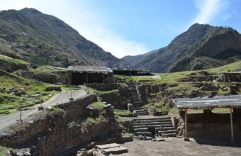
The Cachiqata (Cachicata) trek, also known as the Quarry Trail, is one of my favourite short treks in the Sacred Valley area. Although close to Ollantaytambo, Cachiqata has a real “off the beaten path” vibe, with very few tourists compared to the area’s other more popular trekking routes.
The trail is named after an Inca Quarry in the mountains above Ollantaytambo. It’s an extensive site and was the main source of stone for the town. You can see quarried stone still left unfinished, burial houses and even a cave with mummies still in situ. This is the only trek around Machu Picchu where you can see firsthand the techniques used by Inca stonemasons to cut and shape rocks for the empire’s impressive constructions.
My preferred route starts from the small settlement of Socma, south of Ollantaytambo. You follow a valley towards the waterfalls and ruins at Perolniyoc before camping for the night in Rayan. The next day you climb a mountain pass and cross high Andean plateau until you reach Cachiqata quarry, going via an Inti Punku ‘sun gate,’ (not to be confused with the more famous sun gate on the Inca Trail), which offers a stunning balcony view of the majestic Veronica mountain.
On the third day you spend most of the day exploring the site before descending to Ollantaytambo. From here you can continue to Aguas Calientes and Machu Picchu, or head in the opposite direction back to Cusco.
No permits are required for this hike, unless you want to combine it with the KM 104 (short Inca Trail’) afterwards.
Difficulty: Moderate to strenuousDuration: Three daysMax elevation: 3,500Accommodation: CampingStart/end point: Leymebamba
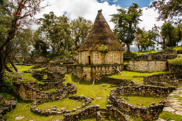
This is a great, lesser-known, multi-day hike in the Chachapoyas area. You'll trek through several ecological zones, as the flora and fauna are different at each level of elevation. Once you reach the lake, you will be treated to a secluded body of water that often has so little wind that it becomes a perfect mirror, reflecting the steep jungle-covered cliffs that surround it.
On your second day, you’ll have all day to visit the cliffs where hundreds of mummies were discovered. Most of the artefacts are in the museum in Leymebamba, which is why it’s a good idea to visit the museum before you begin the trek. Some mausoleums in the cliff are intact, so bring binoculars. As the name promises, you’ll often see condors soaring along the cliffs above the lake.
Some agencies combine this with hikes to the Gocta waterfalls or other nearby archeological sites to make a four or five day itinerary. You may also spend a day in Leymebamba visiting the museum and spend the night there before you begin the trek.
The trek is difficult enough that you will be glad to spend the second day visiting the lake and the cliff where the mummies were found. On the hike in, you’ll ascend 1,400 metres of altitude and descend about 700 metres. You’ll hike back out on the same trail, so it will be only 700 metres up but a knee-aching 1,400 metres of descent.
You will camp two nights at the lake. Some agencies have built small cabins nearby, so inquire what kind of accommodation is included. Most agencies don’t include sleeping bags.
Trekking agencies always include transportation from Chachapoyas. If you require transportation from the airport in Cajamarca or Jaen be sure to notify the agency when you book.
Difficulty: EasyDuration: One dayMax elevation: 2,000 metresStart/end point: Cocachimba
The Gocta Waterfall is 771 metres high, making it the third highest waterfall in Peru. The forest you walk through on the way is brimming with birds and you’re likely to see several species of hummingbirds. It’s common to see the Gallito de las Rocas, often translated as Cock of the Rock, though the Spanish word “gallito” means little rooster.
Though the Chachapoyas civilisation used the waterfall area, it was unknown to the modern world of tourism until recently. In 2002 the German archeologist Stefan Ziemendorff was researching the Chachapoyas culture in the area and came upon the waterfalls. The exact height wasn’t measured until 2006.
The hike is five km each way and the trail has a lot of up and down. The trail is not difficult, but many people opt to rent a horse for the day. It can be muddy and slippery at any time of the year because of the cloud forest.
You can book with any agency in Cajamarca or Chachapoyas. If you choose to go without an agency, have cash for the S/20 entrance fee. You can also hire a guide on arrival for about S/50.
If you book through an agency, they will include transportation from Chachapoyas to Cocachimba. If you choose to go on your own, ask about public transportation in town. You will take a bus to Puente Cocahuaico and then a moto taxi (tuktuk) to the trailhead in Cocachimba.
Difficulty: ModerateDistance: 5kmDuration: Two daysMax elevation: 5,672 metresStart/end point: Arequipa
The Ubinas (also sometimes spelled Uvinas) trek is located in the southern region of Peru, near the city of Arequipa. The trek takes you to the summit of Ubinas, the most active volcano in Peru. Looking down into the crater you’ll see puffs of ash and sulphur. The volcano has been active for over 800 years and has had two eruptions during that time.
On the drive out from from Arequipa you’ll probably stop at Laguna Salinas to see flamingos, llamas, alpacas and vicuñas. You’ll continue the drive to Piscococha, a Quechua name which translates to Bird Lake. This is one of the shortest volcano treks near Arequipa but agencies still run it as a two day itinerary so that you can start walking early without a long drive on the same morning.
This is the best volcano near Arequipa for people who are unsure about hiking at altitude but who want to see an active volcano.
Difficulty: ModerateDistance: 16kmDuration: Two daysMax elevation: 5,664 metresStart/end point: Arequipa
Picchu Picchu, pronounced peek-chu, is a crescent shaped crater of a much larger volcano that erupted long ago. There are seven peaks, the highest of which is 5,664 metres. Picchu Picchu was sacred for Inca and pre-Inca civilisations, which often made offerings and sacrifices on the volcano. In 1986 the mummy of a child was found here with gold and silver artefacts.
The road from Arequipa to the trailhead takes you past Laguna de las Salinas at 4,300 metres. You’ll see pink flamingos as well as llamas, alpacas and vicuñas. On the hike you’ll go by a platform that the Inca used to make sacrifices. The first day is a short walk from the trailhead. You’ll get up around 3:00 am to start hiking early and be at the summit for sunrise. The hike takes about six hours roundtrip.
This is the easiest of the Arequipa volcanoes, though not the most popular. Most agencies take trekkers up the Coronado Cumbre peak that is 5,664 metres high.
Base camp is at 4,400 metres, so be prepared for a very cold night.
On the second day, on the way back to Arequipa most agencies stop at the town of Chinguata so you can see a traditional Andean village.
Difficulty: Moderate to strenuousDistance: 24kmDuration: Two daysMax elevation: 5,825 metresStart/end point: Arequipa
Misti is the most popular of Arequipa’s volcanoes partly because it’s the closest to the city. Misti is a perfectly cone-shaped volcano and the one you’ll notice first when you arrive in Arequipa. There are no trees on the mountain, so you’ll have unobstructed views of the entire region.
There are two trails, up the south and north faces of the mountain. The northern route called Aguada Blanca is the most common. The second morning starts early so you can get up to the summit in the morning and be heading back down before the sun is too strong.
As with all hikes in the Arequipa region, the most difficult part of the trek is the altitude. The trail is not technical, though towards the top some parts of the trail are covered with loose ash.
You’ll start at 4,140 metres and hike up to Monte Blanco camp at 4,760 metres. Be sure to ask the tour operator about the quality of the tents and sleeping bags. If they don’t have four season bags, bring your own.
There is another trail on the south side of the mountain called the Chiguata variant. This second route takes you up to the summit via the town of Chiguata. You’ll drive 30 km from Arequipa to the town of Chiguata at 2,970 where you’ll start hiking. You’ll spend the night at Camp Piramide at 4,700 metres before making the summit ascent the next morning.
The classic itinerary to Peru's absolute top highlights. Starting in Lima head to the southern Andes to visit the ancient capital and Inca stronghold of Cusco, followed by a night or two exploring the glorious Sacred Valley. From here round off the trip with a guided tour of Machu Picchu itself.
There's no denying that this is a well-trodden route, but with the help of a quality tour operator with intimate local expertise it's still easy to get off the beaten path for a view of Peru's indigenous cultural heritage.
If you've got time to extend your trip you can get truly off the beaten path with a visit to some of Peru's lesser-known archaeological sites, the Amazon rain forest, or simply spend a little longer in Lima and Cusco for a better insight into contemporary Peru, its fascinating culture and world-beating cuisine.
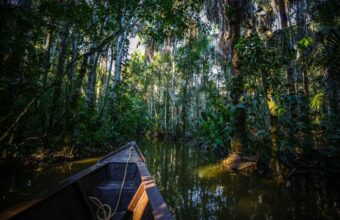
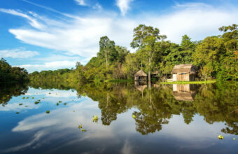
The northern Amazon is very different to the more popular Puerto Maldonado in the south. Located closer to the Amazon River, this is a watery wonderland best explored by a small-ship river cruise. Cruises depart from Iquitos for a three-night voyage to the remote Pacaya Samiria National Park. On the way you'll take guided excursions into the jungle to spot its myriad wildlife, kayak the tributaries, fish and swim in the mighty Amazon River. After your rainforest adventure you'll head south via Lima and up into the Peruvian Andes to visit historical Cusco, the glorious Sacred Valley and, the cherry on the cake, the world-famous ruins of Machu Picchu.
Combine Peru's two finest gems in one trip: the biodiverse wonderland of Puerto Maldonado in the southern Amazon basin, and the incredible cultural heritage of Machu Picchu and the Sacred Valley. Start your trip in Lima before heading to a remote jungle lodge to explore the rainforest with expert guides, before arriving up into the high Andes to marvel at Machu Picchu, historical Cusco and the many ruins of the beautiful Sacred Valley.
This popular route covers the best of the Peruvian highlights in one convenient itinerary, calling at all the key locations in the country's southern highlands, a region of remarkable natural and historical heritage.
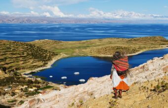
Starting from Lima you'll head south to Arequipa, Peru's elegant second city and gateway to the Colca Canyon. From here you'll travel to Puno, on the shores of Lake Titicaca, the highest navigable lake on earth and cradle of the Aymara pre-Colombian cultures.
Finish the epic trip in the Sacred Valley, exploring Cusco and, of course, Machu Picchu.
Go on an Incan adventure in Peru by combining a trip to culture-rich Machu Picchu and the Sacred Valley with a trek along the forgotten Great Inca Trail from Huaraz to Huanuco Pampa.
Start your trip in Lima before heading marvelling at the Inca citadel of Machu Picchu, historical Cusco and the ruins of the Sacred Valley. Then, journey to Huaraz where you'll pick up the Great Inca Trail, passing through Andean mountains and along river basins, camping out under the stars as you learn more about this fascinating culture.
This Sacred Valley tour is for travellers who want to explore hidden villages on foot while also seeing the glorious historical sights the Inca heartland has to offer. You will hike to the remote indigenous community of Choquechaca to learn about their ancient weaving traditions, enjoy a freshly prepared mountainside lunch, and explore the ruins of Pumamarca, before heading on to tour the world-famous Machu Picchu and Cusco in style.
Your details are safe and will not be used for any other purpose. By using this service you agree for us to share your details with your chosen tour operator according to our Privacy Policy.
1Your trip
2Complete your request
3Meet your specialist
Find a Peru specialist
Tell us about your trip and we'll find your match
We'll connect you directly with the experts.
Connect with Martha Cohen, Miles Buesst and 4 other Peru specialists.
We'll connect you directly with the experts.
Connect with Martha Cohen, Miles Buesst and 4 other Peru specialists.