Ha Giang trek
Ha Giang away from the motorbikes
-
Ha Giang
Ha Giang is Vietnam’s northernmost province and the landscapes are like something from a science fiction flick... -
Đồng Văn
... -
Ha Giang
Ha Giang is Vietnam’s northernmost province and the landscapes are like something from a science fiction flick...
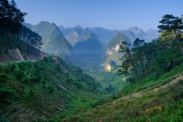
Ha Giang province, nestled in the mountains of Northern Vietnam near the Chinese border, is one of the most isolated, and stunningly beautiful, corners of the Tonkin Alps. In fact, I’d say it’s the most spectacular place to go hiking in Vietnam. Its deep valleys, terraced rice paddies and piercing karst formations are home to a mosaic of different ethnic groups, who, until recently, were almost entirely untouched by tourism.
Alas, as with Sa Pa before it, it’s precisely this beauty and isolation that has made it so interesting for intrepid visitors. Social media-fuelled popularity of the Ha Giang Loop, a 350km motorbike circuit, has been the main factor, bringing traffic jams on mountain passes and excessive crowding at iconic viewpoints along the loop.
This is unfortunate because beyond the loop, the rest of Ha Giang province remains exceptionally quiet. Here’s my favourite Ha Giang trekking itinerary that gets you away from all the motorbikes and Instagrammers.
Good to know
- Difficulty: Moderate
- Duration: Three days
- Distance: Approx. 35km
- Accommodation: Homestay
Key information
| Destinations | Ha Giang |
|---|---|
| Activity | Adventure, Hiking & Trekking, Active, Walking, Nature & Wildlife, Culture, Responsible Travel, Slow Travel |
| October - April |
Ha Giang trek itinerary

Hà Giang to Nam Dàm (via Lùng Vài and Khuổi Mỹ)
Day 1 in Ha Giang
Begin the day setting off from Hà Giang city and head north on foot through the mountainous terrain of Hà Giang Province. The day’s trek covers 13 to 15 kilometres and typically takes between six and eight hours, depending on conditions and pace.
The route winds through palm-lined forests, terraced rice fields, and rugged hills, with regular encounters with members of ethnic minority communities, including the Mán and Dao. While brief, these interactions offer a glimpse into local rural life.
Have a picnic lunch en route, with the path continuing toward the remote village of Khuổi Mỹ. Depending on the time of year, the surrounding fields may be active with local agricultural work, and there is occasionally the chance to observe or even assist with farming tasks.
From here, the trail continues to Bản Tha, where you can continue by road to Nam Dàm village, a community inhabited by Dzao families. Stay here in a traditional stilt-house homestay.

Quản Bạ to Đồng Văn (via Tam Sơn and Sà Phìn)
Day 2 in Đồng Văn
The second day begins with a road journey north from Hà Giang, following a series of winding mountain passes through the limestone highlands of the Đồng Văn Karst Plateau Geopark. A permit, usually obtained in Hà Giang town, is required for travel in this frontier region near the Chinese border.
Stop in Tam Sơn, a small mountain town set against dramatic karst scenery, before continuing north to Sà Phìn. Here stands the former residence of the so-called H’mong King, Vương Chính Đức, a fortified manor built in the early 20th century in a Qing-era Chinese style, using stone, timber and terracotta. The structure is one of the most architecturally significant in the region and offers insight into the complex political alliances of the colonial era.
In the afternoon, a 3.5-hour trek (eight to ten km) departs From Đồng Văn you can hike around eight km to ascend the highest mountain in the area, passing H’mong, Lô Lô and Giáy villages, offering broad views across the highlands. Trails here are often quiet and undeveloped, and the terrain can be steep in sections.
Return to Đồng Văn for a night in a simple guesthouse.

Đồng Văn to Mèo Vạc to Hà Giang
Day 3 in Ha Giang
After breakfast, spend time in the Đồng Văn Old Quarter, where a small number of historic buildings reflect the area’s trade history and H’mong heritage. From here, hike up to the French-built Pu Lô fortress, which dates to 1890 and was used until the mid-20th century. The fort occupies a strategic ridge and offers commanding views over the karst peaks and valleys below.
The final hike leads to the top of the Mã Pí Lèng Pass, one of the highest and most dramatic mountain passes in northern Vietnam. The route winds through a striking landscape of limestone spires and narrow canyons before descending into the deep valley around Mèo Vạc.
From Mèo Vạc, return by road to Hà Giang.
FAQs
Question
Extend the Ha Hiang Trek?
Is it possible to extend the standard three day Ha Giang Trek to add another day of hiking?
Answer
Yes, you could add a day before the final day (day 3), to hike to the more remote areas of the Dong Van Karst Plateau at a more relaxed pace, adding an extra day of trekking (around 10–15 km), before continuing toward Meo Vac and picking up the usual route.
Question
Quieter Ha Giang?
We want to hike in Ha Giang with long hiking days but keep away from the motorbikes, what do you suggest?
Answer
You can do a good 4 day itinerary that gets you deep into Hmong areas where motorbikes don't reach. You start with Ha Giang – Nam Dam, trekking 12–15km (6–8 hrs) through farmland and stay in a Dao homestay. The next day it's Nam Dam – Lao Xa – Dong Van, a scenic trek featuring remote high peak views. The third day it's Dong Van – Thien Huong – Meo Vac, approximately 6 hours hiking through karst landscapes. Then the fourth day is Meo Vac – Lung Tam – Ha Giang returning to the city by 17:00.
Other itineraries you might like
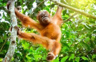
Orangutans and Tanjung Puting
Wildlife of Central Kalimantan
Approx. 5 days
Sarawak’s national parks
Wildlife spotting and colourful Kuching
Approx. 7 days
The best of Sarawak
Orangutans, rainforests and beaches
Approx. 14 days