Arequipa & Colca Canyon Treks
Trekking the volcanoes and canyons of Southern Peru
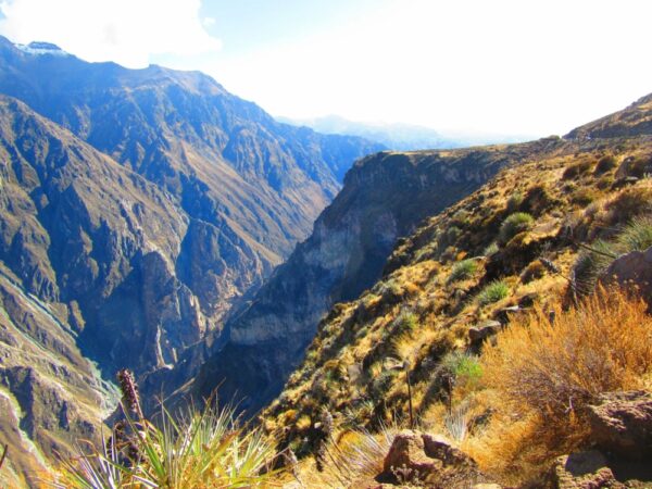
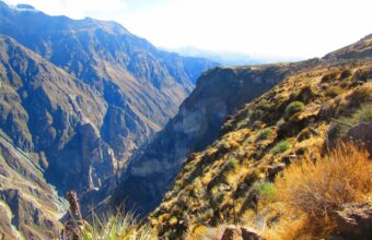
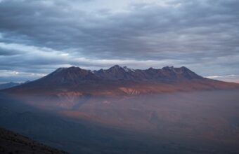
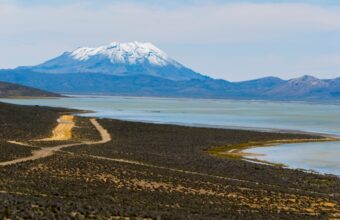
The Arequipa region in southern Peru is famous for its volcanoes and the harsh beauty of its desert landscapes.
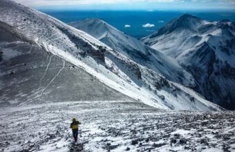
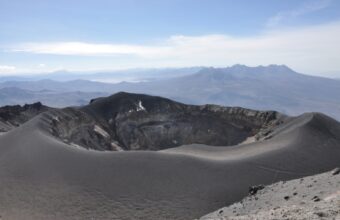
This is one of the best places in the world to hike up a volcano because the trails, although tough, are not technical climbs. It’s also great for spotting condors and vicuñas, the wild cousin of the llama.
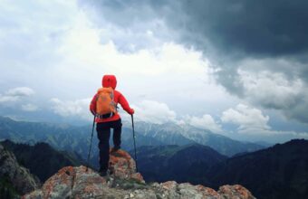
Be prepared for high altitude - most treks around Arequipa take you to almost 6,000 metres above sea level. April to October is the best hiking season, when there is almost no precipitation and little risk of any snow or ice on the trails.
Arequipa & Colca Canyon Treks
On this page:

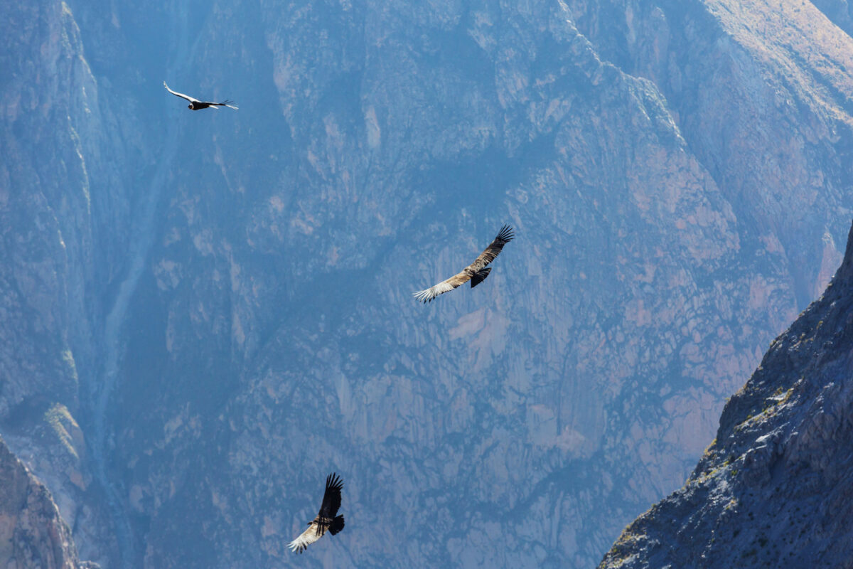
Condors soaring over the Colca Canyon
Arequipa & Colca Canyon Treks
Best treks in the Arequipa region
Treks in the Arequipa region are best done with a licensed local agency and guide. Trails are not well marked and the high-altitude terrain is beautiful but also unforgiving.
Colca Canyon trek
Colca Canyon trek
Difficulty: Moderate to challenging
Distance: 14km
Duration: Two days
Max elevation: 3,500 metres
Start/end point: Cabanaconde
The Colca Canyon Trek is the most popular trek in the Arequipa region. The trailhead is in Cabanaconde, 200 km from Arequipa. The trail takes you down into the Colca Canyon, one of the deepest canyons in the world, and offers spectacular views of the Andes Mountains and the Colca River.
What you’ll see
Just 20 minutes before you arrive at the trailhead, you’ll stop at the Cruz del Condor, where condors soar so close to the canyon walls that you will feel like you can reach out and touch them. After you hike down into the canyon, the trail follows the Colca River, passing through small villages and terraced fields.
How long is the Colca Canyon Trek?
Trekking agencies include transportation from Arequipa, a 220 km drive that takes about four and a half hours. If you do the popular two day trek from Cabanaconde to San Juan de Chuccho, you’ll hike about 7km each day. Some agencies have a three day itinerary that is easier and includes a second night in Sangalle. There are also one day tours from Arequipa that are mostly driving but may include a short hike.
How difficult is the trek?
Colca Canyon is moderately difficult because of the steep climbs and high altitudes. The hike up out of the canyon from San Juan de Chuccho to Cabanaconde is gruelling, especially if you don’t start early enough and you are subject to the harsh desert sun. For people coming directly from sea level, the altitude can also make the uphill hike more difficult.
Accommodation
There are both hotels and homestays in San Juan de Chuccho. If you book through an agency, they will already have a room reserved for you. If you are hiking on your own, you can find a place on arrival.
How to book
All agencies in Arequipa offer Colca Canyon, as do most agencies in Lima and Cusco. You can book ahead of time or upon arrival in Arequipa. If you are booking through an agency that’s not located in Arequipa, ask which local operator they use so you can check reviews of the guides and services.
Key considerations
Sun hat, extra water and hiking poles are highly recommended. Agencies include food on treks but you may want to bring your own snacks for the hike.
Chachani Volcano trek
Chachani Volcano
Difficulty: Challenging
Distance: 31 km
Duration: Two days
Max elevation: 6,035 metres
Start/end point: Arequipa
The Chachani Volcano is the highest volcano in the region and has four summits, the highest of which is 6,075 metres. Despite being the highest, it is not the most popular volcano so you have a good chance of having the summit to yourself. The climb is not technical, though you may need crampons and ice axes December through February.
How long is the Chachani Trek?
The drive from Arequipa to the trailhead takes about 3 hours. The hike up to base camp at 5170 metres takes about two hours. Most guides will get their group up at about 3:00am so you can summit early in the day. Afterwards, you’ll hike down to the trailhead and go back to Arequipa.
How difficult is the trek?
This is a challenging trek because of the altitude but the views are absolutely worth it. The trail towards the top has loose rocks and ash, which can make walking more difficult.
Accommodation
You will camp at 5,300 metres, so be sure the agency includes a four season sleeping bag or bring your own. You may also want a sleeping bag liner for extra warmth.
How to book
Booking directly with a local tour operator is recommended to ensure that you have a local guide who is familiar with the trail.
Key considerations
The second day of this hike always starts very early and you must be able to sleep at high altitude to summit successfully. Spend at least a couple days hiking above 4,000 metres before attempting Chachani.

Misti Volcano trek
Misti Volcano trek
Difficulty: Moderate to hard
Distance: 24km
Duration: Two days
Max elevation: 5,825 metres
Start/end point: Arequipa
Misti is the most popular of Arequipa’s volcanoes partly because it’s the closest to the city. There are two trails, up the south and north faces of the mountain. The northern route called Aguada Blanca is the most common.
What you’ll see
Misti is a perfectly cone-shaped volcano and the one you’ll notice first when you arrive in Arequipa. There are no trees on the mountain, so you’ll have unobstructed views of the entire region.
How long is the Misti Volcano Trek?
The second morning starts early so you can get up to the summit in the morning and be heading back down before the sun is too strong.
How difficult is the trek?
As with all volcanoes in the Arequipa region, the most difficult part of the trek is the altitude. The trail is not technical, though towards the top some parts of the trail are covered with loose ash.
Camping on the trek
You’ll start at 4,140 metres and hike up to Monte Blanco camp at 4,760 metres. Be sure to ask the tour operator about the quality of the tents and sleeping bags. If they don’t have four season bags, bring your own.
How to book
It’s recommended to book directly with a local tour operator to ensure that you have a local guide who is familiar with the trail.
Key considerations
There is another trail on the south side of the mountain called the Chiguata variant. This second route takes you up to the summit via the town of Chiguata. You’ll drive 30 km from Arequipa to the town of Chiguata at 2,970 where you’ll start hiking. You’ll spend the night at Camp Piramide at 4,700 metres before making the summit ascent the next morning.
Picchu Picchu trek
Picchu Picchu trek
Difficulty: Moderate
Distance: 16km
Duration: Two days
Max elevation: 5,664 metres
Start/end point: Arequipa
The Picchu Picchu volcano, pronounced peek-chu, is located near Arequipa. The mountain is a crescent shaped crater of a much larger volcano that erupted long ago. There are seven peaks, the highest of which is 5635 metres. Picchu Picchu was sacred for Inca and pre-Inca civilizations, which often made offerings and sacrifices on the volcano. In 1986 the mummy of a child was found with gold and silver artefacts.
What you’ll see
The road from Arequipa to the trailhead takes you past Laguna de las Salinas at 4,300 metres. You’ll see pink flamingos as well as llamas, alpacas and vicuñas. On the hike you’ll go by a platform that the Inca used to make sacrifices.
How long is the Picchu Picchu Trek?
The first day is a short walk from the trailhead. You’ll get up around 3:00 am to start hiking early and be at the summit for sunrise. The hike takes about six hours roundtrip.
How difficult is the trek?
This is the easiest of the Arequipa volcanoes, though not the most popular. Most agencies take trekkers up the Coronado Cumbre peak that is 5,664 metres high.
Accommodation
Camping: base camp is at 4,400 metres, so be prepared for a very cold night.
How to book
Like the other Arequipa volcanoes, this is best booked with a local operator so you can be sure the guide is experienced on the volcanoes.
Key considerations
On the second day, on the way back to Arequipa most agencies stop at the town of Chinguata so you can see a traditional Andean village.
Ubinas trek
Ubinas trek
Difficulty: Moderate
Distance: 5km
Duration: Two days
Max elevation: 5,672 metres
Start/end point: Arequipa
The Ubinas (also sometimes spelled Uvinas) trek is located in the southern region of Peru, near the city of Arequipa. The trek takes you to the summit of Ubinas, the most active volcano in Peru. Looking down into the crater you’ll see puffs of ash and sulphur. The volcano has been active for over 800 years and has had two eruptions during that time.
What you’ll see
Only two hours from Arequipa you’ll stop at Laguna Salinas to see flamingos, llamas, alpacas and vicuñas. You’ll continue the drive to Piscococha, a Quechua name which translates to Bird Lake.
How long is the Ubinas Trek?
Early in the morning you’ll drive the last half-hour to the trailhead. The trek to the crater takes around 3 hours and requires climbing over loose volcanic rock and ash.
How difficult is the trek?
This is one of the shortest volcano treks near Arequipa but agencies still run it as a two day itinerary so that you can start walking early without a long drive on the same morning.
Accommodation
The campsite is near the road at Piscococha, so you don’t need to hike up to a base camp.
How to book
Book with a local operator from Arequipa to ensure the guide knows all the safety protocols for hiking an active volcano.
Key considerations
This is the best volcano near Arequipa for people who are unsure about hiking at altitude but who want to see an active volcano.