Trekking in Huaraz
The best treks in Cordillera Blanca, Huayhuash & Negra
Move over Cusco. The mountains around the central-Andean city of Huaraz are the Peru trekking capital for discerning hikers. The region’s three ranges; Cordillera Blanca, Cordillera Huayhuash, and Cordillera Negra, are quite simply some of the best places in South America for trekking and mountaineering.
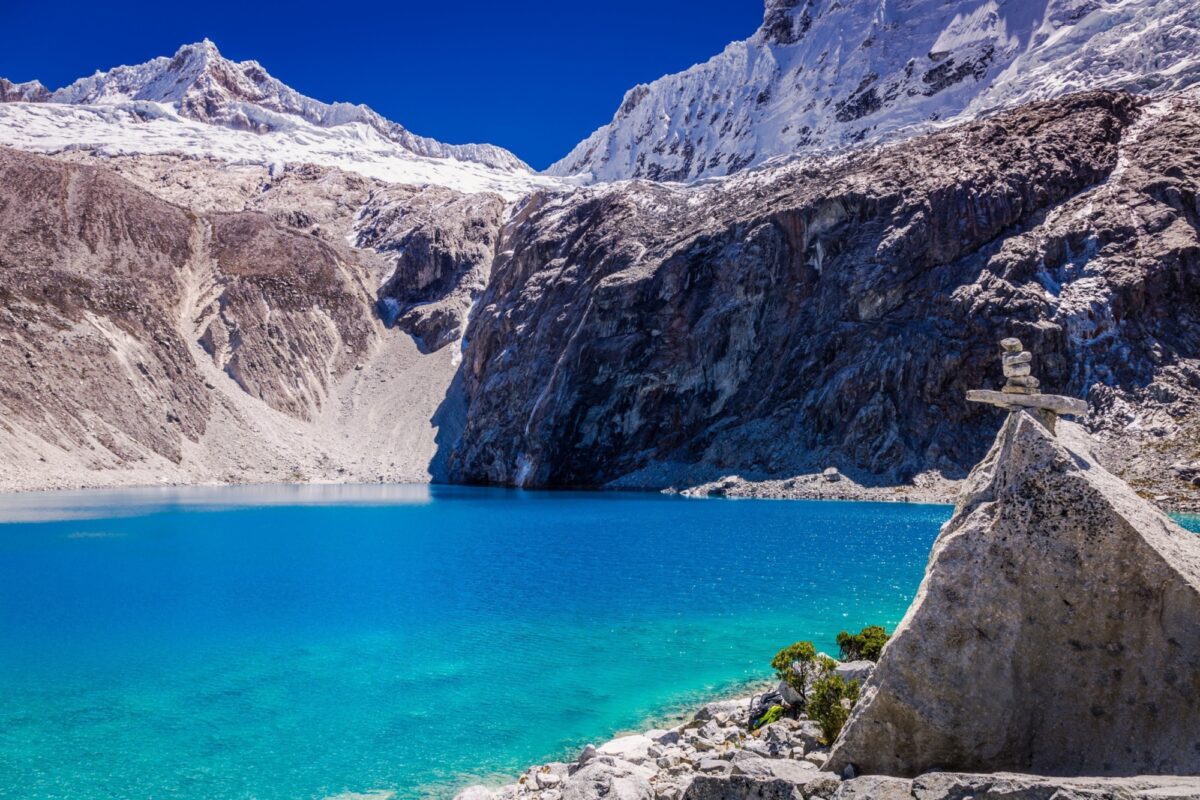
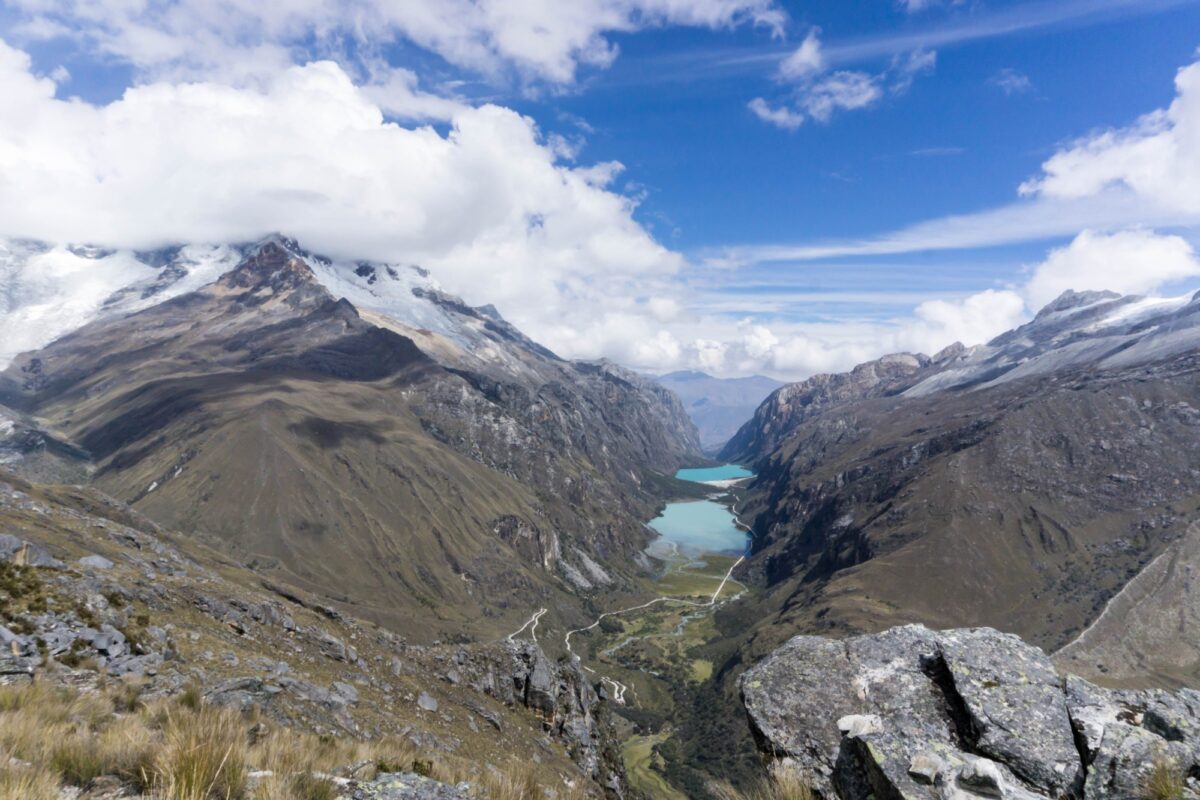
Here you'll find astonishing mountainscapes of hanging glaciers, turquoise alpine lakes, and stark, rolling puna grasslands, all dominated by the incredible presence of colossal snow capped mountains in every direction.
And most appealing of all? An almost complete absence of crowds. While the masses flock to Cusco for the world–famous Machu Picchu hikes, those in the know do their trekking in Huaraz. And now that includes you. Buckle up, you’re in for a thrill.

Information overload?
TL;DR? Get my Peru trekking highlights straight to your inbox in this free email series.
Huaraz trekking: At a glance
I recently spent over three months in the region, seeking out the popular treks as well as some lesser-known routes. The following is my first-hand guide to the Huaraz trekking highlights and hidden gems.
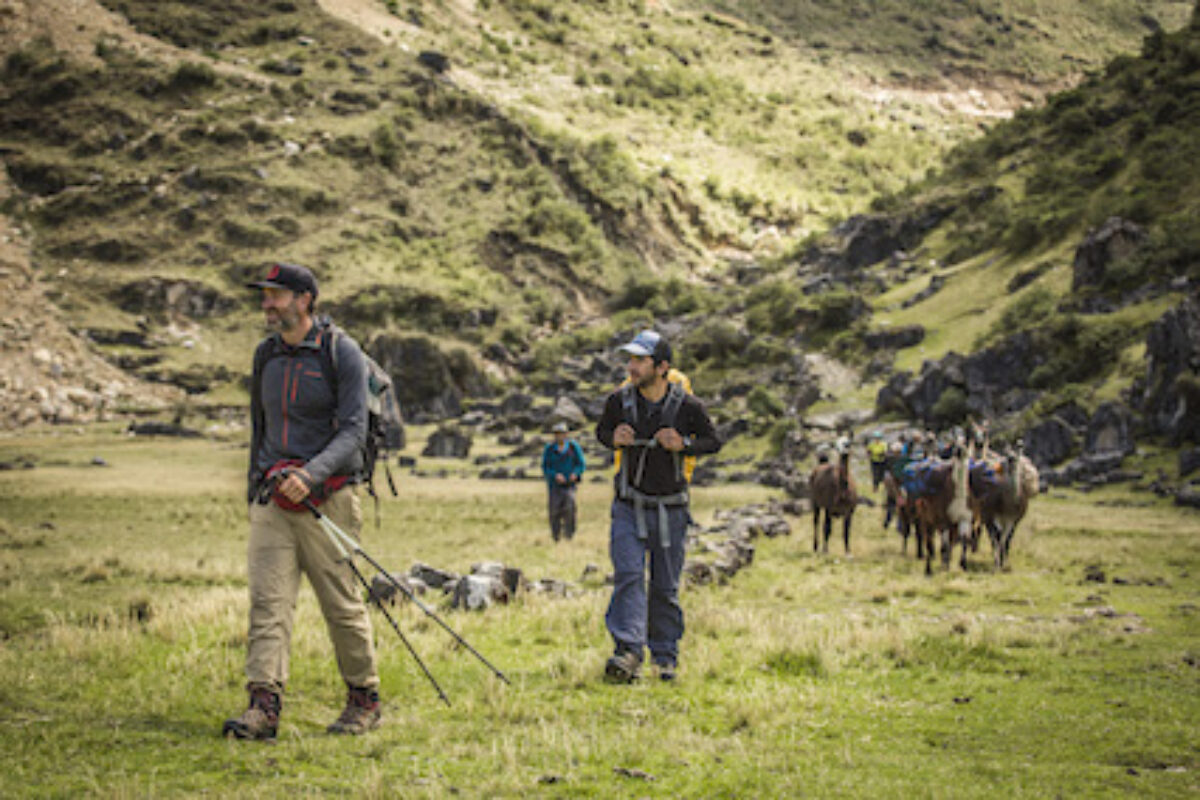
Most popular treks: While you won’t find many crowds in this part of Peru, the Huayhuash and Santa Cruz Circuits are the most popular multi day treks here. Laguna 69 and Pastorouri Glacier are the most popular for single day hikes. They're not Inca Trail level busy, but you’ll be sharing the trails and campsites with other groups.
Underrated treks: If you’d rather do something a little different, I’d recommend the full Alpamayo Loop, or for a mountaineering challenge, any of the summit ascents mentioned below – some are suitable for beginners (with a guide).
When to go: The Huaraz trekking season runs from May/June to September. Trekking is discouraged (or just impossible) from December to March.
The best Huaraz treks
Popular treks and hidden gems
-
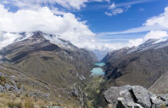
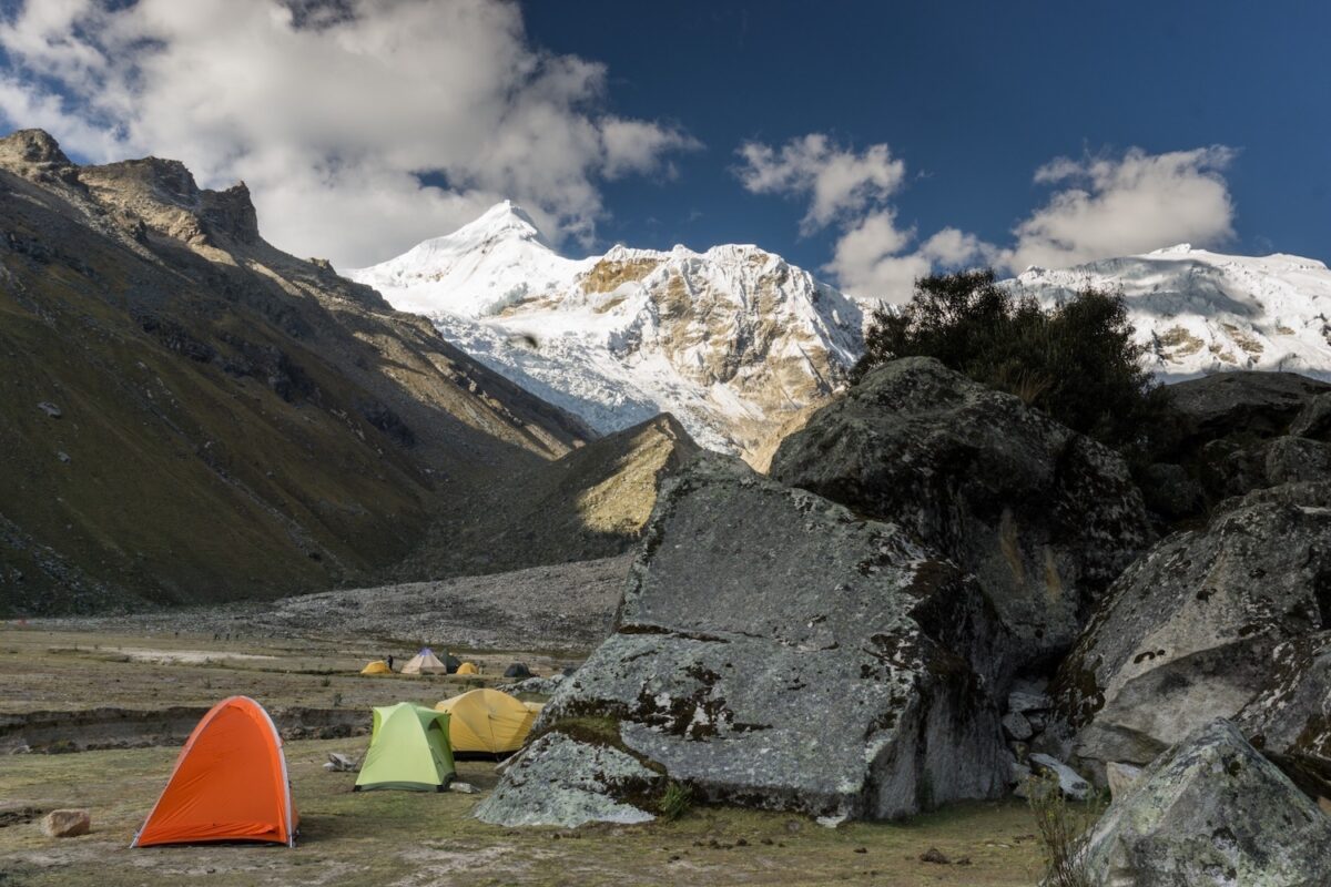
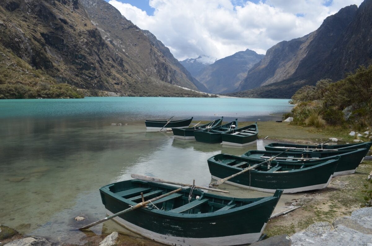
Santa Cruz trek
-
The Huayhuash Circuit
-

Pisco Base Camp trek
-

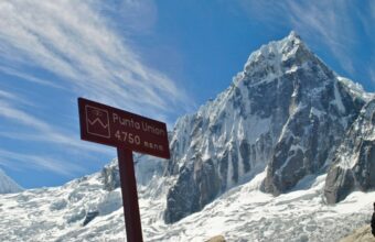
Alpamayo trek
-

Nevado Pisco Summit ascent
-

Nevado Tocllaraju Summit ascent
-

Nevado Chopicalqui Summit
-

Cójup trek
-

Olleros-Chavín trek
-

Qhapac Ñan trek
-
Laguna Aguak day hike
-
Laguna Radian day hike
-

Wilcacocha Lake day hike
-

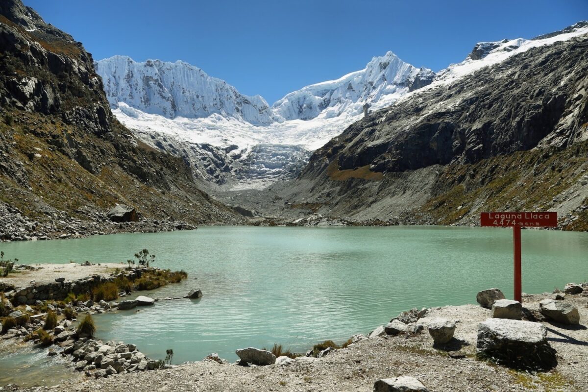
Laguna Llaca day hike
-
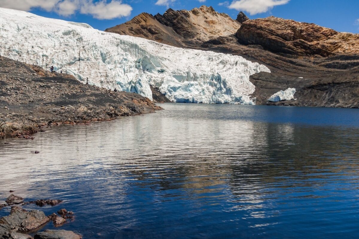
Nevado Mateo glacier hike
-

Pastoruri Glacier day hike
-
Laguna 69 day hike
-

Llanganuco Lakes day hike


featured Cordillera Blanca Treks

featured Cordillera Blanca Treks

Where to hike in Huaraz
The best trekking areas around Huaraz

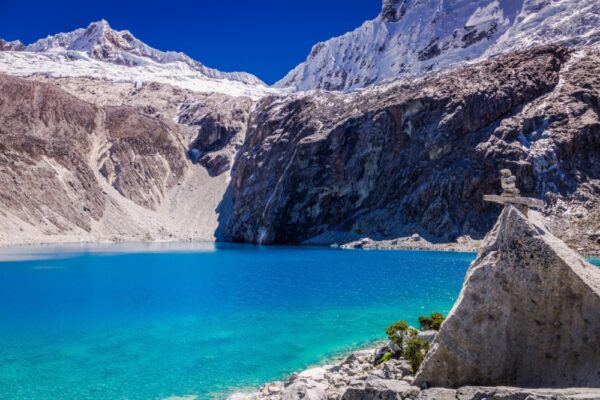
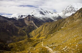
Cordillera Blanca
Cordillera Blanca
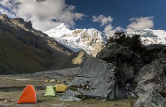
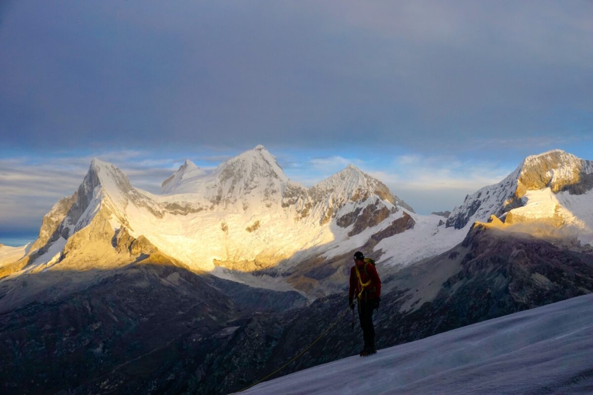
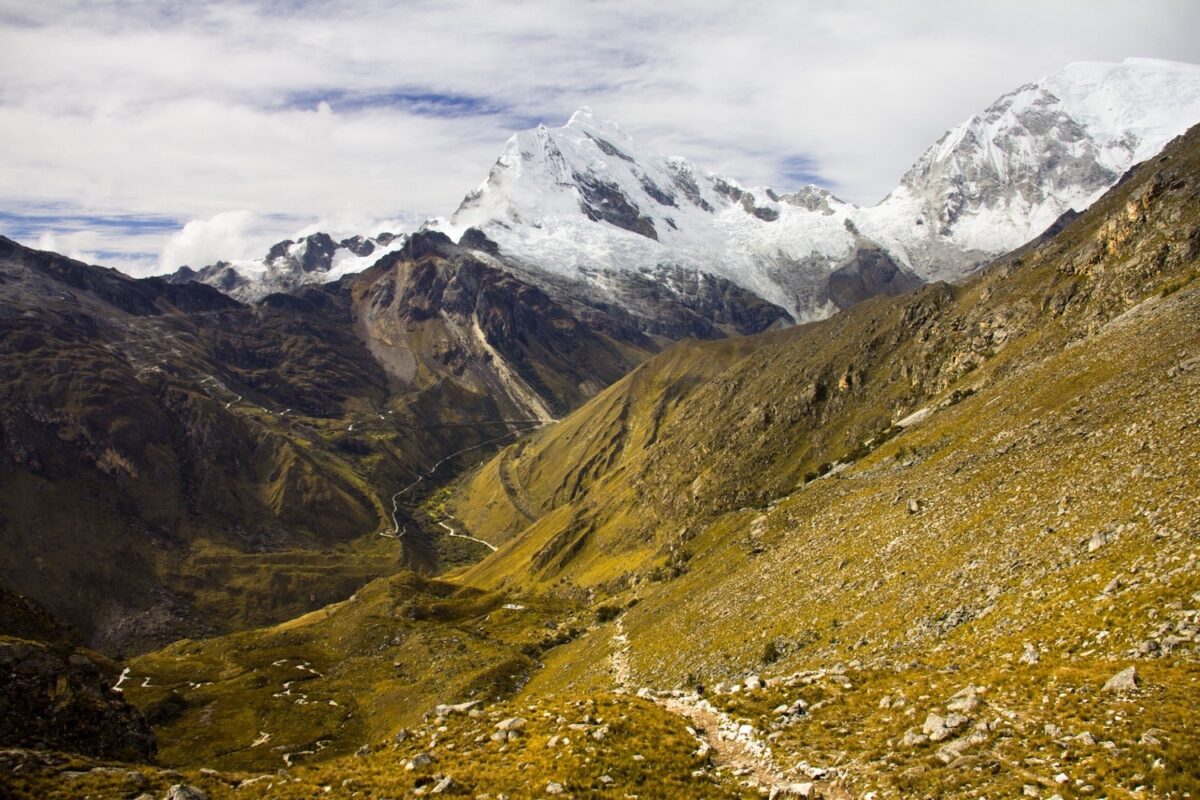
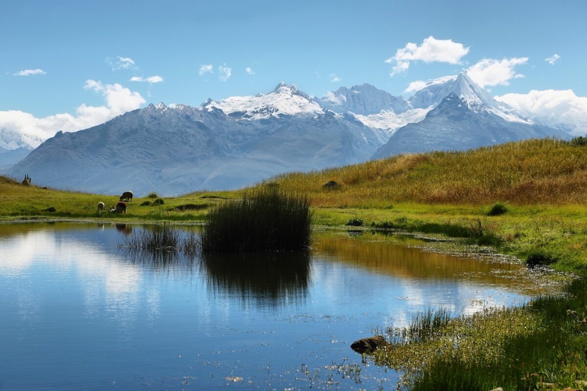
This famed range, largely contained within UNESCO designated Huascarán National Park, is the highest tropical mountain range on earth and has the highest mountains in Peru, along with over 700 (rapidly retreating) glaciers. Trekking here is a serious business, sometimes verging into mountaineering.
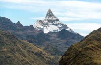
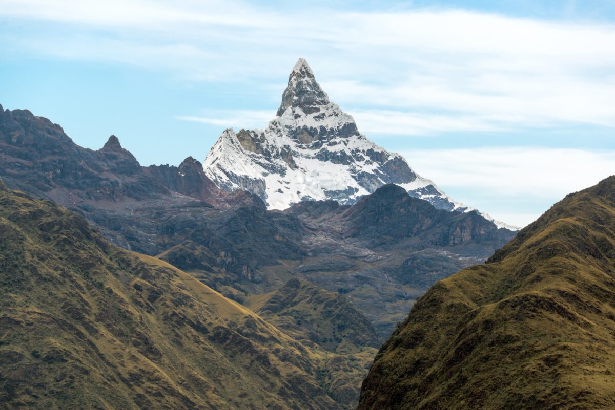
There are more than 30 peaks with summits over 6,000 metres, which makes this the most important destination for mountaineering in Peru. Huascarán (6,768m) is the highest mountain in Peru and the fifth highest in South America. However, other mountains are even more famous. Artesonraju (6,025m) was the model for Paramount Pictures’ logo when it was designed in 1953. Alpamayo (5,947m) is a perfect pyramid and has been voted the most beautiful mountain in the world. (You must have significant mountaineering experience to summit any of these mountains.)
In addition to the incredible scenery, this is a great place to see condors and vicuñas, as well as the Puya Raimondii, the largest bromeliad in the world that can grow to 10 metres high.
Despite its attractions, you will encounter far fewer people here than in the Cusco region. The distance from Machu Picchu and high altitudes in the Cordillera Blanca discourage the more casual trekker.

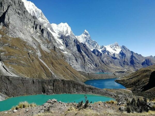
Cordillera Huayhuash
Cordillera Huayhuash
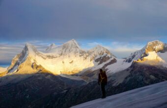
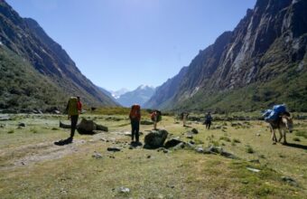
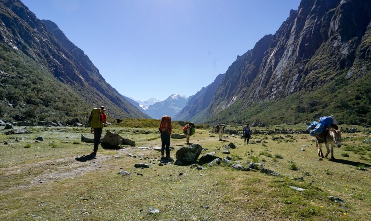
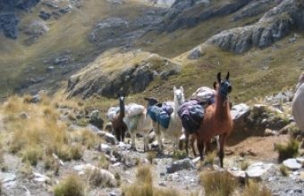
Approximately 30 kilometres north to south, Cordillera Huayhuash is extremely remote with only a handful of small settlements scattered below 4,000 metres. A dense cluster of jagged, snowy towers and glacial lakes, the Huayhuash boasts seven peaks over 5,700 metres and is home to Peru’s second highest mountain, Yerupajá, at 6,635 metres.
Huayhuash is perhaps best known for Siula Grande (6,344m), made famous by Joe Simpson and Simon Yates' epic survival story, Touching The Void. For the mortals among us, the main attraction is an incredible 130 kilometre trek called the Huayhuash Circuit which strings together nine mountain passes, all of which are over 4,700 metres. The Circuit is normally completed in 8 to 10 days. The highest pass you’ll cross reaches an altitude of 5,050 metres on day five, followed by the mirador (viewpoint) at San Antonio, one of the most stunning views that I have ever witnessed.
For me, every day of the Huayaush Circuit offered utterly spectacular and solitary views. I’ve completed dozens of stunning multi day treks in Patagonia and the high altitude Chilean Andes, and I can say without a doubt that the Huayhuash Circuit offered some of the most rugged and memorable landscapes I have ever seen.

Huaraz
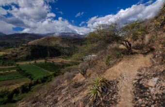
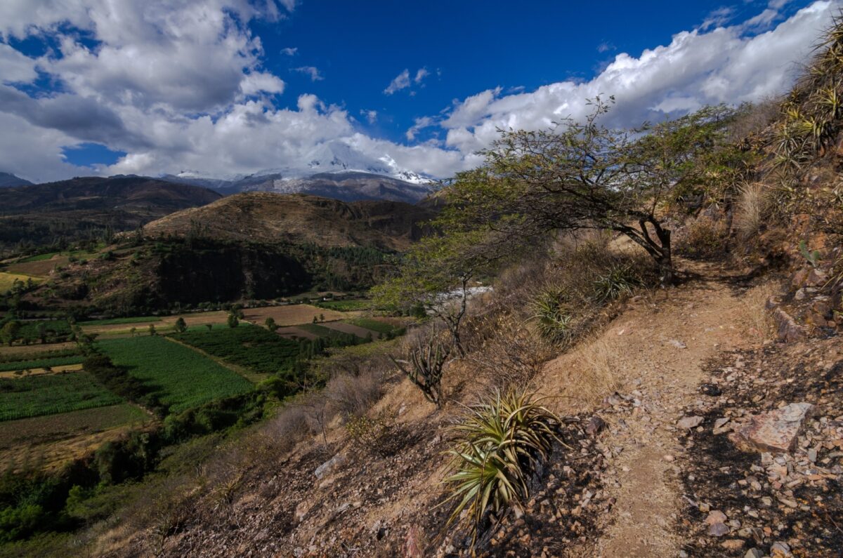
Cordillera Negra
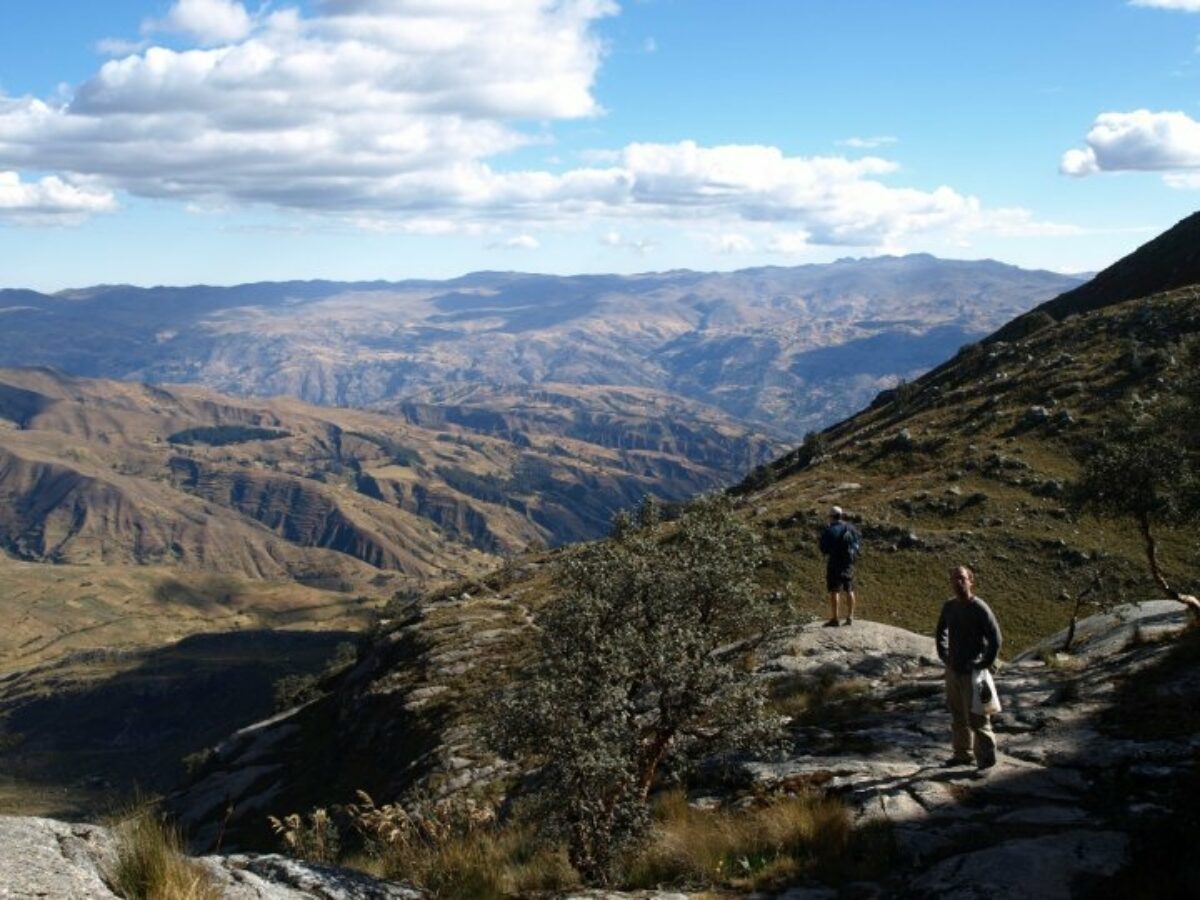
Located west of Huaraz and running parallel to Cordillera Blanca, the Cordillera Negra is a more modest chain of peaks all under 5,200 metres. There are no snow caps and very little snowfall in winter. Approximately 230 kilometres long and 35 kilometres wide, the highest peak, Coñocranra, stands at 5,181 metres.
The two ranges are separated by Callejón de Huaylas (Santa River Valley). Objectively less grand and spectacular compared to the Cordillera Blanca, I still found some beautiful hiking in the Cordillera Negra, such as Wilcacocha Lake and Antacocha. Apart from hiking, the Cordillera Negra also has its own cultural significance: throughout the range there are sparse settlements of indigenous Peruvians that remain remote and mainly untouched by tourism.
Glorious scenery hiking outside of Huaraz
Huaraz trekking need to know
Everything you wish you knew before you booked
Fees & permits
There is a daily fee for Huascarán National Park. You can buy a day pass for 30/S ($8), a 3 day pass for 60/S, or a 30 day pass for 150/S. Passes are usually sold at every park entrance.
The Cordillera Huayhuash is not a national park but there is a daily fee for entering and camping within the reserve, charged per campground by the community that maintains each one and range from S/10-S/50. There are officially nine communities within the reserve. When I went, each fee was S/25 (S/250 soles total) and was collected at different check points on the trail or at the campsites. Note that you’ll still need to pay the fee regardless if you stay at the designated campsite, as the fee is also for passage through their land.
Getting there & around
The city of Huaraz is the capital of the region and is the primary base for exploring the surrounding mountains. Most visitors get to Huaraz by overnight coach from Lima, although there is now a direct flight from Lima to Huaraz operated by LATAM.
Most organised treks will depart from Huaraz town and will include road transport to the trailheads.
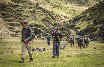
Solo trekking: doable, but hire a guide
Other than park entry fees, unlike on the Inca Trail, there are no special permits required for the treks and hikes around Huaraz, and there’s nothing stopping you from doing any of these hikes solo or without a guide.
The Casa de Guías (Guides’ House) next to Parque Ginebra near the Huaraz Plaza de Armas can give you information on current conditions for any route. It’s open M-F 9 am to 1 pm / 3:30 to 6:30 pm and Saturday 9 am to 1 pm. It’s also a great source of general expertise on the routes and is a good place to hire a private guide without an agency.
You can buy pretty much all necessary hiking and camping gear in town (venture away from the touristy main square for better prices.) You might find GPX files for your hikes on platforms like Wikiloc or Komoot.
Be aware that trail markers are either unreliable or nonexistent, altitude sickness is a serious risk, and that conditions are notoriously changeable and treacherous. My advice for all but the most experienced of solo trekkers is to at least hire a guide, even if you’d rather organise your other logistics yourself.
Find an organised trek (without getting ripped off)
If you’d prefer the experience of hiking with others, or want the security and convenience of having an agency/tour operator handle your logistics, you’ve got plenty of options – some better than others.
Some people book their treks months in advance with an international tour operator. This is by far the most expensive way to do it. The agency will contract a local operator to actually conduct the trek, and you could be grouped up with others who’ve paid much less than you did! In my opinion, the only real advantage is the financial security in case anything goes wrong with your booking, or if your trek is part of a bigger and more complex trip.
The cheapest way is to just book when you arrive in Huaraz with one of the many operators around the main town square. I’d advise against booking on the spot, take some time to check reviews and get assurances on equipment standards, food and group sizes. Make sure you’re booking with the actual operator and not a tout working on commission. If they’re pushing you to book there and then, that’s a red flag.
A good middle ground is to book in advance with a high quality, locally-based operator or a trekking specialist. You can find them online or here. You can do your due diligence beforehand, and they may take payment by credit card for some financial protection.
However you book, the cost for an organised trek should include qualified guide(s), two to three cooks, tents, all food and water, transport, porters who will set up & strike camp each day, maybe support horses, and emergency evacuation if needed. Your sleeping bag and sleeping pad may be provided, however you’ll need your own personal hiking gear. You can rent most kit from your operator but if you’re trekking for more than a few days it’s probably cheaper to buy second hand in Huaraz. I bought a used parka for $40, whereas renting one for eight days would have cost me $50.
AMS & acclimatisation
Huaraz is 3,000 metres above sea level and the treks ascend from here. This sort of altitude must be taken seriously, especially if you’re arriving from sea level. It’s essential you take at least three days to acclimatise before you start trekking and doing a few moderate day hikes prior to your multi-day trek will help prepare your body.
In my experience of high altitude trekking, I’ve seen various degrees of Acute Mountain Sickness (AMS) in my fellow hikers and have experienced mild symptoms myself. Altitude sickness affects everyone differently and does not directly correlate with physical fitness. While being in good physical condition is important, I’ve been among athletes who have experienced more severe AMS symptoms compared to other moderately fit hikers on the same trek. That being said, it is extremely important that you know how your body handles altitude.
Common AMS symptoms may include headaches, nausea, diarrhoea, loss of appetite, trouble sleeping, and light-headedness or dizziness. Mild symptoms of AMS are usually not a major cause for concern, however, if you notice you’re having extremely painful headaches, severe dizziness (also known as drunken climber’s syndrome), or symptoms that resemble a bad fever such as abnormal sweating and chills, do not continue ascending. Drink frequent sips of water and begin to descend at a moderate pace as going down the mountain too quickly can actually worsen symptoms. If you are trekking with a guide, most guided groups are equipped with an emergency evacuation horse and can take you down to lower elevation where you can recover.
Huaraz trekking FAQs
Your questions, our expert answers
Question
When is the best time to go trekking in Huaraz?
Answer
The Andean dry season, from May/June to September, is the best time to go trekking in the Huaraz region.
The shoulder seasons, March-April & October-November, see smaller crowds and lower prices, but the weather is less predictable and you may have trouble finding tours and departure dates.
Hiking during the rainy season, December-March, is discouraged and often simply not possible due to flooding, landslides, and dangerous or inaccessible hiking trails.
Since Huaraz is close to the equator, daylight hours remain roughly 11 to 12 hours per day year-round.
Question
Where are good trekking lodges in/near Huaraz?
Answer
There’s plenty of budget hostels in the town and some decent trekking lodges in the surrounding hills.
For low budget hostels in Huaraz I can recommend Krusty Hostal; best for solo travellers, located in the city centre with a lively, social atmosphere. Big Mountain Hostel; a good budget option, located in the city centre, free breakfast included. Aldos Guest House; best for private rooms, clean spacious rooms.
The average price for a bed in a shared dormitory is $5 - 15 USD per night.
For trekking lodges, I’d suggest the Lazy Dog Inn; 30 minutes outside the city centre, very tranquil and near many trailheads. Churup Mountain Lodge; 45 minutes outside the city centre in the Cordillera Blanca, amazing views, also near many trailheads.
For a private room expect to pay $25 - 50 USD per night.
Question
How much should I tip?
Answer
Good question! PLEASE remember to tip your guide, cook, and donkey handlers! Most guides lead over 28 separate Huayhuash trips per year. Considering that the Huayhuash Circuit is eight days long, that comes to over 224 days of hiking per year, not including extra days for gear preparation and unloading. You can divide it up by guide, porters and cooks (approx $10, $5 & $5 per person per day respectively) or just pool around 10% of the total trip cost and they'll divide among themselves. Your guide will give you an honest steer.
Question
Similar trek to Salkantay in Huaraz?
I'll be in the Huaraz region but looking for a trek similar to the Salkantay Trek - what do you recommend?
Answer
For something similar to Salkantay in Huaraz I'd recommend the Santa Cruz Trek (4 days). It is the best option of the Cordillera Blanca for a first trekking experience: high mountain landscapes, glaciers and lagoons, without technical difficulty.