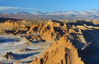
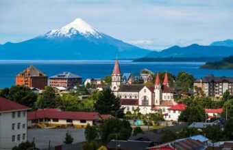
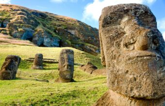
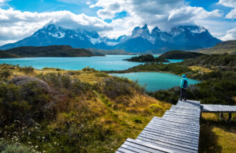
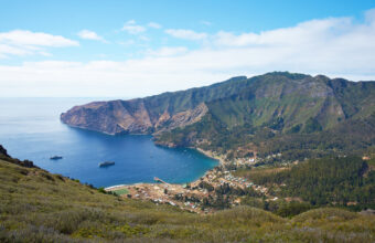
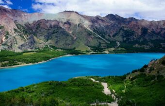
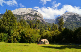
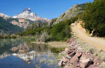
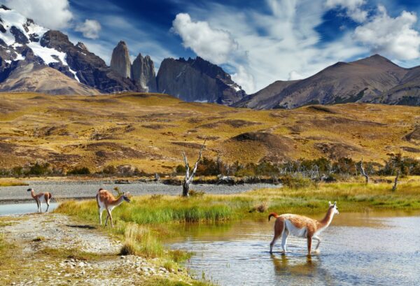
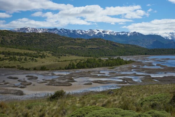
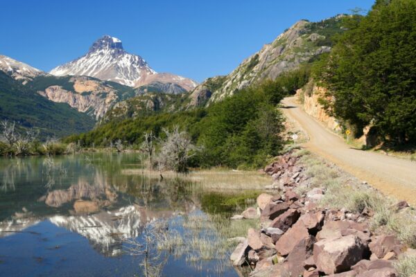
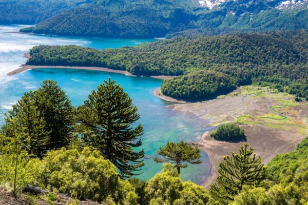
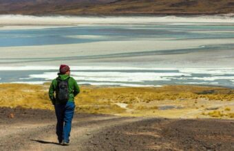
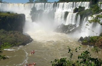
At over 4300km in length but only 170km wide, Chile is sandwiched between the lofty Andes and the Pacific Ocean. With a climate that ranges from the driest deserts to some of the most imposing glaciers in the world, its unique biosphere makes it an ideal home for unusual wildlife and hundreds of species of flowers. From trekking through the salt flats of San Pedro de Atacama to launching off the ski slopes of Santiago, Chile’s diverse landscape has the potential to offer a year of seasons within a single day.
Booking is mandatory for Torres del Paine. You can only hike the W or the Circuit of you have all accommodation booked in advance (and it gets booked out fast, so get this done as far ahead of your planned visit as possible), as well as paying the entrance fee for the national park. This is the case whether you’re camping or staying at lodges, and you will need to show proof of accommodation bookings and having paid the entrance fee in order to enter the national park.
The Circuit can only be walked in an anticlockwise direction. The W can be hiked in either direction, and which you chose will dictate whether you’re hiking against or with a lot of the other hiking traffic. I prefer east to west for the W, which means in the opposite direction from those on the Circuit, and because Glacier Grey arguably makes the best finale.
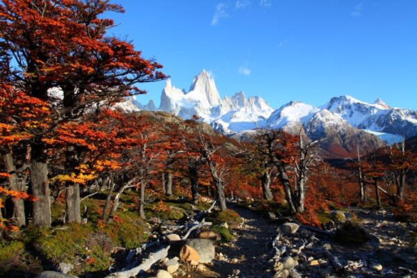
For me it’s the Circuit which eclipses pretty much anything else in Torres del Paine National Park – it’s more remote, less crowded than the W, with views that are even more epic in scale. Not for nothing is it often described as one of the world’s truly great treks. However I also really love the Fitzroy area in Argentina, where the scenery is every bit as amazing, and where unlike Torres del Paine the national park has not allowed the construction of lodges (let alone luxury hotels), meaning overnights are restricted to well maintained campsites. For my money, that gives the place a much more unspoilt and untouched feel.
Torres del Paine National Park has big lodges as well as campsites – not to mention some very upmarket hotels. I prefer using a mixture of lodges and campsites, which keeps costs down a little (and on the northern part of the circuit you’ll have to camp on some of the stages regardless), and having meals at some of the lodges means you can carry a bit less food.
The W and the Circuit as well as the shorter walks in Torres del Paine National Park are well-known and well-used, the routes are well marked, and you’ll find plenty of other hikers on the trail – so yes, hiking independently is fine. I’ve hiked independently on the treks listed above. Whether you go solo or with one or more hikers is up to you and depends on your level of confidence – the northern part of the Circuit is quite remote, for example. If you’re camping, hiking with one or more other people allows you to share the weight of a tent, food and other camping equipment.
Surprisingly, given that the Andes Mountains trace the western edge of Chile from tip to toe, trekking elevations are rarely higher than 1,200 metres. Altitude sickness is therefore not an issue in Chile. The only exception is the Aconcagua Summit trek, where you reach 6,961 metres above sea level at the top.
Chile, as a rule, is a safe place to travel, although increasing levels of crime in the capital, Santiago, means it’s worth taking common sense precautions. However, once you get out into the national parks, the biggest consideration is getting hold of a map, as trails can sometimes be poorly marked and difficult to follow.
Many of the more intrepid multi-day paths are not for inexperienced hikers. There is a serious risk of getting lost—or worse—without GPS, good-quality camping equipment and enough food and water to ride out a couple of days if you end up stuck in inclement weather conditions.
Women can hike alone in Chile, particularly on routes such as the W Trek and in national parks such as Huerquehue that have plenty of visitors. For other destinations, it’s better to hike with a partner, regardless of your gender, because routes are remote and it can be difficult to get assistance if you become injured.
Camping equipment, including rucksacks, tents, stoves, hiking poles and sleeping bags are available to rent in a couple of key locations, including Santiago, Puerto Varas, Coyhaique and Puerto Natales. Outside of these places, it’s possible to buy trekking gear but I’ve found it can cost at least double what you’d pay to buy similar equipment back home.
Most day hikes in Chile’s national parks are possible without a guide. Similarly, routes such as the W and O treks in Torres del Paine National Park, the Cerro Castillo Traverse and the Sendero Transversal in Parque Tantauco can be trekked independently. More extreme routes, such as the Dientes de Navarino on Isla Navarino, and the Aconcagua Summit are best hiked with a local expedition company.
Unfortunately, I’ve experienced first-hand how trails are often poorly marked, a legacy of the considerable underfunding of the national parks governing body, CONAF. Reliable maps are also few and far between, with the best available at the entrances to national. Outdoor hotspots such as Pucón, Puerto Varas and Puerto Natales sometimes have more accurate third-party maps available for purchase, while the free app Maps.me works without an internet connection and has been my go-to resource.
For most national parks you now need to book a ticket in advance through the official—and irritatingly glitchy—booking website. You’ll receive a QR code confirming your booking; download this when you’ve got internet access. Many national parks have little to no phone coverage.
Most national parks in Chile have multi-day hiking trails, however, none have the same tourism services as found in Torres del Paine. As a result, they’re far quieter and more likely to fulfil the vision of trekking in remote, untouched places.
Sendero Transversal in Chiloé’s Parque Tantauco is a great alternative to Torres del Paine National Park. The scenery couldn’t be more different: set within the thick, damp Valdivian temperate rainforests, this trail won’t show you mountains, but you will encounter 2,000-year-old forests and—if you’re lucky— rare, endemic species of pudú and Darwin’s frog.
Alternatively, experienced trekkers armed with GPS and lightweight camping gear will find the five-day Dientes de Navarino trek a welcome challenge. Circumnavigating the toothy Dientes de Navarino mountains as it strikes out across the otherwise inaccessible interior of Patagonia’s Isla Navarino, it’s the southernmost trek in the world—and promises staggering views and bog tramping in equal measures.
Southern Patagonia and, primarily, Torres del Paine, are Chile’s most renowned trekking destinations. However, my favourite places are the national parks that run along Ruta 7, or the Carretera Austral.
Wedged between the Andes Mountains in the east and the Chilean fjords in the west, this remote road winds between what I consider some of Chile’s most beautiful national parks:
Add in the fact that it receives far fewer visitors than those in Southern Patagonia—while still serving up a range of volcanoes, glaciers and rare wildlife—and the Carretera Austral is the true Patagonia hiking mecca.
Because of its southerly latitude, Patagonia has a relatively short trekking season, with trails opening around September and closing late April—although this is typically weather dependent. Most visitors head to the national parks along the Carretera Austral and in Southern Patagonia during the Austral summer (between the months of December and February).
However, the climate in Patagonia is famously unpredictable and four seasons’ weather can be experienced in an afternoon—even during the height of summer. My usual advice is to travel during the shoulder seasons either side of Austral summer. While you can’t guarantee the weather from September through early November and late March through the end of April, you can expect to share trails with far fewer visitors.
For the Lakes District heading north, national parks are typically open year-round, although heavy rains and snow can close trails between June and August.
You'll receive a reply by email. Questions and replies may be anonymised and reproduced on Horizon Guides.
§ 04
The Chile atlas
27 picksPlaces & Experiences You Won't Find Elsewhere
Where
What
The Cañi Sanctuary has 500 hectares of mountain rainforest, 12 volcanic-born lakes, and a wide variety of birdlife to make any nature lover’s heart flutter. Located just 28km east of Pucon along the route to el Huife thermal baths, you can take the bus or drive yourself. Park entrance is 4,000CLP and the guard will hand you a route to follow along with a list of flora and fauna that you can find on the trail.
The entire route consists of 8.5km of intermediate hiking, starting with a steep incline through a fantastic forest of native trees until you reach Laguna Negra viewpoint. After that, you’ll be faced with a 45 minute uphill climb and a magnificent view of the region where you’ll be able to spot four volcanoes; Llaima, Villarica, Quetrupillan, and Lanin. You must take a guide with you except during the summer when the trail is more obvious.
The region is popular with adventure seekers. Pucon and Villarica have great information centres to help you book side trips. Apart from hiking, the region has great thermal baths, kayaking, rafting, and nature watching.
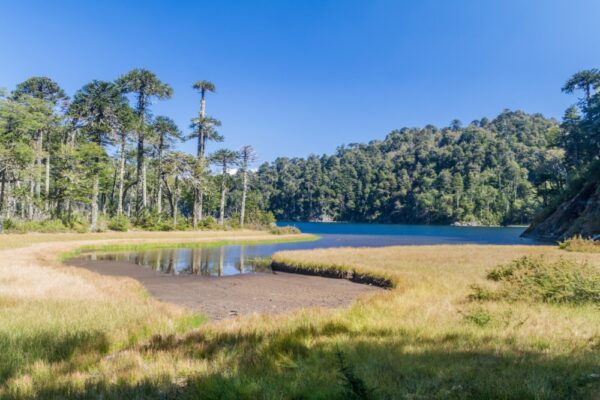
This is a true hiker’s paradise. Located just 35km from Pucon, this national park is famed for its ancient araucaria trees. The oldest tree is 1,800 years old and their seeds are a staple food in the diet of indigenous mapuche tribes. Within the park, there are two main trails for visitors to enjoy.
Park entrance fee is 5,200CLP for international visitors during the high season (November-March) and 3,200CLP during the low season (April-October). Buses leave from Pucon at 08:30 and the last one returns at 19:00. Make sure you bring enough drinking water with you. The only place where you can refill with drinkable water is at the entrance of the park.
The easier of the two trails is the Los Lagos Circuit, which explores the parks crystal clear lakes and lagoons. This route is perfect for beginner to intermediate hikers and the total time to explore the circuit’s five deep-blue lagoons is between 4-5 hours.
If you’re looking for something a bit more challenging, the San Sebastian trail might be better suited. This trail takes you through a magical araucaria forest until you reach Cerro San Sebastian for a 360-view of the entire region, including nine volcanoes. The total hiking time is 5-6 hours with 1200m of uphill climbing. The last hour is probably the most difficult part of the trail, involving some scrambling to reach the top. Follow the orange painted rocks that will lead you to the summit — and enjoy the views.
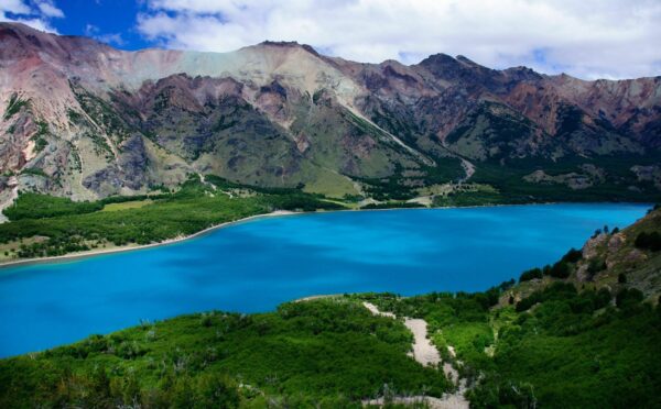
I think Jeinimeni National Reserve in Chile Chico, Patagonia might just be Patagonia’s best-kept secret. This national reserve has been around for years but only now has popped up on the radar thanks to the newly-formed Patagonia National Park that brings Lago Cochrane National Reserve, Patagonia Park and this reserve together as one giant natural wonderland.
The park has a 7.4km trail that takes roughly four hours to complete. You'll see the beautiful milky turquoise lake and walk through valleys, dense forests and even see ancient paintings from the nomadic Tehuelche people who travelled between Argentina and Chile 14,000 years ago.
Ojos del Salado is the world's highest active volcano and it straddles the border between Argentina and northern Chile. The full trek to the summit can take between seven to 20 days and is considered an intermediate hike but gets tricky in the last 30 metres as you climb the summit on fixed ropes. The main reason people fail to reach the peak is through not acclimatising properly.
Starting from the town of Copiapo, expeditions will typically spend nights at four shelters on the way to the summit, including the shimmering turquoise lake of Laguna Verde (4342m), before ascending to Refugio Claudio Lucero (4540m), Refugio Atacama (5100m) and Refugio Tejos (5833m).
The mountain can be climbed between December and March. During November and December, wind speeds can be a challenge while hiking. The peak season runs between late December and March and is your best chance to get good weather, but you’ll meet plenty of people who are also climbing to the summit. Be aware that climbers will need permission from Chile’s Direccion de Fronteras y Limites (DIFROL) to climb. You can get authorisation on their website.
I've been living, working and hiking in Chile since 2015, and while there's no doubt that Torres del Paine is one of the crown jewels of South America, you'd be hard-pressed to call it a hidden gem. If you're looking for a Chile hiking experience without the blockbuster appeal (and crowds) I'd vote for the epic Pacific Coast Trek which has been developed by Amity Tours in the Mapu Lahual Indigenous Park network. This is a fabulous option for experienced hikers. You can hike along pristine coastal beaches and ancient Patagonian temperate rainforests and share in the ancestral knowledge from some of Chile’s most important indigenous communities.
Distance: 11 miles (17 km)Duration: Six to ten hoursStart/end point: Pehoé LakeDifficulty: Moderate
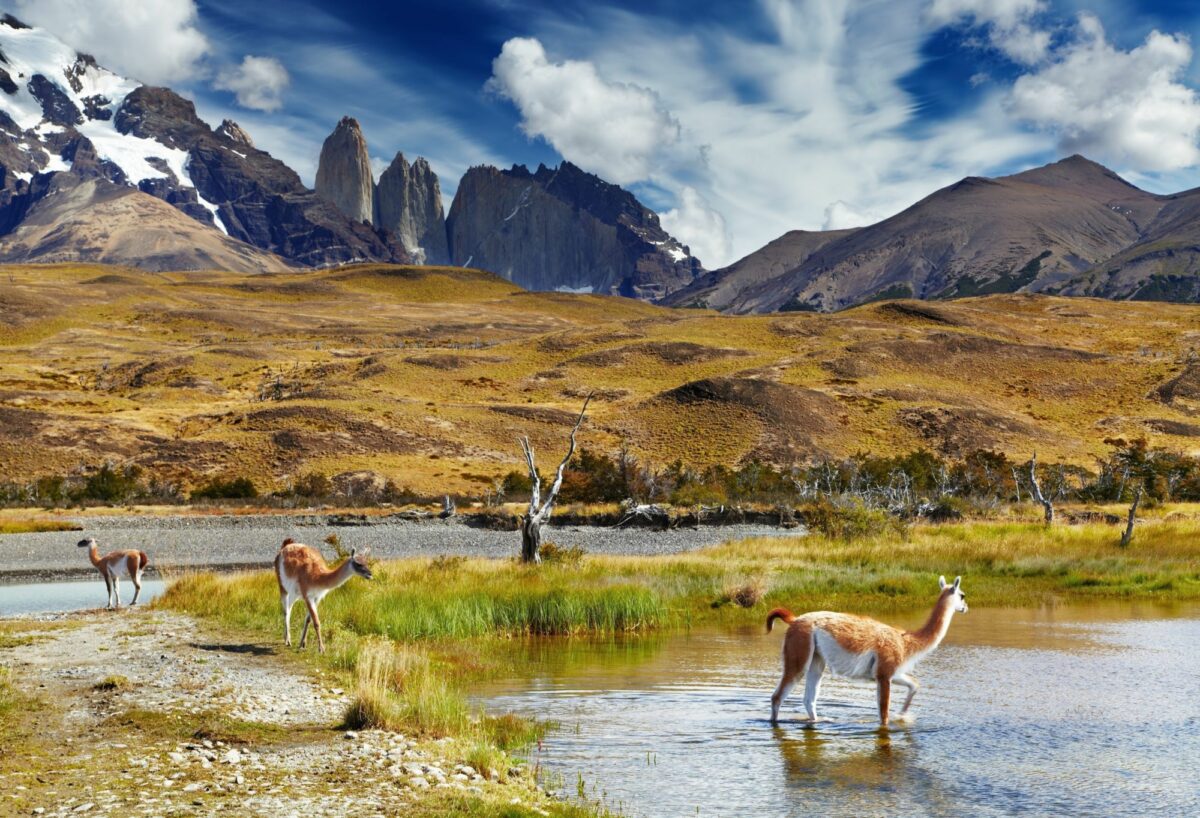
Torres del Paine’s splendid French Valley (Valle del Francés) is a naturally-formed amphitheatre encircled by sheer cliffs, hanging glaciers and dramatic rock formations. The valley rewards hikers for their efforts with a 360-degree view of the park where the elements and scenery play off each other as if competing for your attention. As you stand surrounded by the valley, the peaks, cliffs and glaciers will make you feel humble and small, and yet energised and intimately connected to your surroundings.
To reach French Valley you’ll first take a catamaran journey across Pehoé Lake, followed by a 1.5 hour hike up glacial moraines towards the valley’s entry point. Some operators also include an easy detour to the Salto Grande waterfalls on the way.
Once in the valley you’ll be bowled over by the 360 degree view that envelopes you as you venture further into the valley until you’re fully encircled. The valley’s geology amplifies the groan and roar of glacial calving as ice breaks off the constantly flowing French Glacier.
You’ll get stunning views of the park’s most impressive formations: the Hoja (Blade), Máscara (Mask), Espada (Sword), Catedral (Cathedral), Aleta de Tiburón (Shark’s Fin) and Fortaleza (Fortress), plus views of Paine Grande, the highest mountain in Torres del Paine at 2,884m (9,462ft).
The lakes of Torres del Paine get their otherworldly, milky-blue hues from particles of "rock flour”, caused by the steady grinding of rock and ice under the region’s vast glaciers and ice sheets.
Like most of Torres del Paine’s main sights, the French Valley is best accessed during the warmer months. As it gets cold, severe weather can come without warning and completely blanket the views of the valley.
Distance: 7.5 miles (11km)Duration: Six hoursStart / end point: Park entrance or Puerto NatalesDifficulty: Moderate
Seen from afar or studied up close, the exquisite Glacier Grey is a true Torres del Paine highlight. Take in the ice monolith from its lookout point, then come up close and personal on a boat trip that brings you within metres of the intricate puzzle of blue, white, glass and turquoise ice.
Most day hikes follow a trail that leads to a lookout point that affords stunning views of the glacier and offers a sense of its immense size. Trips may or may not complete the entire walk, as the trail involves several ascents and descents that not everyone will be prepared for. Check with your operator.
Afterwards you’ll board a small boat on Lake Grey to sail among the icebergs right up to the glacier’s ice wall. From up close you’ll see countless hues of blue and impossibly complex ice structures. If you’re lucky you’ll see a glacial calving, where ice breaks off from the constantly moving glacier.
As with the rest of Patagonia, the weather here is changeable and boat trips may sometimes be cancelled depending on conditions. Trips with fewer than the minimum 10 passengers may also be called off. Check with your operator on their contingency plans.
Distance: 3.7 miles (6 km)Duration: Four to six hoursStart/end point: Park entrance or Puerto NatalesDifficulty: Moderate
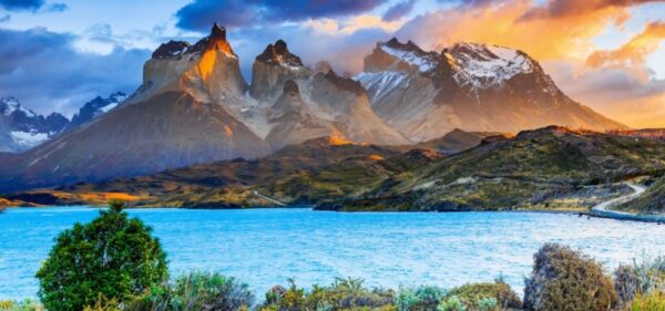
I think this short hike packs more of a punch than any other short walk in Torres del Paine National Park, and is a must whether or not you’re doing either the W or the Circuit. This is the view of the famous ‘horns’ of Paine, with a mighty waterfall thrown in for good measure.
The trail follows the northern shore of Lake Nordenskjöld between two accompanying and juxtaposing sights. On the one hand, the multi-shaded drama of the Cuernos (horns), jutting up into the sky; and on the other, the arresting blue of the lake.
This fairly flat hike holds a lot of appeal as it fringes Lake Nordenskjöld with its startling shades of blue.
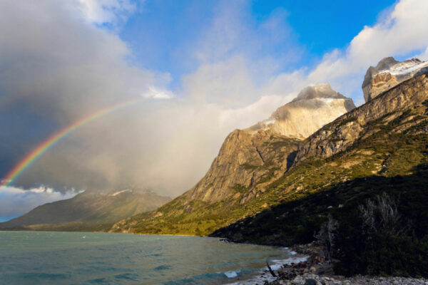
If you’re looking for one of the best photo ops of Torres del Paine’s iconic peaks, look no further. This hike has it. Paso Los Cuernos hiking route holds some of the best views of the iconic Los Cuernos. The picturesque cuernos are made of black slate sitting atop a grey granite base. This layered combination of colours, along with their twisted horn shape, win them their fame.
It’s common for hikers to complete this trek between Refugio Los Cuernos and one of the park’s hotels. It’s also part of the W and Paine Circuit trails, so you’ll see regular traffic during spring and summer.
Distance: 11 miles (17 km)Duration: Seven to ten hoursStart/end point: Park entrance or Puerto NatalesDifficulty: Moderate
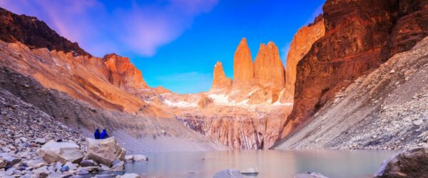
If you don’t have time for the W or the Circuit but want a glimpse of that amazing view of the granite towers which give the area its name at dawn, this one might be for you. However it’s a long ascent, and frankly if you’re going to Torres del Paine National Park and hiking this which forms part of the W anyway, I think it would be an enormous shame not to do the whole thing!
Distance: 47 miles (75 km)Trek duration: Four to five daysStart / end point: Park entranceDifficulty: Moderate to strenuous
Torres del Paine is Chile's big-hitter, pulling more trekkers than the rest of the country combined. The views are unparalleled, trekking infrastructure and services are world-class, the only downside is the park’s seemingly unlimited appeal which means you’ll be sharing the views with plenty of other hikers.
This shorter version of the Full Circuit includes many – but definitely not all – of its highlights, and is the busiest section of the national park. Despite preferring the Circuit because of the wonderfully remote northern half of the trail, the W is still an incredible hike, and given the chance I’d do it again in a heartbeat.
Distance: Approx. 11 miles (18 km)Duration: Six to seven hoursStart and end point: Tahai to Anakena beachDifficulty: Mild
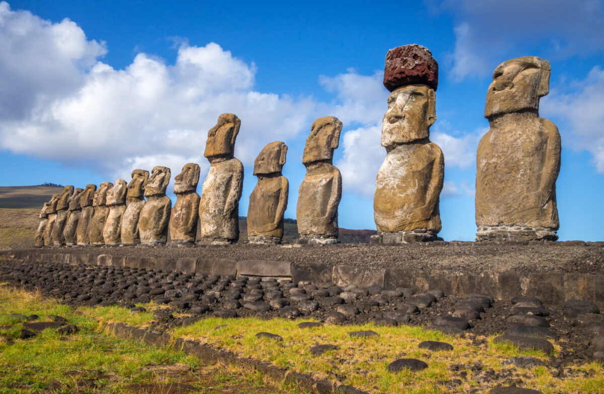
A speck of land cast some 3,500km from the mainland, the story of the rise and fall of the Rapa Nui civilisation is fascinating and tragic in equal measures. Best known for its enigmatic statues (Moai) and stunning beaches, Easter Island is perfectly scaled for hiking.
North Coast Trail is a spectacular but challenging day hike along the remote and rugged northern coast of Rapa Nui.
The route begins at the Tahai Ceremonial Complex, which is within walking distance from Hanga Roa, the island's only town. Tahai hosts three significant ahu, or ceremonial platforms, featuring restored moai statues—a breathtaking sight at sunrise or sunset.
From Tahai, the trail takes you along the coast, passing some important archaeological sites including Ahu Tepeu and Ahu Akivi, the latter of which is unique for its seven inward-facing moai. Further along the path, you'll encounter Puna Pau, a small crater that served as the source for the red scoria stone used to carve the moai's topknots, or pukaos.
The hike also provides the chance to see other intriguing sights, such as fallen moai, petroglyphs, and caves. You'll walk through varying landscapes, from rugged coastline to rolling pastures, occasionally encountering wild horses.
The final stretch of the hike brings you to the beautiful Anakena Beach, one of only two sandy beaches on the island. Anakena is also home to the Nau Nau ceremonial platform, with some of the best-preserved moai on the island. From here you’ll take a road transfer back to Hanga Roa – this must be pre-arranged in advance!
Distance: Approx. 28 miles (45 km) Duration: Six days Start and end point: Puerto WilliamsDifficulty: Strenuous
The Dientes de Navarino trek is one of the southernmost treks in the world, departing from the town of Puerto Williams on Navarino Island in Chilean Tierra del Fuego. It's renowned for its rugged beauty, remoteness, and the spectacular, tooth-like peaks that give the trail its name - "Dientes" means "teeth" in Spanish.
The hike is a circular route that takes you through untouched Magellanic forests, over mountain passes, past beautiful lakes, and gives you stunning panoramic views of the Beagle Channel and Cape Horn.
The trek involves multiple steep ascents and descents, and the trail often involves hiking over rocky, uneven terrain. Additionally, the region's weather can be extreme and change rapidly, with strong winds, rain, and even snow possible, even in the summer months.
Distance: Approx. 13 miles (21 km) Duration: Eight to ten hoursStart and end point: Valle Avilés Difficulty: Moderate
The trail is approximately 21 kilometres long and takes about 8-10 hours to complete, making it a challenging but achievable day hike for those with good physical fitness. If you prefer a slower pace or wish to fully enjoy the experience, you can turn it into an overnight trek as there's a designated camping area along the route.
The Lagunas Altas Loop is so named because it takes you past several high-altitude lagoons, offering beautiful views and opportunities to observe local wildlife. It's a moderate-to-difficult hike with some steep ascents and descents, but the rewards are incredible panoramic views of the park, including vistas of the Chacabuco Valley and the distant Jeinimeni and Tamango ranges.
The trail starts and ends at the park's visitor centre, and along the way, you'll traverse through lenga forests, alpine meadows, and rocky landscapes. One of the highlights is the view of the Avilés River, which carved the stunningly beautiful Avilés Valley.
Distance: Approximately 7 miles (11 km) round trip Duration: Six hoursStart and end point: Puerto Río Tranquilo Difficulty: Mild
The Exploradores Glacier day hike is a fantastic experience if you're in the Aysén region of Chilean Patagonia.
The trail is located in the vicinity of Puerto Río Tranquilo, a small town known primarily for its proximity to the stunning Marble Caves. However, the opportunity to get up close to a glacier makes the Exploradores Valley a noteworthy destination in its own right.
This trail leads you to the viewpoint of the Northern Ice Field and the Exploradores Glacier, a part of the massive Patagonian Ice Fields.
The trek starts off easy, meandering through a forest, but gets progressively more difficult as it ascends through moraines and rock fields. The last section requires walking on the glacier itself, which demands special gear like crampons, and in some cases, ropes and ice axes.
From the viewpoint, the sight of the Exploradores Glacier is a stunning spectacle, with its immense wall of ice surrounded by sharp peaks. On a clear day, you may also be able to spot Mount San Valentín, the tallest peak in Patagonia.
Distance: 51 kmDuration: Three to four daysStart and end point: Villa Cerro Castillo Difficulty: Moderate-strenuous
Located in the heart of Aysen Patagonia, this jagged mountain peak is getting more attention from hikers and is said to be the "next Torres del Paine" just without the crowds.
There are two main hiking routes in Cerro Castillo, a single day hike to the meltwater lake of Laguna Castillo, or the Cerro Castillo Circuit (aka Cerro Castillo Traverse), a roughly 50km trek that takes around three to four days of backpacking.
Both routes offer constant views of Cerro Castillo and its glaciers. There are panoramic views of the Turbio River and the Ibáñez River and you can even spot huemules, a native deer-like animal hidden in the trees along the path. Whichever option you choose, it’s worth going with a guide.
The full route is moderate to challenging, with some steep ascents and descents, and it is often compared to the more famous W-trek in Torres del Paine National Park, but with fewer crowds.
The trail takes you through diverse landscapes, including old-growth forests, rivers, glacial lakes, and vast moraines. One of the main highlights is the view of Cerro Castillo's glaciated peak, particularly stunning from the vantage point of the glacial lake at the base of the mountain.
The trek involves a combination of camping and hiking, with designated campsites along the route. These campsites are basic and do not offer amenities like food or gear rental, so hikers need to be fully self-sufficient and carry all necessary equipment and supplies.
The trail is relatively well-marked, but it's still recommended to carry a map and compass (and know how to use them). Always register with park authorities before starting the trek, and let someone know your plans.
Distance: Approx. three miles (4.8 km) round trip Duration: Two to three hoursStart and end point: Chaiten Volcano trailheadDifficulty: Mild
This park to the far north of Chilean Patagonia was named in honour of Douglas Tompkins, the visionary entrepreneur who was a driving force for conservation across Patagonia. Ragged mountains give way through forests of Alerce trees towards what must be one of the world’s most spectacular coastlines.
The Volcán Chaitén trail here is an absolutely stunning day hike. The Volcán Chaitén is a volcano situated within the boundaries of the park, and it famously erupted in 2008 after being dormant for over 9,000 years. The eruption dramatically reshaped the surrounding landscape and the hike gives you a firsthand look at nature's powerful processes.
The trail to the volcano's rim generally takes about two to three hours to complete depending on your pace. It's a steep ascent, often over rough volcanic terrain, so it can be challenging, but the view from the top is worth every bit of effort.
From the top, you can see the resurgent lava dome in the centre of the crater, an impressive testament to the volcano's most recent eruption. There are also panoramic views of the surrounding valleys and forests, some still showing the effects of the 2008 eruption.
Distance: Approx. 32 miles (52 km) Duration: Five to seven days Start and end point: Vizcachas Trailhead, Parque Tantauco Difficulty: Moderate
One of my favourite places to hike in Chile, Chiloé Island boasts spectacular national parks, wild coastlines and thick forests. Parque Tantauco, a large private nature reserve at the island's far southern tip, is a walkers' paradise. Its 118,000 hectares are home to rich biodiversity and significant conservation areas, which include unique ecosystems of cold rainforests, peat bogs, and a variety of endemic and threatened species.
The Sendero Transversal, or Transversal Trail runs from the northern sector of the park (Renihue) to the southernmost part (Inío).
The trail traverses dense forests to stunning coastline. Along the way, there are numerous camping areas and shelters. These amenities are basic, and you'll need to carry all your necessary supplies, including food and camping gear.
Distance: Approx. 14 kmDuration: Five to six hoursStart and end point: Park entranceDifficulty: Moderate
Huerquehue National Park is a true hiker’s paradise. Located just 35km from Pucon, this national park is famed for its ancient araucaria trees. The oldest tree is 1,800 years old and their seeds are a staple food in the diet of indigenous mapuche tribes.
Within the park, there are two main trails for visitors to enjoy. The easier of the two trails is the Los Lagos Circuit, which explores the parks crystal clear lakes and lagoons. This route is perfect for beginner to intermediate hikers and the total time to explore the circuit’s five deep-blue lagoons is between four to five hours.
If you’re looking for something a bit more challenging, the San Sebastian trail might be better suited. This trail takes you through a magical araucaria forest until you reach Cerro San Sebastian for a 360-view of the entire region, including nine volcanoes. The total hiking time is five to six hours with 1200m of uphill climbing. The last hour is probably the most difficult part of the trail, involving some scrambling to reach the top. Follow the orange painted rocks that will lead you to the summit — and enjoy the views.
Distance: Approx. seven miles (11 km) Duration: Five hours Start and end point: Conguillío National Park entrance Difficulty: Mild
The Sendero Sierra Nevada is a popular day hike within Conguillío National Park and is considered one of Chile’s most beautiful hikes.
With a bit of luck, you might spot species such as the Magellanic Woodpecker or even the elusive Pudu, the smallest deer in the world.
The main highlight of the hike, however, is the panorama from the Sierra Nevada Lookout: breathtaking views of the park, including the Llaima Volcano, Lake Conguillío, and the surrounding araucaria forest.
Distance: Approx. 75 miles (120 km)Duration: Eight to ten daysStart/end point: Amarga Lagoon ranger stationDifficulty: Strenuous
Despite the huge number of visitors, and Chile’s insistence on building a large number of lodges as well as luxury hotels within the national park, I still consider this one of the most breathtakingly beautiful hikes on the planet.
If your hiking boots demand more, this is the trek for you. You’ll spend days with rivers, glaciers, mountains, and take in wild, rugged views which stretch out as far as you can see. The Full Circuit makes its way around the entire Paine Massif, taking in the same highlights as the W Trek – plus so much more.
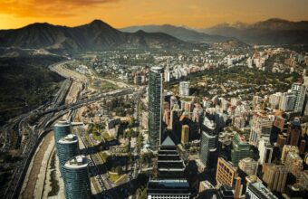
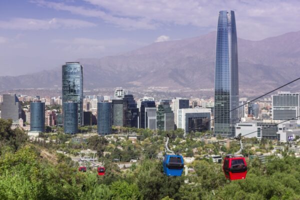
Take the cable car or walk up to San Cristobal Hill for a stunning panorama of the city. It’s a great way to see the city before going on to explore its vibrant street art, galleries, beautiful parks and colonial architecture up close, perhaps via a bike tour. Look out for Plaza de Armas and La Moneda Presidential Palace.
This route brings together some of Patagonia’s world-renowned ecosystems whilst also giving a good dose of city life. Start with a tour of Buenos Aires, the home of Tango, before flying down to the scenic Patagonian town of El Calafate. From here you will visit the monumental Perito Moreno glacier and Glaciers National Park, where you can hike amidst glacial lakes, forests and the towering granite monoliths of El Chaltén, Cerro Torre and Fitzroy. Stay at a traditional estancia before travelling over to Torres del Paine National Park in Chile. Here you can enjoy hiking, cycling and nature watching before flying from Puerto Natales to Santiago to end your journey.
A popular cruise itinerary combining the fjords of Chilean Patagonia and the Antarctic Peninsula.
Set sail from Valparaíso and cruise through the channels and dramatic fjords of Chilean Patagonia. After stopping to explore Cape Horn, cross the infamous Drake Passage and sail south to the Antarctic Peninsula.
Spend at least a week exploring the frozen desert, its noisy penguins, pods of whales and abandoned whaling stations before returning north to Ushuaia.
This suggested 19-day cruise from Chile to Antarctica is a great route for seeing the highlights of Chilean Patagonia and Antarctica in one expedition.
The journey begins in Chile's capital, Santiago, before heading south to Punta Arenas in Patagonia, across the Drake Passage towards the Antarctic Peninsula. After exploring the White Continent the trip heads back north back through Patagonia to explore the incredible fjords of Cape Horn and Torres del Paine national park.
A 10-day route that calls at some of Argentina and Chile's absolute highlights. Spend some time in cosmopolitan Buenos Aires before heading south to El Calafate and the spectacular Glaciers National Park. Then hop across the border into Chile to visit Torres del Paine, one of the most beautiful national parks on earth. From here head to Puerto Varas to explore Chile's Lakes District, before crossing back into Argentina to finish your trip in the picturesque town of Bariloche on the shores of Lake Nahuel Huapi.
Explore the highlights of Chile with an additional cruise of the spectacular Patagonian fjords. From Santiago fly north to experience the otherworldly Atacama, the driest desert on earth. Then head south to the Lakes District, a landscape of glacial lakes and mountains. From here head even further south into Patagonia itself where you can spend several days hiking, biking and enjoying the remote beauty. Finally board a small-ship cruise to sail around the southern edge of Tierra del Fuego to legendary Cape Horn.
A two-week route that somehow manages to pack all of Chile's top highlights into one manageable trip. After a couple of nights in Santiago head south to Torres del Paine National Park for several days of easy-going adventures in wild Patagonia. From here wind your way back north, calling in at Puerto Natales, the stunning Lakes District and Chiloé Island. From here bunny hop to the far north and explore the strange landscapes of the Atacama Desert before heading back to Santiago and on to Colchagua Valley for a cycling tour of the region's wineries.
Your details are safe and will not be used for any other purpose. By using this service you agree for us to share your details with your chosen tour operator according to our Privacy Policy.
1Your trip
2Complete your request
3Meet your specialist
Find a Chile specialist
Tell us about your trip and we'll find your match
We'll connect you directly with the experts.
Connect with Martha Cohen, Maria Abud Campomar, Marie-Lou Goullieux and 3 other Chile specialists.
We'll connect you directly with the experts.
Connect with Martha Cohen, Maria Abud Campomar, Marie-Lou Goullieux and 3 other Chile specialists.