The best walking holidays in the UK
An essential guide to planning a walking holiday in the UK
Walking holidays in the UK: Overview
I’ve been walking in the UK for decades, revisiting the popular spots and seeking out hidden gems in my role as a travel journalist and TV researcher.
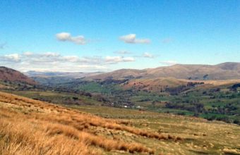
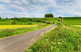
If you're planning a walking holiday in the UK, you'll already know the obvious – and often busy – hotspots; the Cotswolds, Lake District, the Scottish Highlands, and so on. But beyond the honeypots there are countless places you may not have heard of. If I had to pick an absolute best place to walk in the UK, it would be my native southwest; the counties of Cornwall, Devon, Somerset and Dorset, but all the following recommendations are well worth your time.
In the following pages I’ll give you my personal recommendations on the UK's best walking holidays – the popular spots, plus some of my favourite hidden gems. Lace up your boots and happy walking!
The best walking holidays in the UK
The UK's most popular walks and some hidden gems
-

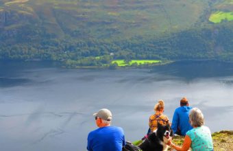
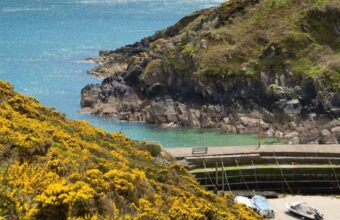
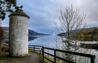
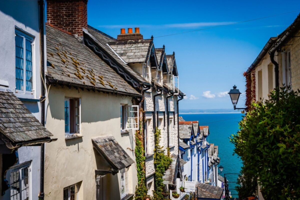
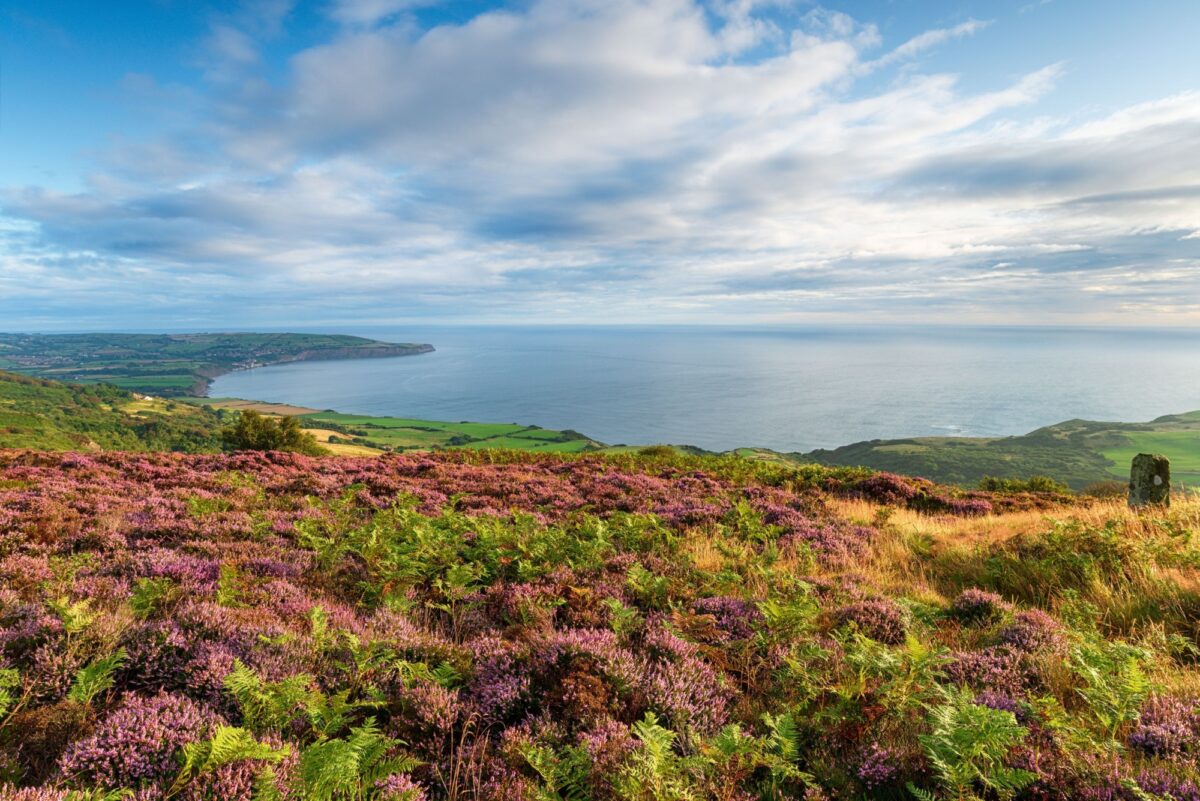
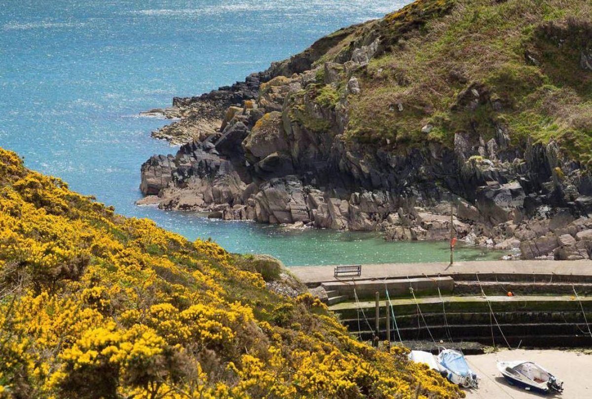
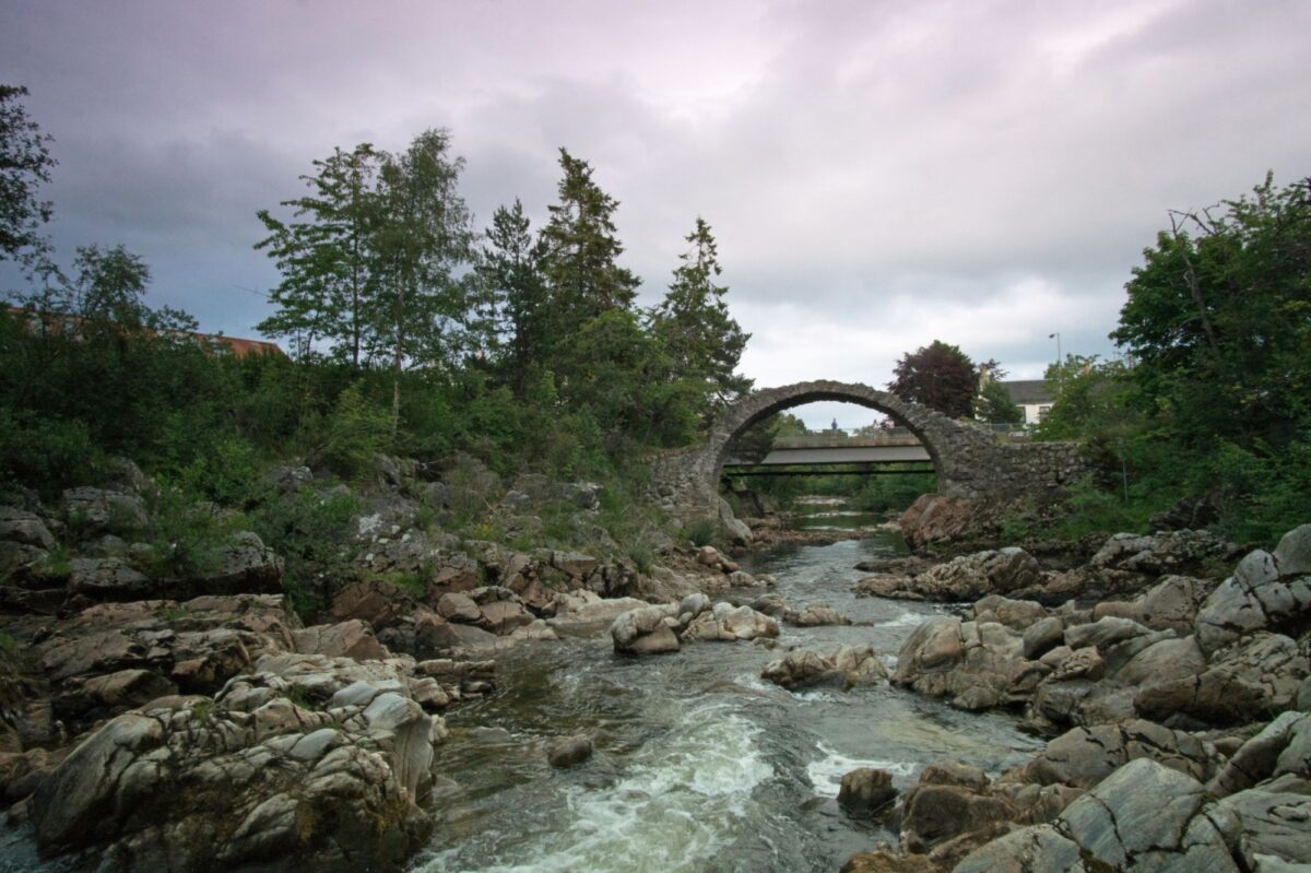
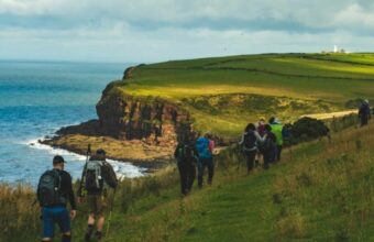
South West Coast Path
-

Wainwright's Coast to Coast Path
-

Pembrokeshire Coast Path
-

Walk the Golden Valley Pilgrim Way
Herefordshire's lesser-known walking holiday
-
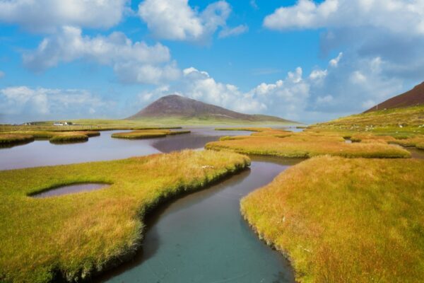
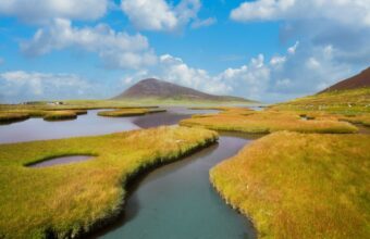
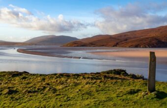
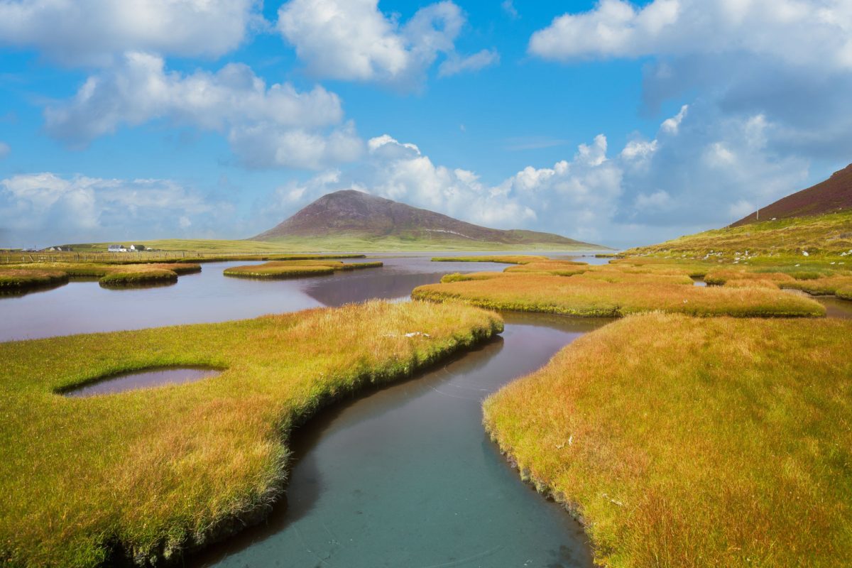
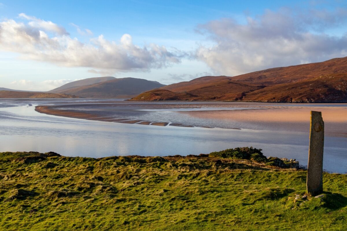
The Hebridean Way
-

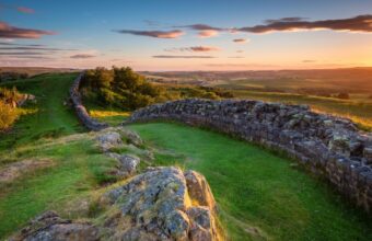
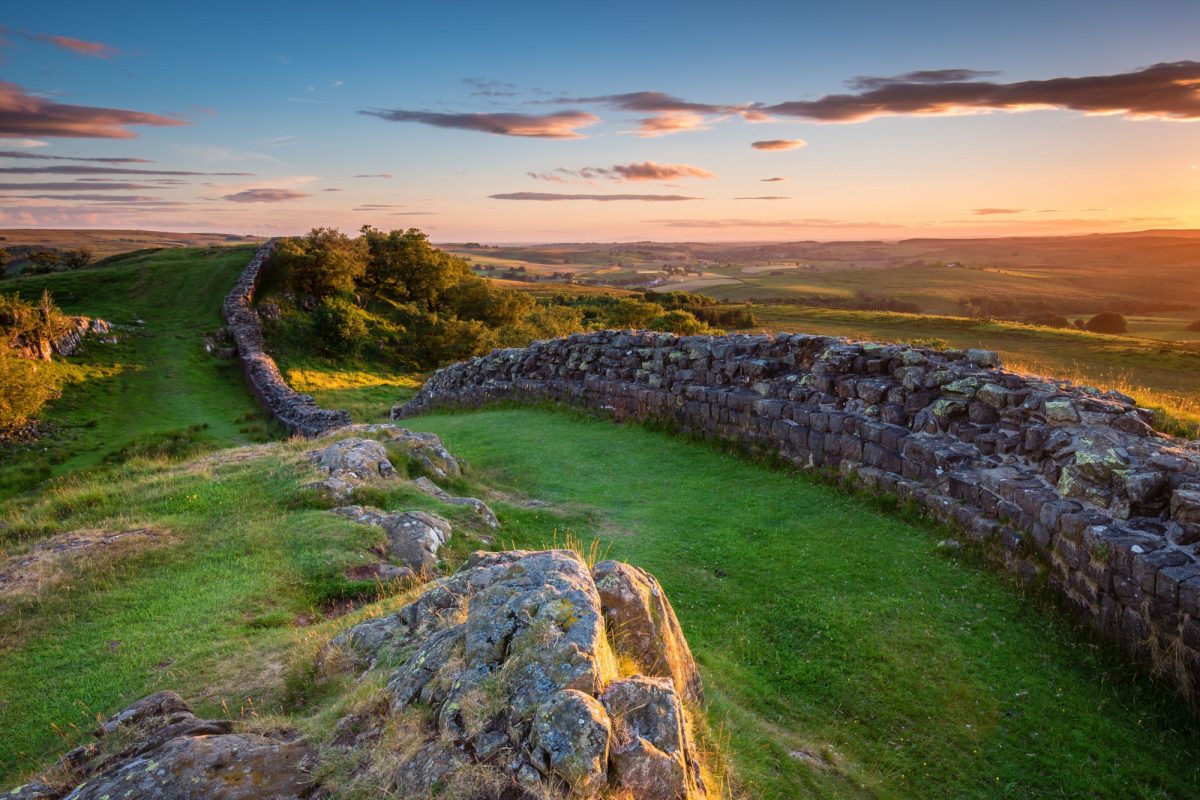
Hadrian's Wall
-
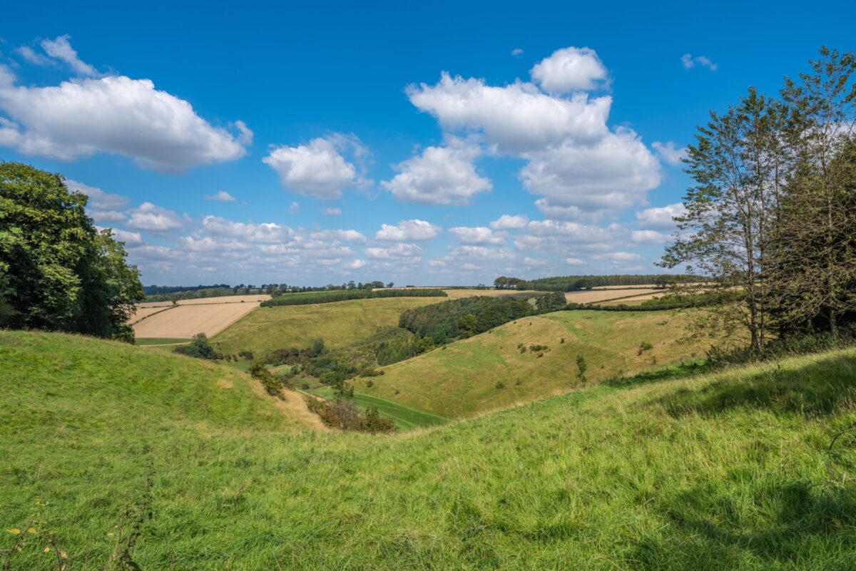
Yorkshire Wolds Way
-

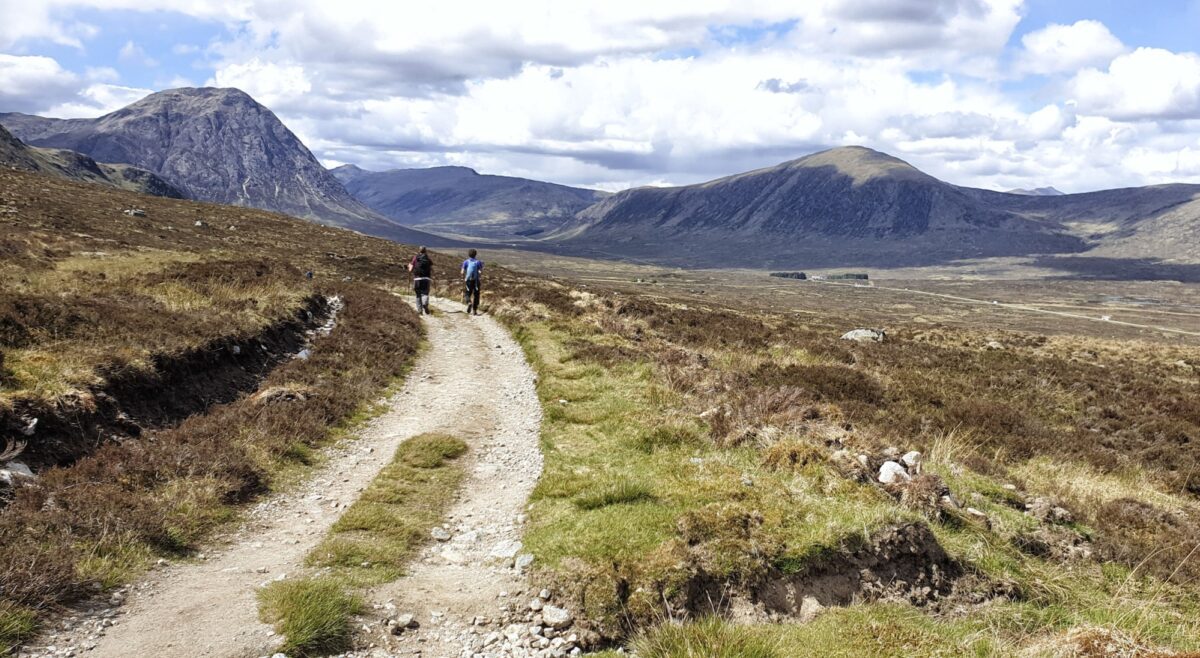
The West Highland Way
-

The East Highland Way
-

The John Muir Way
-

The Monarch’s Way
-
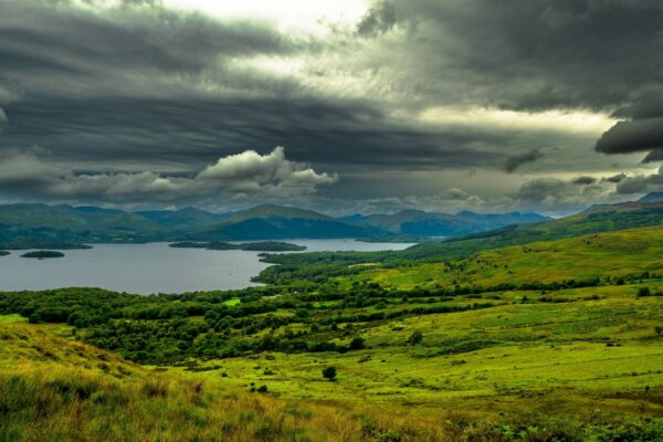
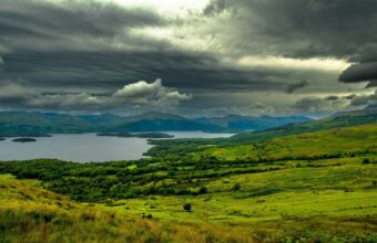
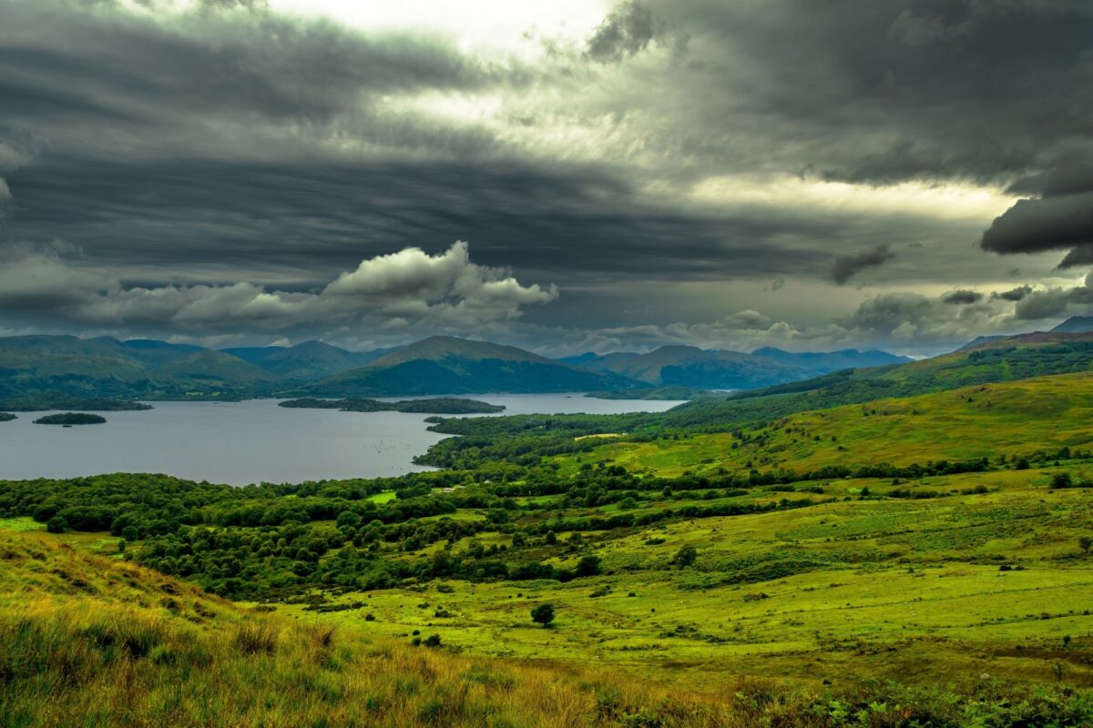
Loch Lomond & the Trossachs
-

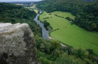
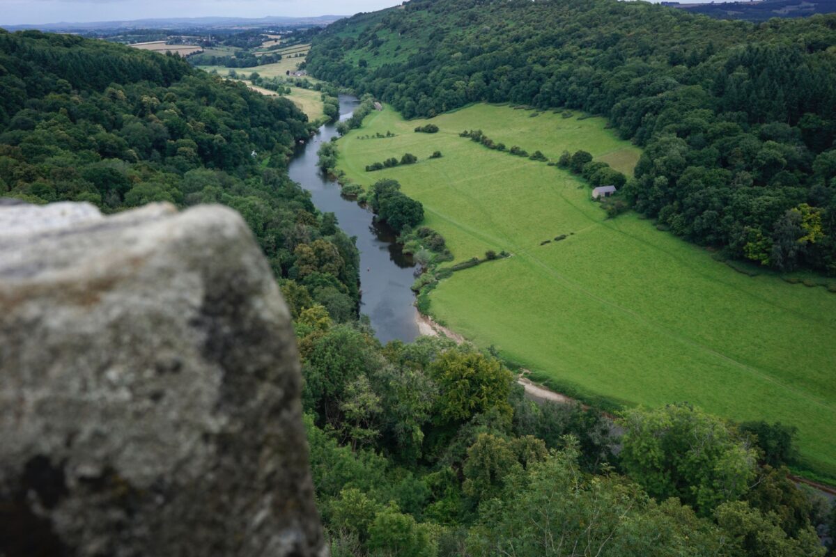
The Wye Valley Walk
-

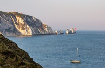
Isle of Wight coastal path
-

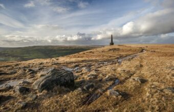
The Pennine Way
-

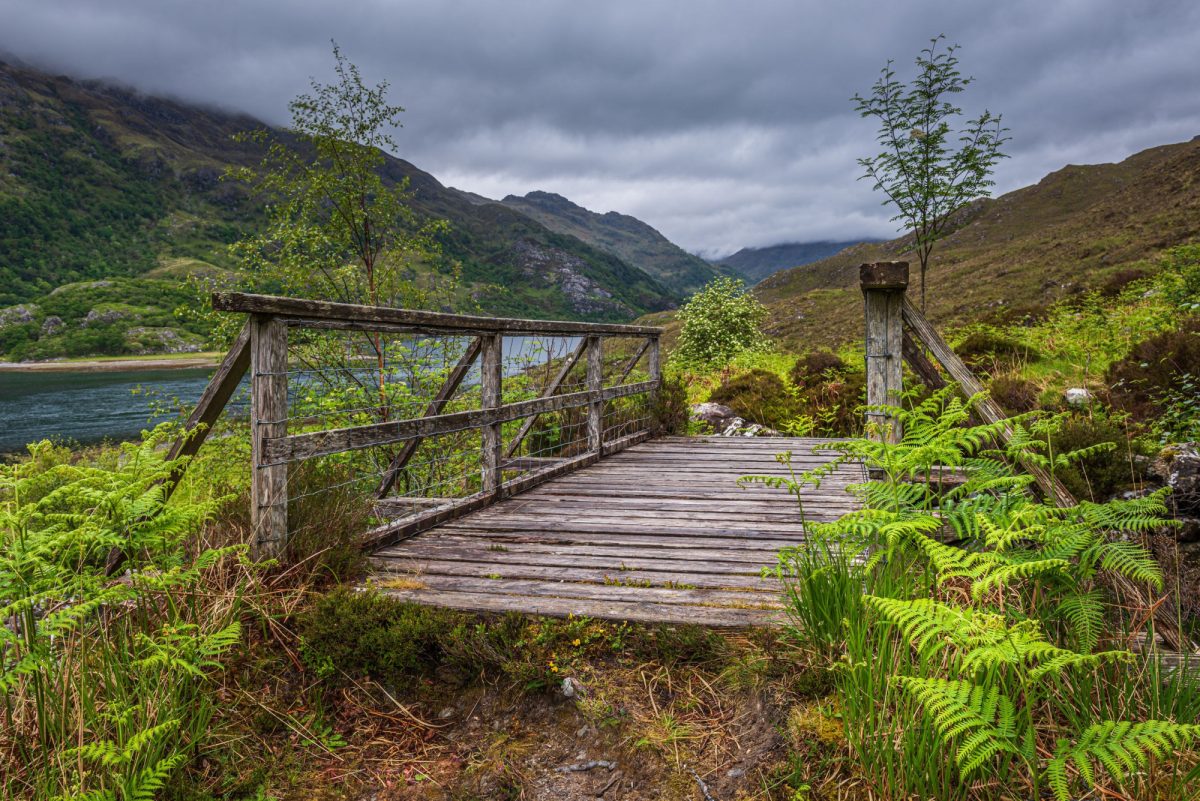
Knoydart Peninsula
-
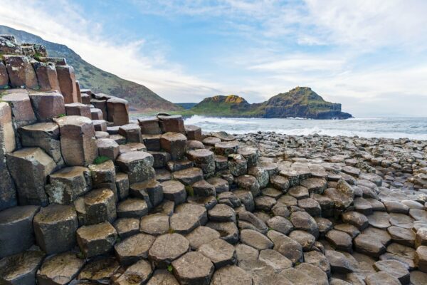
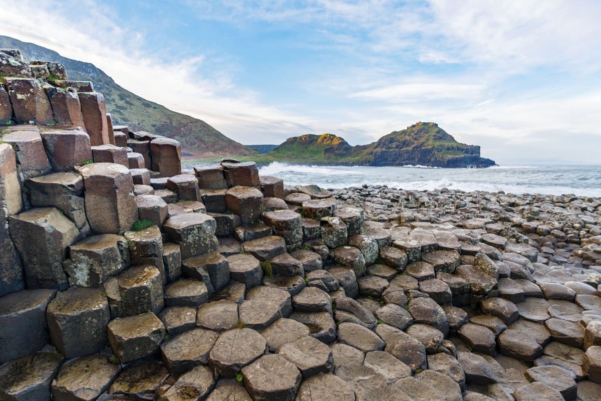
Causeway Coast Way
-

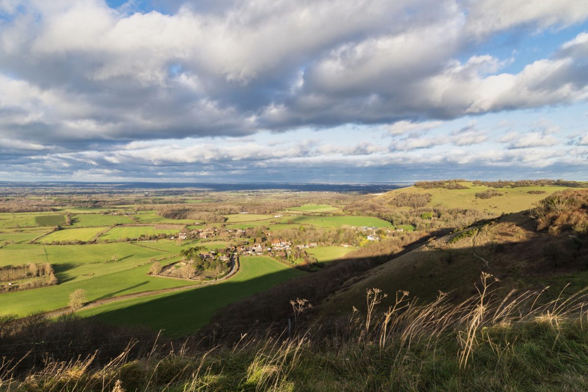
South Downs Way
-

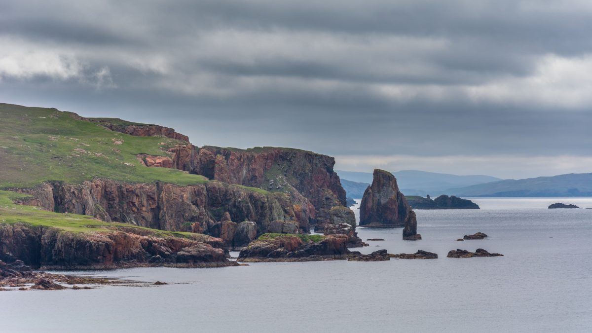
The Northern Isles
-

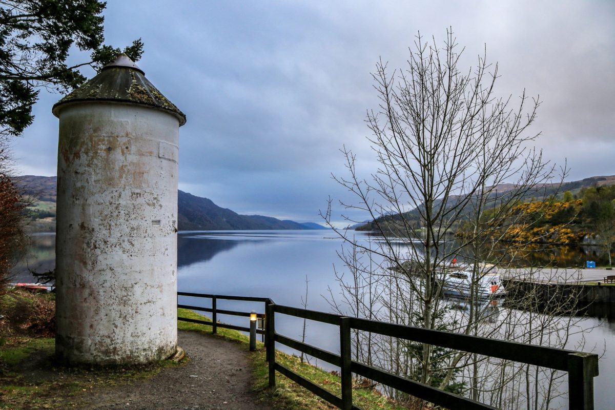
The Great Glen Way
-

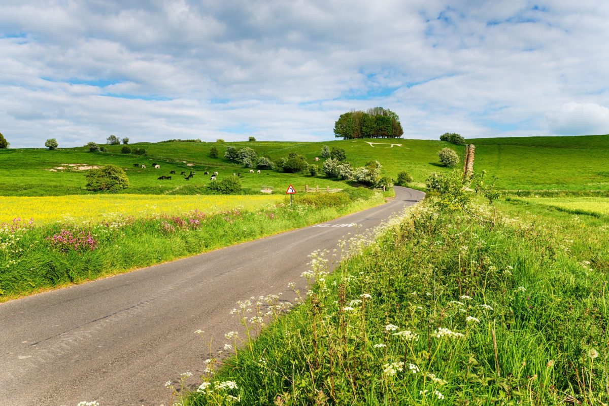
The White Horse Trail
-

The Speyside Way
-

The Cape Wrath Trail


featured UK walking holidays
featured UK walking holidays
Where to go walking in the UK
Our experts' top picks for a UK walking holiday

England
The Southwest
Best for: scenic inn-to-inn walking holidays
Easily my favourite place in the UK to walk, although as it's my home patch I may be biased.
England’s southwestern peninsular of Cornwall, Devon, Somerset, Dorset and Wiltshire has the mildest climate and a varied coastline, which explains why it’s the UK’s most popular holiday area.
Across the southwest walkers will find some serious wild moorland areas and a few cities, but generally the landscape comprises rolling farmland that’s never far from the sea.
Expect crowds at holiday times but the positive side of the area’s popularity is a huge choice of accommodation that means inn-to-inn walks are an easy option. Organised self-guided walks are commonplace, with several specialist operators to choose from.
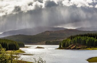
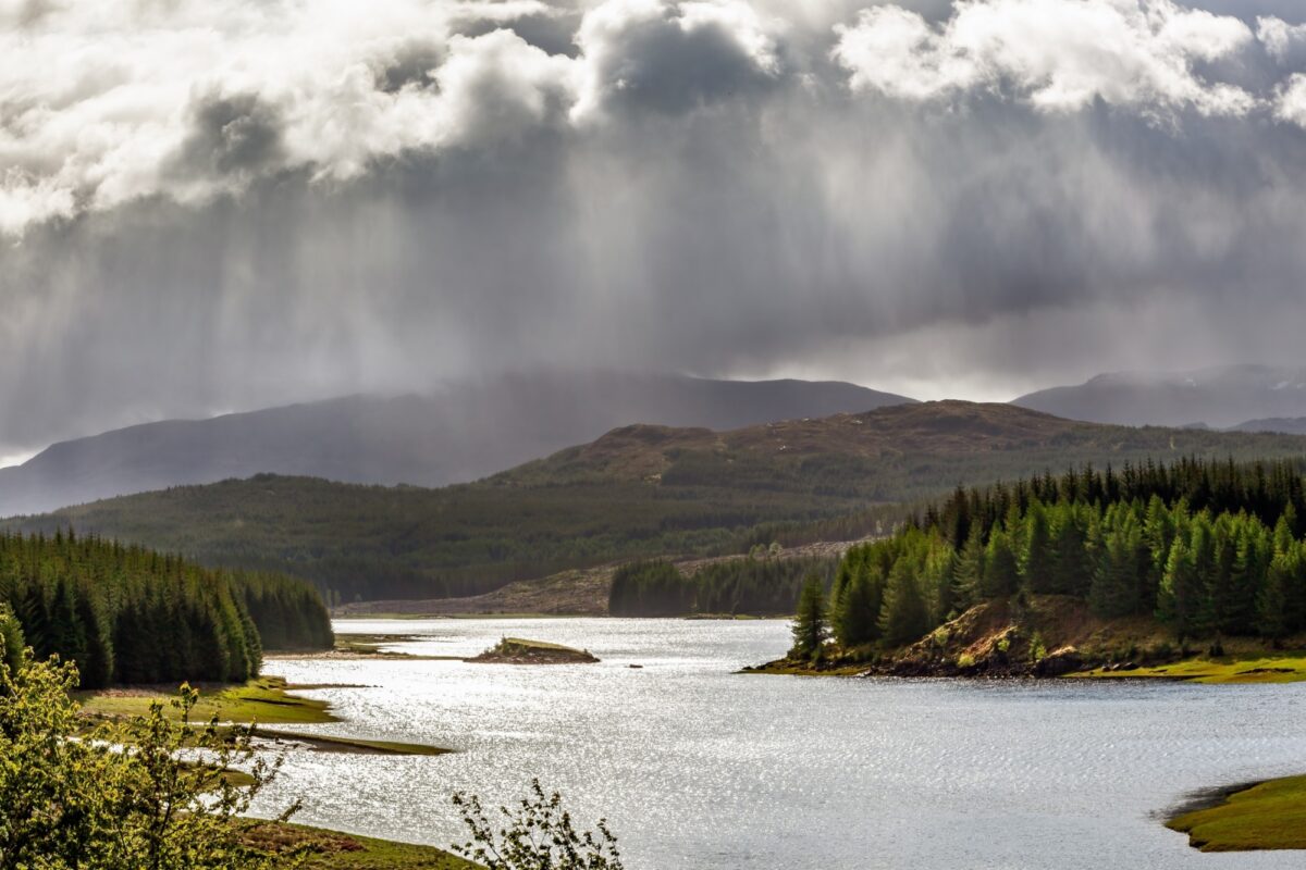
Scotland
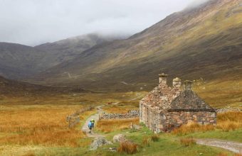
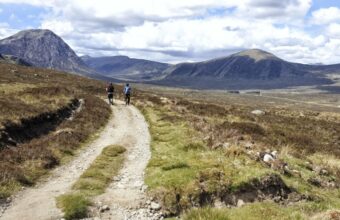
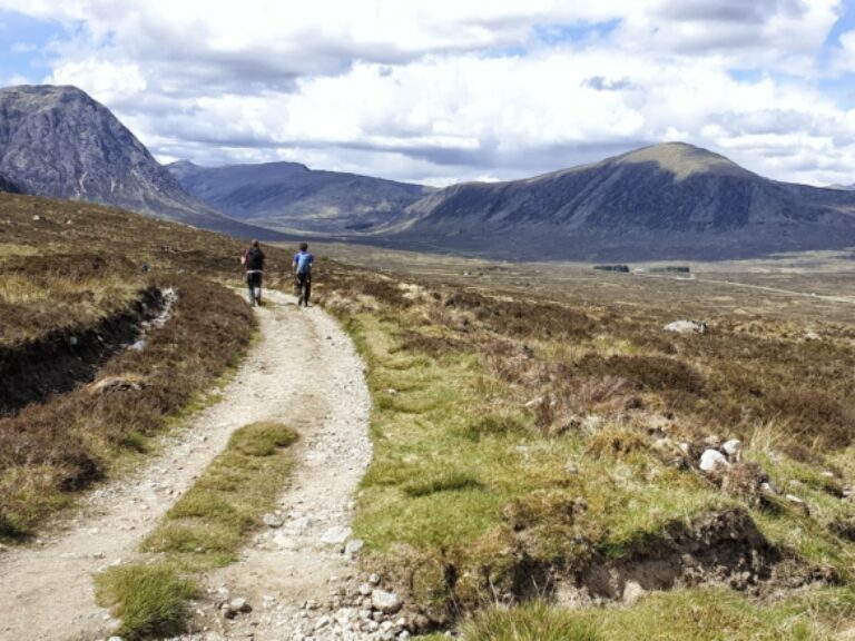
Scottish Highlands
Best for: mountains & wilderness walking
Scotland’s geological fault line runs from the Isle of Arran in the south-west to Stonehaven in the north-east, delineating the dramatic Highlands from the more gently rolling landscapes to the south. This vast, sparsely populated area is the closest thing to true wilderness in the UK and is a justifiably popular region for serious hiking.
The Highlands is a vast region with landscapes that are suitable for hikers of all abilities. Families and inexperienced walkers might enjoy the easy-to-moderate woodland and shore paths of the Trossachs while the northwest Highlands and the wilder reaches of the Cairngorms present a challenge for even experienced multi-day trekkers and hillwalkers.
England
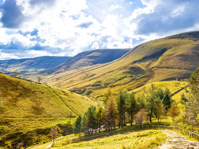
The Peak District
Best for: shorter or centre-based walking holidays
The Peak District was the UK's first national park, established in 1951 to carve out a protected space between the encroaching industrial cities of the midlands and northern England. The national park and the UK's 'right to roam' laws owe their existence to the struggles of ordinary working people who, in the 1932 Kinder Trespass, forced private landowners to grant public access to the nation's beautiful but previously restricted countryside.
Divided by a geological fault line between the gritstone 'Dark Peak' and the limestone 'White Peak', the landscape switches from open, even severe-looking, moorland to the north and secluded dales and quaint farming villages to the south.
Its proximity to motorways and several major cities means the Peak District gets busy in places, particularly around pleasant but popular honeytraps such as Dovedale, Castleton and Matlock. But with nearly 2,000 miles of public footpaths and rights of way, it's still very easy to find yourself alone and enjoying empty trails and wide open views. The northern Dark Peak is generally quieter, as is the far south on the border with Staffordshire.
Aside from the Pennine Way, which starts in Edale, there are no major long-distance walks here. It's more a place for a short walking break, perhaps based in one of the ten magnificent YHAs to be found in the Peaks.

Wales
Pembrokeshire
Best for: stunning and remote coastlines
Think South Wales is all industrial heritage and dour coastal cities? Think again: most of the southern half of Wales is rural, and the Pembrokeshire coast is truly glorious.
The 186 mile Pembrokeshire Coast Path is one of the finest long-distance footpaths in the country. It can be done in around 16 days, or in shorter segments.

England
The Lake District
Best for: hill walking holidays
Perhaps the most famous walking region in the UK, the Lake District offers a chance to wander lonely as a cloud amid impressive landscapes of mountains and water.
The choices for walkers range from England’s most serious climbing routes to gentle lakeside circuits. The two main hazards to consider are that the main roads and towns get very busy with day trippers and tour buses in the summer months, while the fells include challenging terrain to be taken very seriously.
Across the Lakes the transport network can be a limiting factor. Roads are narrow and sometimes jammed. Nevertheless there is a huge range of places to stay, from farm B&Bs and hostels to luxury hotels and suiting either inn-to-inn or centre-based walking holidays.

England
Northumberland
Best for: remote hills and desolate castles
There’s a large area between the Tyne and the Scottish border that is little troubled by tourists but full of walking possibilities. It’s not a widely marketed destination for inn-to-inn walking holidays and luggage transfer services may be patchy.
In fact England’s least populated countryside includes no cites and few towns, so expect to have to plan inn-to-inn holiday routes carefully around limited accommodation and transport links. Much easier is a centre-based walking trip, either based on the coast or in the Cheviots.
England
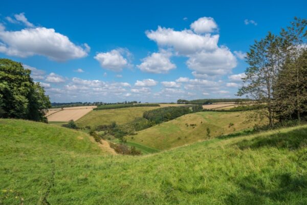
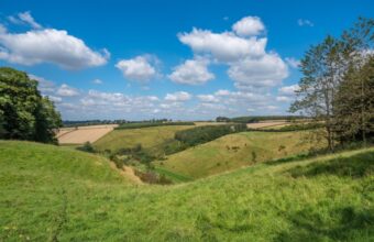
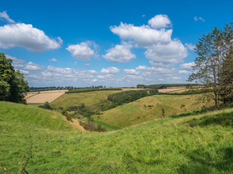
Yorkshire Wolds
Best for: unpretentious & quiet walks
Yorkshire isn't known for its modesty, especially not when it comes to the well-known (and busy) Dales, Moors and Peak District. In comparison, the Yorkshire Wolds is a quiet and unpretentious stretch of gentle countryside and very quiet paths. The Yorkshire Wolds Way is the best long distance walk you've never heard of; expect homely inns, B&B’s and guesthouses, real ales and hearty traditional food.

England
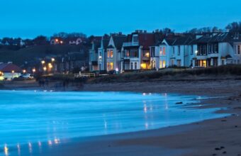
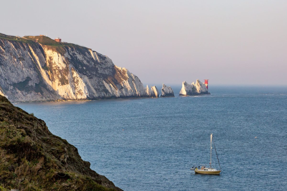
The Isle of Wight
Best for: glorious coastal walking holidays
With a varied and fascinating coastline of 60 miles, the Isle of Wight is bigger than many outsiders expect. Safe, quiet and untroubled by mountains or wilderness areas, it has become one of England’s most popular walking destinations. There are no motorways or cities to avoid, instead expect peaceful, pretty landscapes, yachting harbours and wooded estuaries, old-fashioned seaside towns and rolling downland.
Northern Ireland
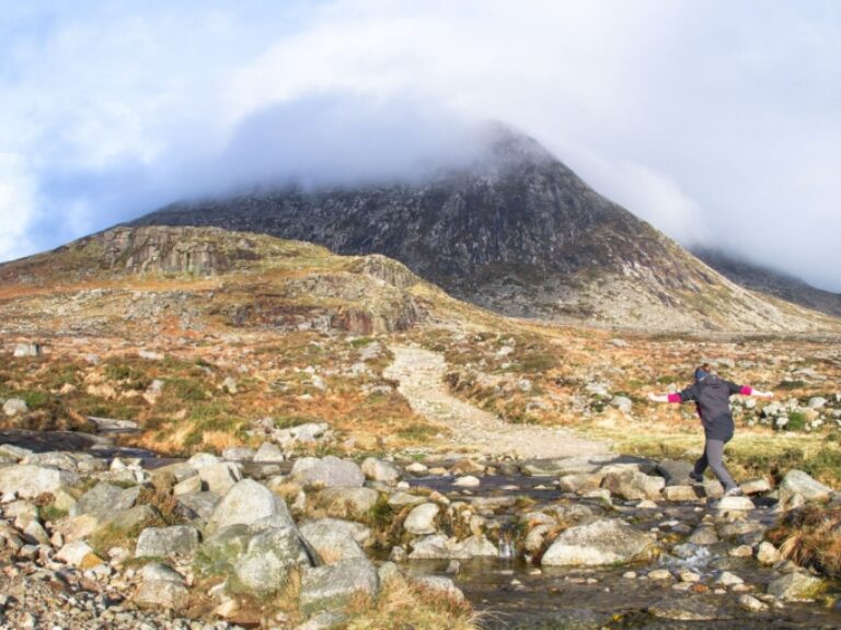
The Mourne Mountains
Best for: blissfully uncrowded walking holidays
Northern Ireland is a fantastic place to escape the UK's more crowded walking destinations. With stunning mountains, coast and moorland, it offers as much for the keen hiker as Scotland, Wales or the more rugged corners of England, just with a fraction of the visitor numbers.
The Mourne Mountains, Northern Ireland's highest hills, are a firm favourite with excellent trails that skirt granite-topped peaks and rolling foothills.
Taxis are geared up for walkers with baggage transfer services available, but most people come here for centre-based walking holidays tackling a new day hike each morning.
England
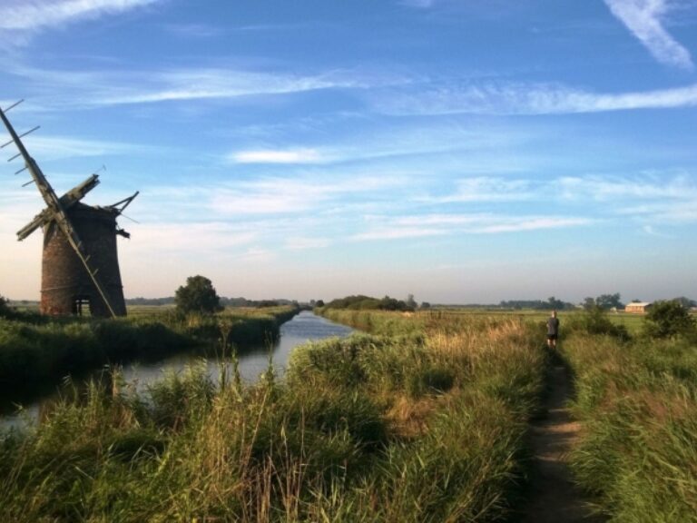
East Anglia & Norfolk Broads
Best for: gentle and flat walking holidays
Hillwalkers look away now. This is Britain’s flattest region with pancake landscapes stretching to the hazy horizon in all directions. Walkers will be able to explore easy flat paths through gorgeous examples of rural lowland England, with frequent pastoral scenes looking like Constable paintings.
Expect a good transport network but plan accommodation ahead because in rural parts options can be limited whether you are travelling inn-to-inn or based in one spot.

England
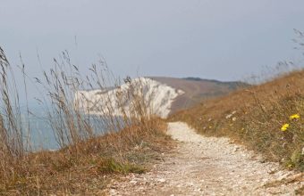
The Southeast
Best for: accessible & easy-going walking holidays
You won’t find wilderness areas along the south coast between Kent’s ‘Garden of England’ and Poole Harbour. Instead walkers enjoy safe and generally easy, well-maintained paths with excellent infrastructure and access.
Expect a mix of coast and well-manicured countryside with long stretches of chalk downland between the two. Most walks include pretty river valleys and rolling farmland with a scattering of affluent villages and towns serving London commuters or escapees.
Accommodation and transport options are plentiful and varied, making the southeast suitable for most types of walking holidays.
England
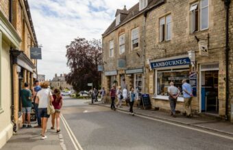
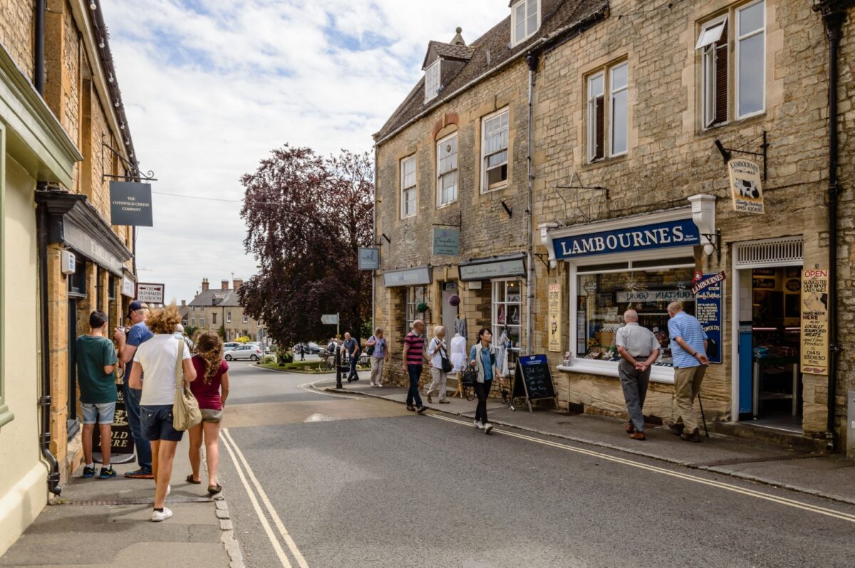
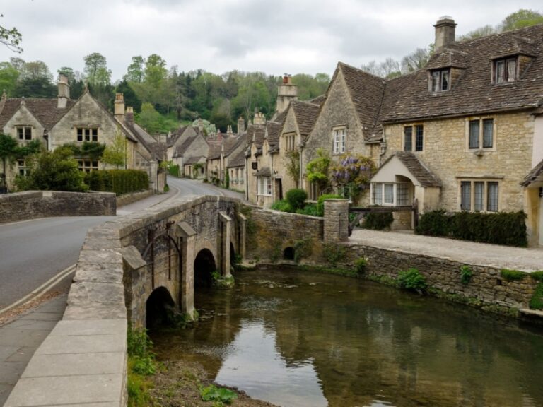
The Cotswolds
Best for: classic English countryside walking holidays
For a glimpse of classic English limestone countryside with rolling hills, leafy vales, dry stone walls and pretty, if sometimes twee, villages, try some of the paths criss-crossing the Cotswold region. Footpaths are generally good quality, waymarked and well maintained, and the en-route facilities are good.
The region suits either point-to-point trails or centre-based walkers. Walkers may find the honey-pot villages too busy with day-trippers at peak times but the comprehensive network of footpaths makes it easy to escape the crowds that rarely go beyond the teashops and car parks. Avoid the tour-bus problem altogether by sticking to the picturesque fringes of the region, like Warwickshire and South Gloucestershire.
Expect accommodation generally on the pricey but exquisite side. Gentrified gastro-pubs are plentiful, but you’ll need to search hard for traditional ‘working village’ pubs.
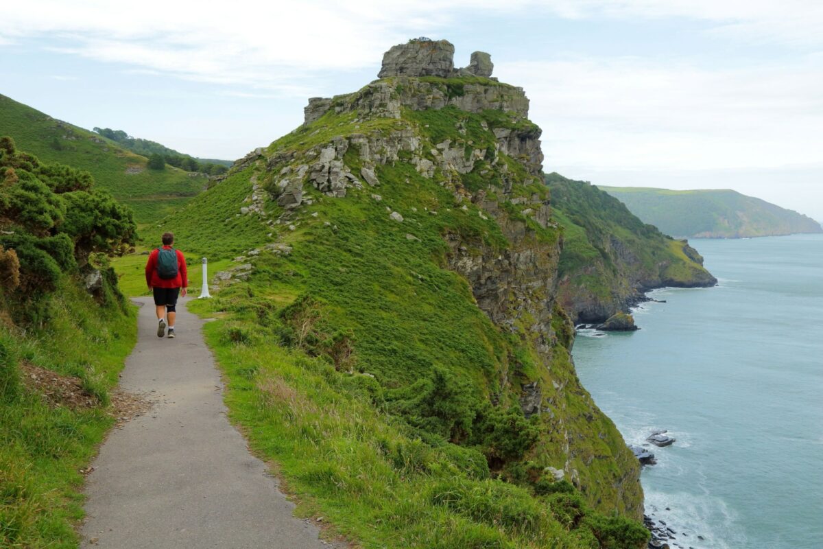
Valley of the Rocks, Exmoor, on the South West Coast Path
Walking holidays in the UK: Need to know
Everything you wish you'd known before you booked
The United Kingdom is a walking holiday paradise: Hundreds of thousands of miles of well-mapped public footpaths, beautifully varied landscapes, excellent hospitality, and easily accessible. It’s no wonder this is a nation of walkers.
From the Scottish Highlands to the South Downs and almost everywhere in between, walker-friendly accommodation, well organised baggage transfer services and convenient transport connections make organising walking trips a piece of cake.
And don’t forget the British USP: almost every day of walking can be rounded off in that most unique and ancient of British institutions: the village pub, a welcoming place to rest, drink, usually eat, often stay and always experience an easy way to meet the locals.
Self-guided vs guided walking holidays
There are three broad categories of walking holidays in the UK: Fully independent, an organised but self-guided holiday, or an escorted tour, typically with a guide and a group of other walkers.
Fully independent
The cheapest and most flexible option, and particularly easy in the UK. Simply plot your itinerary, book your own accommodation and off you go. On the more popular long distance paths you'll find baggage transfer services, either as a standalone service or an optional add-on from your B&B.
Most walking trails in the UK are well marked, particularly the National Trails and the coastal paths, and they are usually covered by a comprehensive, easy-to-follow guidebook. My top tip: Invest in a walking guide. It’ll be the best £10 you spend on your trip.
Recommended guidebooks
The information on the following pages is intended to help you decide what, when and where your next walking holiday should be. Once you've booked your trip it's wise to invest in a detailed, location-specific walking guidebook. There are lots on the market, the following are particularly recommended:
Cicerone Guides are the best-known source of up-to-date walking guides, with a range of around 350 practical, pocket-sized books and around 30 new editions a year. Expect to pay between £9 and £16 for a guide.
Trailblazer guides are highly recommended by walkers and travel writers alike with a level of detail and usability that is second to none, and large-scale maps that are drawn from scratch.
Look out too for Poucher’s Guides, published by Frances Lincoln and highly rated by walkers. They’re hard to find today other than secondhand from online sources. Other good titles are Crimson Publishing’s Pathfinder Guides or the Inn Way Series.
Organised/self-guided walking holidays
This is by far the most common and popular mode of walking holiday in the UK.
On a self-guided walking holiday a specialist walking company will tailor an itinerary to your level and the distance you'd want to walk each day, and will book your accommodation and baggage transfer for each overnight stop.
There's an obvious benefit to having someone else worry about the logistics and bookings, but the main advantage is tapping the valuable expertise of a specialist travel company who knows the area. They know the terrain and can tailor your daily walking to suit your level, they'll have reliable baggage transfer services, and they'll know the best B&Bs (and may be able to secure preferential rates). Most importantly they'll know all the important little details, such as booking accommodation close to the footpath – it's surprisingly easy to finish a day's walking and realise you're still several miles from your B&B!
Escorted/group walking tours
For those who don’t trust their navigational skills or just prefer to walk with others, escorted tours offer fully supported group walks with an experienced guide. This also removes the hassle of having to plan your trip—a nice feeling when you’re on a holiday. Trips usually include accommodation, transport arrangements, baggage transfer, minibus back-up and, of course, a guide.
The downside is that you won’t be able to stop where and when you want, to take that afternoon snooze on a sunny riverbank, to spend an extra few minutes lining up that perfect selfie, or to take an extra rest day in an idyllic fishing village you discover you have a soft spot for.
Point-to-point vs centre-based walking holidays
Classic point-to-point (sometimes marketed as ‘inn-to-inn’) walking trips follow a single route for the duration of your holiday. This allows walkers to tackle long distance trails and enter into the purposeful mindset of accomplishing a single, longer journey with a rewarding sense of completion at the end.
The downsides are of course a lot of planning for changing accommodation and refreshment on a daily basis. It may mean organising a luggage transfer service, either formally with a specialist company, via taxi, or through your accommodation. You’ll never be settled and feel at home in one place and may be forced to walk to the next accommodation whatever the weather or state of your legs.
Centre-based walking holidays are a more relaxed option, although if your centre is Llanberis in Snowdonia or Windermere in the Lakes you could be in for a very challenging series of day walks. The choice of home base becomes more important if you are spending every night of the holiday there.
If your holiday is more than a couple of days your walks from the same base are likely to involve some repetition, but that’s not necessarily a bad thing if the scenery is truly great. You will never get the same smug feeling of completion at the end of a two-week hike but balance that with the compensation of being able to do something different whenever you fancy or find a short cut back to your accommodation if it starts raining. You can adapt to the weather and your energy levels in a way that point-to-point walkers can’t.
Muddying the waters further is the option of dual (or more) centre trips. There’s nothing stopping you spending several days in one place and then moving on to the next. A specialist walking holiday company can create a suitable itinerary.
How much does a UK walking holiday cost?
Costs vary depending on your chosen flavour of trip and can fluctuate significantly by location. Prices are generally higher the further south you go, but also spike in tourist hotspots like the Lake District and the Cotswolds. Solo travellers will often pay more for accommodation than a couple would pay per person.
Fully independent
(per person)
Accommodation (B&B/walking inns): £50 - £100 per night
Evening meals (in pubs/hotel restaurants): £15 - £20 per day
Baggage transfer, if applicable: around £10 per day per bag
Extras (lunch, snacks, entrance tickets): £5 - £20 per day
Self-guided walking holidays
Between £80 and £150 per person per day, depending on the location. Typically includes accommodation, breakfasts, bag transfers and all other logistics.
Escorted/group walking holidays
One week escorted tour: depending on standard of accommodation, from £700 to £1,000 (including accommodation & breakfast, but no other meals)
Meals: £120-£200
When to go walking in the UK
The UK has a temperate-maritime climate which brings cold, wet winters and warm(er) but also often wet summers. Surrounded by sea, the country has changeable weather that can vary within short distances and timescales. There can be fine bright walking days at any time of the year, but they can just as quickly turn into wet and windy afternoons!
Summer is almost never too hot to walk but winters can bring snow, particularly in Scotland and on high ground in Wales and northern England.
Overall the north is on average four or five degrees cooler and wetter. The southwest and Wales are mildest but due to prevailing winds from the Atlantic get more rain than eastern areas.
Generally the shoulder seasons of spring and autumn offer the best balance of smaller crowds and more agreeable weather.
Aside from the more remote stretches of the Scottish Highlands, you won’t find any genuine wilderness in the UK. But conditions can still turn treacherous even when you’re relatively close to civilisation. Regardless of the month, sensible preparation and packing all-weather gear is essential.
UK walking resources
Maps, walking guides, apps and other trip planning resources for UK walking holidays.
Walking maps
Ordnance Survey: The gold standard of maps and a national treasure.
Harvey Maps: Specialist walking maps in a variety of scales.