Cordillera Blanca treks
Trekking and hiking the world famous Cordillera Blanca range
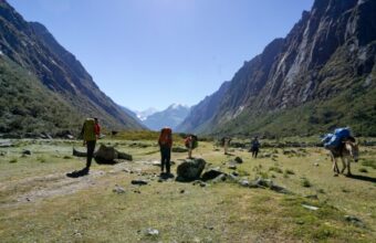
Move over Cusco. The Cordillera Blanca, near Huaraz is the Peru trekking capital for discerning hikers. This famed range is one of the highest tropical mountain ranges in the world and has the highest mountains in Peru, along with 722 glaciers. Trekking here is a serious business, sometimes verging into mountaineering.
There are more than 30 peaks with summits over 6,000 metres, which makes this the most important destination for mountaineering in Peru. The highest peak is Huascarán, at 6,768m. This is a great place to see condors and vicuñas, as well as the Puya Raimondii, the largest bromeliad in the world that can grow to 10 metres high.
Despite its attractions, you will encounter far fewer people here than in the Cusco region. The distance from Machu Picchu and high altitudes in the Cordillera Blanca discourage the more casual trekker.
Fancy your chances? Here's our essential guide to the best Cordillera Blanca treks.
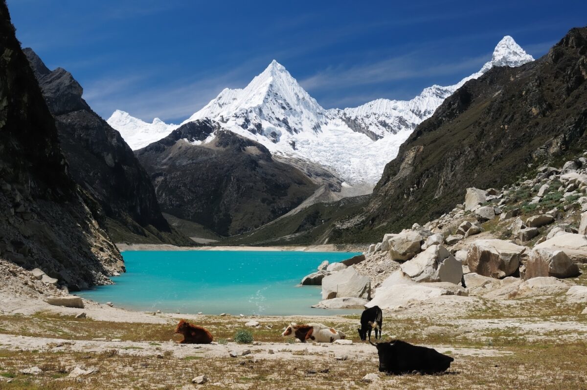
The iconic Cordillera Blanca range near Huaraz
Cordillera Blanca treks
The best hikes in the Cordillera Blanca
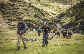
These are the most spectacular, but also the most serious, mountains in Peru. The following treks do not require technical mountaineering skills but are still difficult due to the steepness of trails and the extreme altitude.
For lighter trips out there are also many great day hikes suitable for most hikers and tours that take you to incredible turquoise lakes without much walking.
Here are a handful of the top multi-day Cordillera Blanca treks.
-
Cordillera Blanca
-
Cordillera Blanca
-
Cordillera Blanca
-
Cordillera Blanca
-
Cordillera Blanca
-
Huaraz

Cordillera Blanca
Santa Cruz trek
- Difficulty: Strenuous
- Duration: Four days
- Distance: 47km
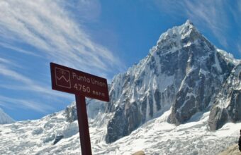
- Max elevation: 4,750 metres
- Start/end point: Cashapampa to Vaquería
The Santa Cruz Trek is considered one of the best treks in the Huaraz region, which also makes it the most commercially available.
The trek takes hikers through beautiful high-altitude landscapes, past crystal-clear lakes, and over high passes, with the option to add on a visit to the nearby Laguna 69. The highest pass is Punta Unión, from which you can see ten of the highest peaks in the Cordillera Blanca, including Alpamayo and Artesonraju.
Most trekkers start in Cashapampa and hike through to Vaquería, though the trail can also be done in reverse. If you are doing this trek without an agency, it is generally easier to get transportation from Huaraz to Cashapampa and from Vaquería back to Huaraz. Stop by the Casa de Guías for free maps and to learn about the current trail conditions.

Cordillera Blanca
The Huayhuash Circuit
- Difficulty: Strenuous
- Distance: 20-108km
- Duration: Two to 12 days
- Maximum elevation: 5,000-5,200m, depending on the route
- Start/end point: Pacllón to Llámac
The trails around the Huayhuash range go by shimmering turquoise lakes, glaciers, high mountain passes and all have expansive views of more glaciers and summits over 6,000m. You may see condors, vizcacha (a kind of chinchilla) and vicuña, the wild cousin of the llama. As the campgrounds are all maintained by local communities, this is a great place to meet Andeans who speak Quechua and maintain their traditional culture and lifestyle.
The Huayhuash Circuit is a challenging multi-day trek which can be adapted for routes as short as two days and as long as twelve days. The Cordillera Huayhuash was made famous by Joe Simpson’s 1988 book Touching the Void, which recounts his nearly fatal climb up Siula Grande (6,344m) with Simon Yates in 1985.
The treks are not nearly as dangerous as attempting to summit the peaks but they are all at high altitude, between 3,300m and 5,200m. All trekkers should check on current conditions with the Casa de Guías in Huaraz before setting out. You can get free maps that are quite basic or purchase detailed topographical maps. There is an extensive network of trails around the Huayhuash Range, which makes it easily adaptable for almost any length of trek. A simple overnight is usually at Laguna Soltera Cocha and the full twelve days is a circle around the entire mountain range.
If you book with an agency, they will provide transportation from Huaraz to the trailhead at Quisipata, near the town of Chiquián. From Quisipata you can hike to either Llámac or Pacllón. If you are hiking alone, enquire about transportation at the Casa de Guías in Huaraz. If you are coming directly from Lima you may start in Cajatambo, but that is not advisable unless you are already acclimated to the high altitude.

Cordillera Blanca
Alpamayo trek
- Difficulty: Challenging
- Duration: Eight to 12 days
- Distance: 80km
- Max elevation: 4,750m
- Start/end point: Hualcayán to Cashapampa
The Alpamayo Trek takes hikers to the base of Alpamayo (5,947m), considered one of the most beautiful peaks in the world. You will trek by numerous glacial lakes and have fabulous views of some of the most famous peaks: Alpamayo (5,947m), Santa Cruz (6,259m) and Pucajirca (6,050m). Even though this is a popular trek, you will see more wildlife than people, especially condors, vizcachas and vicuñas.
The trek can take between eight and 12 days, depending on the route. The shortest route is to start in Cashapampa, closest to the foot of Alpamayo, then exit at the end of the Santa Cruz trek to Vaquería. The full loop starts in Hualcayán and finishes in Cashapampa, though you can also do the trail in reverse. Either way, you’ll go to the town of Caraz from Huaraz to access the trailhead.

Cordillera Blanca
Cójup trek
- Difficulty: Challenging
- Duration: Three days
- Distance: 32km
- Max elevation: 5,050
- Start/end point: Pítec
The Cójup trek is a shorter loop than most Huaraz area treks and a great way to acclimate if you are building up for a longer trek. You’ll walk by the glacial lakes of Tullpacocha, Cuchillacocha and Palcacocha. From the Huapi pass (5,050m) you will have views of five peaks over 6,000m, including Palcaraju (6,274m).
All guiding companies in Huaraz offer this trek and will include transportation from Huaraz. If you are going without a guide, check at the Casa de Guías for maps and trail conditions. Vans to Pítec depart from the corner of Avenida Las Americas and Avenida Agustín Gamarra in Huaraz.

Cordillera Blanca
Olleros-Chavín trek
- Difficulty: Moderate
- Duration: Three days
- Distance: 37km
- Max elevation: 4,700m
- Start/end point: Olleros/Chavín
This is the best trek for people interested in pre-Inca cultures and archeology. It follows a pre-Inca trail used to travel between the Callejón de Huaylas and the Conchucos Valley. When you arrive in Chavín, you should visit the Chavín de Huántar archeological site, which dates from 1200BCE.
This trek is one of the easiest in the Cordillera Blanca and a great option for training for a longer trek or a summit climb. The overall altitude is lower than other treks and the trail does not have the steep sections that characterise the region.
The Olleros Trek is not a loop like most Huaraz region treks. The trail begins in Olleros, a half hour drive east of Huaraz and ends in the town of Chavín. If you do this trek with an agency, they will provide transportation from Huaraz. If you go on your own, there is public transportation available from Huaraz to Olleros and from Chavín back to Huaraz. You can hire llamas to carry your camping gear, which is preferable to mules because llamas’ small feet do not damage the pre-Inca trail.

Huaraz
Qhapac Ñan trek
- Difficulty: Moderate to challenging
- Distance: Various routes, typically around 60 km (37 miles)
- Duration: Five to seven days
- Accommodation: Camping
- Start/end point: Huanuco Pampa
Not really a single trek, Qhapac Ñan ("Beautiful Road" in Quechua) is the name for the 25,000 mile road network that stitched the Inca Empire together from Colombia in the north to Chile in the south.
Only recently discovered (by the tourism industry at least – locals have always known about it), pioneering travel companies are now developing sections of the Qhapac Ñan into commercial treks. This is a truly frontier travel experience, and one that can contribute directly to the preservation of a fascinating but criminally overlooked historical artefact.
Most of the action is centred around the central region near Huaraz, but various routes stretch a long way both up and down the Andes.
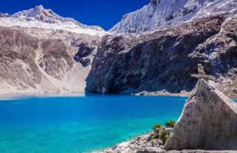
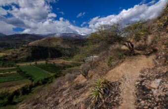
Glorious scenery hiking outside of Huaraz
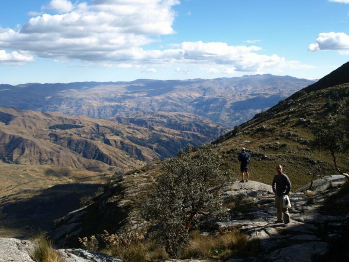
Cordillera Blanca trekking need to know
Essential trek planning and safety information
The entire Cordillera Blanca is within Huascarán National Park and most popular hikes are within the park.
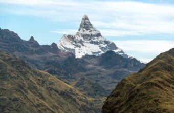
The Cordillera Blanca has some world famous peaks. Huascarán (6,768m) is the highest mountain in Peru and the fifth highest in South America. However, other mountains are even more famous. Artesonraju (6,025m) was the model for Paramount Pictures’ logo when it was designed in 1953. Alpamayo (5,947m) is a perfect pyramid and has been voted the most beautiful mountain in the world. Siula Grande (6,344m), in neighbouring Cordillera Huayhuash, was the scene of Joe Simpson and Simon Yates' epic survival story, Touching The Void. (You must have significant mountaineering experience to summit any of these mountains.)
Note that there is a daily fee for Huascarán National Park. You can buy a pass for several days or pay the daily fee of S/30 ($8). Passes are sold at every park entrance. The Cordillera Huayhuash (pronounced why-wash) is a separate, smaller mountain range that is protected with a nature reserve, though not a national park. Fees for Huayhuash are charged per campground by the community that maintains each one and range from S/10-S/50. You must have cash for campground fees.
The town of Huaraz is the capital of the region and the best base for exploring both mountain ranges. There are several local trekking and mountaineering agencies who hire experienced and licensed mountain guides. Always check with the Casa de Guías (Guides’ House) next to Parque Ginebra near the Huaraz Plaza de Armas on current conditions for any mountain trek. The Casa de Guías is open M-F 9am-1pm and 3:30-6:30pm and Saturday 9am-1pm and always has an expert on hand to answer questions about conditions and routes. This is also a great place to meet guides to ask questions or hire them directly, without an agency.
For any high altitude multi-treks in Peru, having the right maps and gear is essential. If you hire a guide, be sure that they are licensed for high altitude mountain trekking or mountaineering. Note that the mountaineering guide training includes glacier safety while the mountain trekking guide training does not. If you plan to climb any glaciers, you must hire a licensed and experienced mountaineering guide. You must be self-sufficient with food and safety equipment. Search and rescue teams in Peru do not have the same training or resources as their counterparts in Europe or North America.
About the author
Heather Jasper
Based in Cusco, Peru, Heather is an expert on travel to Peru and South America. Heather writes on tourism, trekking, and social issues in Peru for publications including BBC Travel, Fodor’s Travel, Matador Network, Thrifty Nomads, World Nomads, Frommer's, Flashpack, and more. Heather co-founded the Covid Relief Project with Henry Quintano Loaiza to assist vulnerable families in the Cusco region.
Featured tours
Santa Cruz Trek
4 daysFrom $594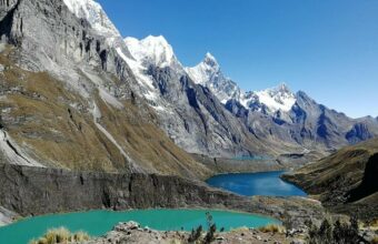
Huayhuash Circuit
9 daysFrom $1,164
Qhapaq Ñan Trek
The original Inca road network
7 daysFrom $2,012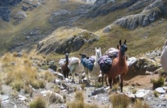
Olleros Trek - Hike to Chavin
3 daysFrom $480