


Road-free Annapurna Circuit itinerary
A new alternative to the classic route
-
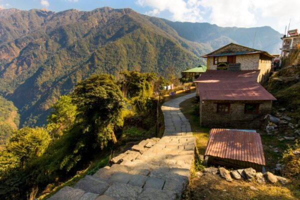
Chame
... -
Upper Pisang
... -
Manang
... -
Manang
... -
Yak Kharka
... -
Thorung Phedi
... -
Muktinath
... -
Jomsom
... -
Marpha
... -
Larjung
... -
Ghasa
... -
Tatopani
... -
Ghorepani
... -
Naya Pul
...
Sadly, the original Annapurna Circuit is not the classic, superlative trek it once was. Road construction has affected up to 75% of the original route, vastly undermining this once iconic trail.
But all is not lost. Thanks to the pioneering work of Nepal trekking guides Prem Rai and Andres de Ruiter, a system of alternative routes – the New Annapurna Trekking Trails (NATT) – stays largely true to the original route while avoiding the worst of the roads.
The road means there are now several places you can start and end your Annapurna Circuit. Few people start from the old kick-off points of Besisahar or Bhulbhule these days; most take a bus from Pokhara or Kathmandu to Besisahar and then a jeep to Jagat or Dharapani and start walking there.
To really minimise road walking I suggest starting the trek even further along in Chame and using the time saved to do one of the more interesting day hikes from Manang, Kagbeni or Larjung.
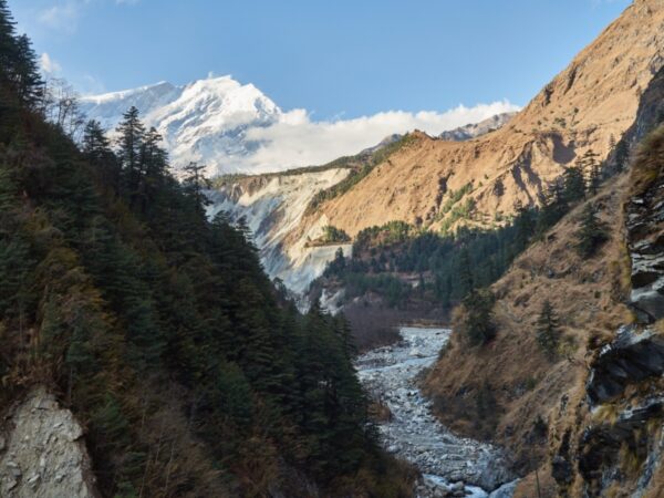
Many people finish their trek in Jomsom, where you can get a flight or bumpy jeep/bus ride to Pokhara. But in my opinion it’s still worth following the NATT trails down the east bank of the dramatic Kali Gandaki gorge towards Tatopani. On this section of the trek, the route follows the roadless eastern bank, often crossing back to roadside villages on the west bank for food and accommodation, before returning to the west bank the next day. It’s also possible to stay in villages on the eastern bank if you don’t mind simpler lodges and homestays.
From Tatopani you can climb away from the road and link up with either the Poon Hill or, much better in my opinion, the Khopra Ridge trek. Both are road free, giving you another few days of fabulous mountain walking.
My final tip: add an extra day to this itinerary for day’s hiking in Larjung or Kagbeni, or add three days to visit Tilicho Lake if you are feeling adventurous.
Key information
| Destinations | Annapurna Region |
|---|---|
| Activity | Adventure, Trekking, Active, Walking, Nature & Wildlife |
| Physical Level | Moderate |
| October - April |
Featured tours
Featured tours
Best of the Annapurna Circuit
Road-free highlights of the famous route
13 days From $1,565 ppRoad-free Annapurna Circuit itinerary itinerary

Dharapani-Chame
Day 1 in Chame
- Distance: 14km
- Duration: Seven hours
- Max elevation: 2,710m
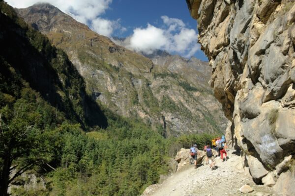
This section is almost all on a dusty jeep road, with only a few shortcuts, so consider hiring a jeep to skip this day. I like the NATT side trail from Karte over the huge suspension bridge of Nache. The side hike up to Odar village to rejoin the road at Bagarchhap is also interesting.

Chame to upper Pisang
Day 2 in Upper Pisang
- Distance: 15km
- Duration: Five hours
- Max elevation: 3,310m
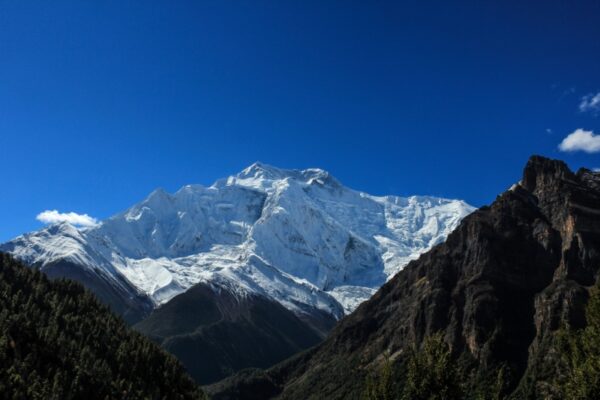
You finally leave the road near Dhukur Pokhari pond (hurray!) and climb to the lovely stone village of upper Pisang, with fantastic views back to the magnificent curved rock face of Paungda Danda.

Upper Pisang to Manang
Day 3 in Manang
- Distance: 15km
- Duration: Seven hours
- Max elevation: 3,670m
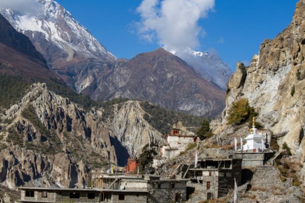
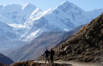
This excellent section climbs to the traditional stone villages of Ghyaru and Ngawal, both of which I’d recommend as an alternative overnight, and offers stunning views of the 8000m Annapurna massif just across the valley. Take the higher route via Julu to Manang and pause to explore the charming village of Bragha; another great alternative place to stay.

Manang acclimatisation
Day 4–5 in Manang
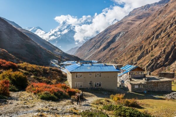
You need two important acclimatisation days in the large, well-supplied village of Manang.
Recommended side trips
While you're here, excellent day hikes include up to Ice Lake or Milarepa’s Cave, or less strenuous options to Gangapurna Lake, Praken Gompa and Bragha village.
A longer alternative route takes in the adventurous three-day detour via Khangsar village and Tilicho Base Camp to the stunning, high-altitude alpine lake of Tilicho Tal, but beware that the exposed scree trail can be hair-raising and even dangerous in places.

Manang to Yak Kharka
Day 6 in Yak Kharka
- Distance: 10km
- Duration: Four hours
- Max elevation: 4,090m
The long climb to the high Thorung La pass starts today, so it’s important to overnight in Yak Kharka to help with acclimatisation.

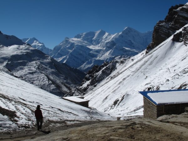
Yak Kharka to Thorung Phedi
Day 7 in Thorung Phedi
Distance: Seven kilmoetres
Duration: Three hours
Max elevation: 4,500m
Another important acclimatisation stop at the simple lodges of Thorung Phedi.
Expect a cold, breathless and fitful night. Consider walking to high camp and returning to Thorung Phedi to help acclimatisation.

Over the Thorung La to Muktinath
Day 8 in Muktinath
- Distance: 16km
- Duration: Seven to nine hours
- Max elevation 5,416m
Today is the big day, with a lung-busting ascent over snow to cross the highpoint of the trek, the 5,416m (17,770ft) Thorung La pass, for a congratulatory selfie beside the prayer flags.
It’s then a long, tiring descent to the sacred Hindu and Buddhist site of Muktinath, and the collection of guesthouses at nearby Ranipauwa.

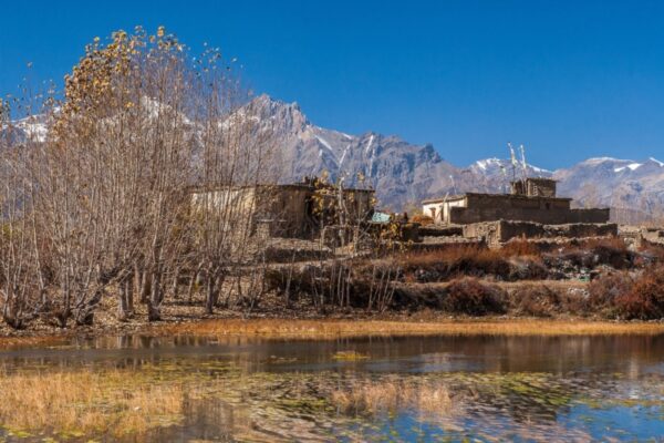
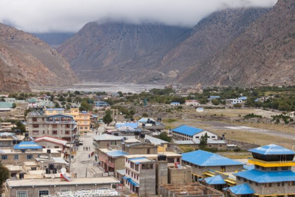
Muktinath to Jomsom via Lubra
Day 9 in Jomsom
- Distance: 19km
- Duration: Five hours
- Max elevation: 3,710m
This alternative route avoids the busy tarmac road and takes you over a ridge into the Lubra Valley, past a pre-Buddhist Bon temple. Before this, I always add on a great three-hour loop detour from Muktinath to the charming Mustang-style villages, monasteries and forts of Chyongkhar, Jhong and Purang.
An increasing number of people end their trek in Jomsom, flying back directly to Pokhara. To me this seems like a waste – you've come all this way, let's finish the job!
Recommended side trip
If you don't mind some road walking, I recommend the timeless village of Kagbeni as an alternative to Jomsom. I generally take a shared jeep on the way south to Jomsom to avoid the valley’s strong afternoon winds.
Kagbeni’s monastery is worth a visit and the atmospheric mediaeval alleys still hold spooky clay effigies of the village’s pre-Buddhist protectors. Kagbeni is the last village before permit-controlled upper Mustang, but you can get a peak of the region on a return half-day hike north to Tiri monastery.

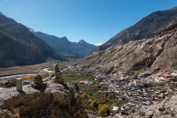
Jomsom/Kagbeni to Marpha
Day 10 in Marpha
- Distance: 12km from Jomsom, 21km from Kagbeni
- Duration: Four to six hours
- Max elevation: 2,920m
Cross the Kali Gandaki at Jomsom along the road to Thini village, then follow dirt tracks to the hilltop ruins of Gharab Dzong, the prayer-flag-lined pond of Dhumba Tal and fabulous 360-degree views from hilltop Katsapterenga Gompa; a favourite of mine.
Continue downhill to Chairo and cross the river to Marpha, a charming stone village set back off the road and famous for its Samtenling Monastery, fine lodges and fresh apple pie.

Marpha to Larjung
Day 11 in Larjung
- Distance: 18km
- Duration: Six hours
- Max elevation: 2,870m
Just south of Marpha take the bridge back over to the east bank to visit the 300 year-old-restored monastery at Chhairo, then climb to Chimang village for fine views. The bridge near Chokopani offers a 30-minute detour along the road to Tukuche, an ancient trading centre on the salt-wool route with Tibet, with good lunch options.
From Tukuche you can walk down the main road to Larjung, though I prefer to return to Chokopani, climb to fine views of Dhaulagiri and then continue up and down east bank trails to Saura, Sirkung and Kokhetanti, where a bridge leads across the Kali Gandaki just south of Larjung.
Recommended side trip
Larjung has some fine day hikes, including to the charming Naurikot village. If I have the energy I add on the demanding full day hike gaining 1,000m to the Dhaulagiri icefall via Serkung Lake, as it offers some of the most dramatic glacier views of the entire trek.

Larjung to Ghasa
Day 12 in Ghasa
- Distance: 23km
- Duration: Six hours
- Max elevation: 2,700m
Back in Kokhetanti on the east bank, climb on a tractor path to Titigaon village with its amazing views of Nilgiri and Annapurna peaks, pass Titi Lake, then continue to Taglung Gompa and Konjo village.
Descend to Chhayo, then climb to Jipra Deorali on the far side of the Pangbu Khola floodplain, before descending to cross the Kali Gandaki, walking on the road for an hour to reach Ghasa.

Ghasa to Tatopani
Day 13 in Tatopani
- Distance: 16km
- Duration: Six hours
- Max elevation: 2,000m
Just south of Ghasa cross back to the east bank and hike past Pairo Thapla, Myagdi and Kopchepani, with a minor uphill to view the waterfall of Rupse Chhaira, and then climb gradually.
Continue down the east bank to Narchyang and then take the bridge to the west bank road to arrive in Tatopani, with its recently relocated hot springs.
Tatopani is another possible endpoint for the trek, with buses heading back to Pokhara.

Tatopani to Ghorepani
Day 14 in Ghorepani
- Distance: 16km
- Duration: Seven to nine hours
- Max elevation: 2,,870m
From Tatopani you face an hour or more on the main road, and then a tractor road, before starting a tough climb up steps, gaining 1,600m of elevation via Sikha and Chitre (both offering overnight accommodation), to reach the Gurung village of Ghorepani.
Recommended side trip
From here most people make the sunset or dawn side trip to the crowded but scenic Himalayan viewpoint at Poon Hill (3,210m). Personally, I prefer the excellent (longer) alternative option of overnighting in lodges at Sikha or Chitre and then joining the Khopra Ridge trek to the even more impressive viewpoint at Mohare Danda.

Ghorepani to Naya Pul
Day 15 in Naya Pul
- Distance: 15km
- Duration: Eight hours
- Max elevation: 2,870m
Prepare your knees for a tough 1,800m descent on stone steps to end your trek at Birethanti or Naya Pul and catch transport back to the big city delights of Pokhara. Consider breaking this stretch into two more leisurely days by overnighting in Tikhedunga.
Other itineraries you might like

Classic Everest Base Camp route
16 day Everest Base Camp trek itinerary
Approx. 16 days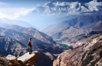
Upper Mustang trek to the Walled City
A trek through Nepal’s restricted Tibetan side
Approx. 14 days
Helambu & Langtang Trek
Crowd-free trekking on Kathmandu’s doorstep
Approx. 16 days

Golden Triangle & Andaman Islands Itinerary
Desert island beaches and Royal Bengal tigers
Approx. 11 days
Find a Annapurna Region specialist
Tell us about your trip and we'll find your match
We'll connect you directly with the experts.


We'll connect you directly with the experts.
- Hand-picked local specialists
- Honest advice from real experts
- Free to use, no hidden fees