


Tasmania's Best Bushwalks
Tasmania's best wilderness treks & hikes
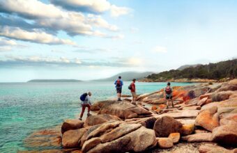
While there are hundreds of excellent day walks to choose from across the state, Tasmania’s multi-day bushwalk trails offer the ultimate adventure, drawing hikers from all over the world for their epic landscapes, remoteness, native wildlife, and – thanks to a cap on hiker numbers on popular trails – a glorious lack of crowds.
The main bushwalking season runs from October to May, but most trails are open year-round if you’re game. Most multi-day affairs require a high level of self-sufficiency, but walkers who like their creature comforts (or simply prefer the company of a knowledgeable guide) will be pleased to know that a handful of operators offer guided options.
No matter who you hike with, familiarising yourself with the safety and packing checklists on the National Parks and Wilderness Tasmania website, as well as national park rules about campfires and more, is essential.
The Overland Track, Cradle Mountain-Lake St Clair
The Overland Track
Distance: 65-80km/40-50 miles
Hiking time: Six days
Difficulty: Hard
When to go: The trail free (AU$200) only applies from October to May, but off-season walkers will need to be equipped for snowy conditions. December to February are the most popular months, with the longer days making side trips more feasible.
Suitable for: Experienced hikers and children at least eight years old.
Top tip: With only 34 independent hikers allowed on the trail per day, booking well ahead is advised.
Australia’s premier multi-day bushwalk, the Overland Track is a six-day odyssey through the guts of Cradle Mountain-Lake St Clair National Park, the only pathway linking Cradle Mountain with the park’s eponymous lake to the south. But if you plan on ticking off all the optional side trips, you might need eight. Three historic huts are situated along the alpine trail, which is thought to have been used as an access route by Palawa, but these can no longer be slept in unless in cases of emergency.
Six modern huts (sleeping up to 36) with adjacent campgrounds now accommodate hikers en route, but beds can’t be booked ahead, so you’ll still need to carry a tent. Campers are allowed to cook in the huts, but as there’s no electricity, you’ll need your own cookstove. There’s no running water at the huts either, but rainwater tanks supply drinking water (which some hikers prefer to filter).
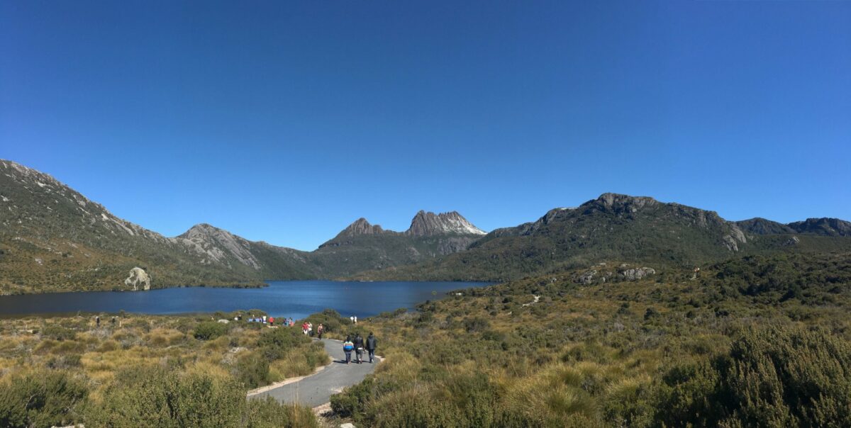
View of Cradle Mountain-Lake St Clair National Park, Tasmania
The trail must be walked north to south from October to May, beginning at Ronny Creek, a 7km shuttle ride from the Cradle Mountain Visitor Information Centre. The first day is the toughest, including the steepest section of the trail, with most walkers flopping in the recently refurbished Waterfall Hut [editors: due to reopen in May 2020] after the 12.2km/4-6hr hike across exposed alpine plateau – look out for wombats and pademelons on the way. If it’s a nice day and time is on your side, making the 2km/2-3hr detour to summit Cradle Mountain (395m ascent) is a must.
The second day is a much easier, mostly flat 7.6km/3.5hr hike to Windermere Lake, with Lake Will (a 3km/1hr side trip) making a great lunch or swim stop. With 16.8km/5-7hr to cover, day three is the longest, with the trail snaking through grassy plains before entering the dense forest sheltering New Pelion Hut. From here it’s an 8.6km/3-4hr slog to Kia Ora on day four, with many walkers opting to make a 5.2km/4-5hr side trip to summit Mt Ossa (1617m), Tasmania’s highest peak, en route.
The fifth section from Kia Ora to Bert Nichols Hut at Windy Ridge (9.6km/3.5-4.5hr) isn’t especially difficult, but does include a steep climb, plus two waterfall side trips that can make it a long day by the time you reach Nicholas Hut. You’ll be grateful for the easier walk out on day six, a 9km/3-4hr downhill meander through eucalypt forest to Narcissus Hut. This is where the trail ends for hikers who have booked the Lake St Clair Ferry to Cynthia Bay (for the Lake St Clair Visitor Centre); use the radio inside Narcissus Hut to confirm your booking or enquire about spare seats. For those keen to keep walking, it’s an extra 17.5km/5-6hr slog around the lake to Cynthia Bay. Several coach companies offer shuttles back to Launceston and Hobart; book ahead.
Three Capes Track
Three Capes Track
Distance: 48km/30 miles
Hiking time: 4 days
Difficulty: Moderate
When to go: The maritime climate moderates the temperature year-round, making this one of Tasmania’s more manageable winter hikes, but the trail is at its prettiest when the coastal heath blooms from September to November.
Suitable for: Anyone with a moderate level of fitness
Top tip: Don’t forget to pick up your complimentary Encounters on the Edge booklet upon check-in at Port Arthur for information about art installations, wildlife and more on the trail.
Tracing the soaring sea cliffs of Tasman National Park, with nothing between you and Antarctica but the Southern Ocean, Tasmania’s newest multi-day hike available to independent walkers (opened in 2015) takes in some of Australia’s most dramatic coastal scenery. With only 48 people per day allowed on the trail (which must be walked in one direction), you’ll want to book ahead for this one.
The journey begins with a scenic ferry ride from the Port Arthur Historic Site to the Tasman Peninsula – keep your eyes peeled for dolphins, fur seals and even whales along the way. From here it’s an easy 4km/1.5-2hr walk through eucalyptus woodland full of cockatoos to Surveyors cabin, the first of three environmentally-sensitive huts on the route equipped with mattresses, basic cooking facilities, composting toilets, running water (fine for drinking), and solar-powered USB charging stations.
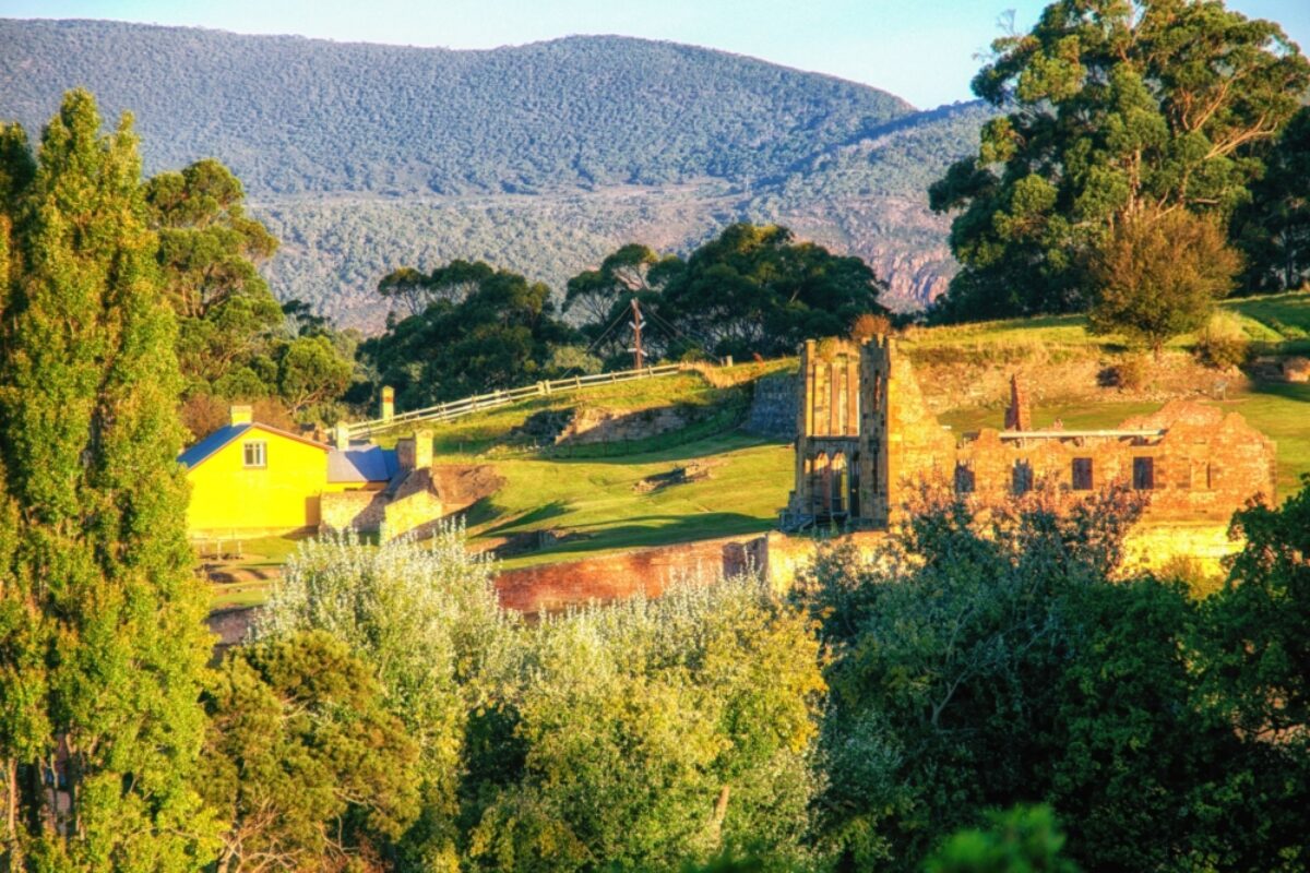
Building ruins at Port Arthur, Tasmania
The real drama begins on day two, an 11km/4-4.5hr walk taking in a variety of vegetation zones, from colourful heathlands to bronzed moorlands. A short climb to Arthur’s Peak offers superb views towards Cape Raoul to the west before you descend from the forested slopes of Crescent Mountain to cross the windswept Ellarwey Valley to Munro cabin. Here you can enjoy the only shower on the trail (albeit outdoor), or simply soak up the incredible views of Munro Bight and Cape Hauy.
The views get even better on day three (19km/6hr), with ancient dolerite cliffs plunging 300m below your feet on Cape Pillar. Get your camera ready for the views of Tasman Island and its lone lighthouse, and test your nerve on the scramble up the knife-edge of rock known as The Blade. The trail doubles back past Munro cabin (where you can leave your big pack for the day) to Retakunna cabin.
The final day (14km/6-7hr) begins with a sweaty ascent of Mount Fortescue before venturing out to the tip of Cape Hauy, where you might spot rock climbers tackling the Totem Pole and other dolerite columns. It’s mostly downhill from this point, where the clear blue waters of Fortescue Bay tempt sweaty hikers to jump in for a bracing dip before the 30-minute bus transfer back to the Port Arthur Historic Site (2pm and 4pm daily).
Freycinet Peninsula Circuit
Freycinet Peninsula Circuit
Distance: 27km/17 miles
Hiking time: 2-3 days
Difficulty: Moderate
When to go: Tasmania’s east coast enjoys a milder climate than the inland state, making this hike another manageable wintertime tramp. With no bookings required for the trail, it’s a great spontaneous option.
Suitable for: Anyone with a moderate level of fitness.
Top tip: Water availability can be scarce along the route (and must be boiled before drinking), so walkers will need to carry sufficient supplies for drinking and cooking.
Taking in some of the most exquisite views of Freycinet National Park, the Freycinet Peninsula Circuit traces the west coast of the peninsula before looping back up through its centre to Wineglass Bay, then through The Hazards back to the start point.
Beginning at the Wineglass Bay car park (off Freycinet Dr, 3km south of the Freycinet National Park Visitor Information Centre), the walk should be undertaken in an anti-clockwise direction to help minimise the spread of Phytophthora (a deadly plant pathogen commonly known as root rot). Before you begin, factor in a side trip to the Wineglass Bay Lookout or Mt Atmos for exquisite views over Wineglass Bay before following the Hazards Beach Track around the headland through coastal heathland, blue gum woodland and she-oak forest to Hazards Beach. Keep your eyes peeled for historic Aboriginal oyster shell middens en route.
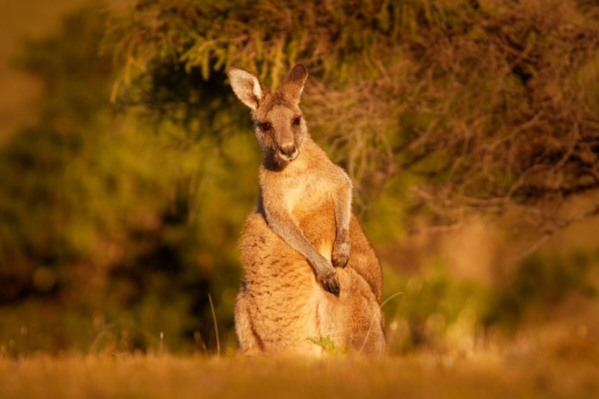
An Eastern Grey Kangaroo, Tasmania
There’s a basic campsite at the southern end of Hazards Beach (5km/1.5hr), but most walkers head onto Cooks Beach campsite for the first night, a 12km/3.5hr walk in total. If you’re feeling energetic, you can take an optional 3km/2hr side trip to Bryans Corner for a more private swim. Nestled amongst the she-oaks at the southern end of the beach, Cooks Beach Campsite facilities are limited to a drop toilet and a water tank, which can run out of water during dry summers. Campfires aren’t permitted on the circuit, so you’ll need your own cookstove (unless there’s a total fire ban, in which case you’ll need to get creative with your meals). Be sure to secure your food from wallabies and possums.
From the Cooks Beach track junction, the trail heads inland on day two, with a total climb of 500m on the 11km/6-8hr journey through heathland, woodland and wet forest to a soundtrack of birdsong. Energetic walkers may wish to make a detour to scramble to the summit of Mt Freycinet (1.5km/2hr) before ascending Mt Graham for superb views of Schouten Island before the track descends to Wineglass Bay. There’s a composting toilet at this sheltered campsite behind the dunes at the southern end of the beach, but no water.
Some hikers choose to power on over the saddle of The Hazards and back to the car park (4km/1.5hr) to complete the loop on day two, but this leaves little time to enjoy idyllic Wineglass Bay, nor watch the Hazards glow pink in the morning sun as you set out for the final leg on day three.
Walk through wild Tasmania in Southwest National Park
A remote and rugged wilderness occupying the southwest corner of Tasmania and home to Australia’s oldest living trees (the rare Huon pine), Southwest National Park is one of the last truly wild places on Earth. Gordon River Road penetrates the northern end of the 6,182.67 sq km park, which is part of the Tasmanian Wilderness World Heritage Area, offering incredible mountain views en route to Lake Gordon and Lake Pedder, both popular fishing spots.
Branching off Gordon River Road, Scotts Peak Dam Road is the jumping-off point for a handful of short and multi-day walks. The park’s most famous walk, however, is the South Coast Track, an 85km (53 mile), 6-8-day tramp alongside the Southern Ocean from Melaleuca to Cockle Creek requiring total self-sufficiency (and a small-plane flight to the start point). To get a taste of the wild south, day walkers can tackle the last section of the trail, a 15.4km/4hr return hike from Cockle Bay (on the southeastern fringe of the park) to South Cape Bay before returning to a warm bed in Hobart, a 122km/2hr drive north.
About the author
Sarah Reid
Sarah is an award-winning Australian travel writer with a passion for sustainability and low-impact travel. Her work has appeared in National Geographic, BBC Travel, Lonely Planet, Adventure.com, The Independent, and more. She also writes travel reference books for Lonely Planet, and manages sustainable travel website Eco Travelist.
Find a Tasmania specialist
Tell us about your trip and we'll find your match
We'll connect you directly with the experts.


We'll connect you directly with the experts.
- Hand-picked local specialists
- Honest advice from real experts
- Free to use, no hidden fees