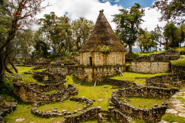
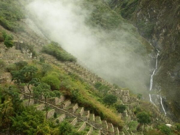
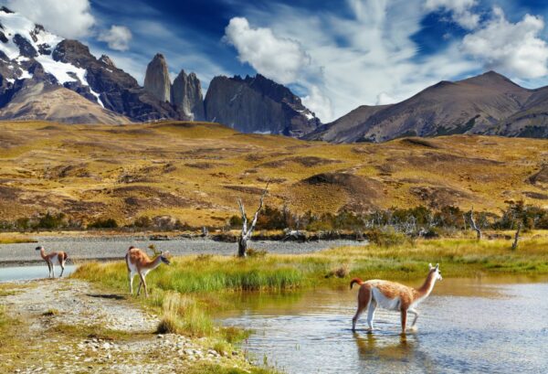
In 1830, in his final days, Simón Bolívar, the crusading independence hero who could have become the George Washington of South America, threw his hands up in resignation and declared the continent to be "ungovernable".
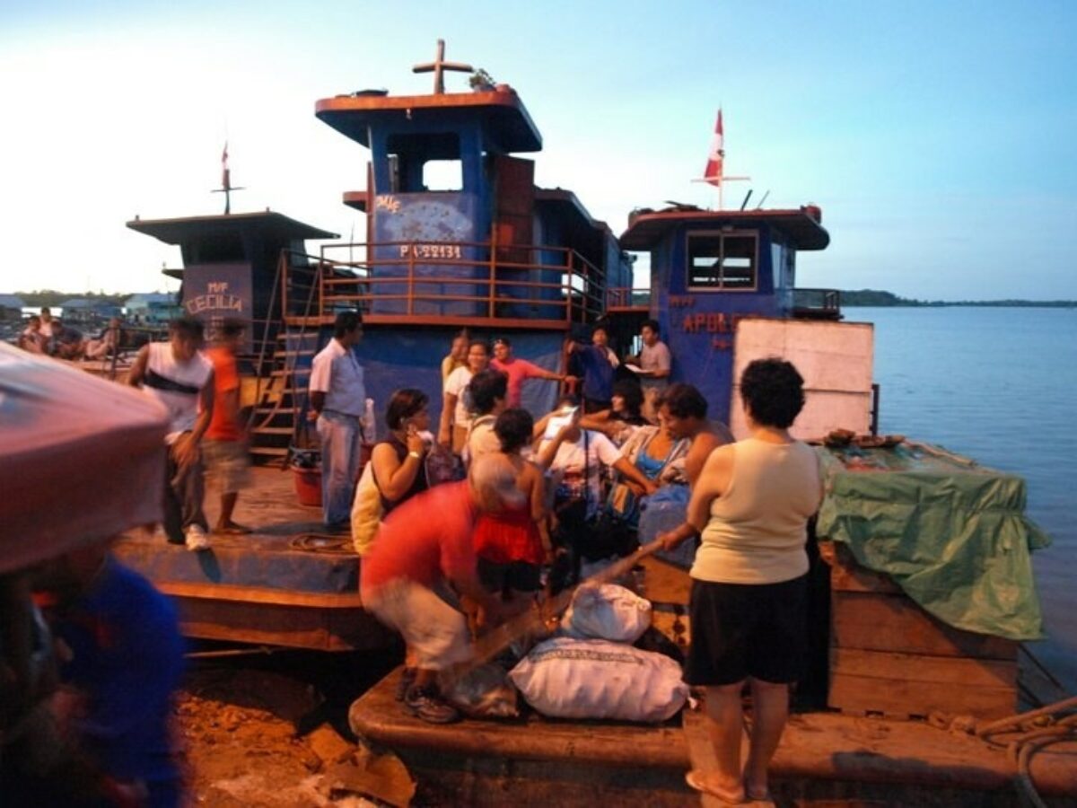
And thanks to much superficial reporting since then, a first-time visitor might well expect to find a hot-blooded, rowdy continent – packed with much to see and do, but daunting and possibly even dangerous.
Stow away the stereotypes, cast aside the clichés, take some sensible precautions, and above all, take your time.
If you really try, you could zip around most of South America's highlights in little more than two weeks. There are plenty of tours to the Galapagos, Machu Picchu, Iguazu Falls, maybe a quick stop in the Atacama or the Amazon, and back home in time (almost) for dinner. These whistle-stop itineraries do a deep disservice to the continent, its people, and the visitor.
Yes, any trip will almost certainly include a visit to one or more of South America’s famous landmarks. You will have a wonderful time, but expect crowds and a largely sanitised experience (pro tip: those marketing slogans about "discovering" a deserted Machu Picchu are criminally misleading!).
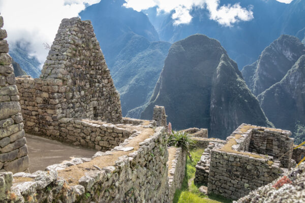
But try not to let the tourist attraction define the country. You're not “doing” Machu Picchu, you're visiting Peru, and the same applies across the 12 (or 13, depending how you're counting) countries of the continent, each with its own identity, history, and culture.
Sitting for 30 minutes at a fruit stall in a busy market will teach you more than two weeks spent looking through the windows of a tour bus. And if you have a smattering of Spanish you'll unlock a whole new dimension.
So our advice is: slow down. Visit the honeytraps (after all, they're popular for a reason), but save time for the cities, the alternative ruins and the quieter reaches of the Andes and the Amazon.
For Bolívar, South America was ungovernable. You’ll find it unforgettable.
Which would you recommend between the Lares and Salkantay trek in March?
Answered by: Roxner Quispe
I would recommend the Lares trek (potentially combined with the Short Inca Trail) over the Salkantay trek in March. This is because the Salkantay trek is prone to landslides this time of year and they won't be clear until late April.
Before visiting Machu Picchu we'd like to arrive in Cusco and go straight to the Sacred Valley. Where would you recommend?
Answered by: Roxner Quispe
This is actually a smart way to start your trip, with a slightly lower altitude than in Cusco. I'd recommend Urubamba as it's got everything you need and has easy access to other sites like Pisac, Chinchero, Moray and Maras. It's about 1.5 hours drive from Cusco.
I'll be in the Huaraz region but looking for a trek similar to the Salkantay Trek - what do you recommend?
Answered by: Edita
For something similar to Salkantay in Huaraz I'd recommend the Santa Cruz Trek (4 days). It is the best option of the Cordillera Blanca for a first trekking experience: high mountain landscapes, glaciers and lagoons, without technical difficulty.
Are permits required for the Lares and Short Inca Trail trek?
Answered by: Sarah Confer
No permits are required for the Lares trek but you do need a permit for the KM104 trek. The good news is this permit system is totally separate to the full Inca Trail permit system, and availability is rarely a problem.
Before starting a trek are two days acclimatisation sufficient in Cusco?
Answered by: Roxner Quispe
You absolutely need to acclimatise before setting off on a trek but I'd recommend you acclimatise in the Sacred Valley – Ollantaytambo etc – rather than Cusco itself, as Cusco is very high and you might find it uncomfortable for your first few days there. I suggest saving your Cusco visit for after your trek.
It has usually started to rain by November, so hiking Ausangate from November onwards is not a good idea.
In fact it can be snowing in places by November. We had a group there recently and it was not fun for them due to the weather conditions. If it has to be November, the Inca Trail or Salkantay are good options.
This is another trek that needs no permit and can, theoretically, be done solo. Yet it is highly advisable to book with a local trekking operator. With the higher altitude and more remote conditions, you will need a guide and support staff who are well-versed in the requirements of trekking in this area.
On the classic camping trek, which loops around Mt. Ausangate, you’ll be camping for four nights in marked campsites that are more or less maintained by local communities.
The lodge route takes you from lodge-to-lodge, each one as beautiful as the last and all constructed from local materials. Part-owned and operated by members of the nearby Chillca community, the lodges are a great example of inclusive tourism. Although there is no electricity, the lodges are comfortable and cosy, especially in the evenings around the fire. The fresh meals prepared each day are delicious and you can even have a hot shower!
You can only really attempt this trek during the dry season, between May and August/September. Trekking during the rainy season (Dec-March) brings snow, flooded paths and the risk of landslides. Note that the dry season is winter in the southern hemisphere, which means night time temperatures will be cold – well below freezing.
The classic Ausangate trek is extremely challenging, in particular, because of the altitude, not to mention the cold nights. Even the very fit will find this a challenging route due to the altitude. You’ll need at least three days acclimatisation at altitude before setting off. An emergency horse will be available for exhausted trekkers but should not be relied upon for completing the trek. Make sure you’re fit, healthy, fully acclimatised and not suffering from any stomach troubles before you set off.
That said, although Ausangate is a beat of a trek, there is – as with Salkantay – a lodge version that brings some very welcome creature comforts to the overall experience, doesn’t negate the altitude, weather and gruelling ascents!
The dry season (April/May to September/October) is the best time for hiking in Peru and the Cusco region, but this is peak tourism season and the trails will be busier. Rainy season (November to March) brings less than ideal trekking conditions, but there are some advantages, not least warmer temperatures at night, quieter trails and (maybe) lower prices.
Unlike most treks in the area, the Lares trek is not prone to landslides or other issues during the rainy season, making it a great choice for the off-season. Just don’t forget to pack your rain gear!
No permits are necessary for hiking the Lares trail, but you will still want to book with a local operator. They will have the right connections with local horsemen and employ qualified guides who know the area well and speak Quechua. This is key for interacting with the communities along the route, as well as for ensuring your safety in the mountains. There is an extensive web of trails that go through valleys and over several mountain passes and trails are not well marked.
The trek is generally rated moderately challenging, although this will vary with side trips or changing the daily distances. Either way, the challenging aspect is principally due to the altitude.
There are several different routes for this hike, but the typical one will have you hiking about three days, covering around 25-30km. Most operators sell the trek with an extension to Machu Picchu, however note this is not, as it’s often described, a trek “to” Machu Picchu. You will go by train to a hotel Aguas Calientes for the night and then up to Machu Picchu with the other day trippers the next morning.
Pack light, quick-drying clothes for the Galápagos. Heavier materials such as cotton take longer to dry in the humid weather. Remember that you’ll be travelling on boats (including pangas and rafts with dry and wet landings) and that you’ll need waterproof clothing. It’s also worth packing seasickness tablets to help you cope with the rocky journeys to the islands.
Other essentials include:
Comfortable hiking shoes
Light rain jacket/windbreaker
Fleece for evenings on board
Bathing suit
Sandals for wet landings
Sunscreen (SPF 50 - you’re on the equator!)
Sunhat
Reusable water bottle
Seasickness tablets
Cash for national park fees, tips and extra expenses on board (not all ships accept credit cards)
Visitors on cruises to uninhabited islands are required to be accompanied by a registered guide for their own safety and for the protection of the islands. Since 2024, many visitor sites on inhabited islands now require a certified guide, such as Charles Darwin Station and Las Grietas on Santa Cruz Island.
Not necessarily. Although land-based trips mean spending the night in hotels or lodges you’ll still visit various islands by boat – usually small speedboats, which can be extremely choppy and can cause problems for younger and older travellers.
Most airlines restrict luggage to one checked bag up to a maximum of 40 pounds and one carry-on bag that weighs up to 15 pounds. This is generally recommended for all air travel within South America. Extra baggage can usually be accommodated for a fee.
Since 2024, many boats now offer internet on board through Starlink. Some charge a high extra cost for internet access, but others offer wifi for free.
Cell phones on GSM networks generally work on the inhabited islands, but signal may be intermittent. Check with your provider to find out the specifics of your plan and the roaming charges. Extremely high rates are common, and it’s better to know beforehand to avoid the shock after returning home. It’s always wise to turn off data roaming before heading abroad.
At the airport in both Quito and Guayaquil you can buy travellers’ sim cards for your stay in Ecuador. These use a pay as you go system, and don’t require an Ecuadorian ID to activate.
Visitors from North America and most European countries don’t currently need a visa to enter Ecuador, but please double check before departure. Your passport must be valid for at least six months beyond the date of departure from Ecuador.
In addition to the originals, bring a copy of your passport, a list of identity card numbers and the international phone numbers of their issuing institutions. Store these separately from your original documents in case of an unforeseen problem with emergency contact numbers and medical information.
Valid health insurance is highly recommended and may be required by your cruise operator. Check that you are covered for emergency air transport as there are only basic facilities on the Islands.
To do the Galápagos justice, aim to spend at least five days on the islands, either on a cruise or a land-based tour. Four-day/three-night cruises are available but will feel rushed and might not get beyond the busier inner islands.
A really important thing to know is that cruises depart with lunch on the first day and end after breakfast and a short last excursion on the final day, so the first and last day are very short. It’s better to think in terms of nights rather than days, for example a seven-night cruise rather than an eight-day cruise.
Six night/five-day cruises generally rotate around the main inner islands, plus one or two outer islands. This will give you a balanced view of the islands and a good range of wildlife, without everything feeling too rushed.
For example, the Comorant five-day eastern itinerary starts at Baltra and visits Santa Cruz, Genovesa, South Plaza, Santa Fe and San Cristobal, with morning and afternoon excursions at each stop. Or the five-day Ocean Spray western itinerary, which heads from Baltra to Bartholomew, Genovesa, Santiago and back via Santa Cruz.
Six and seven night cruises tend to be the sweet spot if you have the time and budget. These itineraries will either focus on the western or the eastern islands, and spend plenty of time at all the highlights. Note that you’ll still see just half of the full archipelago, but with plenty of time for a greater range of activities and excursions.
Longer 14-night cruises are formed by combining a ship's eastern and western itinerary into a single trip. The main advantage to this is you get to see the full archipelago from the younger islands to the older islands, observing how the wildlife has evolved differently on each.
The tour programme will be action packed but you may choose to spend some more leisure time on board. Note that some activities may start to feel repetitive, and you’ll need a good guide to keep you engaged.
Unless you’re doing something specialist such as a diving course or a birdwatching cruise, two weeks is probably too much—use your spare time on the mainland instead, the rest of Ecuador is just as fascinating!
Good question! PLEASE remember to tip your guide, cook, and donkey handlers! Most guides lead over 28 separate Huayhuash trips per year. Considering that the Huayhuash Circuit is eight days long, that comes to over 224 days of hiking per year, not including extra days for gear preparation and unloading. You can divide it up by guide, porters and cooks (approx $10, $5 & $5 per person per day respectively) or just pool around 10% of the total trip cost and they'll divide among themselves. Your guide will give you an honest steer.
There’s plenty of budget hostels in the town and some decent trekking lodges in the surrounding hills.
For low budget hostels in Huaraz I can recommend Krusty Hostal; best for solo travellers, located in the city centre with a lively, social atmosphere. Big Mountain Hostel; a good budget option, located in the city centre, free breakfast included. Aldos Guest House; best for private rooms, clean spacious rooms.
The average price for a bed in a shared dormitory is $5 - 15 USD per night.
For trekking lodges, I’d suggest the Lazy Dog Inn; 30 minutes outside the city centre, very tranquil and near many trailheads. Churup Mountain Lodge; 45 minutes outside the city centre in the Cordillera Blanca, amazing views, also near many trailheads.
For a private room expect to pay $25 - 50 USD per night.
The Andean dry season, from May/June to September, is the best time to go trekking in the Huaraz region.
The shoulder seasons, March-April & October-November, see smaller crowds and lower prices, but the weather is less predictable and you may have trouble finding tours and departure dates.
Hiking during the rainy season, December-March, is discouraged and often simply not possible due to flooding, landslides, and dangerous or inaccessible hiking trails.
Since Huaraz is close to the equator, daylight hours remain roughly 11 to 12 hours per day year-round.
December is a wet month to trek in Peru, but all the main routes are open as normal. Here are a few suggestions for December:
1) On the Salkantay trail it's entirely possible to have a stretch of several dry days in December, but it will definitely be muddy in places. There is the option of lodge-to-lodge trekking on the Salkantay route so you don't have to camp in the rain.
2) Most of the trails through the Lares valley are rocky enough that they don't get muddy, but that's all camping with no lodges.
3) While Choquequirao has cabins along the route, I wouldn't hike that trail in the rain because of how steep most of it is.
4) The Inca Trail is usually pretty quiet in December, so you'll find it easy to get permits. However I can't in good conscience recommend the Inca Trail until they address the workers' rights (and even human rights) abuses of porters.
Two tips for making your hike more comfortable: First, have a good rain poncho, not the disposable ones that tear easily. Ponchos are better than rain jackets and rain pants because they let air flow around you and it’s likely to be warm since December is summer. Second, if you have the flexibility, tell your trekking agency that you would rather delay your trek a day or two in case a major rain storm is predicted for the original trek dates. They’re rare in December, but always a possibility.
I'd say the Two Day Inca Trail is a much better choice if you're concerned about altitude. The highest point on the full (four day) Inca Trail is 4,215 metres but on the two day trail it's only 3,680 metres. That's still high, but on the two day trail you are at high altitude for much less time and you can sleep at lower altitude the night before. The full four day trek has you at about 4,000 metres for a long time, and that 4,215 metre high point isn't the only high pass you have to cross.
Obviously the longer you can acclimatise the better, I'd strongly advise against arriving and heading straight off onto the trek.
Most people acclimatise in Cusco, but at 3,500 metres the altitude sickness can be rough here too! I'd recommend spending a couple days before your hike in the Sacred Valley such as in Ollantaytambo, which is a much more manageable 2,792 metres.
None of this constitutes medical advice and if you have any concerns you should talk to a doctor first.
It only takes about half an hour each way to hike Huchuy Picchu, so it's absolutely possible to do the hike, spend time at the top taking photos and get back down to Aguas Calientes. If you take the noon shuttle departing Machu Picchu, you should have time to buy take-out lunch in Aguas Calientes to eat on the 1:37 train.
It is not possible to buy an individual ticket only for any of the Machu Picchu day hikes (Huayna Picchu, Huchuy Picchu, etc). Tickets for those add-on hikes must be chosen when you are buying your Machu Picchu entrance ticket. If your tour agency bought your Machu Picchu ticket, you need to ask them if they can return it for a refund and buy you another. Machu Picchu tickets are sold by the government and are normally non-refundable and non-transferrable. However, an agency might be able to make that change for you.
If you bought the ticket yourself, you should buy another one that includes the day hike. Then, when you're in Cusco you can go to the Machu Picchu ticket office on Plazoleta Regocijo and try to get a refund for the original ticket. I can't guarantee that they'll give you a refund.
There are two train services from Cusco to Aguas Calientes (Machu Picchu), PeruRail and IncaRail. They each offer different classes of train services: PeruRail has three classes of train and IncaRail has five.
The lower class, called Expedition for PeruRail and Voyager for IncaRail, is still very nice and costs $55-$70 each way. If you want to splurge, check out the other classes of train but keep in mind that the ride is only about two hours each way from Ollantaytambo.
Prices for each service vary by time of year and time of day. (Like airlines, they have lower prices during times of day that fewer people want to travel.) During the off season, from October through March, prices tend to be about $10 USD cheaper each way.
You can see the exact prices for your travel dates on the PeruRail and IncaRail websites.
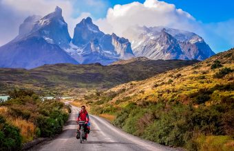
The Circuit can only be walked in an anticlockwise direction. The W can be hiked in either direction, and which you chose will dictate whether you’re hiking against or with a lot of the other hiking traffic. I prefer east to west for the W, which means in the opposite direction from those on the Circuit, and because Glacier Grey arguably makes the best finale.
Booking is mandatory for Torres del Paine. You can only hike the W or the Circuit of you have all accommodation booked in advance (and it gets booked out fast, so get this done as far ahead of your planned visit as possible), as well as paying the entrance fee for the national park. This is the case whether you’re camping or staying at lodges, and you will need to show proof of accommodation bookings and having paid the entrance fee in order to enter the national park.
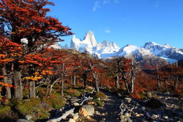
For me it’s the Circuit which eclipses pretty much anything else in Torres del Paine National Park – it’s more remote, less crowded than the W, with views that are even more epic in scale. Not for nothing is it often described as one of the world’s truly great treks. However I also really love the Fitzroy area in Argentina, where the scenery is every bit as amazing, and where unlike Torres del Paine the national park has not allowed the construction of lodges (let alone luxury hotels), meaning overnights are restricted to well maintained campsites. For my money, that gives the place a much more unspoilt and untouched feel.
Torres del Paine National Park has big lodges as well as campsites – not to mention some very upmarket hotels. I prefer using a mixture of lodges and campsites, which keeps costs down a little (and on the northern part of the circuit you’ll have to camp on some of the stages regardless), and having meals at some of the lodges means you can carry a bit less food.
The W and the Circuit as well as the shorter walks in Torres del Paine National Park are well-known and well-used, the routes are well marked, and you’ll find plenty of other hikers on the trail – so yes, hiking independently is fine. I’ve hiked independently on the treks listed above. Whether you go solo or with one or more hikers is up to you and depends on your level of confidence – the northern part of the Circuit is quite remote, for example. If you’re camping, hiking with one or more other people allows you to share the weight of a tent, food and other camping equipment.
Surprisingly, given that the Andes Mountains trace the western edge of Chile from tip to toe, trekking elevations are rarely higher than 1,200 metres. Altitude sickness is therefore not an issue in Chile. The only exception is the Aconcagua Summit trek, where you reach 6,961 metres above sea level at the top.
Camping equipment, including rucksacks, tents, stoves, hiking poles and sleeping bags are available to rent in a couple of key locations, including Santiago, Puerto Varas, Coyhaique and Puerto Natales. Outside of these places, it’s possible to buy trekking gear but I’ve found it can cost at least double what you’d pay to buy similar equipment back home.
Chile, as a rule, is a safe place to travel, although increasing levels of crime in the capital, Santiago, means it’s worth taking common sense precautions. However, once you get out into the national parks, the biggest consideration is getting hold of a map, as trails can sometimes be poorly marked and difficult to follow.
Many of the more intrepid multi-day paths are not for inexperienced hikers. There is a serious risk of getting lost—or worse—without GPS, good-quality camping equipment and enough food and water to ride out a couple of days if you end up stuck in inclement weather conditions.
Women can hike alone in Chile, particularly on routes such as the W Trek and in national parks such as Huerquehue that have plenty of visitors. For other destinations, it’s better to hike with a partner, regardless of your gender, because routes are remote and it can be difficult to get assistance if you become injured.
Most day hikes in Chile’s national parks are possible without a guide. Similarly, routes such as the W and O treks in Torres del Paine National Park, the Cerro Castillo Traverse and the Sendero Transversal in Parque Tantauco can be trekked independently. More extreme routes, such as the Dientes de Navarino on Isla Navarino, and the Aconcagua Summit are best hiked with a local expedition company.
Unfortunately, I’ve experienced first-hand how trails are often poorly marked, a legacy of the considerable underfunding of the national parks governing body, CONAF. Reliable maps are also few and far between, with the best available at the entrances to national. Outdoor hotspots such as Pucón, Puerto Varas and Puerto Natales sometimes have more accurate third-party maps available for purchase, while the free app Maps.me works without an internet connection and has been my go-to resource.
For most national parks you now need to book a ticket in advance through the official—and irritatingly glitchy—booking website. You’ll receive a QR code confirming your booking; download this when you’ve got internet access. Many national parks have little to no phone coverage.
Southern Patagonia and, primarily, Torres del Paine, are Chile’s most renowned trekking destinations. However, my favourite places are the national parks that run along Ruta 7, or the Carretera Austral.
Wedged between the Andes Mountains in the east and the Chilean fjords in the west, this remote road winds between what I consider some of Chile’s most beautiful national parks:
Add in the fact that it receives far fewer visitors than those in Southern Patagonia—while still serving up a range of volcanoes, glaciers and rare wildlife—and the Carretera Austral is the true Patagonia hiking mecca.
Most national parks in Chile have multi-day hiking trails, however, none have the same tourism services as found in Torres del Paine. As a result, they’re far quieter and more likely to fulfil the vision of trekking in remote, untouched places.
Sendero Transversal in Chiloé’s Parque Tantauco is a great alternative to Torres del Paine National Park. The scenery couldn’t be more different: set within the thick, damp Valdivian temperate rainforests, this trail won’t show you mountains, but you will encounter 2,000-year-old forests and—if you’re lucky— rare, endemic species of pudú and Darwin’s frog.
Alternatively, experienced trekkers armed with GPS and lightweight camping gear will find the five-day Dientes de Navarino trek a welcome challenge. Circumnavigating the toothy Dientes de Navarino mountains as it strikes out across the otherwise inaccessible interior of Patagonia’s Isla Navarino, it’s the southernmost trek in the world—and promises staggering views and bog tramping in equal measures.
Because of its southerly latitude, Patagonia has a relatively short trekking season, with trails opening around September and closing late April—although this is typically weather dependent. Most visitors head to the national parks along the Carretera Austral and in Southern Patagonia during the Austral summer (between the months of December and February).
However, the climate in Patagonia is famously unpredictable and four seasons’ weather can be experienced in an afternoon—even during the height of summer. My usual advice is to travel during the shoulder seasons either side of Austral summer. While you can’t guarantee the weather from September through early November and late March through the end of April, you can expect to share trails with far fewer visitors.
For the Lakes District heading north, national parks are typically open year-round, although heavy rains and snow can close trails between June and August.
Research your trekking operator carefully before you book. Don’t go for the cheapest, as corners will be cut on the ground employees’ wellbeing and livelihoods. Don’t book anything on the street in Cusco. If you’re booking through an international brand, try to find out who is actually running the ground operations. Good quality trekking outfitters will talk openly about how they work responsibly with indigenous communities, or – ideally – will be fully or part-owned by local people. Stay in family-run hostels or hotels rather than big hotels owned by international brands. Buy souvenirs from non-profits like the Traditional Textile Center of Cusco, Mantay and Xapiri.
As Machu Picchu grows in its renown as a destination, a permit system has been enforced in order to keep the sheer volume of travellers in check. Permits to the following sites are required, and can be found here. (Note, however, that the site’s language options are limited and the online payment portal is notoriously spotty). You can also pay directly at the offices in Cusco or Aguas Calientes, or have permits arranged through a reputable tour operator.
Inca Trail permits
The classic four-day Inca Trail route is strictly regulated by a permit system. The limit is 500 people per day, including guides and porters, and permits sell out months in advance. Any variation of this route (even the one-day “Km 104 hike”, which overlaps with the last stretch of the Inca Trail), requires a permit. The Inca Trail is closed for conservation work every February.
Machu Picchu permits
Entrance to the citadel itself is capped at 2,500 per day. While this limit is rarely reached, it’s better to reserve in advance — especially during the peak season and festivals.
Huayna Picchu permits
For a short but steep hike to the top of the peak hovering behind Machu Picchu (called Huayna Picchu), reserve in advance. This permit is added to the entrance ticket. Entrances are managed in waves of 75 people at 7am, 8am, 9am and 10am for a total of 300 people per day. Less popular is the hike up Machu Picchu Mountain, which is also permit-regulated and can also be added to the entrance ticket.
In the Cusco region, Choquequirao is definitely the hardest trek that I’ve done, because the trail is very steep and you have to first descend 2,000 metres of elevation before hiking back up that same amount. The Inca Trail is hard because on the second day you hike over a pass that’s 4,215 metres above sea level.
The easiest is KM104 to Machu Picchu, which is really a day hike but you spend the night in Aguas Calientes and visit Machu Picchu the next morning. Lares can be relatively easy because it’s not a long trek, so you can take it slow.
I have been travelling solo around Peru since 2013 and have never had a problem as a female traveller. That said, I speak Spanish and take the time to research places before I go so I don't wander around looking lost. I have found hostels around Peru to be safe, but I avoid clubs and the party hostels. The Policía de Turismo is a police force dedicated to serving tourists but they rarely have anybody on staff who speaks English so if you need help you’ll probably have to find your own translator. Call the Centro de Emergencía de la Mujer at 100 for any crimes against women.
I wouldn’t call Machu Picchu a must-see, especially if you don’t like crowds. That said, of all the Inca ruins near Cusco, Machu Picchu is the biggest that’s easiest to get to and has the most qualified guides who can tell you all about the site. Comparatively, the Inca ruins at Pisac are more accessible, cheaper and have fewer crowds but aren’t as big. Choquequirao is just as big and impressive but requires a long and challenging hike.
Lunch and dinner almost always start with soup because it’s cold in the mountains and you need to hydrate. Meals are relatively light with small portions because digestive systems don’t work as well when you’re at altitude, i.e. when your body is functioning with less oxygen than it’s used to. However, trekking agencies cook plenty of food, so there’s always seconds and thirds if the portions are too small for you.
Yes. Choquequirao is the easiest to do without a guide because the trail is easy to follow and local families rent cabins and provide meals. Salkantay is getting easier every year, in terms of infrastructure.
Personally, I like Lares the most because you get a real taste of indigenous Andean culture while staying close to Machu Picchu. If you want to do a challenging trek and see Inca archeology, but not necessarily Machu Picchu, go to Choquequirao.
Yes, if you acclimate to the altitude first. Every day somebody gets to the point that they can’t walk any more and a porter actually carries that person piggy-back. I don’t think that should be allowed, but it happens and you don’t want that to be you.
Trail conditions are best during the dry season, from April/May through September/October. I’ve done plenty of trekking in November, December, March and April but avoid January and February because those are the rainiest months. I think April and May are the best because it doesn't rain much but the hills are still green and covered with flowers.
Note that the Inca Trail is closed for maintenance during the month of February.
Acute Mountain Sickness (AMS) is by far the most important factor to keep in mind while trekking in Peru. Most treks in Peru involve high altitude at some point. Machu Picchu is situated at 2,430m above sea level and Cusco at an incredible 3,400m. The town of Huaraz is at 3,052 metres but the hikes in the area are between 4,000 and 6,000 metres. Arequipa is only 2,335 but most treks there take you to close to 6,000 metres. Arriving here from Lima or elsewhere you’ll immediately notice the thin air, with reactions ranging from mild breathlessness to headaches and nausea. Severity varies by person and is usually more pronounced for younger and older travellers.
Plan two or three days at altitude before you start your trek. I recommend two days taking it easy in town, followed by an easy hike at high altitude before you start the trek. Near Cusco, consider hiking to Inkilltambo or Waqra Pukará. In Huaraz, Laguna Parón and Pastoruri Glacier both take you to high altitude without a lot of walking. Near Arequipa, check out the Ruta del Sillar. In Chachapoyas, visit Kuélap or Yalape. During that time, drink plenty of coca leaf tea (the traditional Andean remedy for altitude sickness), stay hydrated, avoid alcohol and heavy meals, and generally just go easy on yourself.
Ask a question
Get answers from our independent South America experts.
Get a free, personalised answer about South America.
You'll receive a reply by email. Questions and replies may be anonymised and reproduced on Horizon Guides.
§ 04
The South America atlas
30 picksPlaces & Experiences You Won't Find Elsewhere
Where
What
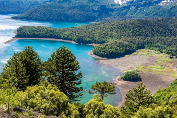
The Cañi Sanctuary has 500 hectares of mountain rainforest, 12 volcanic-born lakes, and a wide variety of birdlife to make any nature lover’s heart flutter. Located just 28km east of Pucon along the route to el Huife thermal baths, you can take the bus or drive yourself. Park entrance is 4,000CLP and the guard will hand you a route to follow along with a list of flora and fauna that you can find on the trail.
The entire route consists of 8.5km of intermediate hiking, starting with a steep incline through a fantastic forest of native trees until you reach Laguna Negra viewpoint. After that, you’ll be faced with a 45 minute uphill climb and a magnificent view of the region where you’ll be able to spot four volcanoes; Llaima, Villarica, Quetrupillan, and Lanin. You must take a guide with you except during the summer when the trail is more obvious.
The region is popular with adventure seekers. Pucon and Villarica have great information centres to help you book side trips. Apart from hiking, the region has great thermal baths, kayaking, rafting, and nature watching.
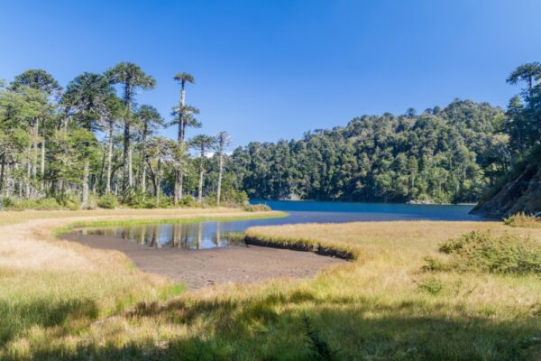
This is a true hiker’s paradise. Located just 35km from Pucon, this national park is famed for its ancient araucaria trees. The oldest tree is 1,800 years old and their seeds are a staple food in the diet of indigenous mapuche tribes. Within the park, there are two main trails for visitors to enjoy.
Park entrance fee is 5,200CLP for international visitors during the high season (November-March) and 3,200CLP during the low season (April-October). Buses leave from Pucon at 08:30 and the last one returns at 19:00. Make sure you bring enough drinking water with you. The only place where you can refill with drinkable water is at the entrance of the park.
The easier of the two trails is the Los Lagos Circuit, which explores the parks crystal clear lakes and lagoons. This route is perfect for beginner to intermediate hikers and the total time to explore the circuit’s five deep-blue lagoons is between 4-5 hours.
If you’re looking for something a bit more challenging, the San Sebastian trail might be better suited. This trail takes you through a magical araucaria forest until you reach Cerro San Sebastian for a 360-view of the entire region, including nine volcanoes. The total hiking time is 5-6 hours with 1200m of uphill climbing. The last hour is probably the most difficult part of the trail, involving some scrambling to reach the top. Follow the orange painted rocks that will lead you to the summit — and enjoy the views.
Tiny Darwin Island, at the remote far north of the archipelago, is one of the world’s premier scuba locations and has the densest biomass of sharks anywhere on earth. Rarely visited by standard cruises, these quiet waters teem with whale, Galápagos and silky sharks, hammerheads and more.
The third largest – and youngest – of the Galápagos Islands, volcanically active Fernandina has a unique environment which makes it a haven for thousands of slowly-moving marine iguanas, Galápagos penguins, flightless cormorants and sea lions. This is also the island where you’re most likely to see a volcanic eruption! There is a good 15km hike to Volcan Sierra Negra which departs from Puerto Villamil.
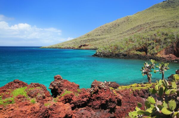
Noted for the unique red colour of its beach and cliffs (from the iron content), Isla Rabida is known for the sizeable population of flamingos that feed on shrimp in its lagoon, snorkelling with sea lions and the large number of bird species that live here.
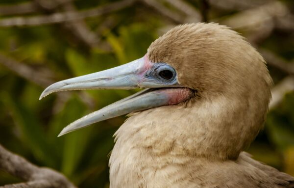
Genovesa, a remote island in the archipelago’s far north, is visited by longer cruise itineraries and is a favourite for birdwatchers. Also known as Booby Island due to the sheer number of goofy-looking Nazca and red-footed boobies that live here, the island is also home to great frigatebirds, short-eared owls, petrels, Galápagos doves, finches, lava gulls, and many more.
Also here you can visit the tidal pools of Darwin Bay where sea birds hover and marine life flourishes, and climb Prince Philip’s Steps, named for the British royal who visited the island. You’ll see red-footed boobies, Nazca boobies and great frigate birds along the way.
North Seymour is home to one of the island’s first conservation projects. In the 1930s, the crew of Captain Alan Hancock’s ship transferred 72 land iguanas from the nearby Baltra Island to North Seymour in the hopes that the reptiles would fare better without the feral goats competing for food. At last count in 2014, there were 2500 land iguanas on the island.
North Seymour and neighbouring Mosquera Islet are home to a large population of sea lions. Snorkelling here puts you up close and personal with these curious creatures and their young pups.
Also here is a flamingo lagoon on the isolated Bachas Beach, and the largest nesting colony of great frigate birds.
One of the sites used in the movie “Master and Commander,” Bartolomé’s Pinnacle Rock is the closest thing to a Galápagos landmark. The volcanic outcrop formed after lava erupted from an underwater volcano and the iconic formation was used for target practice by US airmen during WWII, adding to its unique shape.
The colourful scenery of the beaches on either side of Pinnacle Rock is contrasted by the barren landscape of Bartolomé’s interior. It’s often compared to the moon or Mars due to the red lava rocks away from the shore.
While here you can climb to the top of the island’s summit, ascending a wooden staircase through the stripped-down landscape. In the shallow waters between the landing point and Pinnacle Rock you can see Galápagos penguins, sea turtles, parrotfish, and small sharks.
On Española, you’ll be greeted by colonies of sea lions and Española lava lizards lounging freely. It’s also known for its nesting sites of Blue-footed and Nazca boobies.
You can hike the Punta Suarez trail to the edge of a cliff overlooking a natural lava blowhole, visit the waved Albatross breeding colony (the world’s population of the species migrates here during April and December). The white sand beach at Gardner Bay is one of the longest in the islands and sea turtles bury their eggs on the beach during mating season between January and March.
After being marooned on Floreana in 1805, Irishman Patrick Watkins became the first known Galápagos resident. Post Office Bay is also here, an informal mail system started in the 1700s by whalers. Mail was left for ships returning home in a barrel by those headed out to sea. The tradition lives on today: you can leave postcards at Post Office Bay for others to pick up and deliver once home.
Also on Floreana is Cormorant Point with two contrasting beaches; a green sand beach caused by olivine crystals and Flour Beach, made from crushed white coral. You can see pink flamingos at the nearby Flamingo Lagoon, watch for Green sea turtles nesting on the sands of Flour Beach. Another highlight is a panga ride to Gardner Inlet for a view of the large caves and rock formations of the island.
Just off the Floreana coast is the Devil’s Crown – a partially submerged, extinct volcano where wildlife thrives. Sea turtles, sea lions and even sharks are commonly seen in and around the crater, while seabirds crowd the outlying cliffs.
Originally named Albemarle Island by pirate Ambrose Cowley, Isabela is one of the youngest and largest of the Galápagos archipelago. It was formed by six volcanoes: Sierra Negra, Wolf, Alcedo, Cerro Azul, Darwin and Ecuador. All are active except Ecuador; Sierra Negra erupted most recently in 2018.
Isabela's famous Los Túneles ('tunnels') are a series of pools sheltered from the sea’s currents with interlacing volcanic bridges spanning the depths. The crystal waters are home to decades-old sea turtles, large sea horses, white-tipped reef sharks and thriving schools of tropical fish.
Also on Isabela you can take a horseback ride to the top of the Sierra Negra Volcano, spot Humpback Whales off the western coast of the island (June to September), see the Galápagos penguins near Tagus Cove – a favourite of pirates and whalers; names of ships dating back to 1836 are carved into the nearby cliff sides.
San Cristobal is the provincial capital of the Galápagos. One of the oldest islands, it was Darwin’s first stop on his historic journey. It’s the home to government and educational institutions. Puerto Baquerizo Moreno acts as the second tourist centre for the islands. Offices of tour agencies, foundations and branches of banks are open during the week.
Kicker Rock, off the west coast of San Cristobal, is one of the best-known sites in the islands to see hammerhead sharks. Hundreds gather in the depths here, while the lion-shaped shadow of Kicker Rock towers above you. Kicker Rock is two hours from San Cristobal and you must be accompanied by a guide.
Also on Cristobal, Cerro Tijeretas is reached by a short hike past the island’s Interpretation Centre. The view offers an amazing view over the bay below and there are trails down to the water and around the area.
Cristobal is also known for its surf, drawing surfers to Punta Carola beach, Tongo Reef, among a few others. There are a few surf clubs and rental shops on the island.
Puerta Ayora, the main town on Santa Cruz island, is the tourist centre of the islands – tour agencies, airline offices, restaurants, banks and shops line the streets. It’s a stop on most tour itineraries and the place to finalise travel plans, find gifts for friends and family, and sample local cuisine.
While here you can hike to Tortuga Bay – considered one of the best beaches in the world and perfect for snorkelling and sea kayaking, hike to lava tubes in the highlands, watch local fishermen compete with sea lions as they land their daily catch, and – a highlight – visit the Charles Darwin Research Station, the original rallying point for scientific and conservation efforts in the islands.
For diving, off the coast of Santa Cruz Island, Gordon Rocks is a submerged volcano where the depths reveal hammerhead sharks, rays, and sea turtles. Currents can be strong and swells in the shallows mean that divers need to stay below 40 ft.
One of the most demanding hikes I’ve done in the Cusco region is the two day/one night hike to Quellcaya Glacier, the largest tropical glacier on the planet, in the Vilcanota Mountain Range, approximately five hours from Cusco.
Known locally as Quenamari, the glacier sits at 5,600 metres above sea level and serves as a critical water source for the Sibinacocha Lagoon and beyond. It feeds the Vilcamayo River, which becomes the Urubamba River that winds through the Sacred Valley towards Machu Picchu, and later the Ucayali River – itself a tributary of the mighty Amazon.
The glacier itself is striking, a vast, glaring expanse of ice stretching across the mountain. Standing there, the silence is profound, broken only by the occasional crack of shifting ice or the distant calls of Andean birds. It’s a scene I haven’t encountered anywhere else.
Beyond its geographical significance, the glacier holds deep cultural importance for the local Quechua communities, who continue to perform ancestral rituals in honour of Pachamama, or Mother Earth. Meeting the people who live in this extreme environment was fascinating. With the help of a guide to translate from Quechua, I was able to hear their stories—how they survive at this altitude, relying on alpaca herding, weaving, and a deep knowledge of their environment. The remoteness of their lives is difficult to comprehend; the nearest town is 40 kilometres away. Spending time with them was a real privilege
The surrounding landscape is every bit as remarkable as the glacier itself. The region is dotted with glacial lakes, peat bogs, and untouched high-altitude grasslands. I was particularly struck by the wildlife—there are vicuñas, llamas, and alpacas here, and, unexpectedly, frogs! In the Sibinacocha Lagoon, I saw more frogs than I’d imagined possible, their chorus filling the air as we set up camp in sub-zero temperatures. Some of these species are endangered, yet here they seemed abundant, thriving in the icy glacial waters.
Need to know
This trek is not for the casual hiker. It’s physically demanding, and the high altitude is a serious factor. Prior acclimatisation in Cusco (at least two days) is essential, and you need to be comfortable hiking for extended periods in sub-zero conditions. The final approach to the glacier involves a three-hour ascent at extreme elevation.
The only viable time to visit is during the dry season (April to October). Even then, weather in the Andes is unpredictable, and sudden rain or snow showers are always a possibility. Avalanches can be a risk in the wet season, making this trek unsafe from November to March. Essential gear includes warm, layered clothing, waterproof trekking trousers and boots, gloves, a hat, sunglasses, and high-SPF sun protection. Despite the cold, the high-altitude sun is intense. A headlamp is also necessary for early-morning trekking in low light.
Accommodation options include camping or a rustic lodge near the glacier. I camped on my visit, but after experiencing temperatures well below freezing, I’d strongly consider the lodge next time.
With the glacier retreating rapidly due to climate change, now is the time to witness this extraordinary natural phenomenon. This trek is challenging, but for those willing to step far beyond the usual tourist trails, it offers an experience that is both humbling and unforgettable.
Difficulty: MildDuration: Approx. two hours hiking (10 hours including travel to/from Cusco)Max elevation: 4,900m
You may have heard of Vinicunca, Peru's ‘rainbow mountain’ made famous as a popular – and often crowded – day trip from Cusco. What most people don’t know is that there are actually several rainbow mountains in the Vilcanota range, of which my favourite to visit is Palcoyo Rainbow Mountain.
Palcoyo is a quieter, less-showy alternative to Vinicunca, with multiple rainbow-striped peaks instead of Vinicunca’s single summit. The colours of Palcoyo are less vibrant than Vinicunca, and don’t make quite such an ‘Instagrammable’ shot – personally I think this is a good thing, as it has kept Palcoyo a much more peaceful place to visit. Having done both hikes, I find Palcoyo to be the more rewarding choice for seeing Peru’s colourful mountains without a demanding climb.
Starting early in Cusco, a scenic three-and-a-half-hour drive takes you through high-altitude Andean landscapes, passing herds of llamas and alpacas, with a stop at the colonial-style village of Checacupe along the way. The drive itself is part of the adventure, with stunning scenery to take in and with breakfast included, you’re fueled up for the trail ahead.
The hike itself is a gradual ascent, beginning with a 25-minute walk to the first viewpoint. The high altitude naturally slows the pace, but I found the route steady and manageable. A cobblestoned path leads to the second viewpoint, where three rainbow mountains come into view. Another 20 minutes leads to the Stone Forest at 4,900m, a rugged area of rock formations that offers a sweeping panorama of all three surrounding mountains.
The landscape holds more than just colourful mountains – a red river flows through the valley, and the distinct terrain of the red valley adds to the scenery. This is an active farming area, with alpacas grazing in the distance. Unlike the crowded trails of Vinicunca, Palcoyo remains largely untouched, and I found it to be a much more peaceful experience.
The weather in the Andes is unpredictable, so layers, sun protection, and a refillable water bottle are essential. Coca leaves can help with altitude, and I’d highly recommend spending a few days acclimatising in Cusco beforehand. Although the journey is long, Palcoyo is a quieter, less strenuous alternative to Vinicunca for those with a free day in Cusco.
Difficulty: ModerateDistance: Approx. 24kmDuration: Four days (three days hiking)Accommodation: HomestayStart/end point: Santa María/Aguas Calientes
In my opinion, Machu Picchu represents everything that needs to change in the tourism industry. The ruins are marketed as the "lost city" that you can "discover" like some sort of modern day Indiana Jones. But tell that to the people who've lived around these ruins for centuries. Why don't they feature in the Machu Picchu story – or benefit from the vast profits it brings to big tourism companies?
To answer some of these questions, alternative ways of getting to Machu Picchu have been developed by those of us in the responsible tourism movement. This 'coffee route' breaks down the barriers between mass tourism and local people. You'll get to know coffee farmers, stay in their family homes, and trek with them on the backroads to Machu Picchu that most visitors don't even know exist.
The final leg does involve taking the regular shuttle bus from Aguas Calientes to the entrance gates, but you'll be there safe in the knowledge that you did it the 'right' way.
Difficulty: StrenuousDistance: Approx. 42kmDuration: Four days hikingStart/end point: Soraypampa/HidroelectricaAccommodation: Camping
The Palcay Trail is a virtually unheard of Machu Picchu trek. The trail runs through community-managed land and access is allowed only with local consent, making this a truly unique trek for those who manage to get permission.
I find this route offers all the magical elements of the Inca Trail – cloud forest, Inca ruins, towering mountains – but almost entirely free of any other trekkers. The route starts in Soraypampa, approximately three hours’ drive from Cusco, and begins climbing almost straight away. The main climb is on the second day, with two high mountain passes, and by the fourth day you arrive at the hydroelectric station near Aguas Calientes. Typically you’d spend the night in a hotel there before doing a day tour of Machu Picchu the following morning.
One word of caution, though: this is a very challenging route, and one I’d only recommend for fit and experienced trekkers. The highest point is Inka Chiriaska at 4,937 m, and Palcay Pass isn’t far off at 4,708 m. The ascents are steep but the views, right across the valley all the way to Salkantay mountain, are incredible.
You can’t realistically do this hike on your own, you need a guide and to gain the necessary permissions to enter community-managed land.
Your days exploring the Galapagos will be action-packed. If you want to build in some beach time, try any of the following:
Tortuga Bay, Santa Cruz
One of the best beaches in the world, the western end of this long expanse of pristine white sand is tranquil and perfect for swimming, kayaking and snorkelling. (The eastern end has strong currents.)
Puerto Villamil beach, Isabela
The beach in front of the sleepy town of Puerto Villamil on Isabela island overlooks the island’s bay. You can see penguins on outcrops and the water is inviting to those who want a dip after a big day of exploring. Small beachside bars and shaded hammocks make it a great spot to relax and unwind far away from the crowds.
Red beach, Rabida
The red sand of the beach on Rabida Island comes from the high iron content in the volcanic rock of the island. Sea lions greet those visiting from cruises on this strange landscape, framed by green cactus and palo santo trees.
Bachas beach, Santa Cruz
Bachas beach on Santa Cruz Island is often a stop on day trips to neighbouring uninhabited islands. Its protected bay is a great place to swim, and the nearby lagoons are home to flamingos feeding in the shallow water. The beach is named after two barges that were abandoned by the army after WWII.
Post Office Bay, Floreana
The beach at Post Office Bay is one of the few places that is just as interesting for its human history. Whalers who first visited the island set up a barrel for mail. Those returning from their time at sea would take mail home for those heading out on their long voyage. Today, visitors from cruise ships leave a postcard and take another home to deliver.
Stay safe
The wildlife of the Galapagos Islands beaches, though used to human presence, present the most danger in the islands. Male sea lions aggressively protect their harems and young, and sea life such as white-tipped reef sharks can be hard to spot in shallow reefs and can react when disturbed.
Okay you're probably here for the wildlife, but you might be surprised by how many good surfing spots there are around the islands. And of them all, the place to go is San Cristobal. The beaches, their breaks, and the animals found here draw surfers from around the world.
Punta Carola beach
Punta Carola is the number one beach in the Galapagos for world-class surfing. During high tide, waves reach ten feet, but at low tide the surf eases up, making it a great place for beginners to hone their skills.
The beach has two breaks — the left reef break is good for beginners and the right break near the point is better for more experienced surfers.
Tongo Reef
Reached after a 15-minute walk south from town through a military zone, Tongo Reef is the surf spot for those who want an alternative to the ten-foot waves of other beaches but still want a challenge.
Waves here reach six feet at high tide -— providing thrills for all levels of surfers. Three take-off zones access the break. Bajito and Medio are the places for beginners and intermediate riders, while further out, Pico has bigger waves for expert surfers to push themselves to the limit.
El Cañón
A sought after surf spot for intermediate and advanced riders, El Cañón has a southern swell with six foot waves.
El Cañon is a 20-minute walk from Helena's Garden, two blocks before Playa Man. The trail goes through a military base and a passport is required to enter. The biggest waves arrive between November and May.
La Loberia beach
La Loberia beach is within walking distance from town and is a good spot to surf, snorkel, swim and frolic with the friendly sea lion population.
It is a popular place for experienced surfers; the surf can get big at high tide. Waves move at a medium speed – but when the wind kicks up the water can get too rough to navigate.
Sea kayaking takes you where the panga boats cannot, exploring the beaches, coves and islets of the islands close up. Paddling along the coast introduces you to the region’s wildlife. Sea turtles swim alongside kayaks, sea lions follow in your wake and marine iguanas dive into the water to join the fun. Some good places for sea kayaking in the Galapagos include:
Tortuga Bay on Santa Cruz Island is considered one of the best beaches in the world. While the first section has strong currents, the more sheltered part of the beach has opportunities to kayak against a backdrop of mangroves. This is a great route for those looking for fun away from the fray and wildlife that shies away from the beaten path.
Another fun spot on Santa Cruz is El Garrapatero beach, a short taxi ride from Puerto Ayora. After a short hike, the secluded beach opens up and kayaks are available to check out the surrounding waters. There is also a tide pool to snorkel or swim and a lagoon behind the sand where flamingos and finches are often seen.
Tagus Cove on Isabela Island was a hideout for whalers and pirates who used the archipelago as a refuge from the Spanish fleet. Kayak trips go up the coast from Puerto Villamil, stopping in the bay to explore and then hiking up to a lookout and Darwin’s Lake in the nearby highlands.
It’s one thing to check out Galápagos tortoises at the islands’ research centres, but it’s another to see them in the wild. Since 97% of the islands are national parkland, you may occasionally catch sight of a tortoise placidly moving near some island road. In the highlands of Isla Santa Cruz, you can visit two ranchos where tortoises graze on tender grass and soak in the ponds but are free to roam through, unimpeded by any barriers. Guides give an informative talk and accompany visitors, who must keep a distance of two metres as with all wildlife in the Galápagos. This respectful distance still allows wonderfully close observation of the many tortoises, some of whom may be over a hundred years old. Simply hearing them exhale is strangely awesome. There’s a small fee to visit either of the two tortoise reserves, Rancho Las Primicias and El Chato Ranch, both down the same road outside the highland village of Santa Rosa.
If you visit Isla Isabela, you can rent a bike in Puerto Villamil and ride up the coastal road west out of town. The dirt road meanders past the island’s cemetery and turnoffs to beaches, lava sinkholes, and lagoons. The ride itself makes for a great day pedalling to lovely detours, but a wild tortoise sighting along the way is the jolt of joy we hope for on any trip.
Probably my top pick for packing the biggest punch of single day experiences, the trip to Isla Bartolomé makes the perfect counterpoint to the tourism bustle of Puerto Ayora on Isla Santa Cruz.
The boat trip to Bartolomé takes around two hours, passing the islands Daphne Minor and Major, after which you’ll disembark on the austere, arid islet of Bartolomé. While hiking to the mirador (viewpoint), your guide will explain the geology of tuff and spatter cones forming this volcanic island. The arresting view of Bartolomé’s peninsula pointing to neighbouring Isla Santiago may already look familiar to you as one of the Galápagos’ more iconic images.
After descending from the summit, you’ll snorkel around Pinnacle Rock, which juts dramatically out of the ocean and where you might see Galápagos penguins speeding around you as you snorkel. You’ll see white-tipped sharks, reef fish, and sea turtles, and your journey to and from Isla Santa Cruz might double as dolphin- and whale-watching trips if any cetaceans make appearances. Bartolomé is a longer day trip from Santa Cruz, but well worth it for the whole experience, especially if you’re short on time.
If you're a real birding fanatics, I strongly recommend you consider a specialty cruise, if budget allows, to visit farther-flung islands like Isla Genovesa. This tiny island is packed mightily with avian Galápagos species throughout the year. Large black frigatebirds soar above, the males showing off their red neck pouches during mating season from March to May. Colonies of swallow-tailed gulls breed year-round, and black-and-white Nazca boobies nest here from around August through November.
But my favourites are the red-footed boobies who have a huge colony on the island, numbering almost 300,000 birds. Their nesting season lasts from around February through September, and unlike other booby species, they build nests in the shrubbery rather than on the ground. You might also spy the endemic Galápagos short-eared owl, your best chance being around dusk when they become more active.
Don’t despair if you’re not on a cruise – luckily, you can also see nesting red-footed, blue-footed, and Nazca boobies on day trips to Punta Pitt on Isla San Cristóbal. Boat trips depart from Puerto Baquerizo in the morning, heading to the northeastern end of the island, and you’ll hike to the clifftop where boobies abound. And if you visit between June and August, you’ll get to witness the delightful mating dance of the blue-footed booby.
Of the six endemic seabirds in the Galápagos, the waved albatross is a critically endangered species, named for the delicate wavy pattern of its feathers. It is the largest bird species in the Galápagos, with a wingspan of seven to eight feet, on which they glide over the ocean to hunt for the majority of their lives. The albatross nest almost exclusively on Isla Española, returning each spring to reunite with their lifelong mates.
In April, the males arrive at Punta Suarez on Isla Española to await the females, who return a few weeks later. When the pairs reunite, they engage in mating dances involving tapping their beaks together with call-and-response patterns to identify each other after long separations – I find this the most interesting time to visit.
Soon thereafter, the nesting season begins, with each female laying one egg on the ground. During the two-month incubation period, the albatross parents take turns bringing food back to the nest, with chicks hatching around May and June. The chicks moult their baby fuzz and fledge by December, when all the albatross head back to sea until the next breeding season.
Book day trips from Isla San Cristóbal from April to December; serious birders will want to reserve as far in advance as possible to ensure availability for this life-list visit.
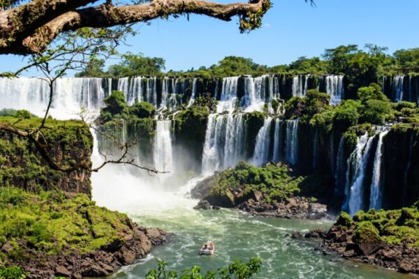
This itinerary brings in the unique landscapes of Argentinian Patagonia and the iconic Iguazu Falls. Start by exploring the diverse neighbourhoods of Buenos Aires before flying down to El Calafate to spend a few days exploring mountains, lakes and glaciers, which includes the gigantic Perito Moreno. Next, you will fly to the the largest waterfall system in the world, Iguazu Falls. Here, on the border of Argentina and Brazil, you can spend a couple of days enjoying nature and history excursions in your unique surroundings before returning to Buenos Aires.
This route brings together some of Patagonia’s world-renowned ecosystems whilst also giving a good dose of city life. Start with a tour of Buenos Aires, the home of Tango, before flying down to the scenic Patagonian town of El Calafate. From here you will visit the monumental Perito Moreno glacier and Glaciers National Park, where you can hike amidst glacial lakes, forests and the towering granite monoliths of El Chaltén, Cerro Torre and Fitzroy. Stay at a traditional estancia before travelling over to Torres del Paine National Park in Chile. Here you can enjoy hiking, cycling and nature watching before flying from Puerto Natales to Santiago to end your journey.
The classic itinerary to Peru's absolute top highlights. Starting in Lima head to the southern Andes to visit the ancient capital and Inca stronghold of Cusco, followed by a night or two exploring the glorious Sacred Valley. From here round off the trip with a guided tour of Machu Picchu itself.
There's no denying that this is a well-trodden route, but with the help of a quality tour operator with intimate local expertise it's still easy to get off the beaten path for a view of Peru's indigenous cultural heritage.
If you've got time to extend your trip you can get truly off the beaten path with a visit to some of Peru's lesser-known archaeological sites, the Amazon rain forest, or simply spend a little longer in Lima and Cusco for a better insight into contemporary Peru, its fascinating culture and world-beating cuisine.
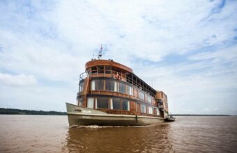
The northern Amazon is very different to the more popular Puerto Maldonado in the south. Located closer to the Amazon River, this is a watery wonderland best explored by a small-ship river cruise. Cruises depart from Iquitos for a three-night voyage to the remote Pacaya Samiria National Park. On the way you'll take guided excursions into the jungle to spot its myriad wildlife, kayak the tributaries, fish and swim in the mighty Amazon River. After your rainforest adventure you'll head south via Lima and up into the Peruvian Andes to visit historical Cusco, the glorious Sacred Valley and, the cherry on the cake, the world-famous ruins of Machu Picchu.
Combine Peru's two finest gems in one trip: the biodiverse wonderland of Puerto Maldonado in the southern Amazon basin, and the incredible cultural heritage of Machu Picchu and the Sacred Valley. Start your trip in Lima before heading to a remote jungle lodge to explore the rainforest with expert guides, before arriving up into the high Andes to marvel at Machu Picchu, historical Cusco and the many ruins of the beautiful Sacred Valley.
This popular route covers the best of the Peruvian highlights in one convenient itinerary, calling at all the key locations in the country's southern highlands, a region of remarkable natural and historical heritage.
Starting from Lima you'll head south to Arequipa, Peru's elegant second city and gateway to the Colca Canyon. From here you'll travel to Puno, on the shores of Lake Titicaca, the highest navigable lake on earth and cradle of the Aymara pre-Colombian cultures.
Finish the epic trip in the Sacred Valley, exploring Cusco and, of course, Machu Picchu.
Your details are safe and will not be used for any other purpose. By using this service you agree for us to share your details with your chosen tour operator according to our Privacy Policy.
1Your trip
2Complete your request
3Meet your specialist
Find a South America specialist
Tell us about your trip and we'll find your match
We'll connect you directly with the experts.
Connect with Martha Cohen, Camille Terra, Maria Abud Campomar and 3 other South America specialists.
We'll connect you directly with the experts.
Connect with Martha Cohen, Camille Terra, Maria Abud Campomar and 3 other South America specialists.